| Home | City Bus | Maps | Villages | Cities | Rail | Tourist Places | School | College | Pin Codes | Corona Cases Count |
| Distance Calculator Bus Services IFSC Codes Trace Mobile Number Weather Search Place Trace IP Available Cash ATM/Banks Locate Polling Booth Report an Error contact People |
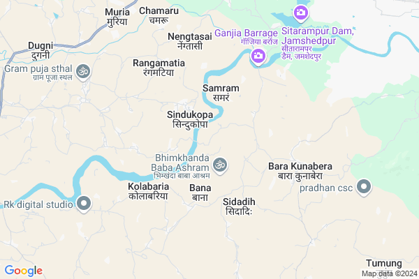
Jota
Jota Map
EDIT Map
Add Your House
 ..
..
Current Corona Virus Infected Patients Count in Saraikela Kharsawan District
| City Name | District Name | Total Covid cases |
|---|
Locality Name :
Jota
( जोटा )
Block Name : Rajnagar
District : Saraikela Kharsawan
State : Jharkhand
Language : Hindi and Santali
Current Time 07:08 AM
Date: Saturday , Apr 26,2025 (IST)
Time zone: IST (UTC+5:30)
Elevation / Altitude: 198 meters. Above Seal level
Telephone Code / Std Code: 06597
Assembly constituency : Saraikela assembly constituency
Assembly MLA : CHAMPAI SOREN
Lok Sabha constituency : Singhbhum parliamentary constituency
Parliament MP : GEETA KORA
Serpanch Name :
Pin Code : 831002
Post Office Name : Tatanagar
Main Village Name : Jota
Commodities Prices : Balarampur Market / Mandi
Jota Live Weather
Temperature: 32.0 °C
clear sky
Humidity: 29%
Wind : 2.72 mt/sec towards SW
StationName : "GopinÄ\u0081thpur"
observed on Now
Temperature: 32.0 °C
clear sky
Humidity: 29%
Wind : 2.72 mt/sec towards SW
StationName : "GopinÄ\u0081thpur"
observed on Now
Jota Weather Forecast for Next 5 days
27-04-2025
30.4°C to 43.6°C
clear sky, few clouds, scattered clouds, broken clouds
30.4°C to 43.6°C
clear sky, few clouds, scattered clouds, broken clouds
28-04-2025
28.2°C to 41.5°C
scattered clouds, broken clouds, overcast clouds
28.2°C to 41.5°C
scattered clouds, broken clouds, overcast clouds
29-04-2025
26.8°C to 38.7°C
broken clouds, few clouds, light rain, scattered clouds
26.8°C to 38.7°C
broken clouds, few clouds, light rain, scattered clouds
30-04-2025
23.7°C to 38.6°C
few clouds, clear sky, moderate rain, overcast clouds
23.7°C to 38.6°C
few clouds, clear sky, moderate rain, overcast clouds
01-05-2025
22.2°C to 37.0°C
overcast clouds, scattered clouds, few clouds, clear sky, light rain, heavy intensity rain, broken clouds
22.2°C to 37.0°C
overcast clouds, scattered clouds, few clouds, clear sky, light rain, heavy intensity rain, broken clouds
National Highways Reachable To Jota
Nationa High Way :NH320D
Nationa High Way :NH118
Nationa High Way :NH320D
Nationa High Way :NH118
Rivers Near Jota
Swarnarekha :Subarnarekha River
Kharkai River
Swarnarekha :Subarnarekha River
Kharkai River
About Jota
Correct below Info and add more info about JotaJota is a small Village/hamlet in Rajnagar Block in Saraikela Kharsawan District of Jharkhand State, India. It comes under Jota Panchayath. It is located 16 KM towards East from District head quarters Seraikela. 14 KM from Rajnagar. 121 KM from State capital Ranchi
Jota Pin code is 831002 and postal head office is Tatanagar .
Itagarh ( 8 KM ) , Murkum ( 8 KM ) , Muria ( 9 KM ) , Dudra ( 9 KM ) , Birbans ( 10 KM ) are the nearby Villages to Jota. Jota is surrounded by Rajnagar Block towards South , Seraikella Block towards west , Saraikela Block towards west , Golmuri Cum Jugsalai Block towards East .
Jamshedpur , Chandil , Chaibasa , Barughutu are the near by Cities to Jota.
This Place is in the border of the Saraikela Kharsawan District and East Singhbum District. East Singhbum District Potka is East towards this place . Also it is in the Border of other district West Singhbhum .
Jota 2011 Census Details
Jota Local Language is Hindi. Jota Village Total population is 526 and number of houses are 89. Female Population is 47.9%. Village literacy rate is 48.5% and the Female Literacy rate is 18.8%.
Population
| Census Parameter | Census Data |
| Total Population | 526 |
| Total No of Houses | 89 |
| Female Population % | 47.9 % ( 252) |
| Total Literacy rate % | 48.5 % ( 255) |
| Female Literacy rate | 18.8 % ( 99) |
| Scheduled Tribes Population % | 97.5 % ( 513) |
| Scheduled Caste Population % | 0.0 % ( 0) |
| Working Population % | 58.7 % |
| Child(0 -6) Population by 2011 | 87 |
| Girl Child(0 -6) Population % by 2011 | 41.4 % ( 36) |
Jota Census More Deatils.
Politics in Jota
Indian National Congress , JBSP , BJP , INC are the major political parties in this area.Polling Stations /Booths near Jota
1)Ums Block Headquater Right Wing2)Primary School Bhawan Tirla
3)Primary School Baridih
4)Primary School Asangi Purana Bhawan
5)Upgrated Middle School Gurah
HOW TO REACH Jota
By Rail
Gamharia Junction Rail Way Station , Birbans Rail Way Station are the very nearby railway stations to Jota.Schools near Jota
Academic English High School Rajnagar
Address : Near Gamdesai
po+ps -Rajnagar
S S + 2 High School
Address :
Govt Health Centers near Jota
1) HSC SAMRAM , , SAMRAM ,2) HSC RAIDIH , , RAIDIH ,
3) HSC TENTOPOSI , , TENTOPOSI ,
Sub Villages in Jota
Hospitals in Jota,Rajnagar
Primary Health Centre; Gobindpur
Jamshedpur - Chaibasa Rd; Jharkhand 831002; India
11.4 KM distance Detail
Sarkari Swastya Kendra
Krishnapur; Adityapur Industrial Area; Adityapur; Jamshedpur; Jharkhand 831014; India
12.2 KM distance Detail
more ..
Petrol Bunks in Jota,Rajnagar
HP Petrol Pump Libra Fuels
Adityapur; Industrial Area; Gamharia; Jamshedpur; Jharkhand 825114; India
13.3 KM distance Detail
Indian Oil
Tata Kandra Road; Gamharia; Adityapur; Jamshedpur; Jharkhand 832108; India
13.3 KM distance Detail
Reliance Petrol Pump
Anand vihar; Adityapur; Jamshedpur; Jharkhand 832109; India
13.5 KM distance Detail
more ..
Schools in Jota,Rajnagar
Vishwesaraiya Industrial Training Centre ;govindpur Dhanbad
Gobindpur; Jharkhand 831002; India
10.4 KM distance Detail
Super Markets in Jota,Rajnagar
Singh store road no 2
01; Tata Kandra Rd; Bhatia Basti; Tata Kandra Rd; Bhatia Basti; Adityapur; Jamshedpur; Jharkhand 832109; India
13.7 KM distance Detail
;Akash:shop
Bhalotia Rd; Dhirajganj; Gamharia; Jamshedpur; Jharkhand 832108; India
13.9 KM distance Detail
Local Parks in Jota,Rajnagar
Veer Shahid Shiddhu Kanhu Park
Jharkhand State Highway 5; Jaganathpur; Jharkhand 833219; India
13.6 KM distance Detail
Jogger's Park
Tisco-Adityapur Housing Complex; Gamharia; Kalikapur; Jharkhand 832108; India
15.0 KM distance Detail
Governement Offices near Jota,Rajnagar
Div.Commissioner office singhbhum kolhan div.
Adityapur - Chaibasa Rd; Industrial Area; Gamharia; Jamshedpur; Jharkhand 832108; India
13.3 KM distance Detail
YUVRAJ TRADERS
BESIDE OF STATE BANK OF INDIA;NEAR NEW TEACHERS TRAINING SCHOOL; Gamharia; Jamshedpur; Jharkhand 832108; India
13.3 KM distance Detail
About Jota &
History
How to reach Jota
Tourist Places Near By Jota
Schools in Jota
Colleges in Jota
Temperature & weather of Jota
places in Jota
Jota photos
More Information
How to reach Jota
Tourist Places Near By Jota
Schools in Jota
Colleges in Jota
Temperature & weather of Jota
places in Jota
Jota photos
More Information
Village Talk
Post News or Events about this Village
Near Cities
Jamshedpur 18 KM near
Chandil 29 KM near
Chaibasa 36 KM near
Barughutu 47 KM near
Jamshedpur 18 KM near
Chandil 29 KM near
Chaibasa 36 KM near
Barughutu 47 KM near
Near By Taluks
Gamarhia 9 KM near
Rajnagar 13 KM near
Seraikella 14 KM near
Saraikela 15 KM near
Gamarhia 9 KM near
Rajnagar 13 KM near
Seraikella 14 KM near
Saraikela 15 KM near
Near By Air Ports
Ranchi Airport 112 KM near
Netaji Subhas Chandra Bose Airport 273 KM near
Gaya Airport 282 KM near
Bhubaneswar Airport 308 KM near
Ranchi Airport 112 KM near
Netaji Subhas Chandra Bose Airport 273 KM near
Gaya Airport 282 KM near
Bhubaneswar Airport 308 KM near
Near By Tourist Places
Seraikela 15 KM near
Jamshedpur 19 KM near
Purulia 61 KM near
Dassam Falls 86 KM near
Bokaro Steel City 115 KM near
Seraikela 15 KM near
Jamshedpur 19 KM near
Purulia 61 KM near
Dassam Falls 86 KM near
Bokaro Steel City 115 KM near
Near By Districts
Saraikela Kharsawan 15 KM near
East Singhbum 17 KM near
West Singhbhum 36 KM near
Purulia 83 KM near
Saraikela Kharsawan 15 KM near
East Singhbum 17 KM near
West Singhbhum 36 KM near
Purulia 83 KM near
Near By RailWay Station
Sini Junction Rail Way Station 15 KM near
Kandra Junction Rail Way Station 16 KM near
Sini Junction Rail Way Station 15 KM near
Kandra Junction Rail Way Station 16 KM near