| Home | City Bus | Maps | Villages | Cities | Rail | Tourist Places | School | College | Pin Codes | Corona Cases Count |
| Distance Calculator Bus Services IFSC Codes Trace Mobile Number Weather Search Place Trace IP Available Cash ATM/Banks Locate Polling Booth Report an Error contact People |
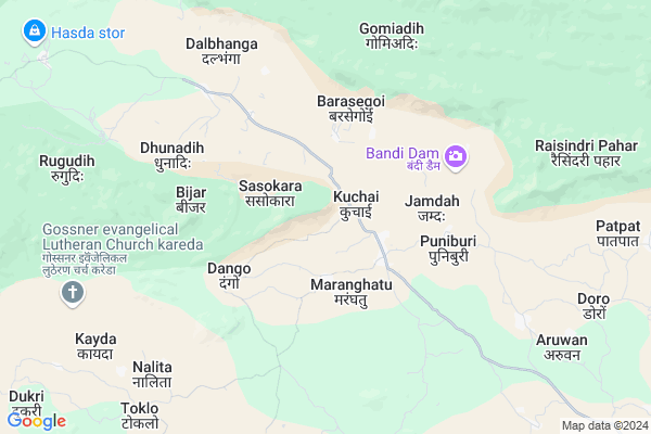
Jojohatu
Jojohatu Map
EDIT Map
Add Your House
 ..
..
Current Corona Virus Infected Patients Count in Saraikela Kharsawan District
| City Name | District Name | Total Covid cases |
|---|
Locality Name :
Jojohatu
( जोजोहातु )
Block Name : Kuchai
District : Saraikela Kharsawan
State : Jharkhand
Language : Hindi and Santali
Current Time 09:23 AM
Date: Wednesday , Apr 30,2025 (IST)
Time zone: IST (UTC+5:30)
Elevation / Altitude: 189 meters. Above Seal level
Telephone Code / Std Code: 06583
Assembly constituency : Kharsawan assembly constituency
Assembly MLA :
Lok Sabha constituency : Khunti parliamentary constituency
Parliament MP :
Serpanch Name :
Main Village Name : Jojohatu
Commodities Prices : Balarampur Market / Mandi
Jojohatu Live Weather
Temperature: 30.7 °C
few clouds
Humidity: 35%
Wind : 1.08 mt/sec towards SE
StationName : "KharsÄ\u0081wÄ\u0081n"
observed on 21 Mins Back
Temperature: 30.7 °C
few clouds
Humidity: 35%
Wind : 1.08 mt/sec towards SE
StationName : "KharsÄ\u0081wÄ\u0081n"
observed on 21 Mins Back
Jojohatu Weather Forecast for Next 5 days
01-05-2025
22.6°C to 37.4°C
few clouds, light rain, broken clouds, scattered clouds
22.6°C to 37.4°C
few clouds, light rain, broken clouds, scattered clouds
02-05-2025
22.0°C to 35.4°C
few clouds, clear sky, light rain, moderate rain, overcast clouds, broken clouds
22.0°C to 35.4°C
few clouds, clear sky, light rain, moderate rain, overcast clouds, broken clouds
03-05-2025
21.8°C to 35.9°C
broken clouds, clear sky, light rain
21.8°C to 35.9°C
broken clouds, clear sky, light rain
04-05-2025
24.5°C to 36.7°C
few clouds, scattered clouds, light rain, broken clouds, clear sky
24.5°C to 36.7°C
few clouds, scattered clouds, light rain, broken clouds, clear sky
05-05-2025
24.1°C to 40.0°C
clear sky, scattered clouds, light rain, broken clouds
24.1°C to 40.0°C
clear sky, scattered clouds, light rain, broken clouds
National Highways Reachable To Jojohatu
Nationa High Way :NH118
Nationa High Way :NH20
Nationa High Way :NH118
Nationa High Way :NH20
Rivers Near Jojohatu
Kharkai River
Subarnarekha River :Subarnarekha River
Kharkai River
Subarnarekha River :Subarnarekha River
About Jojohatu
Correct below Info and add more info about JojohatuJojohatu is a small Village/hamlet in Kuchai Block in Saraikela Kharsawan District of Jharkhand State, India. It comes under Jojohatu Panchayath. It is located 31 KM towards west from District head quarters Seraikela. 80 KM from State capital Ranchi
Jojohatu is surrounded by Kharsawan Block towards South , Tamar Block towards North , Chakradharpur Block towards South , Khuntpani Block towards South .
Barughutu , Chakradharpur , Chaibasa , Chandil are the near by Cities to Jojohatu.
Demographics of Jojohatu
Hindi is the Local Language here.Politics in Jojohatu
J V (P) , Bharatiya Janata Party , BJP , JMM , JKP , INC are the major political parties in this area.Polling Stations /Booths near Jojohatu
1)Primary School Bhawan Pidki2)Middle School Bhawan Aruwan West Part
3)Middle School Bhawan Kuchai East Part
4)Upgrated Middle School Bhawan Mahedevpur
5)Primary School Bhawan Basahatu
HOW TO REACH Jojohatu
By Rail
There is no railway station near to Jojohatu in less than 10 km.Pincodes near Jojohatu
833216 ( Kharsawangarh ) , 833102 ( Chakradharpur ) , 835225 ( Tamar )Schools near Jojohatu
Govt Health Centers near Jojohatu
1) HSC BADASEGAI , , BADASEGAI ,2) HSC RUGUDIH , , RUGUDIH ,
3) HSC ARUWAN , , ARUWAN ,
Sub Villages in Jojohatu
Super Markets in Jojohatu,Kuchai
Local Parks in Jojohatu,Kuchai
Governement Offices near Jojohatu,Kuchai
About Jojohatu &
History
How to reach Jojohatu
Tourist Places Near By Jojohatu
Schools in Jojohatu
Colleges in Jojohatu
Temperature & weather of Jojohatu
places in Jojohatu
Jojohatu photos
More Information
How to reach Jojohatu
Tourist Places Near By Jojohatu
Schools in Jojohatu
Colleges in Jojohatu
Temperature & weather of Jojohatu
places in Jojohatu
Jojohatu photos
More Information
Village Talk
Post News or Events about this Village
Near Cities
Barughutu 6 KM near
Chakradharpur 24 KM near
Chaibasa 38 KM near
Chandil 41 KM near
Barughutu 6 KM near
Chakradharpur 24 KM near
Chaibasa 38 KM near
Chandil 41 KM near
Near By Taluks
Kuchai 0 KM near
Kharsawan 17 KM near
Tamar 21 KM near
Chakradharpur 21 KM near
Kuchai 0 KM near
Kharsawan 17 KM near
Tamar 21 KM near
Chakradharpur 21 KM near
Near By Air Ports
Ranchi Airport 73 KM near
Gaya Airport 252 KM near
Netaji Subhas Chandra Bose Airport 313 KM near
Bhubaneswar Airport 323 KM near
Ranchi Airport 73 KM near
Gaya Airport 252 KM near
Netaji Subhas Chandra Bose Airport 313 KM near
Bhubaneswar Airport 323 KM near
Near By Tourist Places
Seraikela 30 KM near
Dassam Falls 48 KM near
Jamshedpur 55 KM near
Purulia 71 KM near
Ranchi 77 KM near
Seraikela 30 KM near
Dassam Falls 48 KM near
Jamshedpur 55 KM near
Purulia 71 KM near
Ranchi 77 KM near
Near By Districts
Saraikela Kharsawan 30 KM near
West Singhbhum 38 KM near
East Singhbum 53 KM near
Khunti 57 KM near
Saraikela Kharsawan 30 KM near
West Singhbhum 38 KM near
East Singhbum 53 KM near
Khunti 57 KM near
Near By RailWay Station
Rajkharsawan Junction Rail Way Station 17 KM near
Chakradharpur Rail Way Station 23 KM near
Rajkharsawan Junction Rail Way Station 17 KM near
Chakradharpur Rail Way Station 23 KM near