| Home | City Bus | Maps | Villages | Cities | Rail | Tourist Places | School | College | Pin Codes | Corona Cases Count |
| Distance Calculator Bus Services IFSC Codes Trace Mobile Number Weather Search Place Trace IP Available Cash ATM/Banks Locate Polling Booth Report an Error contact People |
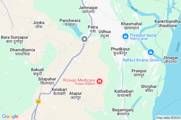
Dharampur Map
EDIT Map
Add Your House
 ..
..
Current Corona Virus Infected Patients Count in Sahebganj District
| City Name | District Name | Total Covid cases |
|---|
Locality Name :
Dharampur
( धरमपुर )
Block Name : Udhwa
District : Sahebganj
State : Jharkhand
Language : Hindi and Santali, Angika
Current Time 01:00 PM
Date: Tuesday , Apr 29,2025 (IST)
Time zone: IST (UTC+5:30)
Telephone Code / Std Code: 06426
Assembly constituency : Rajmahal assembly constituency
Assembly MLA : Anant Kumar Ojha
Lok Sabha constituency : Rajmahal parliamentary constituency
Parliament MP : VIJAY KUMAR HANSDAK
Serpanch Name :
Main Village Name : Dharampur
Commodities Prices : English Bazar Market / Mandi
Dharampur Live Weather
Temperature: 34.5 °C
broken clouds
Humidity: 30%
Wind : 1.38 mt/sec towards SW
StationName : "Farakka"
observed on 14 Mins Back
Temperature: 34.5 °C
broken clouds
Humidity: 30%
Wind : 1.38 mt/sec towards SW
StationName : "Farakka"
observed on 14 Mins Back
Dharampur Weather Forecast for Next 5 days
30-04-2025
24.3°C to 33.1°C
light rain, scattered clouds, overcast clouds
24.3°C to 33.1°C
light rain, scattered clouds, overcast clouds
01-05-2025
23.1°C to 34.5°C
overcast clouds, broken clouds, clear sky, light rain
23.1°C to 34.5°C
overcast clouds, broken clouds, clear sky, light rain
02-05-2025
23.4°C to 34.2°C
light rain, scattered clouds, heavy intensity rain, overcast clouds
23.4°C to 34.2°C
light rain, scattered clouds, heavy intensity rain, overcast clouds
03-05-2025
23.9°C to 34.7°C
overcast clouds, broken clouds, clear sky, light rain
23.9°C to 34.7°C
overcast clouds, broken clouds, clear sky, light rain
04-05-2025
26.6°C to 36.9°C
broken clouds, scattered clouds, light rain
26.6°C to 36.9°C
broken clouds, scattered clouds, light rain
National Highways Reachable To Dharampur
Nationa High Way :NH12
Nationa High Way :NH31
Nationa High Way :NH12
Nationa High Way :NH31
Rivers Near Dharampur
Border India - Bangladesh
Border India - Bangladesh
Border India - Bangladesh
Border India - Bangladesh
About Dharampur
Correct below Info and add more info about DharampurDharampur is a small Village/hamlet in Udhwa Block in Sahebganj District of Jharkhand State, India. It comes under Dharampur Panchayath. It is located 45 KM towards South from District head quarters Sahibganj. 364 KM from State capital Ranchi
Dharampur is surrounded by Barharwa Block towards South , Rajmahal Block towards North , Pathna Block towards west , Manikchak Block towards North .
Dhulian , Pakaur , Sahibganj , Paschim Punropara are the near by Cities to Dharampur.
This Place is in the border of the Sahebganj District and Maldah District. Maldah District Manikchak is North towards this place . It is near to the West Bengal State Border.
Dharampur 2011 Census Details
Dharampur Local Language is Hindi. Dharampur Village Total population is 283 and number of houses are 74. Female Population is 50.5%. Village literacy rate is 31.4% and the Female Literacy rate is 13.8%.
Population
| Census Parameter | Census Data |
| Total Population | 283 |
| Total No of Houses | 74 |
| Female Population % | 50.5 % ( 143) |
| Total Literacy rate % | 31.4 % ( 89) |
| Female Literacy rate | 13.8 % ( 39) |
| Scheduled Tribes Population % | 99.6 % ( 282) |
| Scheduled Caste Population % | 0.0 % ( 0) |
| Working Population % | 58.3 % |
| Child(0 -6) Population by 2011 | 44 |
| Girl Child(0 -6) Population % by 2011 | 45.5 % ( 20) |
Dharampur Census More Deatils.
Politics in Dharampur
Jharkhand Mukti Morcha , BJP , JMM are the major political parties in this area.Polling Stations /Booths near Dharampur
1)Middle School Kathalbari (south Part)2)Primary School Khatiyakana (south Part)
3)Up. Middle School Samaspur
4)Primary School Masna (north Part)
5)Up. Middle School Mirjibazar North Part
HOW TO REACH Dharampur
By Rail
Bakudi Rail Way Station , Dhamdhamia Rail Way Station are the very nearby railway stations to Dharampur.Pincodes near Dharampur
816116 ( Tinpahar RS ) , 816105 ( Kotalpokhar ) , 816104 ( Hiranpur )Colleges near Dharampur
Sibu Soren Janjatiya Mahavidyalay
Address : Boarijor Road,borio
Schools near Dharampur
High School Jonka
Address : At+Post-Jonka,P.S-Rajmahal,District-Sahebganj{JHARKHAND}
Middle School Jonka
Address : At+post-Jonka,P.S-Rajmahal,District,Sahebganj
Govt Health Centers near Dharampur
1) HSC SURANGA , Goverment building , suranga diku tola , suranga2) HSC DIGGHI , Goverment building , naya tola digghi , digghi
3) HSC BARMASIA , Goverment building , Barmasiya , tuyu tola ( krasher ke bagal me)
Sub Villages in Dharampur
Petrol Bunks in Dharampur,Udhwa
Reliance Petroleum
JAMABANDI NO :12; DAG NO 495; Barharwa; Jharkhand 816101; India
12.4 KM distance Detail
more ..
Colleges in Dharampur,Udhwa
kalimi medical hall eid gah chouk roadfulwaria rajmaha
Mastangarh; Jharkhand 816108; India
11.2 KM distance Detail
Shiksha Evam Kalyan Samiti
Informatic Campus; Rajmahal road; Barharwa; Jharkhand 816101; India
13.2 KM distance Detail
BSA Mahila College
Naya Tola; Sahibganj; Barhat Barharwa Road; Barharwa; Barharwa; Jharkhand 816101; India
13.5 KM distance Detail
more ..
Schools in Dharampur,Udhwa
High School Udhwa
Udhwa; Sahibganj; NH-80; Udhwa Rajmahal Barharwa Main Road; Udhwan; Udhwan; Jharkhand 816108; India
3.6 KM distance Detail
Electronic Shops in Dharampur,Udhwa
T.N. Engineering and Repairing Centre (Tasrul Lathe)
Talbanna; (Udhwa-Barharwa Road; near Alam petrol pump; Udhwa; Jharkhand 816108; India
3.2 KM distance Detail
Jahir Telecom (All Android Mobiles Sales & Services)
Patra; Jharkhand 816108; India
3.9 KM distance Detail
Super Markets in Dharampur,Udhwa
Kalimi Store& Foto Studio
Fulwariya ward no 12rajmahal; Jharkhand 816108; India
11.4 KM distance Detail
Local Parks in Dharampur,Udhwa
Farrakka Barrage Bird Watching Area
Barrage Colony Link Road; Gobindarampur; West Bengal 742212; India
17.8 KM distance Detail
Governement Offices near Dharampur,Udhwa
Mgnrega Bhawan; Block Development Office; Barharwa
Ratanpur; Jharkhand 816110; India
14.4 KM distance Detail
About Dharampur &
History
How to reach Dharampur
Tourist Places Near By Dharampur
Schools in Dharampur
Colleges in Dharampur
Temperature & weather of Dharampur
places in Dharampur
Dharampur photos
More Information
How to reach Dharampur
Tourist Places Near By Dharampur
Schools in Dharampur
Colleges in Dharampur
Temperature & weather of Dharampur
places in Dharampur
Dharampur photos
More Information
Village Talk
Post News or Events about this Village
Near Cities
Dhulian 35 KM near
Pakaur 38 KM near
Sahibganj 43 KM near
Paschim Punropara 45 KM near
Dhulian 35 KM near
Pakaur 38 KM near
Sahibganj 43 KM near
Paschim Punropara 45 KM near
Near By Taluks
Udhwa 0 KM near
Barharwa 14 KM near
Rajmahal 15 KM near
Pathna 17 KM near
Udhwa 0 KM near
Barharwa 14 KM near
Rajmahal 15 KM near
Pathna 17 KM near
Near By Air Ports
Bagdogra Airport 223 KM near
Rupsi Airport 277 KM near
Netaji Subhas Chandra Bose Airport 293 KM near
Patna Airport 320 KM near
Bagdogra Airport 223 KM near
Rupsi Airport 277 KM near
Netaji Subhas Chandra Bose Airport 293 KM near
Patna Airport 320 KM near
Near By Tourist Places
Malda 35 KM near
English-Bazar 35 KM near
Pakur 38 KM near
Sahibganj 44 KM near
Bhagalpur 103 KM near
Malda 35 KM near
English-Bazar 35 KM near
Pakur 38 KM near
Sahibganj 44 KM near
Bhagalpur 103 KM near
Near By Districts
Maldah 35 KM near
Pakur 37 KM near
Sahebganj 43 KM near
Godda 72 KM near
Maldah 35 KM near
Pakur 37 KM near
Sahebganj 43 KM near
Godda 72 KM near
Near By RailWay Station
Bakudi Rail Way Station 7.5 KM near
Dhamdhamia Rail Way Station 7.5 KM near
Barharwa Junction Rail Way Station 12 KM near
Tinpahar Junction Rail Way Station 12 KM near
Bakudi Rail Way Station 7.5 KM near
Dhamdhamia Rail Way Station 7.5 KM near
Barharwa Junction Rail Way Station 12 KM near
Tinpahar Junction Rail Way Station 12 KM near