| Home | City Bus | Maps | Villages | Cities | Rail | Tourist Places | School | College | Pin Codes | Corona Cases Count |
| Distance Calculator Bus Services IFSC Codes Trace Mobile Number Weather Search Place Trace IP Available Cash ATM/Banks Locate Polling Booth Report an Error contact People |
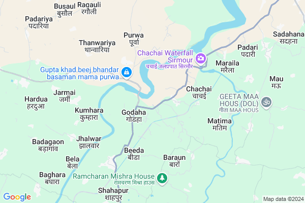
Hardiha
Hardiha Map
EDIT Map
Add Your House
 ..
..
Current Corona Virus Infected Patients Count in Rewa District
| City Name | District Name | Total Covid cases |
|---|
Locality Name :
Hardiha
( हर्दिहा )
Tehsil Name : Sirmour
District : Rewa
State : Madhya Pradesh
Division : Rewa
Language : Hindi and Devanagari,dravidian,agariya
Current Time 09:40 AM
Date: Wednesday , Feb 05,2025 (IST)
Time zone: IST (UTC+5:30)
Elevation / Altitude: 306 meters. Above Seal level
Telephone Code / Std Code: 07660
Assembly constituency : Semariya assembly constituency
Assembly MLA : Abhay Mishra
Lok Sabha constituency : Rewa parliamentary constituency
Parliament MP : JANARDAN MISHRA
Serpanch Name :
Pin Code : 486445
Post Office Name : Semariya
Main Village Name : Hardiha
Commodities Prices : Rewa Market / Mandi
Hardiha Live Weather
Temperature: 24.0 °C
clear sky
Humidity: 33%
Wind : 1.15 mt/sec towards NW
StationName : "Sirmaur"
observed on 14 Mins Back
Temperature: 24.0 °C
clear sky
Humidity: 33%
Wind : 1.15 mt/sec towards NW
StationName : "Sirmaur"
observed on 14 Mins Back
Hardiha Weather Forecast for Next 5 days
06-02-2025
15.6°C to 31.2°C
clear sky
15.6°C to 31.2°C
clear sky
07-02-2025
13.0°C to 27.5°C
clear sky
13.0°C to 27.5°C
clear sky
08-02-2025
11.4°C to 27.3°C
clear sky, few clouds, scattered clouds
11.4°C to 27.3°C
clear sky, few clouds, scattered clouds
09-02-2025
12.9°C to 28.9°C
broken clouds, overcast clouds, scattered clouds
12.9°C to 28.9°C
broken clouds, overcast clouds, scattered clouds
10-02-2025
14.9°C to 31.4°C
scattered clouds, broken clouds, clear sky, few clouds
14.9°C to 31.4°C
scattered clouds, broken clouds, clear sky, few clouds
Rivers Near Hardiha
Tons
Bihar
Tons
Bihar
About Hardiha
Correct below Info and add more info about HardihaHardiha is a small Village/hamlet in Sirmour Tehsil in Rewa District of Madhya Pradesh State, India. It comes under Hardiha Panchayath. It belongs to Rewa Division . It is located 30 KM towards North from District head quarters Rewa. 498 KM from State capital Bhopal
Hardiha Pin code is 486445 and postal head office is Semariya .
Hardiha is surrounded by Jawa Tehsil towards North , Rewa Tehsil towards South , Gangev Tehsil towards East , Raipur Karchuliyan Tehsil towards East .
Rewa , Satna , Chitrakoot , Mauganj are the near by Cities to Hardiha.
Hardiha 2011 Census Details
Hardiha Local Language is Hindi. Hardiha Village Total population is 179 and number of houses are 48. Female Population is 51.4%. Village literacy rate is 56.4% and the Female Literacy rate is 21.2%.
Population
| Census Parameter | Census Data |
| Total Population | 179 |
| Total No of Houses | 48 |
| Female Population % | 51.4 % ( 92) |
| Total Literacy rate % | 56.4 % ( 101) |
| Female Literacy rate | 21.2 % ( 38) |
| Scheduled Tribes Population % | 0.0 % ( 0) |
| Scheduled Caste Population % | 34.6 % ( 62) |
| Working Population % | 31.8 % |
| Child(0 -6) Population by 2011 | 14 |
| Girl Child(0 -6) Population % by 2011 | 71.4 % ( 10) |
Hardiha Census More Deatils.
Politics in Hardiha
Bharatiya Janata Party , BJP , BSP , INC are the major political parties in this area.Polling Stations /Booths near Hardiha
1)Pipara2)Rangouli
3)Khadda
4)Birakham Goutaman
5)Hinouta 586
HOW TO REACH Hardiha
By Rail
There is no railway station near to Hardiha in less than 10 km.Colleges near Hardiha
Yamuna Prasad Sastri Snatkottar Mahavidyalay Semaira
Address :
Schools in Hardiha
Uegs Hardiha
Address : hardiha , sirmour , rewa , Madhya Pradesh . PIN- 486445 , Post - Semariya
Govt Health Centers near Hardiha
1) PHC CHACHAI , CHACHAI , ,2) PHC BARON , BARON , ,
3) PHC Beeda , Beeda , ,
Sub Villages in Hardiha
Colleges in Hardiha,Sirmour
Science Guru Institute of Computer & Technology Sirmour
Rewa; Madhya Pradesh 486448; India
13.4 KM distance Detail
yamuna prasad shastri collage sirmour ; rewa
Sirmaur; Madhya Pradesh 486448; India
13.9 KM distance Detail
more ..
Local Parks in Hardiha,Sirmour
Barwah Park
MP SH 9; Deen Bandhu Nagar; Badi Barwah; Barwah; Madhya Pradesh 486446; India
8.5 KM distance Detail
School Garden
Gopika Pd. Tiwari Marg; Deen Bandhu Nagar; Badi Barwah; Barwah; Madhya Pradesh 486446; India
8.7 KM distance Detail
Adarsh Higher Secondary School
244; MP SH 9; Bakiya Bailo; Madhya Pradesh 485111; India
15.3 KM distance Detail
Police Stations near Hardiha,Sirmour
Shahpur Police Chowki Barwah
MP SH 9; Badi Barwah; Hinauta 588; Madhya Pradesh 486446; India
9.7 KM distance Detail
Governement Offices near Hardiha,Sirmour
About Hardiha &
History
How to reach Hardiha
Tourist Places Near By Hardiha
Schools in Hardiha
Colleges in Hardiha
Temperature & weather of Hardiha
places in Hardiha
Hardiha photos
More Information
How to reach Hardiha
Tourist Places Near By Hardiha
Schools in Hardiha
Colleges in Hardiha
Temperature & weather of Hardiha
places in Hardiha
Hardiha photos
More Information
Village Talk
Post News or Events about this Village
Near Cities
Rewa 30 KM near
Satna 54 KM near
Chitrakoot 68 KM near
Mauganj 69 KM near
Rewa 30 KM near
Satna 54 KM near
Chitrakoot 68 KM near
Mauganj 69 KM near
Near By Taluks
Sirmour 0 KM near
Jawa 30 KM near
Rewa 31 KM near
Gangev 33 KM near
Sirmour 0 KM near
Jawa 30 KM near
Rewa 31 KM near
Gangev 33 KM near
Near By Air Ports
Bamrauli Airport 98 KM near
Khajuraho Airport 153 KM near
Varanasi Airport 197 KM near
Kanpur Airport 224 KM near
Bamrauli Airport 98 KM near
Khajuraho Airport 153 KM near
Varanasi Airport 197 KM near
Kanpur Airport 224 KM near
Near By Tourist Places
Rewa 30 KM near
Satna 55 KM near
Kaushambi 75 KM near
Maihar 85 KM near
Kalinjar 93 KM near
Rewa 30 KM near
Satna 55 KM near
Kaushambi 75 KM near
Maihar 85 KM near
Kalinjar 93 KM near
Near By Districts
Rewa 29 KM near
Satna 54 KM near
Chitrakoot 58 KM near
Sidhi 82 KM near
Rewa 29 KM near
Satna 54 KM near
Chitrakoot 58 KM near
Sidhi 82 KM near
Near By RailWay Station
Rewa Rail Way Station 28 KM near
Manikpur Junction Rail Way Station 41 KM near
Rewa Rail Way Station 28 KM near
Manikpur Junction Rail Way Station 41 KM near