| Home | City Bus | Maps | Villages | Cities | Rail | Tourist Places | School | College | Pin Codes | Corona Cases Count |
| Distance Calculator Bus Services IFSC Codes Trace Mobile Number Weather Search Place Trace IP Available Cash ATM/Banks Locate Polling Booth Report an Error contact People |
Ibrahimpattan
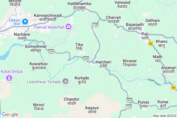
Ibrahimpattan Map
EDIT Map
Add Your House
 ..
..
Current Corona Virus Infected Patients Count in Ratnagiri District
| City Name | District Name | Total Covid cases |
|---|---|---|
| Ratnagiri District | Ratnagiri | 7 |
| Shrungartali | Ratnagiri | 1 |
Locality Name :
Ibrahimpattan
( इब्राहिमपट्टण )
Taluka Name : Ratnagiri
District : Ratnagiri
State : Maharashtra
Region : Konkan
Division : Konkan
Language : Marathi and Daldi
Current Time 10:25 AM
Date: Wednesday , Feb 05,2025 (IST)
Time zone: IST (UTC+5:30)
Elevation / Altitude: 129 meters. Above Seal level
Telephone Code / Std Code: 02352
Assembly constituency : Ratnagiri assembly constituency
Assembly MLA : Uday Ravindra Samant
Lok Sabha constituency : Ratnagiri-Sindhudurg parliamentary constituency
Parliament MP : Vinayak Raut
Serpanch Name :
Pin Code : 416712
Post Office Name : Devadhe
Main Village Name : Ibrahimpattan
Commodities Prices : Ratnagiri (Nachane) Market / Mandi
Ibrahimpattan Live Weather
Temperature: 18.6 °C
few clouds
Humidity: 63%
Wind : 1.63 mt/sec towards N
StationName : "Ratnagiri"
observed on 2 Hours Back
Temperature: 18.6 °C
few clouds
Humidity: 63%
Wind : 1.63 mt/sec towards N
StationName : "Ratnagiri"
observed on 2 Hours Back
Ibrahimpattan Weather Forecast for Next 5 days
06-02-2025
19.3°C to 33.2°C
scattered clouds, few clouds, clear sky
19.3°C to 33.2°C
scattered clouds, few clouds, clear sky
07-02-2025
18.9°C to 33.0°C
clear sky
18.9°C to 33.0°C
clear sky
08-02-2025
20.0°C to 33.4°C
clear sky
20.0°C to 33.4°C
clear sky
09-02-2025
20.2°C to 34.0°C
clear sky
20.2°C to 34.0°C
clear sky
10-02-2025
20.5°C to 33.4°C
clear sky
20.5°C to 33.4°C
clear sky
National Highways Reachable To Ibrahimpattan
Nationa High Way :NH66
Nationa High Way :NH66;NH166
Nationa High Way :NH66
Nationa High Way :NH66;NH166
Rivers Near Ibrahimpattan
Warna River
Kajvi
Warna River
Kajvi
About Ibrahimpattan
Correct below Info and add more info about IbrahimpattanIbrahimpattan is a small Village/hamlet in Ratnagiri Taluka in Ratnagiri District of Maharashtra State, India. It comes under Ibrahimpattan Panchayath. It belongs to Konkan region . It belongs to Konkan Division . It is located 16 KM towards East from District head quarters Ratnagiri. 10 KM from Ratnagiri. 276 KM from State capital Mumbai
Ibrahimpattan Pin code is 416712 and postal head office is Devadhe .
Kurtade ( 3 KM ) , Chindravali ( 4 KM ) , Zarewadi ( 5 KM ) , Kapadgaon ( 5 KM ) , Panaval ( 5 KM ) are the nearby Villages to Ibrahimpattan. Ibrahimpattan is surrounded by Lanja Taluka towards East , Sangmeshwar Taluka towards North , Rajapur Taluka towards South , Guhagar Taluka towards North .
Ratnagiri , Chiplun , Devgarh , Karad are the near by Cities to Ibrahimpattan.
It is near to arabian sea. There is a chance of humidity in the weather.
Demographics of Ibrahimpattan
Marathi is the Local Language here.Politics in Ibrahimpattan
BJP , NCP , SHS are the major political parties in this area.Polling Stations /Booths near Ibrahimpattan
1)Purna Prathamik Urdu Shala Kurdhunda Khurda Juni Building2)Z.p.ratnagiri Purna Prathmik Shala Lajul No. 1
3)Z.p. Ratnagiri Purna Prathimik Marathi Shala Kelye East Side Room No. 1
4)Chatrpati Shivaji Highschool Zadgaon South Side Room
5)Z.p. Vidyamandir Jaki Mirya Room No. 2
HOW TO REACH Ibrahimpattan
By Rail
Nivasar Rail Way Station , Ratnagiri Rail Way Station are the very nearby railway stations to Ibrahimpattan. Ratnagiri Rail Way Station (near to Ratnagiri) are the Rail way stations reachable from near by towns.By Road
Ratnagiri are the nearby by towns to Ibrahimpattan having road connectivity to IbrahimpattanColleges near Ibrahimpattan
Parvati Shankar Bapat College
Address :
Schools in Ibrahimpattan
Zpps Ibrahimpattan Urdu
Address : ibrahimpattan , ratnagiri , ratnagiri , Maharashtra . PIN- 416712 , Post - Devadhe
Govt Health Centers near Ibrahimpattan
1) Chanderai , , ,2) Harcheri , , , At post Harcheri
3) Umare , , , At post Umare
Sub Villages in Ibrahimpattan
Schools in Ibrahimpattan,Ratnagiri
Electronic Shops in Ibrahimpattan,Ratnagiri
Super Markets in Ibrahimpattan,Ratnagiri
Local Parks in Ibrahimpattan,Ratnagiri
Police Stations near Ibrahimpattan,Ratnagiri
Governement Offices near Ibrahimpattan,Ratnagiri
About Ibrahimpattan &
History
How to reach Ibrahimpattan
Tourist Places Near By Ibrahimpattan
Schools in Ibrahimpattan
Colleges in Ibrahimpattan
Temperature & weather of Ibrahimpattan
places in Ibrahimpattan
Ibrahimpattan photos
More Information
How to reach Ibrahimpattan
Tourist Places Near By Ibrahimpattan
Schools in Ibrahimpattan
Colleges in Ibrahimpattan
Temperature & weather of Ibrahimpattan
places in Ibrahimpattan
Ibrahimpattan photos
More Information
Village Talk
Post News or Events about this Village
Near Cities
Ratnagiri 15 KM near
Chiplun 72 KM near
Devgarh 73 KM near
Karad 95 KM near
Ratnagiri 15 KM near
Chiplun 72 KM near
Devgarh 73 KM near
Karad 95 KM near
Near By Taluks
Ratnagiri 10 KM near
Lanja 20 KM near
Sangmeshwar 31 KM near
Rajapur 39 KM near
Ratnagiri 10 KM near
Lanja 20 KM near
Sangmeshwar 31 KM near
Rajapur 39 KM near
Near By Air Ports
Kolhapur Airport 114 KM near
Sambre Airport 198 KM near
Dabolim Airport 202 KM near
Lohegaon Airport 210 KM near
Kolhapur Airport 114 KM near
Sambre Airport 198 KM near
Dabolim Airport 202 KM near
Lohegaon Airport 210 KM near
Near By Tourist Places
Ratnagiri 15 KM near
Vijaydurg 51 KM near
Velneshwar 58 KM near
Guhagar 70 KM near
Kunkeshwar 78 KM near
Ratnagiri 15 KM near
Vijaydurg 51 KM near
Velneshwar 58 KM near
Guhagar 70 KM near
Kunkeshwar 78 KM near
Near By Districts
Ratnagiri 15 KM near
Kolhapur 103 KM near
Sindhudurg 109 KM near
Satara 113 KM near
Ratnagiri 15 KM near
Kolhapur 103 KM near
Sindhudurg 109 KM near
Satara 113 KM near
Near By RailWay Station
Nivasar Rail Way Station 4.7 KM near
Ratnagiri Rail Way Station 9 KM near
Adavali Rail Way Station 21 KM near
Nivasar Rail Way Station 4.7 KM near
Ratnagiri Rail Way Station 9 KM near
Adavali Rail Way Station 21 KM near