| Home | City Bus | Maps | Villages | Cities | Rail | Tourist Places | School | College | Pin Codes | Corona Cases Count |
| Distance Calculator Bus Services IFSC Codes Trace Mobile Number Weather Search Place Trace IP Available Cash ATM/Banks Locate Polling Booth Report an Error contact People |
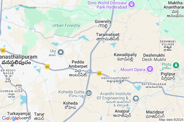
Gunthapally
Gunthapally Map
EDIT Map
Add Your House
 ..
..
Current Corona Virus Infected Patients Count in Rangareddi District
| City Name | District Name | Total Covid cases |
|---|---|---|
| Vikarabad District | Vikarabad | 37 |
| Ranga Reddy District | Ranga Reddy | 25 |
| Medchal Malkajgiri District | Medchal Malkajgiri | 8 |
| Nagarkurnool District | Nagarkurnool | 2 |
| Kokapet | Ranga Reddy | 1 |
| Chandanagar | Ranga Reddy | 1 |
| Qutbullapur | Medchal Malkajgiri | 1 |
Locality Name :
Gunthapally
( గుంతపల్లి )
City Name : Hayathnagar
District : Rangareddi
State : Telangana
Region : Telangana
Language : Telugu and Urdu
Current Time 06:39 AM
Date: Saturday , Apr 26,2025 (IST)
Time zone: IST (UTC+5:30)
Elevation / Altitude: 505 meters. Above Seal level
Telephone Code / Std Code: 08415
Assembly constituency : Ibrahimpatnam assembly constituency
Assembly MLA : Malreddy Ranga Reddy
Lok Sabha constituency : Bhongir parliamentary constituency
Parliament MP : Komati Reddy Venkat Reddy
Pin Code : 501512
Post Office Name : Ramoji Film City
Main Village Name : Gunthapally
Commodities Prices : L B Nagar Market / Mandi
Gunthapally Live Weather
Temperature: 28.1 °C
overcast clouds
Humidity: 40%
Wind : 2.38 mt/sec towards SE
StationName : "Lal Bahadur Nagar"
observed on 1 Hours Back
Temperature: 28.1 °C
overcast clouds
Humidity: 40%
Wind : 2.38 mt/sec towards SE
StationName : "Lal Bahadur Nagar"
observed on 1 Hours Back
Gunthapally Weather Forecast for Next 5 days
27-04-2025
30.1°C to 37.3°C
overcast clouds, broken clouds, light rain
30.1°C to 37.3°C
overcast clouds, broken clouds, light rain
28-04-2025
26.9°C to 33.9°C
overcast clouds, broken clouds, scattered clouds
26.9°C to 33.9°C
overcast clouds, broken clouds, scattered clouds
29-04-2025
26.6°C to 38.9°C
overcast clouds, broken clouds, scattered clouds, clear sky
26.6°C to 38.9°C
overcast clouds, broken clouds, scattered clouds, clear sky
30-04-2025
26.4°C to 39.0°C
clear sky, scattered clouds, broken clouds
26.4°C to 39.0°C
clear sky, scattered clouds, broken clouds
National Highways Reachable To Gunthapally
Nationa High Way :Old NH7
Nationa High Way :NH765
Nationa High Way :Old NH7
Nationa High Way :NH765
Rivers Near Gunthapally
Musi River :మూసి
Musi River :మూసి
About Gunthapally
Correct below Info and add more info about GunthapallyGunthapally is a in Hayathnagar City in Telangana State, India. It belongs to Telangana region .
Gunthapally Pin code is 501512 and postal head office is Ramoji Film City .
Hyderabad , Bhongir , Farooqnagar , Singapur are the nearby Cities to Hayathnagar.
Demographics of Gunthapally
Telugu is the Local Language here. Total population of Gunthapally is 1108 .Males are 600 and Females are 508 living in 243 Houses. Total area of Gunthapally is 253 hectares.Politics in Gunthapally
TDP , CPM , TRS , INC are the major political parties in this area.Polling Stations /Booths near Gunthapally
1)Bacharam2)Pedda Ambarpet
3)Pedda Amberpet
4)Pedda Amebrpet
5)Peddaamberpet
HOW TO REACH Gunthapally
By Road
L B Nagar is the Nearest Town to Hayathnagar. L B Nagar is 12 km from Gunthapally. Road connectivity is there from L B Nagar to Gunthapally.By Rail
There is no railway station near to Gunthapally in less than 10 km.Govt Health Centers near Gunthapally
1) SubCentre Abdullapur , Govt Building , JNNRUM colony , JNNRUM colony2) SubCentre Peddaamberpet , Govt Building , Pedda Amberpet , Gandhi statue road
3) Primary Health Centre Abdullapur , Govt Building , BC colony road , Anganwadi Beside
Sub Villages in Gunthapally
Hospitals in Gunthapally,Hayathnagar
Sai Kiran Hospital
Plot No:5-13; tu; Hyathnagar; Vijayawada - Hyderabad Hwy; Abdullahpurmet; Hyderabad; Telangana 501505; India
2.1 KM distance Detail
Sai Priya Clinic
; 501505; Rajeev Gruha Kalpa; Abdullahpurmet; Telangana; India
2.4 KM distance Detail
more ..
Petrol Bunks in Gunthapally,Hayathnagar
Malakpet Service Station
; Pedda Amberpet; Hyderabad; Telangana 501505; India
1.6 KM distance Detail
HP Petrol Bunk - Lakshninarasimha
Nh-9(hyd-vij Road)batasingaram;pedda Amberpet Vill Hayathnagar Mandal; Secunderabad; 501512; India
1.7 KM distance Detail
Laxmi Narasimha Filling Station-Bharat Petroleum
Pedda Amberpet; Rangareddy; NH-9; Vijayawada Hyderabad Road; Hayath Nagar; Hayath Nagar; Telangana 501505; India
1.7 KM distance Detail
hindustan Petroleum
Vijayawada - Hyderabad Hwy; Hyderabad; Telangana 501505; India
1.7 KM distance Detail
more ..
Colleges in Gunthapally,Hayathnagar
Narayana IAS Academy Intermediate Boys Campus
Pasumamula; Peddambarpet Village; Hyderabad; Telangana 501505; India
2.4 KM distance Detail
Sanjay Gandhi Memorial Government Polytechnic College.
Abdullahpurmet; Hyderabad; Telangana 501505; India
3.1 KM distance Detail
more ..
Schools in Gunthapally,Hayathnagar
pasumamula Z.P.H.S HIGH SCHOOL
Pasumamula; Hyderabad; Telangana 501505; India
2.3 KM distance Detail
School Govt
kala nagar pasumamula;501505; telangana; Hayathnagar; Hyderabad; Telangana 501505; India
2.3 KM distance Detail
Zilla Pahrishad Unnatha Patashala
kala nagar;pasumamula road; Hayathnagar; Hyderabad; Telangana 501505; India
2.3 KM distance Detail
Super Markets in Gunthapally,Hayathnagar
Ashok Kirana Store 28 Block
; Rajeev Gruha Kalpa; Abdullahpurmet; Telangana 501505; India
2.4 KM distance Detail
Surendar Kirana and General store
Seetharampuram colony; Opposite word and deed high school; Anumagal; Hayatnagar; Hyderabad; Telangana 501505; India
5.7 KM distance Detail
Local Parks in Gunthapally,Hayathnagar
Brahmam Komala Gardens and Function Hall
Taramatipet; Telangana 501505; India
3.6 KM distance Detail
Police Stations near Gunthapally,Hayathnagar
Hayath Nagar Mandal Office
NH65; RTC Supervisors Colony; Hayathnagar; Hyderabad; Telangana 501505; India
6.9 KM distance Detail
Hayathnagar Police Station
NH 65; Opposite Shadow Hospital; Hayathnagar; Hyderabad; Telangana 501505; India
7.1 KM distance Detail
BJ SURAKSHA ACADEMY OF POLICE
Road Number 1; Arunodaya Nagar;nagole;opp:more super market ;bandlaguda road;gsi post;hyderabad-500068; India
8.7 KM distance Detail
Governement Offices near Gunthapally,Hayathnagar
Sub Registrar Office Pedda Amberpet
Pedda Amberpet; Hyderabad; Telangana 501505; India
2.9 KM distance Detail
MeeSeva Center
3-109; Balaji Internet & Xerox; Subregister Office; Pedda Amberpet; Hyderabad; Telangana 501505; India
2.9 KM distance Detail
About Gunthapally &
History
How to reach Gunthapally
Tourist Places Near By Gunthapally
Schools in Gunthapally
Colleges in Gunthapally
Temperature & weather of Gunthapally
places in Gunthapally
Gunthapally photos
More Information
How to reach Gunthapally
Tourist Places Near By Gunthapally
Schools in Gunthapally
Colleges in Gunthapally
Temperature & weather of Gunthapally
places in Gunthapally
Gunthapally photos
More Information
Locality Talk
Post News or Events about this Locality
Near Cities
Hyderabad 22 KM near
Bhongir 35 KM near
Farooqnagar 62 KM near
Singapur 65 KM near
Hyderabad 22 KM near
Bhongir 35 KM near
Farooqnagar 62 KM near
Singapur 65 KM near
Near By Taluks
Hayathnagar 0 KM near
Ghatkesar 13 KM near
Saroornagar 16 KM near
Ibrahimpatnam 16 KM near
Hayathnagar 0 KM near
Ghatkesar 13 KM near
Saroornagar 16 KM near
Ibrahimpatnam 16 KM near
Near By Air Ports
Rajiv Gandhi International Airport 29 KM near
Vijayawada Airport 273 KM near
Nanded Airport 280 KM near
Latur Airport 292 KM near
Rajiv Gandhi International Airport 29 KM near
Vijayawada Airport 273 KM near
Nanded Airport 280 KM near
Latur Airport 292 KM near
Near By Tourist Places
Hyderabad 21 KM near
Medak 101 KM near
Nagarjunsagar 122 KM near
Warangal 139 KM near
Bidar 149 KM near
Hyderabad 21 KM near
Medak 101 KM near
Nagarjunsagar 122 KM near
Warangal 139 KM near
Bidar 149 KM near
Near By Districts
Hyderabad 26 KM near
Rangareddi 66 KM near
Medak 77 KM near
Nalgonda 79 KM near
Hyderabad 26 KM near
Rangareddi 66 KM near
Medak 77 KM near
Nalgonda 79 KM near
Near By RailWay Station
Charlapalli Rail Way Station 17 KM near
Moula Ali Rail Way Station 18 KM near
Charlapalli Rail Way Station 17 KM near
Moula Ali Rail Way Station 18 KM near