| Home | City Bus | Maps | Villages | Cities | Rail | Tourist Places | School | College | Pin Codes | Corona Cases Count |
| Distance Calculator Bus Services IFSC Codes Trace Mobile Number Weather Search Place Trace IP Available Cash ATM/Banks Locate Polling Booth Report an Error contact People |
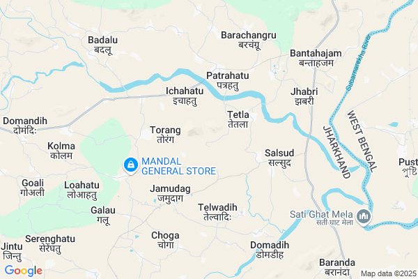
Kotab Map
EDIT Map
Add Your House
 ..
..
Current Corona Virus Infected Patients Count in Ranchi District
| City Name | District Name | Total Covid cases |
|---|---|---|
| Ranchi District | Ranchi | 32 |
| Hindpiri | Ranchi | 12 |
| Hindipiri | Ranchi | 5 |
| Hindpidi | Ranchi | 2 |
| Lowadih | Ranchi | 2 |
| Azad Basti | Ranchi | 2 |
Locality Name :
Kotab
( कोतब )
Block Name : Sonahatu
District : Ranchi
State : Jharkhand
Language : Hindi and Urdu, Bengali, Asuri, Munda
Current Time 12:44 PM
Date: Tuesday , Apr 29,2025 (IST)
Time zone: IST (UTC+5:30)
Elevation / Altitude: 335 meters. Above Seal level
Telephone Code / Std Code: 06522
Assembly constituency : Silli assembly constituency
Assembly MLA : SUDESH KUMAR MAHTO
Lok Sabha constituency : Ranchi parliamentary constituency
Parliament MP : SANJAY SETH
Serpanch Name :
Pin Code : 835102
Post Office Name : Silli
Main Village Name : Kotab
Commodities Prices : Khunti Market / Mandi
Kotab Live Weather
Temperature: 36.2 °C
broken clouds
Humidity: 22%
Wind : 3.73 mt/sec towards SE
StationName : "Muri"
observed on 32 Mins Back
Temperature: 36.2 °C
broken clouds
Humidity: 22%
Wind : 3.73 mt/sec towards SE
StationName : "Muri"
observed on 32 Mins Back
Kotab Weather Forecast for Next 5 days
30-04-2025
23.5°C to 33.8°C
light rain, broken clouds, overcast clouds
23.5°C to 33.8°C
light rain, broken clouds, overcast clouds
01-05-2025
22.6°C to 38.4°C
broken clouds, clear sky, light rain, overcast clouds, scattered clouds
22.6°C to 38.4°C
broken clouds, clear sky, light rain, overcast clouds, scattered clouds
02-05-2025
23.6°C to 37.2°C
few clouds, clear sky, light rain, overcast clouds
23.6°C to 37.2°C
few clouds, clear sky, light rain, overcast clouds
03-05-2025
23.3°C to 36.8°C
overcast clouds, scattered clouds, few clouds, clear sky, light rain, broken clouds
23.3°C to 36.8°C
overcast clouds, scattered clouds, few clouds, clear sky, light rain, broken clouds
04-05-2025
24.9°C to 37.8°C
overcast clouds, clear sky, light rain, moderate rain, broken clouds
24.9°C to 37.8°C
overcast clouds, clear sky, light rain, moderate rain, broken clouds
National Highways Reachable To Kotab
Nationa High Way :NH43
Nationa High Way :NH20;NH43
Nationa High Way :NH43
Nationa High Way :NH20;NH43
Rivers Near Kotab
Subarnarheka River
Subarnarekha river
Subarnarheka River
Subarnarekha river
About Kotab
Correct below Info and add more info about KotabKotab is a small Village/hamlet in Sonahatu Block in Ranchi District of Jharkhand State, India. It comes under Kotab Panchayath. It is located 53 KM towards East from District head quarters Ranchi. 5 KM from Sonahatu. 54 KM from State capital Ranchi
Kotab Pin code is 835102 and postal head office is Silli .
Patrahatu ( 3 KM ) , Telwadih ( 4 KM ) , Nawadih ( 4 KM ) , Basantpur ( 5 KM ) , Galau ( 7 KM ) are the nearby Villages to Kotab. Kotab is surrounded by Silli Block towards North , Bundu Block towards west , Jhalda-I Block towards East , Angara Block towards west .
Barughutu , Chandil , Ranchi , Purulia are the near by Cities to Kotab.
Kotab 2011 Census Details
Kotab Local Language is Hindi. Kotab Village Total population is 379 and number of houses are 93. Female Population is 49.6%. Village literacy rate is 56.5% and the Female Literacy rate is 20.3%.
Population
| Census Parameter | Census Data |
| Total Population | 379 |
| Total No of Houses | 93 |
| Female Population % | 49.6 % ( 188) |
| Total Literacy rate % | 56.5 % ( 214) |
| Female Literacy rate | 20.3 % ( 77) |
| Scheduled Tribes Population % | 16.1 % ( 61) |
| Scheduled Caste Population % | 0.8 % ( 3) |
| Working Population % | 60.2 % |
| Child(0 -6) Population by 2011 | 57 |
| Girl Child(0 -6) Population % by 2011 | 52.6 % ( 30) |
Kotab Census More Deatils.
Politics in Kotab
AJSU Party , JVM , Bharatiya Janata Party , AJSUP , AJSU , BJP , JMM , INC are the major political parties in this area.Polling Stations /Booths near Kotab
1)Ps Garadih East Part2)Ps Danadih East Part
3)Ps Irku
4)Ps Kashidih East Part
5)Ps Choga
HOW TO REACH Kotab
By Rail
There is no railway station near to Kotab in less than 10 km.Colleges near Kotab
Ranchi College Ranchi
Address :
Ramsobha College Of Education
Address :
Amanat Ali Inter College
Address :
Sbs College Ranchi
Address :
L.m.n.s.m Memorial College Itki
Address : Near
Schools near Kotab
Upgraded Middle School, Barisaldih
Address : Revenue vill- Nakidih, Tola-Barisaldih, Panchayat -Jintu, P.S.-Sonahatu.Dist-Ranchi.
Govt Health Centers near Kotab
1) HSC TETLA , TETLA , TETLA , TETLA2) HSC JAMUADAGH , JAMUDAG , JAMUDAG , PANCHYAT BHAWAN
3) PHC PATRAHATU , phc patrahatu , patrahatu , main market
Sub Villages in Kotab
Hospitals in Kotab,Sonahatu
Thakur Poly Clinic
seams narayan mandir; Bank More; Dhanbad; Jharkhand 835102; India
4.1 KM distance Detail
Dr Birendra Clinic
Dhanamunji Basti; Basantpur Ranchi Rd; Chirudih; Jharkhand 835102; India
10.0 KM distance Detail
more ..
Petrol Bunks in Kotab,Sonahatu
HP PETROL PUMP - SHREE RAMJEE AUTOMOBILES
HP Retail Outlet AT & PO Banta P.S. -silli; Ranchi; Jharkhand 835102; India
8.3 KM distance Detail
more ..
Colleges in Kotab,Sonahatu
INSTITUTE OF VOCATIONAL STUDIES
New Bundu Rd; Patka; Jharkhand 835102; India
13.2 KM distance Detail
Intermediate Silli College
New Bundu Road; Silli; Tutki; Ranchi; Jharkhand 835102; India
13.9 KM distance Detail
more ..
Police Stations near Kotab,Sonahatu
Ranchi-Purulia State Highway
Jharkhand State Highway 1; Kashidih; Jharkhand 835101; India
20.1 KM distance Detail
About Kotab &
History
How to reach Kotab
Tourist Places Near By Kotab
Schools in Kotab
Colleges in Kotab
Temperature & weather of Kotab
places in Kotab
Kotab photos
More Information
How to reach Kotab
Tourist Places Near By Kotab
Schools in Kotab
Colleges in Kotab
Temperature & weather of Kotab
places in Kotab
Kotab photos
More Information
Village Talk
Post News or Events about this Village
Near Cities
Barughutu 45 KM near
Chandil 50 KM near
Ranchi 51 KM near
Purulia 53 KM near
Barughutu 45 KM near
Chandil 50 KM near
Ranchi 51 KM near
Purulia 53 KM near
Near By Taluks
Sonahatu 5 KM near
Silli 13 KM near
Bundu 20 KM near
Jhalda-I 21 KM near
Sonahatu 5 KM near
Silli 13 KM near
Bundu 20 KM near
Jhalda-I 21 KM near
Near By Air Ports
Ranchi Airport 50 KM near
Gaya Airport 207 KM near
Patna Airport 300 KM near
Netaji Subhas Chandra Bose Airport 316 KM near
Ranchi Airport 50 KM near
Gaya Airport 207 KM near
Patna Airport 300 KM near
Netaji Subhas Chandra Bose Airport 316 KM near
Near By Tourist Places
Dassam Falls 30 KM near
Ranchi 52 KM near
Purulia 53 KM near
Bokaro Steel City 61 KM near
Seraikela 72 KM near
Dassam Falls 30 KM near
Ranchi 52 KM near
Purulia 53 KM near
Bokaro Steel City 61 KM near
Seraikela 72 KM near
Near By Districts
Ranchi 51 KM near
Ramgarh 54 KM near
Khunti 59 KM near
Purulia 69 KM near
Ranchi 51 KM near
Ramgarh 54 KM near
Khunti 59 KM near
Purulia 69 KM near
Near By RailWay Station
Muri Junction Rail Way Station 19 KM near
Jhalida Rail Way Station 28 KM near
Muri Junction Rail Way Station 19 KM near
Jhalida Rail Way Station 28 KM near