| Home | City Bus | Maps | Villages | Cities | Rail | Tourist Places | School | College | Pin Codes | Corona Cases Count |
| Distance Calculator Bus Services IFSC Codes Trace Mobile Number Weather Search Place Trace IP Available Cash ATM/Banks Locate Polling Booth Report an Error contact People |
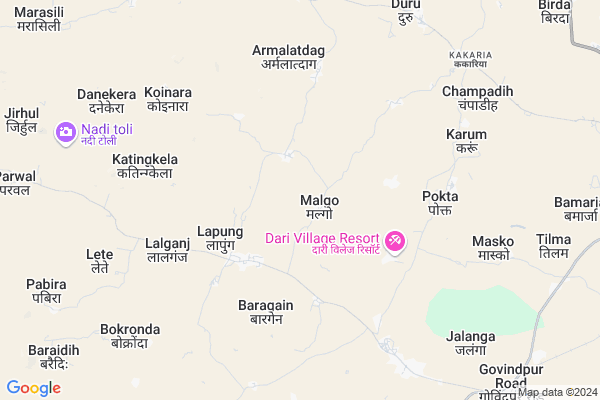
Semla Map
EDIT Map
Add Your House
 ..
..
Current Corona Virus Infected Patients Count in Ranchi District
| City Name | District Name | Total Covid cases |
|---|---|---|
| Ranchi District | Ranchi | 32 |
| Hindpiri | Ranchi | 12 |
| Hindipiri | Ranchi | 5 |
| Hindpidi | Ranchi | 2 |
| Lowadih | Ranchi | 2 |
| Azad Basti | Ranchi | 2 |
Locality Name :
Semla
( सेमला )
Block Name : Lapung
District : Ranchi
State : Jharkhand
Language : Hindi and Urdu, Bengali, Asuri, Munda
Current Time 03:24 PM
Date: Wednesday , Apr 30,2025 (IST)
Time zone: IST (UTC+5:30)
Elevation / Altitude: 696 meters. Above Seal level
Telephone Code / Std Code: 06553
Assembly constituency : Mandar assembly constituency
Assembly MLA : BANDHU TIRKEY
Lok Sabha constituency : Lohardaga parliamentary constituency
Parliament MP : SUDARSHAN BHAGAT
Serpanch Name :
Main Village Name : Semla
Commodities Prices : Khunti Market / Mandi
Semla Live Weather
Temperature: 34.4 °C
few clouds
Humidity: 21%
Wind : 2.54 mt/sec towards W
StationName : "Khunti"
observed on Now
Temperature: 34.4 °C
few clouds
Humidity: 21%
Wind : 2.54 mt/sec towards W
StationName : "Khunti"
observed on Now
Semla Weather Forecast for Next 5 days
01-05-2025
22.9°C to 31.4°C
moderate rain, broken clouds, light rain, clear sky
22.9°C to 31.4°C
moderate rain, broken clouds, light rain, clear sky
02-05-2025
20.9°C to 35.1°C
clear sky, scattered clouds, light rain, overcast clouds
20.9°C to 35.1°C
clear sky, scattered clouds, light rain, overcast clouds
03-05-2025
20.6°C to 35.4°C
clear sky, scattered clouds, broken clouds
20.6°C to 35.4°C
clear sky, scattered clouds, broken clouds
04-05-2025
22.7°C to 35.9°C
few clouds, clear sky, broken clouds, light rain, scattered clouds
22.7°C to 35.9°C
few clouds, clear sky, broken clouds, light rain, scattered clouds
05-05-2025
22.8°C to 37.0°C
clear sky, broken clouds, light rain, overcast clouds, scattered clouds
22.8°C to 37.0°C
clear sky, broken clouds, light rain, overcast clouds, scattered clouds
Rivers Near Semla
Bandi Koel Nadi
North Koel River
Bandi Koel Nadi
North Koel River
About Semla
Correct below Info and add more info about SemlaSemla is a small Village/hamlet in Lapung Block in Ranchi District of Jharkhand State, India. It comes under Semla Panchayath. It is located 50 KM towards west from District head quarters Ranchi. 49 KM from State capital Ranchi
Semla is surrounded by Bharno Block towards west , Karra Block towards East , Bero Block towards North , Kamdara Block towards South .
Khunti , Ranchi , Gumla , Lohardaga are the near by Cities to Semla.
This Place is in the border of the Ranchi District and Gumla District. Gumla District Bharno is west towards this place . Also it is in the Border of other district Khunti .
Semla 2011 Census Details
Semla Local Language is Hindi. Semla Village Total population is 808 and number of houses are 155. Female Population is 49.4%. Village literacy rate is 51.2% and the Female Literacy rate is 21.5%.
Population
| Census Parameter | Census Data |
| Total Population | 808 |
| Total No of Houses | 155 |
| Female Population % | 49.4 % ( 399) |
| Total Literacy rate % | 51.2 % ( 414) |
| Female Literacy rate | 21.5 % ( 174) |
| Scheduled Tribes Population % | 78.8 % ( 637) |
| Scheduled Caste Population % | 0.0 % ( 0) |
| Working Population % | 56.3 % |
| Child(0 -6) Population by 2011 | 139 |
| Girl Child(0 -6) Population % by 2011 | 43.2 % ( 60) |
Semla Census More Deatils.
Politics in Semla
Bharatiya Janata Party , AITMC , JVM(P) , BJP , JHJAM , INC are the major political parties in this area.Polling Stations /Booths near Semla
1)Ps Mahru2)Ps Malgo
3)Ps Jaria
4)Primary School Kathkunwari
5)Nav Ps Madai
HOW TO REACH Semla
By Rail
There is no railway station near to Semla in less than 10 km.Pincodes near Semla
835234 ( Govindpur (Ranchi) ) , 835209 ( Karra ) , 835202 ( Bero )Colleges near Semla
Ranchi College Ranchi
Address :
Ramsobha College Of Education
Address :
Amanat Ali Inter College
Address :
Sbs College Ranchi
Address :
L.m.n.s.m Memorial College Itki
Address : Near
Schools near Semla
S.s.high Kakaria Lapung
Address : Village-Kakaria, karra road kakaria
Govt Health Centers near Semla
1) HSC JOTALIYA , HSC JATALOYA, PANCHAYAT - MALGO , LAPUNG ROAD , HANDPUMP2) HSC PANDU , HSC PANDU ,VILL- PANDU , ,
3) CHC LAPUNG , CHC LAPUNG, PANCHYAT - SAPUKERA , LAPUNG , MIDDLE SCHOOL LAPUNG
Sub Villages in Semla
Local Parks in Semla,Lapung
Governement Offices near Semla,Lapung
Panchayat sachivalay Dolaicha
Dolaicha - Bharno Rd; Dolaicha; Jharkhand 835202; India
8.3 KM distance Detail
About Semla &
History
How to reach Semla
Tourist Places Near By Semla
Schools in Semla
Colleges in Semla
Temperature & weather of Semla
places in Semla
Semla photos
More Information
How to reach Semla
Tourist Places Near By Semla
Schools in Semla
Colleges in Semla
Temperature & weather of Semla
places in Semla
Semla photos
More Information
Village Talk
Post News or Events about this Village
Near Cities
Khunti 35 KM near
Ranchi 48 KM near
Gumla 49 KM near
Lohardaga 51 KM near
Khunti 35 KM near
Ranchi 48 KM near
Gumla 49 KM near
Lohardaga 51 KM near
Near By Taluks
Lapung 0 KM near
Karra 16 KM near
Bharno 16 KM near
Bero 23 KM near
Lapung 0 KM near
Karra 16 KM near
Bharno 16 KM near
Bero 23 KM near
Near By Air Ports
Ranchi Airport 47 KM near
Gaya Airport 202 KM near
Patna Airport 308 KM near
Bhubaneswar Airport 370 KM near
Ranchi Airport 47 KM near
Gaya Airport 202 KM near
Patna Airport 308 KM near
Bhubaneswar Airport 370 KM near
Near By Tourist Places
Chotanagpur 14 KM near
Ranchi 47 KM near
Gumla 50 KM near
Lohardaga 50 KM near
Dassam Falls 61 KM near
Chotanagpur 14 KM near
Ranchi 47 KM near
Gumla 50 KM near
Lohardaga 50 KM near
Dassam Falls 61 KM near
Near By Districts
Khunti 35 KM near
Ranchi 48 KM near
Gumla 49 KM near
Lohardaga 51 KM near
Khunti 35 KM near
Ranchi 48 KM near
Gumla 49 KM near
Lohardaga 51 KM near
Near By RailWay Station
Hatia Rail Way Station 45 KM near
Ranchi Junction Rail Way Station 50 KM near
Hatia Rail Way Station 45 KM near
Ranchi Junction Rail Way Station 50 KM near