| Home | City Bus | Maps | Villages | Cities | Rail | Tourist Places | School | College | Pin Codes | Corona Cases Count |
| Distance Calculator Bus Services IFSC Codes Trace Mobile Number Weather Search Place Trace IP Available Cash ATM/Banks Locate Polling Booth Report an Error contact People |
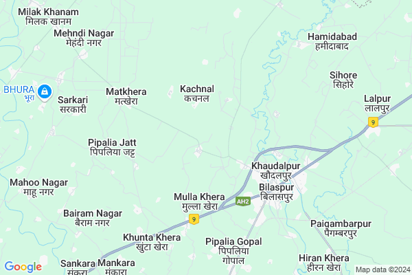
Gada
Gada Map
EDIT Map
Add Your House
 ..
..
Current Corona Virus Infected Patients Count in Rampur District
| City Name | District Name | Total Covid cases |
|---|---|---|
| Rampur District | Rampur | 20 |
Locality Name :
Gada
( गदा )
Block Name : Bilaspur
District : Rampur
State : Uttar Pradesh
Division : Moradabad
Language : Hindi and Urdu
Current Time 06:53 PM
Date: Sunday , Apr 27,2025 (IST)
Time zone: IST (UTC+5:30)
Elevation / Altitude: 196 meters. Above Seal level
Telephone Code / Std Code: 0595
Assembly constituency : Bilaspur assembly constituency
Assembly MLA : Baldev Singh Aulakh
Lok Sabha constituency : Rampur parliamentary constituency
Parliament MP : Mohammad Azam Khan
Serpanch Name :
Pin Code : 244921
Post Office Name : Bilaspur (Rampur)
Main Village Name : Gada
Commodities Prices : Vilaspur Market / Mandi
Gada Live Weather
Temperature: 34.6 °C
scattered clouds
Humidity: 11%
Wind : 2.05 mt/sec towards S
StationName : "BÄ«lÄ\u0081spur"
observed on 10 Mins Back
Temperature: 34.6 °C
scattered clouds
Humidity: 11%
Wind : 2.05 mt/sec towards S
StationName : "BÄ«lÄ\u0081spur"
observed on 10 Mins Back
Gada Weather Forecast for Next 5 days
28-04-2025
26.6°C to 36.2°C
broken clouds
26.6°C to 36.2°C
broken clouds
29-04-2025
24.9°C to 41.3°C
scattered clouds, clear sky, few clouds
24.9°C to 41.3°C
scattered clouds, clear sky, few clouds
30-04-2025
25.8°C to 40.6°C
clear sky, few clouds, scattered clouds, broken clouds
25.8°C to 40.6°C
clear sky, few clouds, scattered clouds, broken clouds
01-05-2025
26.8°C to 40.6°C
overcast clouds, few clouds, clear sky, broken clouds
26.8°C to 40.6°C
overcast clouds, few clouds, clear sky, broken clouds
02-05-2025
27.0°C to 40.6°C
overcast clouds, light rain, broken clouds, scattered clouds
27.0°C to 40.6°C
overcast clouds, light rain, broken clouds, scattered clouds
National Highways Reachable To Gada
Nationa High Way :NH9
Nationa High Way :NH734
Nationa High Way :NH9
Nationa High Way :NH734
Rivers Near Gada
Baur
Ramganga
Baur
Ramganga
About Gada
Correct below Info and add more info about GadaGada is a small Village/hamlet in Bilaspur Block in Rampur District of Uttar Pradesh State, India. It comes under Gada Panchayath. It belongs to Moradabad Division . It is located 27 KM towards East from District head quarters Rampur. 8 KM from Bilaspur. 333 KM from State capital Lucknow
Gada Pin code is 244921 and postal head office is Bilaspur (Rampur) .
Sikraura ( 3 KM ) , Tah Khurd ( 3 KM ) , Mulla Khera ( 3 KM ) , Bihari Nagar ( 4 KM ) , Pipalia Jatt ( 4 KM ) are the nearby Villages to Gada. Gada is surrounded by Gadarpur Block towards North , Saidnagar Block towards west , Suar Block towards west , Rampur Block towards west .
Rudrapur , Suar , Shishgarh , Rampur are the near by Cities to Gada.
This Place is in the border of the Rampur District and Udam Singh Nagar District. Udam Singh Nagar District Rudrapur is East towards this place . It is near to the Uttarakhand State Border.
Gada 2011 Census Details
Gada Local Language is Hindi. Gada Village Total population is 308 and number of houses are 52. Female Population is 47.4%. Village literacy rate is 73.1% and the Female Literacy rate is 34.7%.
Population
| Census Parameter | Census Data |
| Total Population | 308 |
| Total No of Houses | 52 |
| Female Population % | 47.4 % ( 146) |
| Total Literacy rate % | 73.1 % ( 225) |
| Female Literacy rate | 34.7 % ( 107) |
| Scheduled Tribes Population % | 0.0 % ( 0) |
| Scheduled Caste Population % | 9.7 % ( 30) |
| Working Population % | 28.2 % |
| Child(0 -6) Population by 2011 | 30 |
| Girl Child(0 -6) Population % by 2011 | 26.7 % ( 8) |
Gada Census More Deatils.
Politics in Gada
BJP , SP , INC are the major political parties in this area.Polling Stations /Booths near Gada
1)Primary School Swarkhurd Uttar Disha2)Primary School Begmabad
3)Primary School Jyohara U. Disha
4)Primary School Room No-1 Ahro
5)Primary School Balbhadrapur
HOW TO REACH Gada
By Rail
Bilaspur Road Rail Way Station is the very nearby railway stations to Gada.Colleges near Gada
Government Degree College
Address :
Dav Inter College
Address :
Dav Inter College
Address :
Dav Inter Callege
Address :
Schools near Gada
Ups Mahesh Pura
Address : akilpur , bilaspur , rampur , Uttar Pradesh . PIN- 454545
Ups Noor Pur
Address : akilpur , bilaspur , rampur , Uttar Pradesh . PIN- 145641
Ups Pipliya Gopal
Address : akilpur , bilaspur , rampur , Uttar Pradesh . PIN- 454544
Ups 333333333333333mudiya
Address : akilpur , bilaspur , rampur , Uttar Pradesh . PIN- 641515
Govt Health Centers near Gada
1) MOHIDDINPUR , , ,2) Darudhpur , DHARUDPUR , DHARUDPUR , DHARUDPUR
3) Pahadi , , ,
Sub Villages in Gada
Hospitals in Gada,Bilaspur
Shashi-chandra Rasha Shala
Sikraura Road; Bair Kheri Faizabad; Uttar Pradesh 244921; India
2.7 KM distance Detail
Bhagwan Mahavir Netra Chikitsalaya
Harraiya Khurd; Uttar Pradesh 244921; India
3.4 KM distance Detail
more ..
Petrol Bunks in Gada,Bilaspur
Reliance Petroleum
MAJ. MANDEEP SINGH RANDHAWAFARM SARWAR NAGAR;MATHKHERA NO 3;BILASPUR; RAMPUR; Bilaspur; Uttar Pradesh 244921; India
2.5 KM distance Detail
Hamara Pump Mehndinagar Fuels
mehndinagar swar; Bilaspur Rd; Uttar Pradesh; India
2.8 KM distance Detail
Reliance Petrol Station
रामपुर बिलासपुर राजमार्ग; Parewa; Uttar Pradesh 244921; India
4.1 KM distance Detail
more ..
Colleges in Gada,Bilaspur
Govt. Mahavidyalaya; Bilaspur
Kuankhera;Bilaspur; Rampur; Uttar Pradesh 244921; India
3.4 KM distance Detail
KUMAR INSTITUTE OF TECHNOLOGY
Adarsh Vihar Colony; Ram Nagaria; Uttar Pradesh 244921; India
4.6 KM distance Detail
more ..
Schools in Gada,Bilaspur
Divine International School
Bilaspur Rd; Sarwar Nagar; Uttar Pradesh 244921; India
1.8 KM distance Detail
St Mary`s School Dilari Milakkhanam Rampur
Bilaspur Rd; Sarwar Nagar; Uttar Pradesh 244921; India
2.7 KM distance Detail
Electronic Shops in Gada,Bilaspur
Prahlad Telecoms
Brar Farm Road; Bilaspur Tehsil; Rampur District; Sadra Khera; Uttar Pradesh 244921; India
4.4 KM distance Detail
Dashmesh Computers
Near Nainital Bank; Patel Nagar; Matkheda Rd; Bilaspur; Uttar Pradesh 244921; India
4.5 KM distance Detail
Local Parks in Gada,Bilaspur
अम्बेडकर पार्क; बिलासपुर
निकट भाखड़ा डाम; NH-87; बिलासपुर; Uttar Pradesh 244921; India
5.1 KM distance Detail
Police Stations near Gada,Bilaspur
Kotwali Thana Bilaspur
Ram Nagaria; Rampur; NH-87; Rampur Rudrapur Road; Bilaspur; Bilaspur; Uttar Pradesh 244921; India
4.6 KM distance Detail
पुलिस चाैकी; कस्बा बिलासपुर
पुराना तहसील रोड; बिलासपुर; रामपुर; उ.प्र.; पिन; Bilaspur; Uttar Pradesh 244921; India
5.2 KM distance Detail
Governement Offices near Gada,Bilaspur
Bilaspur Sehkari Sangh Limited
Rampur-Bilaspur Rd; Bialspur; Uttar Pradesh 244921; India
4.8 KM distance Detail
FLIGHT ABROAD SERVICE ( IELTS & VISA FILING )
NEAR DAM; Rudrapur Bypass Rd; Bilaspur; Uttar Pradesh 244921; India
5.3 KM distance Detail
About Gada &
History
How to reach Gada
Tourist Places Near By Gada
Schools in Gada
Colleges in Gada
Temperature & weather of Gada
places in Gada
Gada photos
More Information
How to reach Gada
Tourist Places Near By Gada
Schools in Gada
Colleges in Gada
Temperature & weather of Gada
places in Gada
Gada photos
More Information
Village Talk
Post News or Events about this Village
Near Cities
Rudrapur 19 KM near
Suar 22 KM near
Shishgarh 25 KM near
Rampur 25 KM near
Rudrapur 19 KM near
Suar 22 KM near
Shishgarh 25 KM near
Rampur 25 KM near
Near By Taluks
Bilaspur 8 KM near
Gadarpur 18 KM near
Saidnagar 21 KM near
Suar 22 KM near
Bilaspur 8 KM near
Gadarpur 18 KM near
Saidnagar 21 KM near
Suar 22 KM near
Near By Air Ports
Pantnagar Airport 30 KM near
Muzaffarnagar Airport 182 KM near
Dehra Dun Airport 217 KM near
Indira Gandhi International Airport 236 KM near
Pantnagar Airport 30 KM near
Muzaffarnagar Airport 182 KM near
Dehra Dun Airport 217 KM near
Indira Gandhi International Airport 236 KM near
Near By Tourist Places
Kashipur 49 KM near
Moradabad 50 KM near
Kathgodam 56 KM near
Ramnagar 62 KM near
Nainital 63 KM near
Kashipur 49 KM near
Moradabad 50 KM near
Kathgodam 56 KM near
Ramnagar 62 KM near
Nainital 63 KM near
Near By Districts
Udam Singh Nagar 20 KM near
Rampur 26 KM near
Moradabad 50 KM near
Nainital 63 KM near
Udam Singh Nagar 20 KM near
Rampur 26 KM near
Moradabad 50 KM near
Nainital 63 KM near
Near By RailWay Station
Bilaspur Road Rail Way Station 6.4 KM near
Rudrapur City Rail Way Station 17 KM near
Bilaspur Road Rail Way Station 6.4 KM near
Rudrapur City Rail Way Station 17 KM near