| Home | City Bus | Maps | Villages | Cities | Rail | Tourist Places | School | College | Pin Codes | Corona Cases Count |
| Distance Calculator Bus Services IFSC Codes Trace Mobile Number Weather Search Place Trace IP Available Cash ATM/Banks Locate Polling Booth Report an Error contact People |
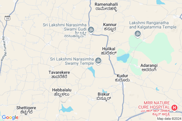
Virupapura
Virupapura Map
EDIT Map
Add Your House
 ..
..
Current Corona Virus Infected Patients Count in Ramanagara District
| City Name | District Name | Total Covid cases |
|---|
Locality Name :
Virupapura
( ವಿರುಪಾಪುರ )
Taluk Name : Magadi
District : Ramanagara
State : Karnataka
Language : Kannada
Current Time 07:05 PM
Date: Monday , Apr 28,2025 (IST)
Time zone: IST (UTC+5:30)
Elevation / Altitude: 773 meters. Above Seal level
Telephone Code / Std Code: 08132
Assembly constituency : Magadi assembly constituency
Assembly MLA : H. C. Balakrishna
Lok Sabha constituency : Bangalore Rural parliamentary constituency
Parliament MP : D.K. SURESH
Serpanch Name :
Pin Code : 561101
Post Office Name : Kudur
Main Village Name : Virupapura
Commodities Prices : Tumkur Market / Mandi
Virupapura Live Weather
Temperature: 32.6 °C
overcast clouds
Humidity: 35%
Wind : 1.26 mt/sec towards N
StationName : "Kunigal"
observed on 2 Hours Back
Temperature: 32.6 °C
overcast clouds
Humidity: 35%
Wind : 1.26 mt/sec towards N
StationName : "Kunigal"
observed on 2 Hours Back
Virupapura Weather Forecast for Next 5 days
29-04-2025
24.9°C to 32.3°C
overcast clouds, light rain
24.9°C to 32.3°C
overcast clouds, light rain
30-04-2025
23.3°C to 35.5°C
broken clouds, scattered clouds, overcast clouds
23.3°C to 35.5°C
broken clouds, scattered clouds, overcast clouds
01-05-2025
23.4°C to 36.9°C
broken clouds, overcast clouds, scattered clouds
23.4°C to 36.9°C
broken clouds, overcast clouds, scattered clouds
02-05-2025
23.8°C to 36.8°C
overcast clouds, broken clouds, scattered clouds
23.8°C to 36.8°C
overcast clouds, broken clouds, scattered clouds
03-05-2025
22.9°C to 37.0°C
scattered clouds, clear sky, light rain, overcast clouds
22.9°C to 37.0°C
scattered clouds, clear sky, light rain, overcast clouds
Edit below overview about Virupapura
Edit below overview about Virupapura
OverView of Virupapura
you can see the holy sri veerabhadreshwara temple here. and this place is famous for trekking also. some people believe that this village was famous because of Sri Rama's visit while searching in Seetha MaathaEdit below overview about Virupapura
National Highways Reachable To Virupapura
Nationa High Way :NH275
Nationa High Way :NH75
Nationa High Way :NH275
Nationa High Way :NH75
About Virupapura
Virupapura is a small Village/hamlet in Magadi Taluk in Ramanagara District of Karnataka State, India. It comes under Virupapura Panchayath. It is located 56 KM towards North from District head quarters Ramanagara. 18 KM from Magadi. 62 KM from State capital Bangalore
Virupapura Pin code is 561101 and postal head office is Kudur .
Hullenahalli ( 5 KM ) , Kudur ( 5 KM ) , Biskur ( 5 KM ) , Srigiripura ( 9 KM ) , Sankighatta ( 9 KM ) are the nearby Villages to Virupapura. Virupapura is surrounded by Tumkur Taluk towards North , Nelamangala Taluk towards East , Kunigal Taluk towards South , Gubbi Taluk towards west .
Magadi , Tumkur , Nelamangala , Ramanagaram are the near by Cities to Virupapura.
Virupapura 2011 Census Details
Virupapura Local Language is Kannada. Virupapura Village Total population is 1177 and number of houses are 261. Female Population is 49.9%. Village literacy rate is 63.7% and the Female Literacy rate is 27.9%.
Population
| Census Parameter | Census Data |
| Total Population | 1177 |
| Total No of Houses | 261 |
| Female Population % | 49.9 % ( 587) |
| Total Literacy rate % | 63.7 % ( 750) |
| Female Literacy rate | 27.9 % ( 328) |
| Scheduled Tribes Population % | 33.4 % ( 393) |
| Scheduled Caste Population % | 20.1 % ( 237) |
| Working Population % | 67.8 % |
| Child(0 -6) Population by 2011 | 140 |
| Girl Child(0 -6) Population % by 2011 | 52.1 % ( 73) |
Virupapura Census More Deatils.
Politics in Virupapura
Indian National Congress , JD(S) , BJP , Janata Dal (Secular) (JD(S)) , INC are the major political parties in this area.Polling Stations /Booths near Virupapura
1)Govt Higher Primary School2)Govt Lower Primary School
3)Govt Higher Primary School
4)Govt Higher Primary School
5)Govt Higher Primary School
HOW TO REACH Virupapura
By Road
Magadi is the Nearest Town to Virupapura. Magadi is 37 km from Virupapura. Road connectivity is there from Magadi to Virupapura.By Rail
There is no railway station near to Virupapura in less than 10 km.Colleges near Virupapura
Govt First Grade College
Address :
Shri Lakshmi Venkateshwara Iti Colleg
Address :
Sree Siddaganga Pu College
Address : Gudemaranahalli, Solur Post,magadi Taluk, Ramanagara District
Schools near Virupapura
Kithururani Channamma Shale
Address : magadi town , magadi , ramanagara , Karnataka . PIN- 562120 , Post - Magadi
Murarji Desai Vasathi School
Address : hulikatte , magadi , ramanagara , Karnataka . PIN- 562120 , Post - Magadi
Minority Muraji Res. School
Address : magadi town , magadi , ramanagara , Karnataka . PIN- 562120 , Post - Magadi
G Lps Thigalarapalya
Address : machohallli , magadi , ramanagara , Karnataka . PIN- 562131 , Post - Thippasandra
Govt Health Centers near Virupapura
1) KAMBALAPALYA , , Sirivara Road , Kambala Palya2) GCR Colony , , GCR COLONY , GCR COLONY
3) MALLASANDRA(R-1) , , ,
Sub Villages in Virupapura
Hospitals in Virupapura,Magadi
ಸರ್ಕಾರಿ ಆಸ್ಪತ್ರೆ ಹೊನ್ನುಡಿಕೆ (Government Hospital Honnudike)
Honnudike; Karnataka 572122; India
10.4 KM distance Detail
more ..
Governement Offices near Virupapura,Magadi
Khb colony bus stop
Kunigal Town Rd; Vidya Nagar; Kunigal; Karnataka 572130; India
17.9 KM distance Detail
About Virupapura &
History
How to reach Virupapura
Tourist Places Near By Virupapura
Schools in Virupapura
Colleges in Virupapura
Temperature & weather of Virupapura
places in Virupapura
Virupapura photos
More Information
How to reach Virupapura
Tourist Places Near By Virupapura
Schools in Virupapura
Colleges in Virupapura
Temperature & weather of Virupapura
places in Virupapura
Virupapura photos
More Information
Village Talk
Post News or Events about this Village
Near Cities
Magadi 22 KM near
Tumkur 30 KM near
Nelamangala 47 KM near
Ramanagaram 53 KM near
Magadi 22 KM near
Tumkur 30 KM near
Nelamangala 47 KM near
Ramanagaram 53 KM near
Near By Taluks
Magadi 16 KM near
Nelamangala 24 KM near
Tumkur 24 KM near
Kunigal 24 KM near
Magadi 16 KM near
Nelamangala 24 KM near
Tumkur 24 KM near
Kunigal 24 KM near
Near By Air Ports
Bengaluru International Airport 70 KM near
Mysore Airport 118 KM near
Salem Airport 223 KM near
Peelamedu Airport 261 KM near
Bengaluru International Airport 70 KM near
Mysore Airport 118 KM near
Salem Airport 223 KM near
Peelamedu Airport 261 KM near
Near By Tourist Places
Shivagange 13 KM near
Savandurga 35 KM near
Bangalore 59 KM near
Nandi Hills 72 KM near
Sravanabelagola 85 KM near
Shivagange 13 KM near
Savandurga 35 KM near
Bangalore 59 KM near
Nandi Hills 72 KM near
Sravanabelagola 85 KM near
Near By Districts
Tumkur 26 KM near
Ramanagara 53 KM near
Bangalore 60 KM near
Bangalore Rural 72 KM near
Tumkur 26 KM near
Ramanagara 53 KM near
Bangalore 60 KM near
Bangalore Rural 72 KM near
Near By RailWay Station
Tumakuru Rail Way Station 25 KM near
Chikka Banavara Junction Rail Way Station 46 KM near
Tumakuru Rail Way Station 25 KM near
Chikka Banavara Junction Rail Way Station 46 KM near