| Home | City Bus | Maps | Villages | Cities | Rail | Tourist Places | School | College | Pin Codes | Corona Cases Count |
| Distance Calculator Bus Services IFSC Codes Trace Mobile Number Weather Search Place Trace IP Available Cash ATM/Banks Locate Polling Booth Report an Error contact People |
Kenkere
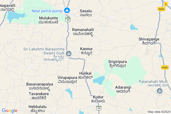
Kenkere Map
EDIT Map
Add Your House
 ..
..
Current Corona Virus Infected Patients Count in Ramanagara District
| City Name | District Name | Total Covid cases |
|---|
Locality Name :
Kenkere
( ಕೆಂಕೆರೆ )
Taluk Name : Magadi
District : Ramanagara
State : Karnataka
Language : Kannada
Current Time 06:02 AM
Date: Saturday , Apr 26,2025 (IST)
Time zone: IST (UTC+5:30)
Elevation / Altitude: 773 meters. Above Seal level
Telephone Code / Std Code: 08132
Assembly constituency : Magadi assembly constituency
Assembly MLA : H. C. Balakrishna
Lok Sabha constituency : Bangalore Rural parliamentary constituency
Parliament MP : D.K. SURESH
Serpanch Name :
Pin Code : 561101
Post Office Name : Kudur
Main Village Name : Kenkere
Alternate Village Name : Kenkerepalya
Commodities Prices : Tumkur Market / Mandi
Edit below overview about Kenkere
Edit below overview about Kenkere
OverView of Kenkere
THIS VILLAGE IS FAMOUS FOR ANJANEYA TEMPLE. THIS VILLAGE IS CLOSE TO SUGGANAHALLI THE PLACE WHICH IS FAMOUS FOR LAKSHMI NARASIMHA TEMPE.AND ALSO NEAR TO SHIVAGANGA KSHETRA 6 KMEdit below overview about Kenkere
National Highways Reachable To Kenkere
Nationa High Way :NH275
Nationa High Way :NH75
Nationa High Way :NH275
Nationa High Way :NH75
About Kenkere
Kenkere is a small Village/hamlet in Magadi Taluk in Ramanagara District of Karnataka State, India. It comes under Kenkere Panchayath. It is located 59 KM towards North from District head quarters Ramanagara. 20 KM from Magadi. 62 KM from State capital Bangalore
Kenkere Pin code is 561101 and postal head office is Kudur .
Srigiripura ( 6 KM ) , Kudur ( 7 KM ) , Adarangi ( 8 KM ) , Biskur ( 9 KM ) , Hullenahalli ( 9 KM ) are the nearby Villages to Kenkere. Kenkere is surrounded by Tumkur Taluk towards North , Nelamangala Taluk towards East , Kunigal Taluk towards South , Gubbi Taluk towards west .
Magadi , Tumkur , Nelamangala , Ramanagaram are the near by Cities to Kenkere.
Kenkere 2011 Census Details
Kenkere Local Language is Kannada. Kenkere Village Total population is 644 and number of houses are 166. Female Population is 51.6%. Village literacy rate is 64.3% and the Female Literacy rate is 29.8%.
Population
| Census Parameter | Census Data |
| Total Population | 644 |
| Total No of Houses | 166 |
| Female Population % | 51.6 % ( 332) |
| Total Literacy rate % | 64.3 % ( 414) |
| Female Literacy rate | 29.8 % ( 192) |
| Scheduled Tribes Population % | 0.0 % ( 0) |
| Scheduled Caste Population % | 44.6 % ( 287) |
| Working Population % | 54.5 % |
| Child(0 -6) Population by 2011 | 40 |
| Girl Child(0 -6) Population % by 2011 | 52.5 % ( 21) |
Kenkere Census More Deatils.
Politics in Kenkere
Indian National Congress , JD(S) , BJP , Janata Dal (Secular) (JD(S)) , INC are the major political parties in this area.Polling Stations /Booths near Kenkere
1)Govt Lower Primary School2)Govt Higher Primary School
3)Govt Lower Primary School
4)Govt Lower Primary School
5)Govt Higher Primary School
HOW TO REACH Kenkere
By Road
Tumkur is the Nearest Town to Kenkere. Tumkur is 34 km from Kenkere. Road connectivity is there from Tumkur to Kenkere.By Rail
There is no railway station near to Kenkere in less than 10 km. How ever there are railway Stations from Near By town Tumkur. are the railway Stations near to Tumkur. You can reach from Tumkur to Kenkere by road after .Colleges near Kenkere
Govt First Grade College
Address :
Shri Lakshmi Venkateshwara Iti Colleg
Address :
Sree Siddaganga Pu College
Address : Gudemaranahalli, Solur Post,magadi Taluk, Ramanagara District
Schools in Kenkere
G Lps Kenkere -2
Address : kenkere , magadi , ramanagara , Karnataka . PIN- 561101 , Post - Kudur
G Lps Kenkere-1
Address : kenkere , magadi , ramanagara , Karnataka . PIN- 561101 , Post - Kudur
Govt Health Centers near Kenkere
1) KAMBALAPALYA , , Sirivara Road , Kambala Palya2) GCR Colony , , GCR COLONY , GCR COLONY
3) MALLASANDRA(R-1) , , ,
Sub Villages in Kenkere
Hospitals in Kenkere,Magadi
ಸರ್ಕಾರಿ ಆಸ್ಪತ್ರೆ ಹೊನ್ನುಡಿಕೆ (Government Hospital Honnudike)
Honnudike; Karnataka 572122; India
7.1 KM distance Detail
ಪಶು ಚಿಕಿತ್ಸಾಲಯ ಶಿವಗಂಗೆ ನೆಲಮಂಗಲ ತಾಲ್ಲೂಕಿನ
Shivaganga; Karnataka 562127; India
10.5 KM distance Detail
Primary Health Centre; Hospital
Sivaganga; Dabaspete; Bangalore Rural; SH-3; Mangadi Road; Nelamangala; Nelamangala; Karnataka 562111; India
10.6 KM distance Detail
more ..
Governement Offices near Kenkere,Magadi
Sree Siddeshwara Swamy Sabha Bhawana
Tumkur Rd; Kesaramadu; Karnataka 572104; India
16.8 KM distance Detail
Tumkur VAt Office
Karnataka; Jayanagar East; Dasappa Garden; Tumakuru; Karnataka 572103; India
20.2 KM distance Detail
About Kenkere &
History
How to reach Kenkere
Tourist Places Near By Kenkere
Schools in Kenkere
Colleges in Kenkere
Temperature & weather of Kenkere
places in Kenkere
Kenkere photos
More Information
How to reach Kenkere
Tourist Places Near By Kenkere
Schools in Kenkere
Colleges in Kenkere
Temperature & weather of Kenkere
places in Kenkere
Kenkere photos
More Information
Village Talk
Post News or Events about this Village
Near Cities
Magadi 25 KM near
Tumkur 27 KM near
Nelamangala 43 KM near
Ramanagaram 56 KM near
Magadi 25 KM near
Tumkur 27 KM near
Nelamangala 43 KM near
Ramanagaram 56 KM near
Near By Taluks
Magadi 19 KM near
Tumkur 21 KM near
Nelamangala 21 KM near
Kunigal 29 KM near
Magadi 19 KM near
Tumkur 21 KM near
Nelamangala 21 KM near
Kunigal 29 KM near
Near By Air Ports
Bengaluru International Airport 67 KM near
Mysore Airport 123 KM near
Salem Airport 225 KM near
Peelamedu Airport 265 KM near
Bengaluru International Airport 67 KM near
Mysore Airport 123 KM near
Salem Airport 225 KM near
Peelamedu Airport 265 KM near
Near By Tourist Places
Shivagange 9 KM near
Savandurga 37 KM near
Bangalore 58 KM near
Nandi Hills 68 KM near
Sravanabelagola 89 KM near
Shivagange 9 KM near
Savandurga 37 KM near
Bangalore 58 KM near
Nandi Hills 68 KM near
Sravanabelagola 89 KM near
Near By Districts
Tumkur 22 KM near
Ramanagara 56 KM near
Bangalore 59 KM near
Bangalore Rural 69 KM near
Tumkur 22 KM near
Ramanagara 56 KM near
Bangalore 59 KM near
Bangalore Rural 69 KM near
Near By RailWay Station
Tumakuru Rail Way Station 22 KM near
Chikka Banavara Junction Rail Way Station 44 KM near
Tumakuru Rail Way Station 22 KM near
Chikka Banavara Junction Rail Way Station 44 KM near