| Home | City Bus | Maps | Villages | Cities | Rail | Tourist Places | School | College | Pin Codes | Corona Cases Count |
| Distance Calculator Bus Services IFSC Codes Trace Mobile Number Weather Search Place Trace IP Available Cash ATM/Banks Locate Polling Booth Report an Error contact People |
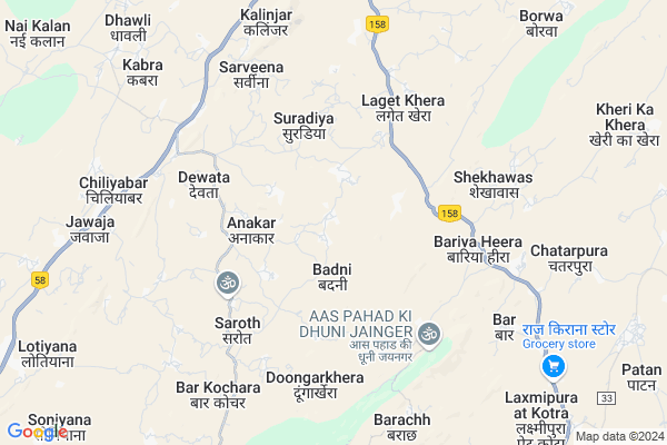
Kheta Khera Map
EDIT Map
Add Your House
 ..
..
Current Corona Virus Infected Patients Count in Rajsamand District
| City Name | District Name | Total Covid cases |
|---|---|---|
| Rajsamand District | Rajsamand | 1 |
Locality Name :
Kheta Khera
( कहता खेरा )
Tehsil Name : Bhim
District : Rajsamand
State : Rajasthan
Division : Udaipur
Language : Hindi and Rajasthani
Current Time 11:44 AM
Date: Friday , Mar 14,2025 (IST)
Time zone: IST (UTC+5:30)
Elevation / Altitude: 894 meters. Above Seal level
Telephone Code / Std Code: 02951
Assembly constituency : Bhim assembly constituency
Assembly MLA :
Lok Sabha constituency : Rajsamand parliamentary constituency
Parliament MP :
Serpanch Name :
Main Village Name : Kheta Khera
Commodities Prices : Beawar Market / Mandi
Kheta Khera Live Weather
Temperature: 25.4 °C
broken clouds
Humidity: 32%
Wind : 3.01 mt/sec towards SW
StationName : "Ä\u0080sind"
observed on 2 Hours Back
Temperature: 25.4 °C
broken clouds
Humidity: 32%
Wind : 3.01 mt/sec towards SW
StationName : "Ä\u0080sind"
observed on 2 Hours Back
Kheta Khera Weather Forecast for Next 5 days
15-03-2025
24.9°C to 34.0°C
broken clouds, scattered clouds, few clouds, clear sky
24.9°C to 34.0°C
broken clouds, scattered clouds, few clouds, clear sky
16-03-2025
21.9°C to 32.8°C
scattered clouds, overcast clouds, broken clouds
21.9°C to 32.8°C
scattered clouds, overcast clouds, broken clouds
17-03-2025
19.7°C to 32.2°C
scattered clouds, clear sky
19.7°C to 32.2°C
scattered clouds, clear sky
18-03-2025
18.5°C to 30.9°C
clear sky
18.5°C to 30.9°C
clear sky
19-03-2025
18.8°C to 31.8°C
clear sky
18.8°C to 31.8°C
clear sky
National Highways Reachable To Kheta Khera
Nationa High Way :NH48
Nationa High Way :NH48
Rivers Near Kheta Khera
Nekhadi
Khari
Nekhadi
Khari
About Kheta Khera
Correct below Info and add more info about Kheta KheraKheta Khera is a small Village/hamlet in Bhim Tehsil in Rajsamand District of Rajasthan State, India. It comes under Kheta Khera Panchayath. It belongs to Udaipur Division . It is located 122 KM towards North from District head quarters Rajsamand. 37 KM from Bhim. 220 KM from State capital Jaipur
Bar ( 6 KM ) , Shekhawas ( 8 KM ) , Borwa ( 13 KM ) , Jaitgarh ( 17 KM ) are the nearby Villages to Kheta Khera. Kheta Khera is surrounded by Beawar Tehsil towards North , Raipur Tehsil towards west , Asind Tehsil towards South , Masooda Tehsil towards East .
Beawar , Jaitaran , Nasirabad , Sojat are the near by Cities to Kheta Khera.
Kheta Khera 2011 Census Details
Kheta Khera Local Language is Hindi. Kheta Khera Village Total population is 206 and number of houses are 51. Female Population is 43.2%. Village literacy rate is 40.8% and the Female Literacy rate is 9.2%.
Population
| Census Parameter | Census Data |
| Total Population | 206 |
| Total No of Houses | 51 |
| Female Population % | 43.2 % ( 89) |
| Total Literacy rate % | 40.8 % ( 84) |
| Female Literacy rate | 9.2 % ( 19) |
| Scheduled Tribes Population % | 0.0 % ( 0) |
| Scheduled Caste Population % | 11.7 % ( 24) |
| Working Population % | 49.5 % |
| Child(0 -6) Population by 2011 | 44 |
| Girl Child(0 -6) Population % by 2011 | 43.2 % ( 19) |
Kheta Khera Census More Deatils.
Politics in Kheta Khera
Bharatiya Janata Party , BJP , INC are the major political parties in this area.Polling Stations /Booths near Kheta Khera
1)Govt Adarsh Hr Sec. School Lasadiya2)Govt. Primary School Kahari
3)Govt.upper Primary School Jai Nagar
4)Govt. Primary School Aasan
5)Govt. Aadrsh Sr Sec School Saroth
HOW TO REACH Kheta Khera
By Rail
There is no railway station near to Kheta Khera in less than 10 km.Pincodes near Kheta Khera
305922 ( Jawaja ) , 305925 ( Rajiawas ) , 305927 ( Kabra )Colleges near Kheta Khera
Govt. College, Bhim
Address :
Schools near Kheta Khera
G.u.p.s.kheri Ka Khera
Address : kheri ka khera , bhim , rajsamand , Rajasthan . PIN- 311302 , Post - Badnore
G.s.s.badhana
Address : baghana , bhim , rajsamand , Rajasthan . PIN- 313331 , Post - Deogarh (Rajsamand)
G.u.p.s.khima Khera
Address : khimakhera , bhim , rajsamand , Rajasthan . PIN- 313331 , Post - Deogarh (Rajsamand)
Vivekanand Vp Ups Barar
Address : barar , bhim , rajsamand , Rajasthan . PIN- 313341 , Post - Barar
Govt Health Centers near Kheta Khera
1) Chatarpura , SC Chatarpura , SC Chatarpura , SC Chatarpura2) Baar , BAAR , BAAR , PHC BAAR
3) RAJAWA , , ,
Sub Villages in Kheta Khera
Hospitals in Kheta Khera,Bhim
Up Swasthya Kendra
Bariya Heera; Ajmer; NH-158; Rajsamand Road; Beawar; Beawar; Rajasthan 311301; India
5.9 KM distance Detail
Government Up Swasthya Kendra
Asind Beawar Rd; Beawar; Rajasthan 311301; India
6.5 KM distance Detail
more ..
Petrol Bunks in Kheta Khera,Bhim
HP PETROL PUMP ROHIT SERVICE STATION
NH-8 Kalatkhera Jwaja TEH Beawr Dist RAJ; Rajasthan 305922; India
7.6 KM distance Detail
Ramesh Agro Service Centre Petrol Pump
Chouhan Colony; Beawar; Rajasthan 305901; India
17.4 KM distance Detail
Indian Oil Petrol Pump
Beawar Bypass to Ajmer; Chouhan Colony; Beawar; Rajasthan 305901; India
17.4 KM distance Detail
more ..
Colleges in Kheta Khera,Bhim
SMS College of Nursing
Ajmer; NH-8; Ajmer Road; Beawar; Beawar; Rajasthan 305901; India
16.5 KM distance Detail
more ..
Schools in Kheta Khera,Bhim
Government Primary School Thoriya Kheda
Thotiya Kheda; Anakar;; Jawaja; Rajasthan 305922; India
3.4 KM distance Detail
goverment senior secondary school;doongarkhera
Doongarkhera; Rajasthan 305925; India
4.0 KM distance Detail
Government Primary School
Bariya Heera; Ajmer; NH-158; Rajsamand Road; Beawar; Beawar; Rajasthan 311301; India
4.7 KM distance Detail
Police Stations near Kheta Khera,Bhim
Sadar Thana (Polic Station)
Station Rd; Shahpura Mohalla; Beawar; Rajasthan 305901; India
22.0 KM distance Detail
Governement Offices near Kheta Khera,Bhim
Atal Seva Center
Bheem; Ajmer; NH-158; Bhilwara Road; Beawar; Beawar; Rajasthan 311301; India
5.9 KM distance Detail
About Kheta Khera &
History
How to reach Kheta Khera
Tourist Places Near By Kheta Khera
Schools in Kheta Khera
Colleges in Kheta Khera
Temperature & weather of Kheta Khera
places in Kheta Khera
Kheta Khera photos
More Information
How to reach Kheta Khera
Tourist Places Near By Kheta Khera
Schools in Kheta Khera
Colleges in Kheta Khera
Temperature & weather of Kheta Khera
places in Kheta Khera
Kheta Khera photos
More Information
Village Talk
Post News or Events about this Village
Near Cities
Beawar 19 KM near
Jaitaran 50 KM near
Nasirabad 65 KM near
Sojat 68 KM near
Beawar 19 KM near
Jaitaran 50 KM near
Nasirabad 65 KM near
Sojat 68 KM near
Near By Taluks
Jawaja 9 KM near
Beawar 20 KM near
Raipur 26 KM near
Masooda 26 KM near
Jawaja 9 KM near
Beawar 20 KM near
Raipur 26 KM near
Masooda 26 KM near
Near By Air Ports
Jodhpur Airport 143 KM near
Dabok Airport 170 KM near
Sanganeer Airport 202 KM near
Jaisalmer Airport 396 KM near
Jodhpur Airport 143 KM near
Dabok Airport 170 KM near
Sanganeer Airport 202 KM near
Jaisalmer Airport 396 KM near
Near By Tourist Places
Pushkar 75 KM near
Ajmer 75 KM near
Bhilwara 84 KM near
Kishangarh 102 KM near
Ranakpur 134 KM near
Pushkar 75 KM near
Ajmer 75 KM near
Bhilwara 84 KM near
Kishangarh 102 KM near
Ranakpur 134 KM near
Near By Districts
Ajmer 76 KM near
Bhilwara 84 KM near
Pali 109 KM near
Rajsamand 118 KM near
Ajmer 76 KM near
Bhilwara 84 KM near
Pali 109 KM near
Rajsamand 118 KM near
Near By RailWay Station
Beawar Rail Way Station 21 KM near
Bijainagar Rail Way Station 41 KM near
Beawar Rail Way Station 21 KM near
Bijainagar Rail Way Station 41 KM near