| Home | City Bus | Maps | Villages | Cities | Rail | Tourist Places | School | College | Pin Codes | Corona Cases Count |
| Distance Calculator Bus Services IFSC Codes Trace Mobile Number Weather Search Place Trace IP Available Cash ATM/Banks Locate Polling Booth Report an Error contact People |
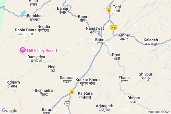
Amarpura Map
EDIT Map
Add Your House
 ..
..
Current Corona Virus Infected Patients Count in Rajsamand District
| City Name | District Name | Total Covid cases |
|---|---|---|
| Rajsamand District | Rajsamand | 1 |
Locality Name :
Amarpura
( अमरपुरा )
Tehsil Name : Bhim
District : Rajsamand
State : Rajasthan
Division : Udaipur
Language : Hindi and Rajasthani
Current Time 11:25 AM
Date: Friday , Mar 14,2025 (IST)
Time zone: IST (UTC+5:30)
Elevation / Altitude: 894 meters. Above Seal level
Telephone Code / Std Code: 02951
Assembly constituency : Bhim assembly constituency
Assembly MLA : Harisingh Rawat S/o Panna Singh
Lok Sabha constituency : Rajsamand parliamentary constituency
Parliament MP : Diya Kumari
Serpanch Name :
Pin Code : 311302
Post Office Name : Badnore
Main Village Name : Amarpura
Commodities Prices : Sojat Road Market / Mandi
Amarpura Live Weather
Temperature: 25.7 °C
broken clouds
Humidity: 33%
Wind : 5.43 mt/sec towards SW
StationName : "Ä\u0080sind"
observed on 2 Hours Back
Temperature: 25.7 °C
broken clouds
Humidity: 33%
Wind : 5.43 mt/sec towards SW
StationName : "Ä\u0080sind"
observed on 2 Hours Back
Amarpura Weather Forecast for Next 5 days
15-03-2025
23.9°C to 33.3°C
broken clouds, scattered clouds, few clouds, clear sky
23.9°C to 33.3°C
broken clouds, scattered clouds, few clouds, clear sky
16-03-2025
21.3°C to 31.9°C
few clouds, overcast clouds, broken clouds
21.3°C to 31.9°C
few clouds, overcast clouds, broken clouds
17-03-2025
19.2°C to 31.5°C
scattered clouds, clear sky
19.2°C to 31.5°C
scattered clouds, clear sky
18-03-2025
18.0°C to 30.2°C
clear sky, few clouds
18.0°C to 30.2°C
clear sky, few clouds
19-03-2025
18.3°C to 31.4°C
clear sky
18.3°C to 31.4°C
clear sky
National Highways Reachable To Amarpura
Nationa High Way :NH48
Nationa High Way :NH48
Rivers Near Amarpura
Nekhadi
Khari
Nekhadi
Khari
About Amarpura
Correct below Info and add more info about AmarpuraAmarpura is a small Village/hamlet in Bhim Tehsil in Rajsamand District of Rajasthan State, India. It comes under Amarpura Panchayath. It belongs to Udaipur Division . It is located 87 KM towards North from District head quarters Rajsamand. 257 KM from State capital Jaipur
Amarpura Pin code is 311302 and postal head office is Badnore .
Amarpura is surrounded by Deogarh Tehsil towards South , Asind Tehsil towards East , Kharchi(Mar.Jun) Tehsil towards west , Jawaja Tehsil towards North .
Sojat , Beawar , Jaitaran , Bilara are the near by Cities to Amarpura.
Amarpura 2011 Census Details
Amarpura Local Language is Hindi. Amarpura Village Total population is 420 and number of houses are 83. Female Population is 50.5%. Village literacy rate is 45.7% and the Female Literacy rate is 14.8%.
Population
| Census Parameter | Census Data |
| Total Population | 420 |
| Total No of Houses | 83 |
| Female Population % | 50.5 % ( 212) |
| Total Literacy rate % | 45.7 % ( 192) |
| Female Literacy rate | 14.8 % ( 62) |
| Scheduled Tribes Population % | 0.0 % ( 0) |
| Scheduled Caste Population % | 48.8 % ( 205) |
| Working Population % | 53.3 % |
| Child(0 -6) Population by 2011 | 73 |
| Girl Child(0 -6) Population % by 2011 | 42.5 % ( 31) |
Amarpura Census More Deatils.
Politics in Amarpura
Bharatiya Janata Party , BJP , INC are the major political parties in this area.Polling Stations /Booths near Amarpura
1)Govt.primary School Pela Badiya2)Govt.primary School Nedi
3)Govt.primary School Nayagaon Shekhawas
4)Govt. Adarsh Sr Secondary School Bar
5)Govt. Adarsh Sr.sec.school Bhim (left Part)
HOW TO REACH Amarpura
By Rail
There is no railway station near to Amarpura in less than 10 km.Colleges near Amarpura
Govt. College, Bhim
Address :
Schools in Amarpura
G.p.s.amarpura
Address : amarpura , bhim , rajsamand , Rajasthan . PIN- 311302 , Post - Badnore
Govt Health Centers near Amarpura
1) Bhojpura , SC Bhojpura , SC Bhojpura , SC Bhojpura2) Thal , SC Thal , Thal , Thal
3) Jinjardi , , ,
Sub Villages in Amarpura
Hospitals in Amarpura,Bhim
aadinath complex aarogiya homoeopathic center bhim
Dharmeshpuri; Bhim; Rajasthan 305921; India
2.9 KM distance Detail
पशुधन इकाई मण्डावर Animal Hospital Mandawar
Mandawar; Rajasthan 313341; India
19.4 KM distance Detail
more ..
Petrol Bunks in Amarpura,Bhim
Bharat Petroleum
Bhim Rajsamand; NH-8; Rajsamand Road; Devgarh; Bhim; Rajasthan 305921; India
1.5 KM distance Detail
more ..
Schools in Amarpura,Bhim
राजकीय आदर्श उच्च माध्यमिक विद्यालय
डूंगाजी का गांव; तहसील भीम जिला; Rajasthan 305921; India
2.4 KM distance Detail
Police Stations near Amarpura,Bhim
Governement Offices near Amarpura,Bhim
Rajiv Gandhi Seva Center
Bhim; Rajsamand; NH-8; Rajsamand Road; Devgarh; Devgarh; Rajasthan 305922; India
6.4 KM distance Detail
Gram Panchyat Office Jashakhera
Bhim; Rajsamand; NH-8; Rajsamand Road; Devgarh; Devgarh; Rajasthan 305922; India
15.1 KM distance Detail
About Amarpura &
History
How to reach Amarpura
Tourist Places Near By Amarpura
Schools in Amarpura
Colleges in Amarpura
Temperature & weather of Amarpura
places in Amarpura
Amarpura photos
More Information
How to reach Amarpura
Tourist Places Near By Amarpura
Schools in Amarpura
Colleges in Amarpura
Temperature & weather of Amarpura
places in Amarpura
Amarpura photos
More Information
Village Talk
Post News or Events about this Village
Near Cities
Sojat 51 KM near
Beawar 55 KM near
Jaitaran 61 KM near
Bilara 67 KM near
Sojat 51 KM near
Beawar 55 KM near
Jaitaran 61 KM near
Bilara 67 KM near
Near By Taluks
Bhim 0 KM near
Deogarh 31 KM near
Asind 33 KM near
Kharchi(Mar.Jun) 37 KM near
Bhim 0 KM near
Deogarh 31 KM near
Asind 33 KM near
Kharchi(Mar.Jun) 37 KM near
Near By Air Ports
Jodhpur Airport 131 KM near
Dabok Airport 138 KM near
Sanganeer Airport 237 KM near
Ahmedabad Airport 368 KM near
Jodhpur Airport 131 KM near
Dabok Airport 138 KM near
Sanganeer Airport 237 KM near
Ahmedabad Airport 368 KM near
Near By Tourist Places
Bhilwara 79 KM near
Ranakpur 97 KM near
Nathdwara 101 KM near
Kumbhalgarh 109 KM near
Pushkar 110 KM near
Bhilwara 79 KM near
Ranakpur 97 KM near
Nathdwara 101 KM near
Kumbhalgarh 109 KM near
Pushkar 110 KM near
Near By Districts
Bhilwara 79 KM near
Pali 82 KM near
Rajsamand 84 KM near
Ajmer 112 KM near
Bhilwara 79 KM near
Pali 82 KM near
Rajsamand 84 KM near
Ajmer 112 KM near
Near By RailWay Station
Sojat Road Rail Way Station 38 KM near
Marwar Junction Rail Way Station 50 KM near
Sojat Road Rail Way Station 38 KM near
Marwar Junction Rail Way Station 50 KM near