| Home | City Bus | Maps | Villages | Cities | Rail | Tourist Places | School | College | Pin Codes | Corona Cases Count |
| Distance Calculator Bus Services IFSC Codes Trace Mobile Number Weather Search Place Trace IP Available Cash ATM/Banks Locate Polling Booth Report an Error contact People |
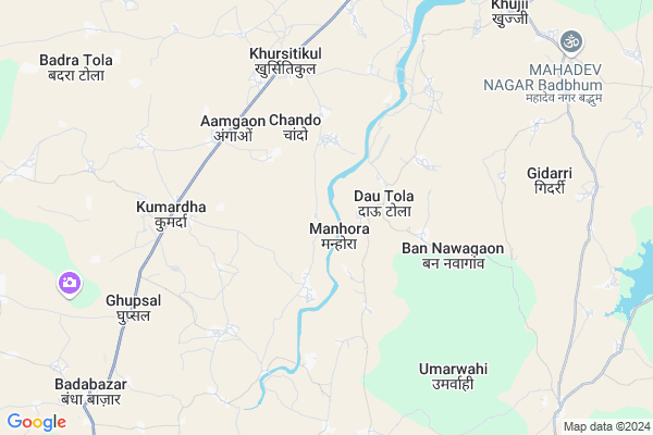
Manhora
Manhora Map
EDIT Map
Add Your House
 ..
..
Current Corona Virus Infected Patients Count in Rajnandgaon District
| City Name | District Name | Total Covid cases |
|---|---|---|
| Rajnandgaon | Rajnandgaon | 1 |
Locality Name :
Manhora
( मन्होरा )
Tehsil Name : Chhuriya
District : Rajnandgaon
State : Chattisgarh
Language : Chhattisgarhi and Hindi
Current Time 10:05 AM
Date: Friday , Apr 25,2025 (IST)
Time zone: IST (UTC+5:30)
Elevation / Altitude: 353 meters. Above Seal level
Telephone Code / Std Code: 07744
Assembly constituency : Khujji assembly constituency
Assembly MLA : Bholaram Sahu
Lok Sabha constituency : Rajnandgaon parliamentary constituency
Parliament MP : SANTOSH PANDEY
Serpanch Name :
Main Village Name : Manhora
Commodities Prices : Bandhabazar Market / Mandi
Manhora Live Weather
Temperature: 40.9 °C
clear sky
Humidity: 16%
Wind : 5.89 mt/sec towards SW
StationName : "Dongargaon"
observed on Now
Temperature: 40.9 °C
clear sky
Humidity: 16%
Wind : 5.89 mt/sec towards SW
StationName : "Dongargaon"
observed on Now
Manhora Weather Forecast for Next 5 days
26-04-2025
31.2°C to 43.5°C
clear sky, few clouds, scattered clouds, broken clouds, overcast clouds
31.2°C to 43.5°C
clear sky, few clouds, scattered clouds, broken clouds, overcast clouds
27-04-2025
28.7°C to 42.2°C
broken clouds, clear sky, light rain, overcast clouds
28.7°C to 42.2°C
broken clouds, clear sky, light rain, overcast clouds
28-04-2025
25.8°C to 38.4°C
light rain, overcast clouds, broken clouds, scattered clouds
25.8°C to 38.4°C
light rain, overcast clouds, broken clouds, scattered clouds
29-04-2025
25.0°C to 41.0°C
few clouds, clear sky, scattered clouds, broken clouds
25.0°C to 41.0°C
few clouds, clear sky, scattered clouds, broken clouds
30-04-2025
26.8°C to 42.7°C
scattered clouds, clear sky, broken clouds, overcast clouds
26.8°C to 42.7°C
scattered clouds, clear sky, broken clouds, overcast clouds
National Highways Reachable To Manhora
Nationa High Way :NH53
Nationa High Way :NH53
Rivers Near Manhora
Sasakuran
Bagh
Sasakuran
Bagh
About Manhora
Correct below Info and add more info about ManhoraManhora is a small Village/hamlet in Chhuriya Tehsil in Rajnandgaon District of Chattisgarh State, India. It comes under Manhora Panchayath. It is located 37 KM towards South from District head quarters Rajnandgaon. 20 KM from Chhuria. 108 KM from State capital Raipur
Bannawagaon ( 4 KM ) , Pangrikhurd ( 4 KM ) , Bhandaribharda ( 5 KM ) , Haladula ( 6 KM ) , Amgaon(k) ( 7 KM ) are the nearby Villages to Manhora. Manhora is surrounded by A.Chowki (Td) Tehsil towards west , Chhuriya Tehsil towards west , Dondilohara Tehsil towards East , Mohala (Td) Tehsil towards South .
Rajnandgaon , Dongargarh , Dalli-Rajhara , Balod are the near by Cities to Manhora.
Manhora 2011 Census Details
Manhora Local Language is Chhattisgarhi. Manhora Village Total population is 678 and number of houses are 139. Female Population is 48.8%. Village literacy rate is 72.0% and the Female Literacy rate is 30.8%.
Population
| Census Parameter | Census Data |
| Total Population | 678 |
| Total No of Houses | 139 |
| Female Population % | 48.8 % ( 331) |
| Total Literacy rate % | 72.0 % ( 488) |
| Female Literacy rate | 30.8 % ( 209) |
| Scheduled Tribes Population % | 1.9 % ( 13) |
| Scheduled Caste Population % | 19.3 % ( 131) |
| Working Population % | 58.0 % |
| Child(0 -6) Population by 2011 | 87 |
| Girl Child(0 -6) Population % by 2011 | 44.8 % ( 39) |
Manhora Census More Deatils.
Politics in Manhora
Bharatiya Janata Party , BJP , INC are the major political parties in this area.Polling Stations /Booths near Manhora
1)Mangatola2)Baniyatola
3)Dhadhutola
4)Sagar
5)Dhanagaon
HOW TO REACH Manhora
By Rail
There is no railway station near to Manhora in less than 10 km.Pincodes near Manhora
491661 ( Dongargaon ) , 491668 ( Bandha Bazar ) , 491665 ( Ambagarh Chowki )Colleges near Manhora
Chhatishgarh Ayurved Medical Collage
Address :
Kunjbihari Chaube Govt. Collage
Address :
Rani Avanti Bai Lodhi Collage.
Address :
Indira Kala Sangeet University
Address : Khairagarhchhattisgarhindia
Chhattisgarh Institute Of Management Studies (cims)
Address : G.e. Road,rajnandgaon (c.g.)
Schools near Manhora
M.s. (new) Gunderdehi
Address : gunder dehi , churia , rajnandgaon , Chattisgarh . PIN- 491661 , Post - Dongargaon
M.s. (new) Daihan
Address : daihan , churia , rajnandgaon , Chattisgarh . PIN- 491668 , Post - Bandha Bazar
M.s. (new) Bijepar
Address : bijepar , churia , rajnandgaon , Chattisgarh . PIN- 491558 , Post - Chhuria
M.s. (new) Nagarkohra
Address : nagar kohara , churia , rajnandgaon , Chattisgarh . PIN- 491557 , Post - Chichola
Govt Health Centers near Manhora
1) Salhe , Sub Health Center Salhe , ,2) SHC Dautola , Sub Health Center Dautola , ,
3) PHC Kumarda , Primary Health Center Kumarda , ,
Sub Villages in Manhora
Hospitals in Manhora,Chhuriya
पशु-औषधालय कुमरदा
से चौकी मार्ग; Kandra Para; Dongargaon; Chhattisgarh 491661; India
11.1 KM distance Detail
more ..
Petrol Bunks in Manhora,Chhuriya
HP PETROL PUMP - DONGARGAON FUELS
HP Petrol Pump Dongargaon; Raipur; Chhattisgarh 491661; India
12.9 KM distance Detail
HP GAS GODOWN
MOGARA COLONY ROAD; Jewartala - Dongargaon Road; Chhattisgarh 491661; India
12.9 KM distance Detail
more ..
Police Stations near Manhora,Chhuriya
Dongargaon Police Station
State Highway; Opp. SDM Office; Dongargaon; Chhattisgarh 491661; India
12.2 KM distance Detail
Governement Offices near Manhora,Chhuriya
Electricity Office
MAIN ROAD; Jewartala - Dongargaon Rd; Dongargaon; Chhattisgarh 491661; India
12.0 KM distance Detail
About Manhora &
History
How to reach Manhora
Tourist Places Near By Manhora
Schools in Manhora
Colleges in Manhora
Temperature & weather of Manhora
places in Manhora
Manhora photos
More Information
How to reach Manhora
Tourist Places Near By Manhora
Schools in Manhora
Colleges in Manhora
Temperature & weather of Manhora
places in Manhora
Manhora photos
More Information
Village Talk
Post News or Events about this Village
Near Cities
Rajnandgaon 35 KM near
Dongargarh 37 KM near
Dalli-Rajhara 49 KM near
Balod 49 KM near
Rajnandgaon 35 KM near
Dongargarh 37 KM near
Dalli-Rajhara 49 KM near
Balod 49 KM near
Near By Taluks
Dongargaon 18 KM near
A.Chowki (Td) 19 KM near
Chhuriya 19 KM near
Dondilohara 32 KM near
Dongargaon 18 KM near
A.Chowki (Td) 19 KM near
Chhuriya 19 KM near
Dondilohara 32 KM near
Near By Air Ports
Raipur Airport 113 KM near
Sonegaon Airport 206 KM near
Jabalpur Airport 244 KM near
Nanded Airport 461 KM near
Raipur Airport 113 KM near
Sonegaon Airport 206 KM near
Jabalpur Airport 244 KM near
Nanded Airport 461 KM near
Near By Tourist Places
Rajnandgaon 35 KM near
Durg 65 KM near
Bhilai 76 KM near
Dhamtari 87 KM near
Raipur 104 KM near
Rajnandgaon 35 KM near
Durg 65 KM near
Bhilai 76 KM near
Dhamtari 87 KM near
Raipur 104 KM near
Near By Districts
Rajnandgaon 35 KM near
Durg 65 KM near
Dhamtari 87 KM near
Gondia 101 KM near
Rajnandgaon 35 KM near
Durg 65 KM near
Dhamtari 87 KM near
Gondia 101 KM near
Near By RailWay Station
Raj Nandgaon Rail Way Station 36 KM near
Dongargarh Rail Way Station 37 KM near
Raj Nandgaon Rail Way Station 36 KM near
Dongargarh Rail Way Station 37 KM near