| Home | City Bus | Maps | Villages | Cities | Rail | Tourist Places | School | College | Pin Codes | Corona Cases Count |
| Distance Calculator Bus Services IFSC Codes Trace Mobile Number Weather Search Place Trace IP Available Cash ATM/Banks Locate Polling Booth Report an Error contact People |
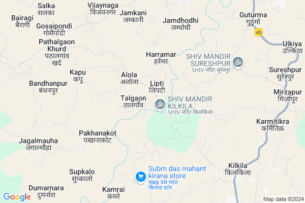
Golabuda
Golabuda Map
EDIT Map
Add Your House
 ..
..
Current Corona Virus Infected Patients Count in Raigarh District
| City Name | District Name | Total Covid cases |
|---|
Locality Name :
Golabuda
( गोलाबुदा )
Tehsil Name : Dharamjaigarh
District : Raigarh
State : Chattisgarh
Language : Chhattisgarhi and Hindi, Oriya
Current Time 12:14 PM
Date: Tuesday , Apr 29,2025 (IST)
Time zone: IST (UTC+5:30)
Elevation / Altitude: 293 meters. Above Seal level
Telephone Code / Std Code: 07766
Assembly constituency : Pathalgaon assembly constituency
Assembly MLA : Gomati Sai
Lok Sabha constituency : Raigarh parliamentary constituency
Parliament MP : GOMATI SAI
Serpanch Name :
Main Village Name : Golabuda
Commodities Prices : Pathalgaon Market / Mandi
Golabuda Live Weather
Temperature: 32.2 °C
clear sky
Humidity: 30%
Wind : 3.64 mt/sec towards SW
StationName : "Pathalgaon"
observed on 1 Hours Back
Temperature: 32.2 °C
clear sky
Humidity: 30%
Wind : 3.64 mt/sec towards SW
StationName : "Pathalgaon"
observed on 1 Hours Back
Golabuda Weather Forecast for Next 5 days
30-04-2025
22.9°C to 36.3°C
clear sky, few clouds, light rain, broken clouds
22.9°C to 36.3°C
clear sky, few clouds, light rain, broken clouds
01-05-2025
21.8°C to 38.1°C
scattered clouds, clear sky, few clouds, light rain
21.8°C to 38.1°C
scattered clouds, clear sky, few clouds, light rain
02-05-2025
21.6°C to 38.2°C
clear sky, broken clouds, scattered clouds
21.6°C to 38.2°C
clear sky, broken clouds, scattered clouds
03-05-2025
21.0°C to 37.7°C
clear sky, scattered clouds, overcast clouds
21.0°C to 37.7°C
clear sky, scattered clouds, overcast clouds
04-05-2025
21.5°C to 38.5°C
clear sky, few clouds, light rain, broken clouds
21.5°C to 38.5°C
clear sky, few clouds, light rain, broken clouds
About Golabuda
Correct below Info and add more info about GolabudaGolabuda is a small Village/hamlet in Dharamjaigarh Tehsil in Raigarh District of Chattisgarh State, India. It comes under Golabuda Panchayath. It is located 94 KM towards North from District head quarters Raigarh. 26 KM from Dharamjaigarh. 278 KM from State capital Raipur
Kilkila ( 4 KM ) , Kapu ( 7 KM ) , Kamrai ( 7 KM ) , Supkalo ( 8 KM ) , Paraghati ( 8 KM ) are the nearby Villages to Golabuda. Golabuda is surrounded by Mainpat Tehsil towards North , Sitapur Tehsil towards North , Dharamjaigarh Tehsil towards South , Batauli Tehsil towards North .
Ambikapur , Korba , Raigarh , Sakti are the near by Cities to Golabuda.
Golabuda 2011 Census Details
Golabuda Local Language is Chhattisgarhi. Golabuda Village Total population is 1132 and number of houses are 233. Female Population is 49.4%. Village literacy rate is 55.1% and the Female Literacy rate is 21.6%.
Population
| Census Parameter | Census Data |
| Total Population | 1132 |
| Total No of Houses | 233 |
| Female Population % | 49.4 % ( 559) |
| Total Literacy rate % | 55.1 % ( 624) |
| Female Literacy rate | 21.6 % ( 245) |
| Scheduled Tribes Population % | 66.3 % ( 751) |
| Scheduled Caste Population % | 1.2 % ( 14) |
| Working Population % | 68.2 % |
| Child(0 -6) Population by 2011 | 166 |
| Girl Child(0 -6) Population % by 2011 | 55.4 % ( 92) |
Golabuda Census More Deatils.
Politics in Golabuda
Bharatiya Janata Party , BJP , INC are the major political parties in this area.Polling Stations /Booths near Golabuda
1)Khutera2)Narayanbahali
3)Bahnatagar ~k
4)Bagiya
5)Hathagdha
HOW TO REACH Golabuda
By Rail
There is no railway station near to Golabuda in less than 10 km.Pincodes near Golabuda
496118 ( Pathalgoan ) , 497114 ( Pratapgarh ) , 496116 ( Dharmajaigarh )Colleges near Golabuda
Salhewana, Batmul Aashram Collage, Mahapalli
Address :
P. Lochan.prasad Panday Mahavidyalay Sarangarh
Address :
Pandit Lochan Prashad Pandey Mahavidyalay Baramkela
Address : Near High School Baramkela
Batmul Ashram College Mahabali
Address : Batmul Ashram Mahapalli
Agriculture Collage
Address : Jorapali
Schools in Golabuda
P.s. Padkipara
Address : golabuda , dharamjaigarh , raigarh (chhattisgarh) , Chattisgarh . PIN- 496118 , Post - Pathalgoan
Rgpsm Sadakpara
Address : golabuda , dharamjaigarh , raigarh (chhattisgarh) , Chattisgarh . PIN- 496118 , Post - Pathalgoan
Twd. Ps. Kathrapali(lipti)
Address : golabuda , dharamjaigarh , raigarh (chhattisgarh) , Chattisgarh . PIN- 496116 , Post - Dharmajaigarh
Govt. Ps. Golabuda
Address : golabuda , dharamjaigarh , raigarh (chhattisgarh) , Chattisgarh . PIN- 496118 , Post - Pathalgoan
Govt Health Centers near Golabuda
1) PHC KILKILA , , Kapu Raod Kilkila , Kilkila2) SHC BAHNATANGER , , SHC BAHNATANGAR , BAHNATANGAR
3) THAKURPODI , , ,
Sub Villages in Golabuda
Hospitals in Golabuda,Dharamjaigarh
patanjali chikitsalaya
c/o goodluck departmental store;पठालगांव; Pathalgaon; Chhattisgarh 496118; India
11.8 KM distance Detail
more ..
Petrol Bunks in Golabuda,Dharamjaigarh
RAMKUMAR MURARILAL
Pathalgaon-Lailunga Rd; JASHPUR; Chhattisgarh 496118; India
11.9 KM distance Detail
Indian Oil Petrol Pump
Jashpur; NH-78; Ranchi Road; Pathalgaon; Pathalgaon; Chhattisgarh 496220; India
12.0 KM distance Detail
more ..
Colleges in Golabuda,Dharamjaigarh
Thakur shobha Singh Govt. college Pathalgaon
Jashpur Nagar; Chhattisgarh 496118; India
14.5 KM distance Detail
GOVERNMENT ITI MAINPAT DISTRICT SURGUJA CG
Surguja; Chhattisgarh 497111; India
22.2 KM distance Detail
more ..
Schools in Golabuda,Dharamjaigarh
Govt. Primary School Narayanpur
Narayanpur; Kilkila; Chhattisgarh 496118; India
1.4 KM distance Detail
Electronic Shops in Golabuda,Dharamjaigarh
Khuntiya Computer
Narayanpur; Basti; shiv mandir; Kilkila; Chhattisgarh 496118; India
1.4 KM distance Detail
Nadipara Murli Mobile Reparing Senter
; Kapiyabhouna; Chhattisgarh 496116; India
10.0 KM distance Detail
Super Markets in Golabuda,Dharamjaigarh
Bangali Paan Shop
Jashpur Nagar Hwy Marg; Pathalgaon; Chhattisgarh 496118; India
12.0 KM distance Detail
Local Parks in Golabuda,Dharamjaigarh
Indra Gandhi Chowk
Patthalgaon-Raigarh Rd; Pathalgaon; Chhattisgarh 496118; India
12.0 KM distance Detail
Governement Offices near Golabuda,Dharamjaigarh
Gram Panchayat Bhavan; Rajapur
Ambikapur Marg; Rajapur; Chhattisgarh 497114; India
11.1 KM distance Detail
cseb bijli office
Patthalgaon-Raigarh Rd; Pathalgaon; Chhattisgarh 496118; India
12.0 KM distance Detail
About Golabuda &
History
How to reach Golabuda
Tourist Places Near By Golabuda
Schools in Golabuda
Colleges in Golabuda
Temperature & weather of Golabuda
places in Golabuda
Golabuda photos
More Information
How to reach Golabuda
Tourist Places Near By Golabuda
Schools in Golabuda
Colleges in Golabuda
Temperature & weather of Golabuda
places in Golabuda
Golabuda photos
More Information
Village Talk
Post News or Events about this Village
Near Cities
Ambikapur 66 KM near
Korba 77 KM near
Raigarh 89 KM near
Sakti 89 KM near
Ambikapur 66 KM near
Korba 77 KM near
Raigarh 89 KM near
Sakti 89 KM near
Near By Taluks
Patthalgaon 23 KM near
Mainpat 24 KM near
Sitapur 24 KM near
Dharamjaigarh 25 KM near
Patthalgaon 23 KM near
Mainpat 24 KM near
Sitapur 24 KM near
Dharamjaigarh 25 KM near
Near By Air Ports
Ranchi Airport 236 KM near
Raipur Airport 263 KM near
Gaya Airport 317 KM near
Varanasi Airport 356 KM near
Ranchi Airport 236 KM near
Raipur Airport 263 KM near
Gaya Airport 317 KM near
Varanasi Airport 356 KM near
Near By Tourist Places
Ambikapur 64 KM near
Korba 89 KM near
Raigarh 90 KM near
Jashpur 91 KM near
Sarguja 91 KM near
Ambikapur 64 KM near
Korba 89 KM near
Raigarh 90 KM near
Jashpur 91 KM near
Sarguja 91 KM near
Near By Districts
Surguja 66 KM near
Korba 87 KM near
Jashpur 90 KM near
Raigarh 91 KM near
Surguja 66 KM near
Korba 87 KM near
Jashpur 90 KM near
Raigarh 91 KM near
Near By RailWay Station
Kharsia Rail Way Station 87 KM near
Raigarh Rail Way Station 92 KM near
Kharsia Rail Way Station 87 KM near
Raigarh Rail Way Station 92 KM near