| Home | City Bus | Maps | Villages | Cities | Rail | Tourist Places | School | College | Pin Codes | Corona Cases Count |
| Distance Calculator Bus Services IFSC Codes Trace Mobile Number Weather Search Place Trace IP Available Cash ATM/Banks Locate Polling Booth Report an Error contact People |
Govthane
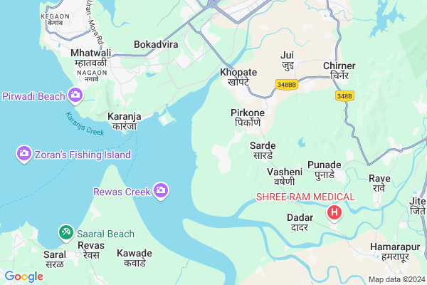
Govthane Map
EDIT Map
Add Your House
 ..
..
Current Corona Virus Infected Patients Count in Raigad District
| City Name | District Name | Total Covid cases |
|---|
Locality Name :
Govthane
( गोवठणे )
City Name : Uran
District : Raigad
State : Maharashtra
Region : Konkan
Division : Konkan
Language : Marathi and Hindi
Current Time 08:53 PM
Date: Sunday , Apr 27,2025 (IST)
Time zone: IST (UTC+5:30)
Elevation / Altitude: 6 meters. Above Seal level
Telephone Code / Std Code: 0215
Assembly constituency : assembly constituency
Assembly MLA :
Lok Sabha constituency : parliamentary constituency
Parliament MP :
Pin Code : 410206
Post Office Name : Panvel
Main Village Name : Govthane
Commodities Prices : Pen Market / Mandi
Govthane Live Weather
Temperature: 29.1 °C
clear sky
Humidity: 69%
Wind : 3.2 mt/sec towards NW
StationName : "Pen"
observed on Now
Temperature: 29.1 °C
clear sky
Humidity: 69%
Wind : 3.2 mt/sec towards NW
StationName : "Pen"
observed on Now
Govthane Weather Forecast for Next 5 days
28-04-2025
28.0°C to 29.0°C
clear sky
28.0°C to 29.0°C
clear sky
29-04-2025
27.4°C to 31.7°C
clear sky
27.4°C to 31.7°C
clear sky
30-04-2025
26.8°C to 31.2°C
clear sky, few clouds
26.8°C to 31.2°C
clear sky, few clouds
01-05-2025
26.5°C to 30.9°C
clear sky
26.5°C to 30.9°C
clear sky
02-05-2025
27.1°C to 31.3°C
clear sky
27.1°C to 31.3°C
clear sky
National Highways Reachable To Govthane
Nationa High Way :NH548A
Nationa High Way :NH348
Nationa High Way :NH548A
Nationa High Way :NH348
About Govthane
Correct below Info and add more info about GovthaneGovthane is a in Uran City in Maharashtra State, India. It belongs to Konkan region . It is belongs to Konkan Division .
Govthane Pin code is 410206 and postal head office is Panvel .
Aware , Kasvalepada , Bhendkhal , Babdevpada , Sudkichapada are the nearby Localities to Govthane.
Uran , Pen , Panvel , Navi Mumbai are the nearby Cities to Uran.
It is near to arabian sea. There is a chance of humidity in the weather.
Demographics of Govthane
Marathi is the Local Language here.HOW TO REACH Govthane
By Rail
Hamarapur Rail Way Station are the very nearby railway station to Govthane.By Road
Uran are the nearby by towns to Uran having road connectivity to Uran and GovthaneGovt Health Centers near Govthane
1) Kelvane , Subcenter Kelavane , , Kelavane Sai Mandir Kelavane2) RH Uran , Rural Hospital Uran , Mora Road , Near Town Hall
3) Dadar , , Dadar , Near by Angnwadi
Sub Villages in Govthane
Colleges in Govthane,Uran
Dronagiri School and College
Sathgharpada; Karanja; Maharashtra 400702; India
5.6 KM distance Detail
Veer Wajekar College Of Science ; Commerce & Arts
Navi Mumbai; Maharashtra 400707; India
7.3 KM distance Detail
T. H. Wajekar Junior College ; Phunde . Tal-Uran
Navi Mumbai; Maharashtra 400707; India
7.4 KM distance Detail
more ..
Schools in Govthane,Uran
K.B.PATIL VIDYALAYA;PIRKON;RAIGAD;MAHARASHTRA 410206
Unnamed Rd;; Pirkon; Maharashtra 410206; India
2.7 KM distance Detail
Electronic Shops in Govthane,Uran
TechSpiron Systems Pvt. Ltd. (Data Warehousing; Hardware & Networking; Access Control Management)
Shop No.2; Viraj Shops; Near Union Bank Uran Kharpada Road; Koproli; Tal Uran Dist; Uran; Maharashtra 410206; India
3.9 KM distance Detail
Super Markets in Govthane,Uran
Royal Kirana Store
Kaamtha Rd; Shreeraj Nagar; Uran; Navi Mumbai; Maharashtra 400702; India
7.8 KM distance Detail
Local Parks in Govthane,Uran
Dronagiri Maidan
Dronagiri Mandir Rd; Navapada; Karanja; Maharashtra 400702; India
5.4 KM distance Detail
Police Stations near Govthane,Uran
Police Uran
Near Masjid; Uran; Navi Mumbai; Mumbai; Maharashtra 400702; India
7.8 KM distance Detail
About Govthane &
History
How to reach Govthane
Tourist Places Near By Govthane
Schools in Govthane
Colleges in Govthane
Temperature & weather of Govthane
places in Govthane
Govthane photos
More Information
How to reach Govthane
Tourist Places Near By Govthane
Schools in Govthane
Colleges in Govthane
Temperature & weather of Govthane
places in Govthane
Govthane photos
More Information
Locality Talk
Post News or Events about this Locality
Near Cities
Uran 5 KM near
Pen 17 KM near
Panvel 23 KM near
Navi Mumbai 23 KM near
Uran 5 KM near
Pen 17 KM near
Panvel 23 KM near
Navi Mumbai 23 KM near
Near By Taluks
Uran 5 KM near
Pen 17 KM near
Alibag 21 KM near
Navi Mumbai 24 KM near
Uran 5 KM near
Pen 17 KM near
Alibag 21 KM near
Navi Mumbai 24 KM near
Near By Air Ports
Chhatrapati Shivaji International Airport 34 KM near
Lohegaon Airport 114 KM near
Gandhinagar Airport 170 KM near
Chikkalthana Airport 310 KM near
Chhatrapati Shivaji International Airport 34 KM near
Lohegaon Airport 114 KM near
Gandhinagar Airport 170 KM near
Chikkalthana Airport 310 KM near
Near By Tourist Places
Karnala 12 KM near
Durshet 14 KM near
Kihim 19 KM near
Navi-Mumbai 23 KM near
Mumbai 27 KM near
Karnala 12 KM near
Durshet 14 KM near
Kihim 19 KM near
Navi-Mumbai 23 KM near
Mumbai 27 KM near
Near By Districts
Mumbai 25 KM near
Raigad 27 KM near
Thane 51 KM near
Pune 109 KM near
Mumbai 25 KM near
Raigad 27 KM near
Thane 51 KM near
Pune 109 KM near
Near By RailWay Station
Panvel Junction Rail Way Station 24 KM near
Dadar Western Rail Way Station 28 KM near
Panvel Junction Rail Way Station 24 KM near
Dadar Western Rail Way Station 28 KM near