| Home | City Bus | Maps | Villages | Cities | Rail | Tourist Places | School | College | Pin Codes | Corona Cases Count |
| Distance Calculator Bus Services IFSC Codes Trace Mobile Number Weather Search Place Trace IP Available Cash ATM/Banks Locate Polling Booth Report an Error contact People |
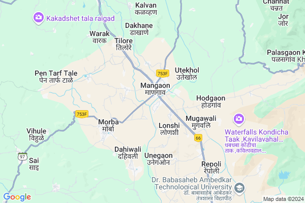
Dhamani
Dhamani Map
EDIT Map
Add Your House
 ..
..
Current Corona Virus Infected Patients Count in Raigad District
| City Name | District Name | Total Covid cases |
|---|
Locality Name :
Dhamani
( धामणी )
Taluka Name : Mangaon
District : Raigad
State : Maharashtra
Region : Konkan
Division : Konkan
Language : Marathi and Hindi
Current Time 03:23 PM
Date: Wednesday , Feb 05,2025 (IST)
Time zone: IST (UTC+5:30)
Elevation / Altitude: 12 meters. Above Seal level
Telephone Code / Std Code: 02140
Assembly constituency : Shrivardhan assembly constituency
Assembly MLA : Aditi Sunil Tatkare
Lok Sabha constituency : Raigad parliamentary constituency
Parliament MP : Tatkare Sunil Dattatray
Serpanch Name :
Pin Code : 402120
Post Office Name : Nizampur (Raigarh(MH))
Main Village Name : Dhamani
Commodities Prices : Mangaon Market / Mandi
Dhamani Live Weather
Temperature: 37.0 °C
clear sky
Humidity: 15%
Wind : 4.32 mt/sec towards W
StationName : "Goregaon"
observed on 19 Mins Back
Temperature: 37.0 °C
clear sky
Humidity: 15%
Wind : 4.32 mt/sec towards W
StationName : "Goregaon"
observed on 19 Mins Back
Dhamani Weather Forecast for Next 5 days
06-02-2025
21.2°C to 35.0°C
clear sky
21.2°C to 35.0°C
clear sky
07-02-2025
21.1°C to 37.8°C
clear sky, scattered clouds
21.1°C to 37.8°C
clear sky, scattered clouds
08-02-2025
22.9°C to 38.3°C
clear sky
22.9°C to 38.3°C
clear sky
09-02-2025
22.4°C to 38.2°C
clear sky
22.4°C to 38.2°C
clear sky
10-02-2025
22.7°C to 38.1°C
clear sky, few clouds, scattered clouds
22.7°C to 38.1°C
clear sky, few clouds, scattered clouds
National Highways Reachable To Dhamani
Nationa High Way :NH965DD
Nationa High Way :NH66
Nationa High Way :NH965DD
Nationa High Way :NH66
Rivers Near Dhamani
Shivaganga :शिवगंगा
Kanandi :कानंदी
Shivaganga :शिवगंगा
Kanandi :कानंदी
About Dhamani
Correct below Info and add more info about DhamaniDhamani is a small Village/hamlet in Mangaon Taluka in Raigad District of Maharashtra State, India. It comes under Dhamani Panchayath. It belongs to Konkan region . It belongs to Konkan Division . It is located 74 KM towards South from District head quarters Alibag. 114 KM from State capital Mumbai
Dhamani Pin code is 402120 and postal head office is Nizampur (Raigarh(MH)).
Dhamani is surrounded by Tala Taluka towards west , Mhasala Taluka towards west , Mahad Taluka towards South , Roha Taluka towards North .
Mahad , Nandgaon , Mahabaleswar , Lonavla are the near by Cities to Dhamani.
It is near to arabian sea. There is a chance of humidity in the weather.
Dhamani 2011 Census Details
Dhamani Local Language is Marathi. Dhamani Village Total population is 162 and number of houses are 45. Female Population is 54.3%. Village literacy rate is 72.2% and the Female Literacy rate is 37.7%.
Population
| Census Parameter | Census Data |
| Total Population | 162 |
| Total No of Houses | 45 |
| Female Population % | 54.3 % ( 88) |
| Total Literacy rate % | 72.2 % ( 117) |
| Female Literacy rate | 37.7 % ( 61) |
| Scheduled Tribes Population % | 0.0 % ( 0) |
| Scheduled Caste Population % | 0.0 % ( 0) |
| Working Population % | 33.3 % |
| Child(0 -6) Population by 2011 | 14 |
| Girl Child(0 -6) Population % by 2011 | 50.0 % ( 7) |
Dhamani Census More Deatils.
Politics in Dhamani
Nationalist Congress Party , NCP , SHS , INC are the major political parties in this area.Polling Stations /Booths near Dhamani
1)Usar Kh.2)Khamgaon
3)Khandad 2
4)Utekhol 1
5)Khandad 1
HOW TO REACH Dhamani
By Rail
Mangaon Rail Way Station , Indapur Rail Way Station are the very nearby railway stations to Dhamani. Roha Rail Way Station (near to Roha Ashtami) , Veer Rail Way Station (near to Mahad) , Sape Wamne Rail Way Station (near to Mahad) , Roha Rail Way Station (near to Roha Ashtami) are the Rail way stations reachable from near by towns.By Road
Mahad , Roha Ashtami are the nearby by towns to Dhamani having road connectivity to DhamaniColleges near Dhamani
J.b.sawant Edu.societys Tmc College
Address :
Doshi Vakil Arts & G.c.u.b Sci & Com Collage - Goregaon
Address :
M.t.e.s. Doshi Vakil Arts & G.c.u.b Sci & Com Collage - Goregaon
Address :
Dr. Babasaheb Ambedkar Technological University
Address :
Dr.babasaheb Ambedkar Technological University, Lonere
Address :
Schools in Dhamani
R.z.p. Pri School Dhamani
Address : dhamani , mangaon , raigarh (maharashtra) , Maharashtra . PIN- 402120 , Post - Nizampur (Raigarh(MH))
Govt Health Centers near Dhamani
1) SDH Mangaon , Sub District Hospital Mangaon , Mumbai Goa Highway , Shriwardhan Road2) Morba , SubCenter Morba , SubCenter Morba , SubCenter Morba
3) Gangawli , SubCenter Gangavali , No , No
Sub Villages in Dhamani
Hospitals in Dhamani,Mangaon
Gandhi Medical
Laxmi Path; Kumbhar Vada; Goregaon; Maharashtra 402103; India
10.0 KM distance Detail
Green City Hospital
Vrindavan Apartment; MH SH 99; Goregaon; Maharashtra 402103; India
10.0 KM distance Detail
more ..
Petrol Bunks in Dhamani,Mangaon
HP PETROL PUMP AUTO CARE CENTRE
Mumbai GOA Highway NH-17; Village- Talegaon Taluka Mangaon; Vashi; Maharashtra 402104; India
6.1 KM distance Detail
more ..
Colleges in Dhamani,Mangaon
M.T.E.S Doshi Vakil Arts Science Commerce College
MH SH 99; Goregaon; Maharashtra 402103; India
10.1 KM distance Detail
Institute of Petrochemical Engineering
Vidyavihar; Taluk Mangaon; District Raigad; Lonere; Maharashtra 402103; India
10.3 KM distance Detail
more ..
Schools in Dhamani,Mangaon
Jamdar Corner
Shrivardhan Rd; Kumbhar Vada; Goregaon; Maharashtra 402103; India
9.7 KM distance Detail
Raigad Zilla Parishad School;Goregaon
Station Rd; Goregaon; Maharashtra 402103; India
10.0 KM distance Detail
Maharashtra Institute Of Information Technology
Vishnu Lake; Goregaon; Maharashtra 402103; India
10.0 KM distance Detail
Electronic Shops in Dhamani,Mangaon
Ok Electronic (Ishver Tiwari)
Kumbhar Vada; Goregaon; Maharashtra 402103; India
9.9 KM distance Detail
A K Computers
Shop No.16 Goga Center Below Bank Of India; Goregaon Raigad; Maharashtra 402103; India
10.0 KM distance Detail
Police Stations near Dhamani,Mangaon
Goregaon Police Station
Mallikarjun Temple Rd; Goregaon; Maharashtra 402103; India
9.6 KM distance Detail
About Dhamani &
History
How to reach Dhamani
Tourist Places Near By Dhamani
Schools in Dhamani
Colleges in Dhamani
Temperature & weather of Dhamani
places in Dhamani
Dhamani photos
More Information
How to reach Dhamani
Tourist Places Near By Dhamani
Schools in Dhamani
Colleges in Dhamani
Temperature & weather of Dhamani
places in Dhamani
Dhamani photos
More Information
Village Talk
Post News or Events about this Village
Near Cities
Mahad 22 KM near
Nandgaon 46 KM near
Mahabaleswar 58 KM near
Lonavla 66 KM near
Mahad 22 KM near
Nandgaon 46 KM near
Mahabaleswar 58 KM near
Lonavla 66 KM near
Near By Taluks
Mangaon 0 KM near
Tala 17 KM near
Mhasala 22 KM near
Mahad 23 KM near
Mangaon 0 KM near
Tala 17 KM near
Mhasala 22 KM near
Mahad 23 KM near
Near By Air Ports
Lohegaon Airport 87 KM near
Chhatrapati Shivaji International Airport 117 KM near
Gandhinagar Airport 225 KM near
Kolhapur Airport 231 KM near
Lohegaon Airport 87 KM near
Chhatrapati Shivaji International Airport 117 KM near
Gandhinagar Airport 225 KM near
Kolhapur Airport 231 KM near
Near By Tourist Places
Kolad 23 KM near
Lavasa 34 KM near
Raigad 37 KM near
Murud Janjira 38 KM near
Shrivardhan 38 KM near
Kolad 23 KM near
Lavasa 34 KM near
Raigad 37 KM near
Murud Janjira 38 KM near
Shrivardhan 38 KM near
Near By Districts
Raigad 71 KM near
Pune 78 KM near
Mumbai 106 KM near
Satara 108 KM near
Raigad 71 KM near
Pune 78 KM near
Mumbai 106 KM near
Satara 108 KM near
Near By RailWay Station
Mangaon Rail Way Station 2.4 KM near
Goregaon Road Halt Rail Way Station 9.2 KM near
Veer Rail Way Station 15 KM near
Mangaon Rail Way Station 2.4 KM near
Goregaon Road Halt Rail Way Station 9.2 KM near
Veer Rail Way Station 15 KM near