| Home | City Bus | Maps | Villages | Cities | Rail | Tourist Places | School | College | Pin Codes | Corona Cases Count |
| Distance Calculator Bus Services IFSC Codes Trace Mobile Number Weather Search Place Trace IP Available Cash ATM/Banks Locate Polling Booth Report an Error contact People |
Bedgaon
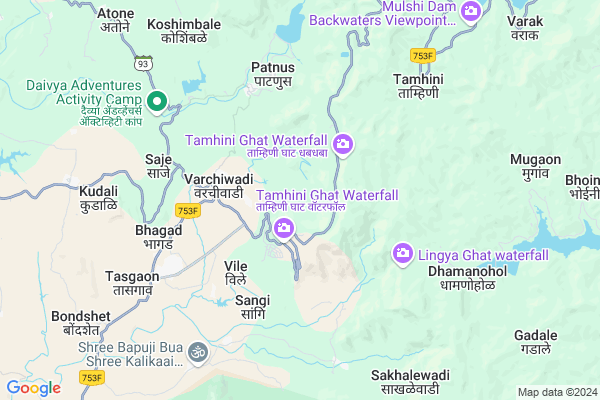
Bedgaon Map
EDIT Map
Add Your House
 ..
..
Current Corona Virus Infected Patients Count in Raigad District
| City Name | District Name | Total Covid cases |
|---|
Locality Name :
Bedgaon
( बेडगाव )
Taluka Name : Mangaon
District : Raigad
State : Maharashtra
Region : Konkan
Division : Konkan
Language : Marathi and Hindi
Current Time 03:20 PM
Date: Wednesday , Feb 05,2025 (IST)
Time zone: IST (UTC+5:30)
Elevation / Altitude: 12 meters. Above Seal level
Telephone Code / Std Code: 02140
Assembly constituency : Mahad assembly constituency
Assembly MLA : Gogawale Bharat Maruti
Lok Sabha constituency : Raigad parliamentary constituency
Parliament MP : Tatkare Sunil Dattatray
Serpanch Name :
Pin Code : 402120
Post Office Name : Nizampur (Raigarh(MH))
Main Village Name : Bedgaon
Commodities Prices : Mangaon Market / Mandi
Bedgaon Live Weather
Temperature: 35.9 °C
clear sky
Humidity: 17%
Wind : 4.13 mt/sec towards W
StationName : "Raigarh Fort"
observed on Now
Temperature: 35.9 °C
clear sky
Humidity: 17%
Wind : 4.13 mt/sec towards W
StationName : "Raigarh Fort"
observed on Now
Bedgaon Weather Forecast for Next 5 days
06-02-2025
22.9°C to 34.6°C
clear sky
22.9°C to 34.6°C
clear sky
07-02-2025
22.2°C to 38.0°C
clear sky, scattered clouds
22.2°C to 38.0°C
clear sky, scattered clouds
08-02-2025
23.3°C to 39.0°C
clear sky
23.3°C to 39.0°C
clear sky
09-02-2025
23.7°C to 38.8°C
clear sky, few clouds
23.7°C to 38.8°C
clear sky, few clouds
10-02-2025
23.9°C to 38.6°C
clear sky, few clouds
23.9°C to 38.6°C
clear sky, few clouds
Edit below overview about Bedgaon
Edit below overview about Bedgaon
OverView of Bedgaon
Veracity handed over more than 300 plots in Bedgaon. Hopefully it would grow rapidly from 2022 onwardsEdit below overview about Bedgaon
National Highways Reachable To Bedgaon
Nationa High Way :NH965DD
Nationa High Way :NH66
Nationa High Way :NH965DD
Nationa High Way :NH66
Rivers Near Bedgaon
Shivaganga :शिवगंगा
Kanandi :कानंदी
Shivaganga :शिवगंगा
Kanandi :कानंदी
About Bedgaon
Bedgaon is a small Village/hamlet in Mangaon Taluka in Raigad District of Maharashtra State, India. It comes under Bedgaon Panchayath. It belongs to Konkan region . It belongs to Konkan Division . It is located 70 KM towards East from District head quarters Alibag. 26 KM from Mangaon. 102 KM from State capital Mumbai
Bedgaon Pin code is 402120 and postal head office is Nizampur (Raigarh(MH)).
Vile ( 3 KM ) , Patnus ( 5 KM ) , Saje ( 5 KM ) , Bhagad ( 5 KM ) , Rawalje ( 6 KM ) are the nearby Villages to Bedgaon. Bedgaon is surrounded by Sudhagad Taluka towards North , Mulshi Taluka towards East , Roha Taluka towards west , Velhe Taluka towards East .
Mahad , Lonavla , Talegaon Dabhade , Pen are the near by Cities to Bedgaon.
It is near to arabian sea. There is a chance of humidity in the weather.
Bedgaon 2011 Census Details
Bedgaon Local Language is Marathi. Bedgaon Village Total population is 106 and number of houses are 32. Female Population is 50.0%. Village literacy rate is 57.5% and the Female Literacy rate is 22.6%.
Population
| Census Parameter | Census Data |
| Total Population | 106 |
| Total No of Houses | 32 |
| Female Population % | 50.0 % ( 53) |
| Total Literacy rate % | 57.5 % ( 61) |
| Female Literacy rate | 22.6 % ( 24) |
| Scheduled Tribes Population % | 0.0 % ( 0) |
| Scheduled Caste Population % | 0.0 % ( 0) |
| Working Population % | 38.7 % |
| Child(0 -6) Population by 2011 | 2 |
| Girl Child(0 -6) Population % by 2011 | 0.0 % ( 0) |
Bedgaon Census More Deatils.
Politics in Bedgaon
Nationalist Congress Party , NCP , SHS , INC are the major political parties in this area.Polling Stations /Booths near Bedgaon
1)Salve2)Walan Khu.
3)Barasgav
4)Vazarvadi
5)Ugavatkond
HOW TO REACH Bedgaon
By Rail
There is no railway station near to Bedgaon in less than 10 km. Roha Rail Way Station (near to Roha Ashtami) , Veer Rail Way Station (near to Mahad) , Sape Wamne Rail Way Station (near to Mahad) , Roha Rail Way Station (near to Roha Ashtami) are the Rail way stations reachable from near by towns.By Road
Mahad , Roha Ashtami are the nearby by towns to Bedgaon having road connectivity to BedgaonColleges near Bedgaon
J.b.sawant Edu.societys Tmc College
Address :
Doshi Vakil Arts & G.c.u.b Sci & Com Collage - Goregaon
Address :
M.t.e.s. Doshi Vakil Arts & G.c.u.b Sci & Com Collage - Goregaon
Address :
Dr. Babasaheb Ambedkar Technological University
Address :
Dr.babasaheb Ambedkar Technological University, Lonere
Address :
Schools in Bedgaon
R.z.p. Pri School Bedgaon
Address : bedgaon , mangaon , raigarh (maharashtra) , Maharashtra . PIN- 402120 , Post - Nizampur (Raigarh(MH))
Govt Health Centers near Bedgaon
1) Patnus , SubCenter Patnus , Near Patnus Gampanchayat , Near Patnus Gampanchayat2) Bhagad , SubCenter Bhagad , Pune Road , Mandira Samor
3) Shirwali , Primary Health Centre Shirawali , ,
Sub Villages in Bedgaon
Hospitals in Bedgaon,Mangaon
Primary Health centre Maale
Jori-patil vasti; Maale; Maharashtra 412108; India
21.8 KM distance Detail
Ashirwad Clinic-Dr.Ramesh Pasalkar
Male; Paud; Pune; SH-57; Paud Road; Pune; Pune; Maharashtra 412108; India
22.0 KM distance Detail
more ..
Colleges in Bedgaon,Mangaon
Sonai Adhyapak Vidhyalay( D Ed College)
Pirangut; Mulshi; Mulshi; Pune; Maharashtra 412111; India
19.3 KM distance Detail
Mulshi Dharan Vibagy Shikshan Mandals Private ITI
Valane; Maharashtra 412108; India
21.8 KM distance Detail
more ..
Schools in Bedgaon,Mangaon
Zila Parishad Prathamik Shala
Mulshi Gaon; Mulshi; Pune; SH-57; Mulshi Road; Pune; Pune; Maharashtra 412108; India
21.5 KM distance Detail
Electronic Shops in Bedgaon,Mangaon
Super Markets in Bedgaon,Mangaon
Police Stations near Bedgaon,Mangaon
Governement Offices near Bedgaon,Mangaon
Gram Sachivalay
Male; Paud; Pune; SH-57; Paud Road; Pune; Pune; Maharashtra 412108; India
22.6 KM distance Detail
About Bedgaon &
History
How to reach Bedgaon
Tourist Places Near By Bedgaon
Schools in Bedgaon
Colleges in Bedgaon
Temperature & weather of Bedgaon
places in Bedgaon
Bedgaon photos
More Information
How to reach Bedgaon
Tourist Places Near By Bedgaon
Schools in Bedgaon
Colleges in Bedgaon
Temperature & weather of Bedgaon
places in Bedgaon
Bedgaon photos
More Information
Village Talk
Post News or Events about this Village
Near Cities
Mahad 40 KM near
Lonavla 42 KM near
Talegaon Dabhade 51 KM near
Pen 54 KM near
Mahad 40 KM near
Lonavla 42 KM near
Talegaon Dabhade 51 KM near
Pen 54 KM near
Near By Taluks
Mangaon 25 KM near
Sudhagad 25 KM near
Mulshi 25 KM near
Velhe 31 KM near
Mangaon 25 KM near
Sudhagad 25 KM near
Mulshi 25 KM near
Velhe 31 KM near
Near By Air Ports
Lohegaon Airport 66 KM near
Chhatrapati Shivaji International Airport 104 KM near
Gandhinagar Airport 200 KM near
Kolhapur Airport 244 KM near
Lohegaon Airport 66 KM near
Chhatrapati Shivaji International Airport 104 KM near
Gandhinagar Airport 200 KM near
Kolhapur Airport 244 KM near
Near By Tourist Places
Lavasa 13 KM near
Kolad 21 KM near
Raigad 27 KM near
Nagothane 34 KM near
Khandala 42 KM near
Lavasa 13 KM near
Kolad 21 KM near
Raigad 27 KM near
Nagothane 34 KM near
Khandala 42 KM near
Near By Districts
Pune 57 KM near
Raigad 68 KM near
Mumbai 96 KM near
Satara 115 KM near
Pune 57 KM near
Raigad 68 KM near
Mumbai 96 KM near
Satara 115 KM near
Near By RailWay Station
Mangaon Rail Way Station 24 KM near
Roha Rail Way Station 31 KM near
Mangaon Rail Way Station 24 KM near
Roha Rail Way Station 31 KM near