| Home | City Bus | Maps | Villages | Cities | Rail | Tourist Places | School | College | Pin Codes | Corona Cases Count |
| Distance Calculator Bus Services IFSC Codes Trace Mobile Number Weather Search Place Trace IP Available Cash ATM/Banks Locate Polling Booth Report an Error contact People |
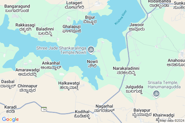
Nowli Map
EDIT Map
Add Your House
 ..
..
Current Corona Virus Infected Patients Count in Raichur District
| City Name | District Name | Total Covid cases |
|---|
Locality Name :
Nowli
( ನೌಲಿ )
Taluk Name : Lingsugur
District : Raichur
State : Karnataka
Division : Gulbarga
Language : Kannada and Telugu, Urdu,hindi
Current Time 02:26 PM
Date: Monday , Apr 28,2025 (IST)
Time zone: IST (UTC+5:30)
Elevation / Altitude: 508 meters. Above Seal level
Telephone Code / Std Code: 08537
Assembly constituency : Lingsugur assembly constituency
Assembly MLA : Manappa D Vajjal
Lok Sabha constituency : Raichur parliamentary constituency
Parliament MP : RAJA AMARESHWARA NAIK
Serpanch Name :
Pin Code : 584127
Post Office Name : Rodalbanda
Main Village Name : Nowli
Alternate Village Name : Navali
Commodities Prices : Lingasugur Market / Mandi
National Highways Reachable To Nowli
Nationa High Way :NH50
Nationa High Way :NH50
Rivers Near Nowli
Malaprabha :ಮಲಪ್ರಭಾ
Malaprabha :ಮಲಪ್ರಭಾ
Malaprabha :ಮಲಪ್ರಭಾ
Malaprabha :ಮಲಪ್ರಭಾ
About Nowli
Correct below Info and add more info about NowliNowli is a small Village/hamlet in Lingsugur Taluk in Raichur District of Karnataka State, India. It comes under Nowli Panchayath. It belongs to Gulbarga Division . It is located 131 KM towards west from District head quarters Raichur. 27 KM from Lingsugur. 444 KM from State capital Bangalore
Nowli Pin code is 584127 and postal head office is Rodalbanda .
Upparnandihal ( 17 KM ) , Kachapur ( 17 KM ) are the nearby Villages to Nowli. Nowli is surrounded by Lingsugur Taluk towards East , Hungund Taluk towards west , Kushtagi Taluk towards South , Shorapur Taluk towards North .
Lingsugur , Muddebihal , Talikota , Shorapur are the near by Cities to Nowli.
Nowli 2011 Census Details
Nowli Local Language is Kannada. Nowli Village Total population is 782 and number of houses are 139. Female Population is 47.8%. Village literacy rate is 62.8% and the Female Literacy rate is 23.1%.
Population
| Census Parameter | Census Data |
| Total Population | 782 |
| Total No of Houses | 139 |
| Female Population % | 47.8 % ( 374) |
| Total Literacy rate % | 62.8 % ( 491) |
| Female Literacy rate | 23.1 % ( 181) |
| Scheduled Tribes Population % | 6.1 % ( 48) |
| Scheduled Caste Population % | 20.8 % ( 163) |
| Working Population % | 51.4 % |
| Child(0 -6) Population by 2011 | 96 |
| Girl Child(0 -6) Population % by 2011 | 42.7 % ( 41) |
Nowli Census More Deatils.
Politics in Nowli
JD(U) , Bharatiya Janata Party , JD(S) , BJP , Indian National Congress (INC) , INC are the major political parties in this area.Polling Stations /Booths near Nowli
1)Governament Lower Primary School Navali2)Governament Higher Primary School Nagarahal
3)Governament Higher Primary School Halabhavi
4)Governament Lower Primary School Mincheri
5)Governament Higher Primary School Chitapoor
HOW TO REACH Nowli
By Rail
There is no railway station near to Nowli in less than 10 km. are the Rail way stations reachable from near by towns.By Road
Lingsugur , Mudgal , Ilkal are the nearby by towns to Nowli having road connectivity to NowliColleges near Nowli
V.c.b College
Address :
Schools near Nowli
Murarjidesai Vasathi School L
Address : lingasugur , lingasugur , raichur , Karnataka . PIN- 584122 , Post - Lingasugur
Ghps Chikkahesarur
Address : chikkahesaruru , lingasugur , raichur , Karnataka . PIN- 584185
Navodaya Vidyalaya Kannapur Hatti
Address : kannapurhatti , lingasugur , raichur , Karnataka . PIN- 584125 , Post - Mudgal
Morarji Desai(sc) Sw Maski
Address : maski , lingasugur , raichur , Karnataka . PIN- 548124
Govt Health Centers near Nowli
1) Nalatwad CHC , Government Hospital Nalatwad , CHC Nalatwad , Main road Nalatwad2) Hunasangi CHC , Hunasangi CHC , ,
3) FRU Kushtagi Taluka Hospital , , ,
Sub Villages in Nowli
Hospitals in Nowli,Lingsugur
ಪ್ರಶಾಂತ ಜಿ ಸೂಗೂರ ಶುದು ಕುಡಿಯುವ ನೀರು
; Anegudi; Anegudi; Eachanhal; Karnataka 584122; India
13.1 KM distance Detail
more ..
Electronic Shops in Nowli,Lingsugur
RABBANI JAGIRDHAR
homeAnahosur; 584122; 11A; 25th A Main Rd; 1st Sector; HSR Layout; Bengaluru; Karnataka 560102; India
12.5 KM distance Detail
Super Markets in Nowli,Lingsugur
Local Parks in Nowli,Lingsugur
Police Stations near Nowli,Lingsugur
Governement Offices near Nowli,Lingsugur
About Nowli &
History
How to reach Nowli
Tourist Places Near By Nowli
Schools in Nowli
Colleges in Nowli
Temperature & weather of Nowli
places in Nowli
Nowli photos
More Information
How to reach Nowli
Tourist Places Near By Nowli
Schools in Nowli
Colleges in Nowli
Temperature & weather of Nowli
places in Nowli
Nowli photos
More Information
Village Talk
Post News or Events about this Village
Near Cities
Lingsugur 18 KM near
Muddebihal 30 KM near
Talikota 41 KM near
Shorapur 71 KM near
Lingsugur 18 KM near
Muddebihal 30 KM near
Talikota 41 KM near
Shorapur 71 KM near
Near By Taluks
Muddebihal 25 KM near
Lingsugur 26 KM near
Hungund 30 KM near
Kushtagi 41 KM near
Muddebihal 25 KM near
Lingsugur 26 KM near
Hungund 30 KM near
Kushtagi 41 KM near
Near By Air Ports
Hubli Airport 175 KM near
Sholapur Airport 189 KM near
Sambre Airport 204 KM near
Kolhapur Airport 243 KM near
Hubli Airport 175 KM near
Sholapur Airport 189 KM near
Sambre Airport 204 KM near
Kolhapur Airport 243 KM near
Near By Tourist Places
Aihole 52 KM near
Pattadakkal 63 KM near
Badami 80 KM near
Hampi 103 KM near
Bijapur 109 KM near
Aihole 52 KM near
Pattadakkal 63 KM near
Badami 80 KM near
Hampi 103 KM near
Bijapur 109 KM near
Near By Districts
Bagalkot 74 KM near
Koppal 102 KM near
Bijapur District 108 KM near
Gadag 119 KM near
Bagalkot 74 KM near
Koppal 102 KM near
Bijapur District 108 KM near
Gadag 119 KM near
Near By RailWay Station
Almatti Rail Way Station 53 KM near
Bagalkot Junction Rail Way Station 71 KM near
Almatti Rail Way Station 53 KM near
Bagalkot Junction Rail Way Station 71 KM near