| Home | City Bus | Maps | Villages | Cities | Rail | Tourist Places | School | College | Pin Codes | Corona Cases Count |
| Distance Calculator Bus Services IFSC Codes Trace Mobile Number Weather Search Place Trace IP Available Cash ATM/Banks Locate Polling Booth Report an Error contact People |
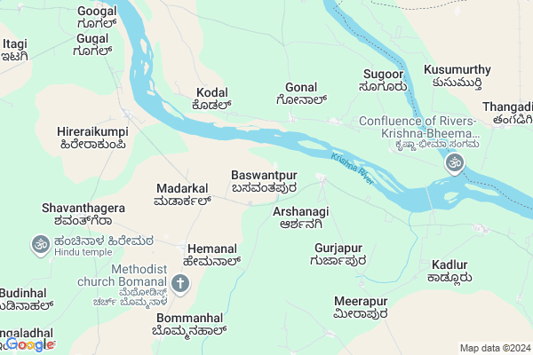
Baswantpur Map
EDIT Map
Add Your House
 ..
..
Current Corona Virus Infected Patients Count in Raichur District
| City Name | District Name | Total Covid cases |
|---|
Locality Name :
Baswantpur
( ಬಾಸ್ವಂತಪುರ್ )
Taluk Name : Devadurga
District : Raichur
State : Karnataka
Division : Gulbarga
Language : Kannada and Telugu, Urdu,hindi
Current Time 12:12 PM
Date: Monday , Apr 28,2025 (IST)
Time zone: IST (UTC+5:30)
Elevation / Altitude: 377 meters. Above Seal level
Telephone Code / Std Code: 08531
Assembly constituency : Devadurga assembly constituency
Assembly MLA : Karemma
Lok Sabha constituency : Raichur parliamentary constituency
Parliament MP : RAJA AMARESHWARA NAIK
Serpanch Name :
Pin Code : 584113
Post Office Name : Gabbur
Main Village Name : Baswantpur
Alternate Village Name : Basavantapur
Commodities Prices : Raichur Market / Mandi
National Highways Reachable To Baswantpur
Nationa High Way :NH46
Nationa High Way :NH50
Nationa High Way :NH46
Nationa High Way :NH50
Rivers Near Baswantpur
Uzhavoor River
Chakan
Uzhavoor River
Chakan
About Baswantpur
Correct below Info and add more info about BaswantpurBaswantpur is a small Village/hamlet in Devadurga Taluk in Raichur District of Karnataka State, India. It comes under Baswantpur Panchayath. It belongs to Gulbarga Division . It is located 32 KM towards North from District head quarters Raichur. 31 KM from Devadurga. 449 KM from State capital Bangalore
Baswantpur Pin code is 584113 and postal head office is Gabbur .
Kadloor ( 10 KM ) , Gabbur ( 14 KM ) , Jegarkal ( 15 KM ) , Hirebudur ( 15 KM ) are the nearby Villages to Baswantpur. Baswantpur is surrounded by Devadurga Taluk towards west , Raichur Taluk towards South , Makthal Taluk towards East , Utkoor Taluk towards East .
Raichur , Yadgir , Narayanpet , Manvi are the near by Cities to Baswantpur.
Baswantpur 2011 Census Details
Baswantpur Local Language is Kannada. Baswantpur Village Total population is 288 and number of houses are 60. Female Population is 51.7%. Village literacy rate is 58.0% and the Female Literacy rate is 23.6%.
Population
| Census Parameter | Census Data |
| Total Population | 288 |
| Total No of Houses | 60 |
| Female Population % | 51.7 % ( 149) |
| Total Literacy rate % | 58.0 % ( 167) |
| Female Literacy rate | 23.6 % ( 68) |
| Scheduled Tribes Population % | 0.0 % ( 0) |
| Scheduled Caste Population % | 21.5 % ( 62) |
| Working Population % | 56.9 % |
| Child(0 -6) Population by 2011 | 27 |
| Girl Child(0 -6) Population % by 2011 | 63.0 % ( 17) |
Baswantpur Census More Deatils.
Politics in Baswantpur
Bharatiya Janata Party , JD(S) , BJP , A.Rajashekhra Nayak , Bharatiya Janata Party (BJP) , INC are the major political parties in this area.Polling Stations /Booths near Baswantpur
1)Govt. Lower Primary School Building Bandegudda2)Govt. Higher Primary School Building Lingadahalli
3)Govt. Higher Primary School Building Heggadadinni
4)Govt. Lower Primary School Building Karkihalli
5)Govt. Lower Primary School Building Bhogiramangunda
HOW TO REACH Baswantpur
By Rail
There is no railway station near to Baswantpur in less than 10 km. are the Rail way stations reachable from near by towns.By Road
Devdurga , Hatti are the nearby by towns to Baswantpur having road connectivity to BaswantpurColleges near Baswantpur
Govt First Grade Degree College Jalahalli
Address :
Universal College Of Management & Science
Address : Mes Road, Jalahalli, Bangalore-13
B.e.l First Grade College
Address : B.e.l First Grade College, Jalahalli, Bangalore-13
Schools near Baswantpur
Adarsa Vidyalaya(rmsa) Arakera
Address : arkera , devadurga , raichur , Karnataka . PIN- 584111 , Post - Deodurga
Shree Kalidasa Vasati Lps
Address : jalahalli , devadurga , raichur , Karnataka . PIN- 584116 , Post - Jalahalli
Murarji Desai School Gabbur
Address : gabbur , devadurga , raichur , Karnataka . PIN- 584113 , Post - Gabbur
Ekalavya Vasathi Kottadoddi
Address : kothadoddi , devadurga , raichur , Karnataka . PIN- 584111 , Post - Deodurga
Govt Health Centers near Baswantpur
1) Ganga Nevasa , Ganga Nevasa , Ganga Nevasa , Ganga Nevasa2) Amarakheda , Amarakheda , Amarakheda , Amarakheda
3) Netaji Nagar , Netaji Nagar , Netaji Nagar , Netaji Nagar
Sub Villages in Baswantpur
Electronic Shops in Baswantpur,Devadurga
Sri raghavendrag electronics
New bustand road gabbur; Gabbur; Karnataka 584113; India
15.2 KM distance Detail
Local Parks in Baswantpur,Devadurga
Police Stations near Baswantpur,Devadurga
About Baswantpur &
History
How to reach Baswantpur
Tourist Places Near By Baswantpur
Schools in Baswantpur
Colleges in Baswantpur
Temperature & weather of Baswantpur
places in Baswantpur
Baswantpur photos
More Information
How to reach Baswantpur
Tourist Places Near By Baswantpur
Schools in Baswantpur
Colleges in Baswantpur
Temperature & weather of Baswantpur
places in Baswantpur
Baswantpur photos
More Information
Village Talk
Post News or Events about this Village
Near Cities
Raichur 30 KM near
Yadgir 45 KM near
Narayanpet 53 KM near
Manvi 54 KM near
Raichur 30 KM near
Yadgir 45 KM near
Narayanpet 53 KM near
Manvi 54 KM near
Near By Taluks
Maganoor 23 KM near
Devadurga 30 KM near
Raichur 31 KM near
Makthal 42 KM near
Maganoor 23 KM near
Devadurga 30 KM near
Raichur 31 KM near
Makthal 42 KM near
Near By Air Ports
Rajiv Gandhi International Airport 178 KM near
Sholapur Airport 215 KM near
Latur Airport 264 KM near
Hubli Airport 286 KM near
Rajiv Gandhi International Airport 178 KM near
Sholapur Airport 215 KM near
Latur Airport 264 KM near
Hubli Airport 286 KM near
Near By Tourist Places
Mantralayam 63 KM near
Gulbarga 123 KM near
Kurnool 124 KM near
Hampi 161 KM near
Aihole 166 KM near
Mantralayam 63 KM near
Gulbarga 123 KM near
Kurnool 124 KM near
Hampi 161 KM near
Aihole 166 KM near
Near By Districts
Raichur 30 KM near
Yadgir 44 KM near
Mahbubnagar 101 KM near
Gulbarga 123 KM near
Raichur 30 KM near
Yadgir 44 KM near
Mahbubnagar 101 KM near
Gulbarga 123 KM near
Near By RailWay Station
Krishna Rail Way Station 14 KM near
Raichur Junction Rail Way Station 31 KM near
Krishna Rail Way Station 14 KM near
Raichur Junction Rail Way Station 31 KM near