| Home | City Bus | Maps | Villages | Cities | Rail | Tourist Places | School | College | Pin Codes | Corona Cases Count |
| Distance Calculator Bus Services IFSC Codes Trace Mobile Number Weather Search Place Trace IP Available Cash ATM/Banks Locate Polling Booth Report an Error contact People |
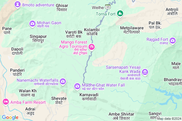
Pasali
Pasali Map
EDIT Map
Add Your House
 ..
..
Current Corona Virus Infected Patients Count in Pune District
| City Name | District Name | Total Covid cases |
|---|---|---|
| Pune District | Pune | 514 |
| PMC | Pune | 69 |
| Pimpri-Chinchwad | Pune | 49 |
| Pune | Pune | 40 |
| Pune Rural | Pune | 17 |
| PCMC | Pune | 8 |
| Parvati - Pune | Pune | 3 |
| Hadapsar-Pune | Pune | 1 |
| Bhawani Peth Pune | Pune | 1 |
| Pune Dist | Pune | 1 |
| Limboni Nagar Pune | Pune | 1 |
| Hadapsar - Pune | Pune | 1 |
| Baramati | Pune | 1 |
Locality Name :
Pasali
( बसली )
Taluka Name : Velhe
District : Pune
State : Maharashtra
Region : Desh or Paschim Maharashtra
Division : Pune
Language : Marathi and Hindi, Kannada, Marwari
Current Time 08:52 AM
Date: Wednesday , Apr 30,2025 (IST)
Time zone: IST (UTC+5:30)
Elevation / Altitude: 549 meters. Above Seal level
Telephone Code / Std Code: 02130
Assembly constituency : Bhor assembly constituency
Assembly MLA : Sangram Anantrao Thopte
Lok Sabha constituency : Baramati parliamentary constituency
Parliament MP : Supriya Sule
Serpanch Name :
Pin Code : 412212
Post Office Name : Velhe
Main Village Name : Pasali
Commodities Prices : Mahad Market / Mandi
Pasali Live Weather
Temperature: 28.0 °C
clear sky
Humidity: 36%
Wind : 1.35 mt/sec towards W
StationName : "Raigarh Fort"
observed on Now
Temperature: 28.0 °C
clear sky
Humidity: 36%
Wind : 1.35 mt/sec towards W
StationName : "Raigarh Fort"
observed on Now
Pasali Weather Forecast for Next 5 days
01-05-2025
21.3°C to 38.1°C
clear sky, few clouds
21.3°C to 38.1°C
clear sky, few clouds
02-05-2025
19.9°C to 38.2°C
clear sky, few clouds
19.9°C to 38.2°C
clear sky, few clouds
03-05-2025
20.1°C to 37.8°C
few clouds, clear sky
20.1°C to 37.8°C
few clouds, clear sky
04-05-2025
20.4°C to 36.1°C
clear sky, broken clouds, few clouds
20.4°C to 36.1°C
clear sky, broken clouds, few clouds
05-05-2025
19.4°C to 34.9°C
clear sky, scattered clouds
19.4°C to 34.9°C
clear sky, scattered clouds
National Highways Reachable To Pasali
Nationa High Way :NH965
Nationa High Way :NH48
Nationa High Way :NH965
Nationa High Way :NH48
Rivers Near Pasali
Amba
Amba
About Pasali
Correct below Info and add more info about PasaliPasali is a small Village/hamlet in Velhe Taluka in Pune District of Maharashtra State, India. It comes under Pasali Panchayath. It belongs to Desh or Paschim Maharashtra region . It belongs to Pune Division . It is located 51 KM towards South from District head quarters Pune. 9 KM from Velhe. 136 KM from State capital Mumbai
Pasali Pin code is 412212 and postal head office is Velhe .
Balwad ( 3 KM ) , Kolambi ( 3 KM ) , Harpud ( 6 KM ) , Metpilaware ( 7 KM ) , Bhutonde ( 7 KM ) are the nearby Villages to Pasali. Pasali is surrounded by Mahad Taluka towards west , Bhor Taluka towards East , Poladpur Taluka towards South , Mangaon Taluka towards west .
Mahad , Mahabaleswar , Pune , Wai are the near by Cities to Pasali.
Pasali 2011 Census Details
Pasali Local Language is Marathi. Pasali Village Total population is 199 and number of houses are 45. Female Population is 47.2%. Village literacy rate is 58.8% and the Female Literacy rate is 25.1%.
Population
| Census Parameter | Census Data |
| Total Population | 199 |
| Total No of Houses | 45 |
| Female Population % | 47.2 % ( 94) |
| Total Literacy rate % | 58.8 % ( 117) |
| Female Literacy rate | 25.1 % ( 50) |
| Scheduled Tribes Population % | 1.0 % ( 2) |
| Scheduled Caste Population % | 2.0 % ( 4) |
| Working Population % | 57.8 % |
| Child(0 -6) Population by 2011 | 31 |
| Girl Child(0 -6) Population % by 2011 | 35.5 % ( 11) |
Pasali Census More Deatils.
Politics in Pasali
Nationalist Congress Party , BJP , NCP , RSP , INC , SHS are the major political parties in this area.Polling Stations /Booths near Pasali
1)Gudhe2)Kudali Bk
3)Khopi
4)Bhordi
5)Pachlinge
HOW TO REACH Pasali
By Rail
There is no railway station near to Pasali in less than 10 km. Pune Junction Rail Way Station (near to Pune) , Shivajinagar Rail Way Station (near to Pune) are the Rail way stations reachable from near by towns.By Road
Pune are the nearby by towns to Pasali having road connectivity to PasaliColleges near Pasali
Rajgad Dnyanpeeth's College Of Pharmacy Bhor
Address :
Bhairavnath Vidyalay & Jr.collage Of Science
Address :
Mamasaheb Mohol Vidyalay Bhugaon
Address :
Vittal Gabaji Kapuskar Jr College
Address :
Shri.shivaji Vidyalaya & Junior College,dhamani
Address :
Schools in Pasali
New English School Pasali
Address : pasali , velhe , pune , Maharashtra . PIN- 412212 , Post - Velhe
Zpps Pasali
Address : pasali , velhe , pune , Maharashtra . PIN- 412212 , Post - Velhe
Govt Health Centers near Pasali
1) Pasali , a/p pasali tal velhe dist pune , Pasali , Near Gram Panchayat2) Kelad , a/p kelad tal velhe dist pune , Kelad , Near Gram Panchayat
3) Bhatti , a/p Bhatti tal velhe dist pune , Bhatti , Velhe Pasali Road
Sub Villages in Pasali
Petrol Bunks in Pasali,Velhe
HP PETROL PUMP - YOGAYOG KONDE DEHMUKH PETROLEUM
GAT NO 860; Village-khedshivapur Tal-haveli Pune Bangalore Road (NH4); Pune; Maharashtra 412205; India
11.0 KM distance Detail
more ..
Colleges in Pasali,Velhe
Amruteshwar Arts; Commerce & Science College
vinzer; Velhe; Pune; Maharashtra 412212; India
10.4 KM distance Detail
Pune Zilha Shikshan Mandal's Late Shankarrao Bhelke Arts; Science & Commerce College
Nasarapur; Bhor Taluka; Pune; Maharashtra 412213; India
22.4 KM distance Detail
more ..
Schools in Pasali,Velhe
Paoolwaat Foundation & Jilha Parishad school; Pasali
Velhe; Maharashtra 412212; India
10.4 KM distance Detail
Electronic Shops in Pasali,Velhe
UNIQUE SYSTEMS
At; Post Velhe. Tal Velhe. Dist Pune; Velhe Bajarpeth; Pune; Maharashtra 412212; India
10.4 KM distance Detail
POONAM ELECTRIC HOUSE & TULJABHAVANI MATAN SHOP
Velhe; Maharashtra 412212; India
10.6 KM distance Detail
Super Markets in Pasali,Velhe
Bhairavnath Supermarket
gao Road; Adawali; Adawali; Maharashtra 412213; India
22.6 KM distance Detail
Local Parks in Pasali,Velhe
Nisargshala
Pasali; Velhe; Balwad Shenwad Road; Pune; Maharashtra 412212; India
1.1 KM distance Detail
NEF Campsite - National Education Foundation
Village Thangaon (ठाणगाव);; Backwaters of Panshet Dam; Panshet - Pole(पोळे) Road;; After Village Shirkoli ( शिर्कोली );; Village Thangaon ( ठाणगाव); Maharashtra 412212; India
15.3 KM distance Detail
Police Stations near Pasali,Velhe
About Pasali &
History
How to reach Pasali
Tourist Places Near By Pasali
Schools in Pasali
Colleges in Pasali
Temperature & weather of Pasali
places in Pasali
Pasali photos
More Information
How to reach Pasali
Tourist Places Near By Pasali
Schools in Pasali
Colleges in Pasali
Temperature & weather of Pasali
places in Pasali
Pasali photos
More Information
Village Talk
Post News or Events about this Village
Near Cities
Mahad 29 KM near
Mahabaleswar 39 KM near
Pune 48 KM near
Wai 49 KM near
Mahad 29 KM near
Mahabaleswar 39 KM near
Pune 48 KM near
Wai 49 KM near
Near By Taluks
Velhe 8 KM near
Mahad 26 KM near
Bhor 27 KM near
Poladpur 32 KM near
Velhe 8 KM near
Mahad 26 KM near
Bhor 27 KM near
Poladpur 32 KM near
Near By Air Ports
Lohegaon Airport 58 KM near
Chhatrapati Shivaji International Airport 136 KM near
Kolhapur Airport 213 KM near
Gandhinagar Airport 217 KM near
Lohegaon Airport 58 KM near
Chhatrapati Shivaji International Airport 136 KM near
Kolhapur Airport 213 KM near
Gandhinagar Airport 217 KM near
Near By Tourist Places
Lavasa 23 KM near
Mahabaleshwar 39 KM near
Panchgani 45 KM near
Pune 47 KM near
Kolad 50 KM near
Lavasa 23 KM near
Mahabaleshwar 39 KM near
Panchgani 45 KM near
Pune 47 KM near
Kolad 50 KM near
Near By Districts
Pune 48 KM near
Satara 83 KM near
Raigad 100 KM near
Mumbai 129 KM near
Pune 48 KM near
Satara 83 KM near
Raigad 100 KM near
Mumbai 129 KM near
Near By RailWay Station
Veer Rail Way Station 33 KM near
Mangaon Rail Way Station 37 KM near
Veer Rail Way Station 33 KM near
Mangaon Rail Way Station 37 KM near