| Home | City Bus | Maps | Villages | Cities | Rail | Tourist Places | School | College | Pin Codes | Corona Cases Count |
| Distance Calculator Bus Services IFSC Codes Trace Mobile Number Weather Search Place Trace IP Available Cash ATM/Banks Locate Polling Booth Report an Error contact People |
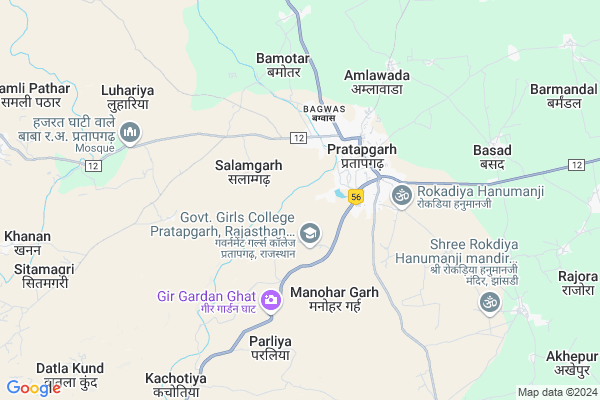
Talab Khera
Talab Khera Map
EDIT Map
Add Your House
 ..
..
Current Corona Virus Infected Patients Count in Pratapgarh District
| City Name | District Name | Total Covid cases |
|---|---|---|
| Pratapgarh District | Pratapgarh | 2 |
Locality Name :
Talab Khera
( तालाब खेरा )
Tehsil Name : Pratapgarh
District : Pratapgarh
State : Rajasthan
Division : Udaipur
Language : Hindi and Rajasthani
Current Time 04:21 PM
Date: Tuesday , Apr 29,2025 (IST)
Time zone: IST (UTC+5:30)
Elevation / Altitude: 455 meters. Above Seal level
Telephone Code / Std Code: 01479
Assembly constituency : Pratapgarh assembly constituency
Assembly MLA : Hemant Meena
Lok Sabha constituency : Chittorgarh parliamentary constituency
Parliament MP : Chandra Prakash Joshi
Serpanch Name :
Main Village Name : Talab Khera
Commodities Prices : Piplya Market / Mandi
Talab Khera Live Weather
Temperature: 39.5 °C
scattered clouds
Humidity: 11%
Wind : 5.17 mt/sec towards S
StationName : "PratÄ\u0081pgarh"
observed on 17 Mins Back
Temperature: 39.5 °C
scattered clouds
Humidity: 11%
Wind : 5.17 mt/sec towards S
StationName : "PratÄ\u0081pgarh"
observed on 17 Mins Back
Talab Khera Weather Forecast for Next 5 days
30-04-2025
29.8°C to 38.9°C
scattered clouds, broken clouds, few clouds
29.8°C to 38.9°C
scattered clouds, broken clouds, few clouds
01-05-2025
27.3°C to 41.2°C
clear sky, few clouds, overcast clouds, broken clouds
27.3°C to 41.2°C
clear sky, few clouds, overcast clouds, broken clouds
02-05-2025
27.5°C to 42.5°C
clear sky, few clouds, broken clouds, scattered clouds
27.5°C to 42.5°C
clear sky, few clouds, broken clouds, scattered clouds
03-05-2025
27.3°C to 41.5°C
clear sky
27.3°C to 41.5°C
clear sky
04-05-2025
25.8°C to 39.2°C
clear sky
25.8°C to 39.2°C
clear sky
National Highways Reachable To Talab Khera
Nationa High Way :NH156
Nationa High Way :NH156
Rivers Near Talab Khera
Jakam
Mahi
Jakam
Mahi
About Talab Khera
Correct below Info and add more info about Talab KheraTalab Khera is a small Village/hamlet in Pratapgarh Tehsil in Pratapgarh District of Rajasthan State, India. It comes under Talab Khera Panchayath. It belongs to Udaipur Division . It is located 3 KM towards west from District head quarters Pratapgarh. 396 KM from State capital Jaipur
Talab Khera is surrounded by Peepal Khoont Tehsil towards South , Arnod Tehsil towards South , Mandsaur Tehsil towards East , Dhariawad Tehsil towards west .
Pratapgarh , Mandsaur , Neemuch , Banswara are the near by Cities to Talab Khera.
Talab Khera 2011 Census Details
Talab Khera Local Language is Hindi. Talab Khera Village Total population is 113 and number of houses are 32. Female Population is 54.0%. Village literacy rate is 55.8% and the Female Literacy rate is 23.0%.
Population
| Census Parameter | Census Data |
| Total Population | 113 |
| Total No of Houses | 32 |
| Female Population % | 54.0 % ( 61) |
| Total Literacy rate % | 55.8 % ( 63) |
| Female Literacy rate | 23.0 % ( 26) |
| Scheduled Tribes Population % | 100.0 % ( 113) |
| Scheduled Caste Population % | 0.0 % ( 0) |
| Working Population % | 79.6 % |
| Child(0 -6) Population by 2011 | 15 |
| Girl Child(0 -6) Population % by 2011 | 26.7 % ( 4) |
Talab Khera Census More Deatils.
Politics in Talab Khera
Bharatiya Janata Party , BJP , INC are the major political parties in this area.Polling Stations /Booths near Talab Khera
1)Goverment Upper Primery School Basad (left Part) Room Number 042)Sefiyah Senior Secondary School Pratapgarh (left Part)
3)Goverment Girls Senior Secondary School Arnod(left Part)
4)Goverment Upper Primery School Basad (right Part) Room Number 01
5)Goverment Senior Secondary School Siddhapura (right Part)
HOW TO REACH Talab Khera
By Rail
There is no railway station near to Talab Khera in less than 10 km.Pincodes near Talab Khera
312605 ( Pratap garh (Chittorgarh) ) , 312623 ( Rathajana ) , 312616 ( Dhamotar )Colleges near Talab Khera
Government P. G. College Of Pratapgarh
Address : Government P. G. College Of Pratapgarh
Schools near Talab Khera
S.a. Ps Kherot
Address : kherot , pratapgarh , pratapgarh(raj.) , Rajasthan . PIN- 312605 , Post - Pratap garh (Chittorgarh)
Ma Badi Pathshala
Address : gyaspur , pratapgarh , pratapgarh(raj.) , Rajasthan . PIN- 312621
K.g.b.v. Achalpur
Address : achalpur , pratapgarh , pratapgarh(raj.) , Rajasthan . PIN- 312605 , Post - Pratap garh (Chittorgarh)
Vijaylaxmi Bal V.m. Bori
Address : bori(1) , pratapgarh , pratapgarh(raj.) , Rajasthan . PIN- 312616 , Post - Dhamotar
Govt Health Centers near Talab Khera
1) NOTIONAL Salamgarh , , ,2) District Hospital Pratapgarh , Banswara Road, Pratapgarh , , Govt. College
3) Achalpur , Sub Center Building , ,
Sub Villages in Talab Khera
Hospitals in Talab Khera,Pratapgarh
Kalarthi Dental Clinic And nursing Care...
Jhandagali; Pratapgarh; Rajasthan 312605; India
2.3 KM distance Detail
Dr. Nitin Suthar Disha Hospital
Jawahar Nagar; Pratapgarh; Rajasthan 312605; India
2.4 KM distance Detail
more ..
Petrol Bunks in Talab Khera,Pratapgarh
Fuji Filling Station-Indian Oil Petrol Pump
Partapgarh; Pratapgarh; NH-113; Partapgarh Road; Pratapgarh; Pratapgarh; Rajasthan 312605; India
2.0 KM distance Detail
PURUSOTTAMLAL RAMESHCHANDER
BUS STAND ROAD PRATAPGAR; Pratapgarh; Rajasthan 312605; India
2.8 KM distance Detail
Reliance Petrol Pump
NH 113; Goutam Nagar; Pratapgarh; Rajasthan 312605; India
3.0 KM distance Detail
Reliance Petroleum
RELIANCE PETROL PUMP; C/O HAMID PETROL PUMP; BASWADA ROAD; NH-113 NEAR MILE STONE 109; IN VILLAGE & TEHSIL- PARTAPGARH ; DISTT; Chittorgarh; Rajasthan 312605; India
3.0 KM distance Detail
more ..
Colleges in Talab Khera,Pratapgarh
Vatsalya PVT ITI
Behind Krishi Mandi; Housing Board road; Pratapgarh; Rajasthan 312605; India
2.6 KM distance Detail
more ..
Schools in Talab Khera,Pratapgarh
Government Primary School
Bandhiya Khurd; Pratapgarh; NH-113; Partapgarh Road; Pratapgarh; Pratapgarh; Rajasthan 312605; India
2.0 KM distance Detail
Electronic Shops in Talab Khera,Pratapgarh
Seva Electricals
Salampura Rd; Salampura; Pratapgarh; Rajasthan 312605; India
2.4 KM distance Detail
Super Markets in Talab Khera,Pratapgarh
Chourasia Paan Bhandar
Private Bus stand; New Maruti Nagar; Gopal Ganj; Pratapgarh; Rajasthan 312605; India
3.1 KM distance Detail
Ajit kumar Mukesh kumar kirana shop
bus station high school road; Pratapgarh; Rajasthan; India
3.1 KM distance Detail
Police Stations near Talab Khera,Pratapgarh
Old Police Thana Rathanjana
Ward No 9; V+P.Rathanjana; Pratapgarh; Rajasthan 312605; India
2.7 KM distance Detail
Governement Offices near Talab Khera,Pratapgarh
Bharat Scout Guide Dhq Pratapgarh
Sadar Bazar; Pratapgarh; Rajasthan 312605; India
1.9 KM distance Detail
Bharat Scout Guide Office; Pratapgarh
Sadar Bazar; Pratapgarh; Rajasthan 312605; India
2.2 KM distance Detail
About Talab Khera &
History
How to reach Talab Khera
Tourist Places Near By Talab Khera
Schools in Talab Khera
Colleges in Talab Khera
Temperature & weather of Talab Khera
places in Talab Khera
Talab Khera photos
More Information
How to reach Talab Khera
Tourist Places Near By Talab Khera
Schools in Talab Khera
Colleges in Talab Khera
Temperature & weather of Talab Khera
places in Talab Khera
Talab Khera photos
More Information
Village Talk
Post News or Events about this Village
Near Cities
Pratapgarh 3 KM near
Mandsaur 36 KM near
Neemuch 58 KM near
Banswara 70 KM near
Pratapgarh 3 KM near
Mandsaur 36 KM near
Neemuch 58 KM near
Banswara 70 KM near
Near By Taluks
Pratapgarh 0 KM near
Peepal Khoont 29 KM near
Arnod 33 KM near
Mandsaur 37 KM near
Pratapgarh 0 KM near
Peepal Khoont 29 KM near
Arnod 33 KM near
Mandsaur 37 KM near
Near By Air Ports
Dabok Airport 123 KM near
Indore Airport 200 KM near
Ahmedabad Airport 271 KM near
Vadodara Airport 274 KM near
Dabok Airport 123 KM near
Indore Airport 200 KM near
Ahmedabad Airport 271 KM near
Vadodara Airport 274 KM near
Near By Tourist Places
Neemuch 56 KM near
Banswara 69 KM near
Ratlam 95 KM near
Dungarpur 121 KM near
Udaipur 139 KM near
Neemuch 56 KM near
Banswara 69 KM near
Ratlam 95 KM near
Dungarpur 121 KM near
Udaipur 139 KM near
Near By Districts
Pratapgarh 3 KM near
Mandsaur 34 KM near
Neemuch 56 KM near
Banswara 68 KM near
Pratapgarh 3 KM near
Mandsaur 34 KM near
Neemuch 56 KM near
Banswara 68 KM near
Near By RailWay Station
Piplia Rail Way Station 36 KM near
Mandsor Rail Way Station 36 KM near
Piplia Rail Way Station 36 KM near
Mandsor Rail Way Station 36 KM near