| Home | City Bus | Maps | Villages | Cities | Rail | Tourist Places | School | College | Pin Codes | Corona Cases Count |
| Distance Calculator Bus Services IFSC Codes Trace Mobile Number Weather Search Place Trace IP Available Cash ATM/Banks Locate Polling Booth Report an Error contact People |
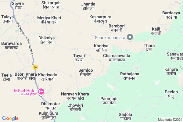
Nagpura
Nagpura Map
EDIT Map
Add Your House
 ..
..
Current Corona Virus Infected Patients Count in Pratapgarh District
| City Name | District Name | Total Covid cases |
|---|---|---|
| Pratapgarh District | Pratapgarh | 2 |
Locality Name :
Nagpura
( नागपुर )
Tehsil Name : Pratapgarh
District : Pratapgarh
State : Rajasthan
Division : Udaipur
Language : Hindi and Rajasthani
Current Time 04:43 PM
Date: Tuesday , Apr 29,2025 (IST)
Time zone: IST (UTC+5:30)
Elevation / Altitude: 455 meters. Above Seal level
Telephone Code / Std Code: 01479
Assembly constituency : Bari Sadri assembly constituency
Assembly MLA : Gautam Kumar
Lok Sabha constituency : Chittorgarh parliamentary constituency
Parliament MP : Chandra Prakash Joshi
Serpanch Name :
Main Village Name : Nagpura
Commodities Prices : Piplya Market / Mandi
National Highways Reachable To Nagpura
Nationa High Way :NH156
Nationa High Way :NH156
Rivers Near Nagpura
Jakam
Mahi
Jakam
Mahi
About Nagpura
Correct below Info and add more info about NagpuraNagpura is a small Village/hamlet in Pratapgarh Tehsil in Pratapgarh District of Rajasthan State, India. It comes under Nagpura Panchayath. It belongs to Udaipur Division . It is located 17 KM towards North from District head quarters Pratapgarh. 19 KM from Pratapgarh. 377 KM from State capital Jaipur
Dhamotar ( 8 KM ) , Gadola ( 9 KM ) , Kulmi Pura ( 9 KM ) , Sidh Pura ( 11 KM ) , Peeloo ( 11 KM ) are the nearby Villages to Nagpura. Nagpura is surrounded by Chhoti Sadri Tehsil towards North , Malhargarh Tehsil towards East , Neemuch Tehsil towards North , Mandsaur Tehsil towards East .
Pratapgarh , Mandsaur , Neemuch , Manasa are the near by Cities to Nagpura.
Nagpura 2011 Census Details
Nagpura Local Language is Hindi. Nagpura Village Total population is and number of houses are . Female Population is -1.0%. Village literacy rate is -1.0% and the Female Literacy rate is -1.0%.
Population
| Census Parameter | Census Data |
| Total Population | |
| Total No of Houses | |
| Female Population % | -1.0 % ( ) |
| Total Literacy rate % | -1.0 % ( ) |
| Female Literacy rate | -1.0 % ( ) |
| Scheduled Tribes Population % | -1.0 % ( ) |
| Scheduled Caste Population % | -1.0 % ( ) |
| Working Population % | -1.0 % |
| Child(0 -6) Population by 2011 | |
| Girl Child(0 -6) Population % by 2011 | -1.0 % ( ) |
Nagpura Census More Deatils.
Politics in Nagpura
Bharatiya Janata Party , BJP , INC are the major political parties in this area.Polling Stations /Booths near Nagpura
1)Govt. Sen. Sacondary School Rathajana (left Part)2)Govt.sen. Sacondary School Rathajana (right Part)
3)Govt.
4)Govt.
5)Govt.
HOW TO REACH Nagpura
By Rail
There is no railway station near to Nagpura in less than 10 km.Pincodes near Nagpura
312616 ( Dhamotar ) , 312623 ( Rathajana ) , 312604 ( Chhoti Sadari )Colleges near Nagpura
Government P. G. College Of Pratapgarh
Address : Government P. G. College Of Pratapgarh
Schools near Nagpura
S.a. Ps Kherot
Address : kherot , pratapgarh , pratapgarh(raj.) , Rajasthan . PIN- 312605 , Post - Pratap garh (Chittorgarh)
Ma Badi Pathshala
Address : gyaspur , pratapgarh , pratapgarh(raj.) , Rajasthan . PIN- 312621
K.g.b.v. Achalpur
Address : achalpur , pratapgarh , pratapgarh(raj.) , Rajasthan . PIN- 312605 , Post - Pratap garh (Chittorgarh)
Vijaylaxmi Bal V.m. Bori
Address : bori(1) , pratapgarh , pratapgarh(raj.) , Rajasthan . PIN- 312616 , Post - Dhamotar
Govt Health Centers near Nagpura
1) Kesarpura , SC Building , ,2) Thara , CHC Thara , Village Thara ,
3) Barkheda , Sub Center Building , ,
Sub Villages in Nagpura
Hospitals in Nagpura,Pratapgarh
Primary Health Center
Dhamotar; Pratapgarh; NH-113; Partapgarh Road; Pratapgarh; Pratapgarh; Rajasthan 312605; India
8.1 KM distance Detail
Government Savitri Bai Hospital
Dhamotar; Pratapgarh; NH-113; Partapgarh Road; Pratapgarh; Pratapgarh; Rajasthan 312616; India
8.1 KM distance Detail
more ..
Petrol Bunks in Nagpura,Pratapgarh
HP PETROL PUMP - JAGDISH FILLING STATION
Village Damalia Damalia TO Tehsil; Pratapgarh - Neemuch Rd; Udaipur; Rajasthan 312605; India
11.4 KM distance Detail
Kushal Filling Station
Chittorgarh road; Bagwas; Pratapgarh; Rajasthan 312605; India
14.8 KM distance Detail
more ..
Colleges in Nagpura,Pratapgarh
Reginol College Dhamotar
Reginol College prtapghar; Dhamotar; Rajasthan; India
8.2 KM distance Detail
mahila vidya mandir tt college; bagwas; pratapgarh
312623; RD Complex; U-3; Unnamed Rd; Sector 3; Avas Vikas Colony; Sikandra; Agra; Rajasthan 282004; India
16.2 KM distance Detail
The Asia pacific convent school
प्रतापगढ़ - नीमच मार्ग; Pragati Nagar; Pratapgarh; Rajasthan 312623; India
16.3 KM distance Detail
more ..
Schools in Nagpura,Pratapgarh
Government Senior Secondary School
Dhamotar; Pratapgarh; NH-113; Partapgarh Road; Pratapgarh; Pratapgarh; Rajasthan 312605; India
8.0 KM distance Detail
Government Secondary School
Kulmipura; Pratapgarh; NH-113; Partapgarh Road; Pratapgarh; Pratapgarh; Rajasthan 312605; India
9.1 KM distance Detail
Super Markets in Nagpura,Pratapgarh
Ajit kumar Mukesh kumar kirana shop
bus station high school road; Pratapgarh; Rajasthan; India
17.6 KM distance Detail
Police Stations near Nagpura,Pratapgarh
Police Choki Gandhi Circle
312605; Gandhi Cir; Chhoti Sadri; Rajasthan 312604; India
17.7 KM distance Detail
Governement Offices near Nagpura,Pratapgarh
Forest Department Office
Dhamotar; Pratapgarh; NH-113; Pratapgarh Road; Pratapgarh; Pratapgarh; Rajasthan 312616; India
7.9 KM distance Detail
Atal Seva Center
Kulmipura; Pratapgarh; NH-113; Partapgarh Road; Pratapgarh; Pratapgarh; Rajasthan 312605; India
8.9 KM distance Detail
About Nagpura &
History
How to reach Nagpura
Tourist Places Near By Nagpura
Schools in Nagpura
Colleges in Nagpura
Temperature & weather of Nagpura
places in Nagpura
Nagpura photos
More Information
How to reach Nagpura
Tourist Places Near By Nagpura
Schools in Nagpura
Colleges in Nagpura
Temperature & weather of Nagpura
places in Nagpura
Nagpura photos
More Information
Village Talk
Post News or Events about this Village
Near Cities
Pratapgarh 16 KM near
Mandsaur 34 KM near
Neemuch 39 KM near
Manasa 54 KM near
Pratapgarh 16 KM near
Mandsaur 34 KM near
Neemuch 39 KM near
Manasa 54 KM near
Near By Taluks
Pratapgarh 18 KM near
Chhoti Sadri 29 KM near
Malhargarh 35 KM near
Neemuch 38 KM near
Pratapgarh 18 KM near
Chhoti Sadri 29 KM near
Malhargarh 35 KM near
Neemuch 38 KM near
Near By Air Ports
Dabok Airport 116 KM near
Indore Airport 213 KM near
Ahmedabad Airport 282 KM near
Vadodara Airport 291 KM near
Dabok Airport 116 KM near
Indore Airport 213 KM near
Ahmedabad Airport 282 KM near
Vadodara Airport 291 KM near
Near By Tourist Places
Neemuch 37 KM near
Banswara 87 KM near
Ratlam 111 KM near
Dungarpur 128 KM near
Udaipur 134 KM near
Neemuch 37 KM near
Banswara 87 KM near
Ratlam 111 KM near
Dungarpur 128 KM near
Udaipur 134 KM near
Near By Districts
Pratapgarh 16 KM near
Mandsaur 32 KM near
Neemuch 37 KM near
Banswara 86 KM near
Pratapgarh 16 KM near
Mandsaur 32 KM near
Neemuch 37 KM near
Banswara 86 KM near
Near By RailWay Station
Piplia Rail Way Station 25 KM near
Mandsor Rail Way Station 34 KM near
Piplia Rail Way Station 25 KM near
Mandsor Rail Way Station 34 KM near