| Home | City Bus | Maps | Villages | Cities | Rail | Tourist Places | School | College | Pin Codes | Corona Cases Count |
| Distance Calculator Bus Services IFSC Codes Trace Mobile Number Weather Search Place Trace IP Available Cash ATM/Banks Locate Polling Booth Report an Error contact People |
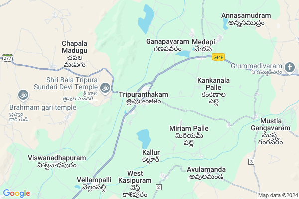
Thimmanapalem
Thimmanapalem Map
EDIT Map
Add Your House
 ..
..
Current Corona Virus Infected Patients Count in Prakasam District
| City Name | District Name | Total Covid cases |
|---|---|---|
| Prakasam District | Prakasam | 23 |
| Ongole | Prakasam | 19 |
| Chirala | Prakasam | 7 |
| Kunkalamarru,karamchedu | Prakasam | 2 |
| Konakalamitta Mandal | Prakasam | 1 |
| Kandukuru | Prakasam | 1 |
| Kunkala Marru | Prakasam | 1 |
| Markapur | Prakasam | 1 |
| Islamapet | Prakasam | 1 |
Locality Name :
Thimmanapalem
( తిమ్మన్నపాలెం )
Mandal Name : Tripuranthakam
District : Prakasam
State : Andhra Pradesh
Region : Andhra
Language : Telugu
Current Time 07:25 AM
Date: Saturday , Apr 26,2025 (IST)
Time zone: IST (UTC+5:30)
Elevation / Altitude: 121 meters. Above Seal level
Telephone Code / Std Code: 08403
Assembly constituency : assembly constituency
Assembly MLA :
Lok Sabha constituency : parliamentary constituency
Parliament MP : MAGUNTA SREENIVASULU REDDY
Serpanch Name :
Pin Code : 523212
Post Office Name : M.M.T. Road
Main Village Name : Thimmanapalem
Commodities Prices : Thungathurthy Market / Mandi
Edit below overview about Thimmanapalem
Edit below overview about Thimmanapalem
OverView of Thimmanapalem
Thimmanapalem is a small village, which is 23 kilometres near ongole. It was developing village in all the near villages. It was ruled by the chowdary's. It may contains the 3000 votes. It was a landmark for TDP. It is under the korisapadu mandalam, prakasam district.In thimmanapalem there is an AVZPH high school where the students studying up to 500. It is besides the NH 16 road. Telugu is the local language.also near the industrial GROWTHCENTER.so many peoples are working in the village in various works by thier talentEdit below overview about Thimmanapalem
National Highways Reachable To Thimmanapalem
Nationa High Way :NH544D
Nationa High Way :NH16
Nationa High Way :NH544D
Nationa High Way :NH16
Rivers Near Thimmanapalem
Krishna :クリシュナ :ಕೃಷ್ಣಾ :कृष्णा :కృష్ణా
Krishna :クリシュナ :ಕೃಷ್ಣಾ :कृष्णा :కృష్ణా
About Thimmanapalem
Thimmanapalem is a small Village/hamlet in Tripuranthakam Mandal in Prakasam District of Andhra Pradesh State, India. It comes under Thimmanapalem Panchayath. It belongs to Andhra region . It is located 96 KM towards west from District head quarters Ongole. 217 KM from State capital Hyderabad
Thimmanapalem Pin code is 523212 and postal head office is M.M.T. Road .
Thimmanapalem is surrounded by Kurichedu Mandal towards South , Pullalacheruvu Mandal towards North , Donakonda Mandal towards South , Yerragondapalem Mandal towards west .
Vinukonda , Markapur , Macherla , Srisailam Project (Right Flank Colony) Township are the near by Cities to Thimmanapalem.
Thimmana Palem 2011 Census Details
Thimmanapalem Local Language is Telugu. Thimmana Palem Village Total population is and number of houses are . Female Population is -1.0%. Village literacy rate is -1.0% and the Female Literacy rate is -1.0%.
Population
| Census Parameter | Census Data |
| Total Population | |
| Total No of Houses | |
| Female Population % | -1.0 % ( ) |
| Total Literacy rate % | -1.0 % ( ) |
| Female Literacy rate | -1.0 % ( ) |
| Scheduled Tribes Population % | -1.0 % ( ) |
| Scheduled Caste Population % | -1.0 % ( ) |
| Working Population % | -1.0 % |
| Child(0 -6) Population by 2011 | |
| Girl Child(0 -6) Population % by 2011 | -1.0 % ( ) |
Thimmana Palem Census More Deatils.
HOW TO REACH Thimmanapalem
By Rail
There is no railway station near to Thimmanapalem in less than 10 km. Markapur Road Rail Way Station (near to Markapur) are the Rail way stations reachable from near by towns.By Road
Markapur are the nearby by towns to Thimmanapalem having road connectivity to ThimmanapalemBy Bus
Tripuranthakam APSRTC Bus Station , Yerra Gonda Palem APSRTC Bus Station , Kurichedu APSRTC Bus Station are the nearby by Bus Stations to Thimmanapalem .APSRTC runs Number of busses from major cities to here.Colleges near Thimmanapalem
Apswrs Jr College For Girls Dupadu
Address : Apswrs Jr College For Girls Dupadu
Vyshnavi Degree College
Address : Tripuranthakam, Prakasham Dist. 523326
Schools near Thimmanapalem
Sbtk Hs Nsp Tripuranthaka
Address : tripuranthakam , tripuranthakam , prakasam , Andhra Pradesh . PIN- 523326 , Post - Tripurantakam
Kgbv Tripuranthakam
Address : tripuranthakam , tripuranthakam , prakasam , Andhra Pradesh . PIN- 523326 , Post - Tripurantakam
Zphs Ramasamudram
Address : ramasamudram , tripuranthakam , prakasam , Andhra Pradesh . PIN- 523326 , Post - Tripurantakam
Sri Bala Chandr Hs Medapi
Address : medapi , tripuranthakam , prakasam , Andhra Pradesh . PIN- 523326 , Post - Tripurantakam
Govt Health Centers near Thimmanapalem
1) Tripuranthakam , , Near NSP Colony, Tripuranthakam ,2) TRIPURANTHAKAM , , Bramham gari colony, BSNL Officer Exchange, Tripuranthakam ,
3) RAJUPALEM , Apr-88 , SC.Colony, Markapur Main Road, Rajupalem ,
Sub Villages in Thimmanapalem
Hospitals in Thimmanapalem,Tripuranthakam
Sanjeevani Medical Shop
Old Ramalayam St; Tripuranthakam; Andhra Pradesh 523326; India
0.6 KM distance Detail
more ..
Petrol Bunks in Thimmanapalem,Tripuranthakam
HP PETROL PUMP - SRI RAJYA LAKSHMI PETROLEUM
HPC Dealers SH-50; Vinukonda Road Tripurantakam; Andhra Pradesh 523236; India
1.5 KM distance Detail
Petrol ⛽
4/131-A; Old Ramalayam St; Tripuranthakam; Andhra Pradesh 523326; India
1.7 KM distance Detail
more ..
Colleges in Thimmanapalem,Tripuranthakam
AP Government Social Welfare Residential College
Dupadu; Andhra Pradesh 523330; India
15.7 KM distance Detail
Gowthami Junior College Yerragondapalem
Nagarjuna Sagar-Srisailam Road; Yerragondapalem; Andhra Pradesh 523327; India
19.1 KM distance Detail
more ..
Schools in Thimmanapalem,Tripuranthakam
Bharathi Residential Public School
Tripuranthakam; Andhra Pradesh 523326; India
0.2 KM distance Detail
MKనిలయం
Mannuva.Kotaiah s/o P Venkaiah KK palli Road Dt A.P; Tripuranthakam; Andhra Pradesh 523326; India
0.3 KM distance Detail
Bharathi School
4/131-A; Old Ramalayam St; Tripuranthakam; Andhra Pradesh 523326; India
0.5 KM distance Detail
Electronic Shops in Thimmanapalem,Tripuranthakam
GURU STUDIO;MOBILES&REDIUMSTICKERING
bus stand; mainroad;tripuranthakam ; near; Tripuranthakam; Andhra Pradesh; India
0.5 KM distance Detail
Berger Paint Shop
opp; YSR Statue; Gollapadu Road; Kunduruvaripalem; Andhra Pradesh 522408; India
0.5 KM distance Detail
Police Stations near Thimmanapalem,Tripuranthakam
Yerragondapalem Police Station
Yerragondapalem; Andhra Pradesh 523327; India
19.9 KM distance Detail
Governement Offices near Thimmanapalem,Tripuranthakam
MeeSeva Center
1/60;Opp Z P H School; Tripuranthakam; Andhra Pradesh 523326; India
0.8 KM distance Detail
About Thimmanapalem &
History
How to reach Thimmanapalem
Tourist Places Near By Thimmanapalem
Schools in Thimmanapalem
Colleges in Thimmanapalem
Temperature & weather of Thimmanapalem
places in Thimmanapalem
Thimmanapalem photos
More Information
How to reach Thimmanapalem
Tourist Places Near By Thimmanapalem
Schools in Thimmanapalem
Colleges in Thimmanapalem
Temperature & weather of Thimmanapalem
places in Thimmanapalem
Thimmanapalem photos
More Information
Village Talk
Post News or Events about this Village
Near Cities
Vinukonda 34 KM near
Markapur 39 KM near
Macherla 59 KM near
Srisailam Project (Right Flank Colony) Township 71 KM near
Vinukonda 34 KM near
Markapur 39 KM near
Macherla 59 KM near
Srisailam Project (Right Flank Colony) Township 71 KM near
Near By Taluks
Tripuranthakam 0 KM near
Kurichedu 17 KM near
Pullalacheruvu 18 KM near
Donakonda 21 KM near
Tripuranthakam 0 KM near
Kurichedu 17 KM near
Pullalacheruvu 18 KM near
Donakonda 21 KM near
Near By Air Ports
Vijayawada Airport 172 KM near
Rajiv Gandhi International Airport 197 KM near
Tirupati Airport 294 KM near
Rajahmundry Airport 313 KM near
Vijayawada Airport 172 KM near
Rajiv Gandhi International Airport 197 KM near
Tirupati Airport 294 KM near
Rajahmundry Airport 313 KM near
Near By Tourist Places
Srisailam 71 KM near
Nagarjunsagar 73 KM near
Nagarjunakonda 102 KM near
Guntur 122 KM near
Amaravathi 129 KM near
Srisailam 71 KM near
Nagarjunsagar 73 KM near
Nagarjunakonda 102 KM near
Guntur 122 KM near
Amaravathi 129 KM near
Near By Districts
Prakasam 92 KM near
Guntur 121 KM near
Nalgonda 132 KM near
Kurnool 170 KM near
Prakasam 92 KM near
Guntur 121 KM near
Nalgonda 132 KM near
Kurnool 170 KM near
Near By RailWay Station
Donakonda Rail Way Station 20 KM near
Vinukonda Rail Way Station 35 KM near
Donakonda Rail Way Station 20 KM near
Vinukonda Rail Way Station 35 KM near