| Home | City Bus | Maps | Villages | Cities | Rail | Tourist Places | School | College | Pin Codes | Corona Cases Count |
| Distance Calculator Bus Services IFSC Codes Trace Mobile Number Weather Search Place Trace IP Available Cash ATM/Banks Locate Polling Booth Report an Error contact People |
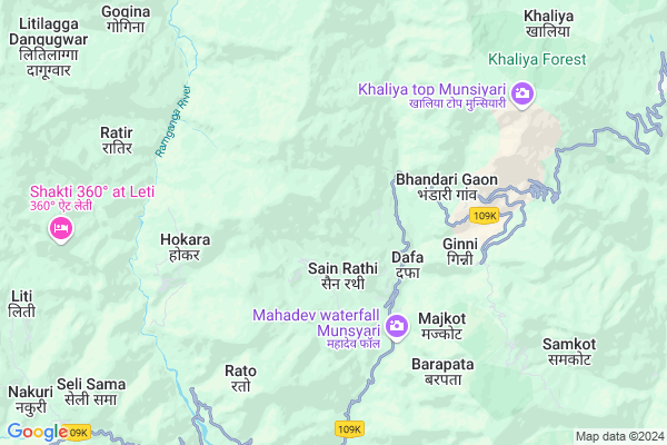
Rumta
Rumta Map
EDIT Map
Add Your House
 ..
..
Current Corona Virus Infected Patients Count in Pithoragarh District
| City Name | District Name | Total Covid cases |
|---|
Locality Name :
Rumta
( रमता )
Block Name : Munsyari
District : Pithoragarh
State : Uttarakhand
Language : Hindi and Urdu, Kumauni
Current Time 09:46 AM
Date: Tuesday , Apr 29,2025 (IST)
Time zone: IST (UTC+5:30)
Telephone Code / Std Code: 05961
Assembly constituency : Dharchula assembly constituency
Assembly MLA : Harish Singh Dhami
Lok Sabha constituency : Almora parliamentary constituency
Parliament MP : Ajay Tamta
Serpanch Name :
Pin Code : 262553
Post Office Name : Tejam
Main Village Name : Rumta
Rumta Live Weather
Temperature: 19.0 °C
clear sky
Humidity: 34%
Wind : 3.81 mt/sec towards S
StationName : "BÄ\u0081geshwar"
observed on Now
Temperature: 19.0 °C
clear sky
Humidity: 34%
Wind : 3.81 mt/sec towards S
StationName : "BÄ\u0081geshwar"
observed on Now
Rumta Weather Forecast for Next 5 days
30-04-2025
10.5°C to 21.5°C
clear sky, scattered clouds, light rain, broken clouds
10.5°C to 21.5°C
clear sky, scattered clouds, light rain, broken clouds
01-05-2025
9.5°C to 22.6°C
scattered clouds, clear sky, light rain, overcast clouds
9.5°C to 22.6°C
scattered clouds, clear sky, light rain, overcast clouds
02-05-2025
9.1°C to 19.3°C
overcast clouds, scattered clouds, light rain, few clouds
9.1°C to 19.3°C
overcast clouds, scattered clouds, light rain, few clouds
03-05-2025
9.7°C to 20.3°C
scattered clouds, clear sky, light rain, overcast clouds
9.7°C to 20.3°C
scattered clouds, clear sky, light rain, overcast clouds
04-05-2025
10.1°C to 19.3°C
overcast clouds, light rain, moderate rain
10.1°C to 19.3°C
overcast clouds, light rain, moderate rain
National Highways Reachable To Rumta
Nationa High Way :NH309A
Nationa High Way :NH309A
Rivers Near Rumta
Goriganga
:काली गाड Sharda :Mahakali River :शारदा नदी :महाकाली नदी
Goriganga
:काली गाड Sharda :Mahakali River :शारदा नदी :महाकाली नदी
About Rumta
Correct below Info and add more info about RumtaRumta is a small Village/hamlet in Munsyari Block in Pithoragarh District of Uttarakhand State, India. It comes under Rumta Panchayath. It is located 58 KM towards North from District head quarters Pithoragarh. 14 KM from Munsyari. 239 KM from State capital Dehradun
Rumta Pin code is 262553 and postal head office is Tejam .
Dafa ( 2 KM ) , Bhurting ( 3 KM ) , Ginni ( 4 KM ) , Hokara ( 5 KM ) , Gola ( 5 KM ) are the nearby Villages to Rumta. Rumta is surrounded by Kapkote Block towards west , Didihat Block towards South , Berinag Block towards South , Bageshwar Block towards west .
Pithoragarh , Almora , Champawat , Nainital are the near by Cities to Rumta.
Rumta 2011 Census Details
Rumta Local Language is Hindi. Rumta Village Total population is 28 and number of houses are 6. Female Population is 39.3%. Village literacy rate is 82.1% and the Female Literacy rate is 21.4%.
Population
| Census Parameter | Census Data |
| Total Population | 28 |
| Total No of Houses | 6 |
| Female Population % | 39.3 % ( 11) |
| Total Literacy rate % | 82.1 % ( 23) |
| Female Literacy rate | 21.4 % ( 6) |
| Scheduled Tribes Population % | 0.0 % ( 0) |
| Scheduled Caste Population % | 0.0 % ( 0) |
| Working Population % | 42.9 % |
| Child(0 -6) Population by 2011 | 1 |
| Girl Child(0 -6) Population % by 2011 | 100.0 % ( 1) |
Rumta Census More Deatils.
Politics in Rumta
INC , BJP , INC are the major political parties in this area.Polling Stations /Booths near Rumta
1)Jaykot2)Birthi
3)Thumli
4)Gunji (dharchula)
5)Hupli
HOW TO REACH Rumta
By Rail
There is no railway station near to Rumta in less than 10 km.Colleges near Rumta
Rajendra Singh Pawar
Address : Smkot Teela
Schools near Rumta
G.i.c. Tejam
Address : tejam , munsyari , pithoragarh , Uttarakhand . PIN- 262553 , Post - Tejam
G.g.h.s. Ucheti
Address : fapa , munsyari , pithoragarh , Uttarakhand . PIN- 262554 , Post - Munsiari
Vvm Munsyari
Address : bunga , munsyari , pithoragarh , Uttarakhand . PIN- 262554 , Post - Munsiari
G.i.c. Kota Pandrapala
Address : malon , munsyari , pithoragarh , Uttarakhand . PIN- 262555 , Post - Bansbagar
Govt Health Centers near Rumta
1) Madkot , Madkot , Madkot ,2) APHC Madkot , Madkot , Madkot ,
3) Munsyari Main Center , Munsyari main Center , Munstyari ,
Sub Villages in Rumta
Petrol Bunks in Rumta,Munsyari
HP PETROL PUMP - BAJRANG FILLING STATION ADHOC
Munsyari; Uttarakhand 262554; India
13.6 KM distance Detail
more ..
Colleges in Rumta,Munsyari
Rajkiya Inter College
Tejam; Pithoragarh; SH-11; Bageshwar Didihat Road; Pithoragarh; Pithoragarh; Uttarakhand 262553; India
4.0 KM distance Detail
more ..
Schools in Rumta,Munsyari
Vivekanand Vidya Mandir Inter College Munsyari
Munsyari; Uttarakhand 262554; India
13.2 KM distance Detail
Electronic Shops in Rumta,Munsyari
Dharamshaktu Electronics
Dist; Bazar Road; Munsyari; Uttarakhand 262554; India
13.3 KM distance Detail
Police Stations near Rumta,Munsyari
Local Police Station
Munsyari-Madkot Rd; Munsyari; Uttarakhand 262554; India
13.1 KM distance Detail
Police Station Nachani
Near SBI ATM Didihat Rd; Chilkiya; Uttarakhand 262553; India
17.0 KM distance Detail
Governement Offices near Rumta,Munsyari
PWD Office
Tejam; Pithoragarh; SH-11; Bhageswar Didihat Road; Pithoragarh; Pithoragarh; Uttarakhand 262553; India
12.8 KM distance Detail
Development Authority Office
Tejam; Pithoragarh; SH-11; Almora Bageshwar Munsiyari Road; Pithoragarh; Pithoragarh; Uttarakhand 262553; India
13.2 KM distance Detail
OFFICE OF ASSISTANT ENGINEER; IRRIGATION SUBDIVISION II
Munsyari; Uttarakhand 262554; India
13.2 KM distance Detail
About Rumta &
History
How to reach Rumta
Tourist Places Near By Rumta
Schools in Rumta
Colleges in Rumta
Temperature & weather of Rumta
places in Rumta
Rumta photos
More Information
How to reach Rumta
Tourist Places Near By Rumta
Schools in Rumta
Colleges in Rumta
Temperature & weather of Rumta
places in Rumta
Rumta photos
More Information
Village Talk
Post News or Events about this Village
Near Cities
Pithoragarh 56 KM near
Almora 74 KM near
Champawat 85 KM near
Nainital 108 KM near
Pithoragarh 56 KM near
Almora 74 KM near
Champawat 85 KM near
Nainital 108 KM near
Near By Taluks
Munsyari 13 KM near
Kapkote 23 KM near
Didihat 29 KM near
Berinag 29 KM near
Munsyari 13 KM near
Kapkote 23 KM near
Didihat 29 KM near
Berinag 29 KM near
Near By Air Ports
Pantnagar Airport 143 KM near
Dehra Dun Airport 228 KM near
Muzaffarnagar Airport 276 KM near
Simla Airport 346 KM near
Pantnagar Airport 143 KM near
Dehra Dun Airport 228 KM near
Muzaffarnagar Airport 276 KM near
Simla Airport 346 KM near
Near By Tourist Places
Chaukori 26 KM near
Bageshwar 44 KM near
Pithoragarh 56 KM near
Binsar 59 KM near
Kasauni 61 KM near
Chaukori 26 KM near
Bageshwar 44 KM near
Pithoragarh 56 KM near
Binsar 59 KM near
Kasauni 61 KM near
Near By Districts
Bageshwar 45 KM near
Pithoragarh 56 KM near
Almora 73 KM near
Champawat 86 KM near
Bageshwar 45 KM near
Pithoragarh 56 KM near
Almora 73 KM near
Champawat 86 KM near
Near By RailWay Station
Kathgodam Rail Way Station 114 KM near
Haldwani Rail Way Station 120 KM near
Kathgodam Rail Way Station 114 KM near
Haldwani Rail Way Station 120 KM near