| Home | City Bus | Maps | Villages | Cities | Rail | Tourist Places | School | College | Pin Codes | Corona Cases Count |
| Distance Calculator Bus Services IFSC Codes Trace Mobile Number Weather Search Place Trace IP Available Cash ATM/Banks Locate Polling Booth Report an Error contact People |
Tulakhand
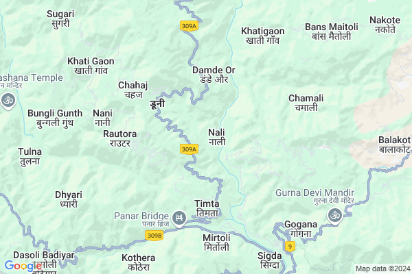
Tulakhand Map
EDIT Map
Add Your House
 ..
..
Current Corona Virus Infected Patients Count in Pithoragarh District
| City Name | District Name | Total Covid cases |
|---|
Locality Name :
Tulakhand
( तुलाखण्ड )
Block Name : Gangolihat
District : Pithoragarh
State : Uttarakhand
Language : Hindi and Urdu, Kumauni
Current Time 01:28 PM
Date: Tuesday , Apr 29,2025 (IST)
Time zone: IST (UTC+5:30)
Elevation / Altitude: 520 meters. Above Seal level
Telephone Code / Std Code: 05964
Assembly constituency : Gangolihat assembly constituency
Assembly MLA : Fakeer Ram
Lok Sabha constituency : Almora parliamentary constituency
Parliament MP : Ajay Tamta
Serpanch Name :
Pin Code : 262522
Post Office Name : Gangolihat
Main Village Name : Tulakhand
Commodities Prices : Haldwani Market / Mandi
National Highways Reachable To Tulakhand
Nationa High Way :NH109
Nationa High Way :NH309A
Nationa High Way :NH109
Nationa High Way :NH309A
Rivers Near Tulakhand
Shalang Gad
Ramganga
Shalang Gad
Ramganga
About Tulakhand
Correct below Info and add more info about TulakhandTulakhand is a small Village/hamlet in Gangolihat Block in Pithoragarh District of Uttarakhand State, India. It comes under Tulakhand Panchayath. It is located 15 KM towards west from District head quarters Pithoragarh. 17 KM from Gangolihat. 252 KM from State capital Dehradun
Tulakhand Pin code is 262522 and postal head office is Gangolihat .
Dharasi Chamela ( 4 KM ) , Chahaj ( 5 KM ) , Rasyun ( 5 KM ) , Tallisar ( 6 KM ) , Chamali ( 6 KM ) are the nearby Villages to Tulakhand. Tulakhand is surrounded by Barakot Block towards South , Gangolihat Block towards North , Dhauladevi Block towards west , Munakot Block towards East .
Pithoragarh , Champawat , Almora , Nainital are the near by Cities to Tulakhand.
Tulakhand 2011 Census Details
Tulakhand Local Language is Hindi. Tulakhand Village Total population is 220 and number of houses are 48. Female Population is 54.5%. Village literacy rate is 65.0% and the Female Literacy rate is 26.8%.
Population
| Census Parameter | Census Data |
| Total Population | 220 |
| Total No of Houses | 48 |
| Female Population % | 54.5 % ( 120) |
| Total Literacy rate % | 65.0 % ( 143) |
| Female Literacy rate | 26.8 % ( 59) |
| Scheduled Tribes Population % | 0.0 % ( 0) |
| Scheduled Caste Population % | 0.0 % ( 0) |
| Working Population % | 48.6 % |
| Child(0 -6) Population by 2011 | 35 |
| Girl Child(0 -6) Population % by 2011 | 65.7 % ( 23) |
Tulakhand Census More Deatils.
Politics in Tulakhand
BJP , BJP , INC are the major political parties in this area.Polling Stations /Booths near Tulakhand
1)Lohathal2)Amthal
3)Lachhima
4)Khitoli
5)Airadai
HOW TO REACH Tulakhand
By Rail
There is no railway station near to Tulakhand in less than 10 km.Colleges near Tulakhand
G I C Gandginager
Address :
Schools near Tulakhand
R.n.school Gangolihat
Address : hat , gangolihat , pithoragarh , Uttarakhand . PIN- 262522 , Post - Gangolihat
J. B. S. G. V. M. Gan.
Address : hat , gangolihat , pithoragarh , Uttarakhand . PIN- 262522 , Post - Gangolihat
Gic Dobal Khet
Address : dobal khet , gangolihat , pithoragarh , Uttarakhand . PIN- 262522 , Post - Gangolihat
Gic Duboula
Address : duboula , gangolihat , pithoragarh , Uttarakhand . PIN- 262529 , Post - Gurna
Govt Health Centers near Tulakhand
1) Sainrathi , Sainranthi , Sainrathi ,2) PHC Barakot , PHC Barakote , Barakote ,
3) Gangolihat Main Center , Gangolihat Main Center , Gangolihat Main Center , Gangolihat Main Center
Sub Villages in Tulakhand
Hospitals in Tulakhand,Gangolihat
Community Health centre
Ran Kote Upreti; Gangolihat; Uttarakhand 262522; India
13.9 KM distance Detail
more ..
Petrol Bunks in Tulakhand,Gangolihat
JAI AMBAY OILS
ALMORA BAGESHWAR ROAD; BAG; Bageshwar; Uttarakhand 263642; India
13.7 KM distance Detail
more ..
Colleges in Tulakhand,Gangolihat
L S M Government P G College
GIC Road; Pithoragarh; Uttarakhand 262501; India
12.6 KM distance Detail
Government Inter College
Link Rd; Jagdamba Colony; Kujoli; Pithoragarh; Uttarakhand 262502; India
12.7 KM distance Detail
Seemant Institute Of Technology Temporary Campus
Link Rd; Jagdamba Colony; Kujoli; Pithoragarh; Uttarakhand 262502; India
12.7 KM distance Detail
SIT Pithoragarh PlayGround
Jagdamba Colony; Kujoli; Gankot; Uttarakhand 262502; India
12.7 KM distance Detail
more ..
Schools in Tulakhand,Gangolihat
saraswati sisu mandir duni
Gangolihat Timta Pithoragarh Rd; डूनी; Uttarakhand 262522; India
3.3 KM distance Detail
Electronic Shops in Tulakhand,Gangolihat
Gitesh Mobile Repairing Center
Ran Kote Upreti; Gangolihat; Uttarakhand 262522; India
13.4 KM distance Detail
Lenovo Exclusive Store
Verma Computers & Peripherals; Takana Rd; Pithoragarh; Uttarakhand 262501; India
13.5 KM distance Detail
Local Parks in Tulakhand,Gangolihat
Sampoornanand Park Ghantakaran
Ghantakaran; Pithoragarh; Uttarakhand 262501; India
14.1 KM distance Detail
Govind Ballabh Pant Park
Mahatma Gandhi Marg; Pithoragarh; Uttarakhand 262501; India
14.1 KM distance Detail
Police Stations near Tulakhand,Gangolihat
Police Station Pithoragarh
Gandhi Nagar; Pithoragarh; Uttarakhand 262501; India
13.9 KM distance Detail
About Tulakhand &
History
How to reach Tulakhand
Tourist Places Near By Tulakhand
Schools in Tulakhand
Colleges in Tulakhand
Temperature & weather of Tulakhand
places in Tulakhand
Tulakhand photos
More Information
How to reach Tulakhand
Tourist Places Near By Tulakhand
Schools in Tulakhand
Colleges in Tulakhand
Temperature & weather of Tulakhand
places in Tulakhand
Tulakhand photos
More Information
Village Talk
Post News or Events about this Village
Near Cities
Pithoragarh 14 KM near
Champawat 26 KM near
Almora 47 KM near
Nainital 71 KM near
Pithoragarh 14 KM near
Champawat 26 KM near
Almora 47 KM near
Nainital 71 KM near
Near By Taluks
Pithoragarh 11 KM near
Barakot 13 KM near
Gangolihat 16 KM near
Dhauladevi 19 KM near
Pithoragarh 11 KM near
Barakot 13 KM near
Gangolihat 16 KM near
Dhauladevi 19 KM near
Near By Air Ports
Pantnagar Airport 93 KM near
Dehra Dun Airport 241 KM near
Muzaffarnagar Airport 263 KM near
Indira Gandhi International Airport 348 KM near
Pantnagar Airport 93 KM near
Dehra Dun Airport 241 KM near
Muzaffarnagar Airport 263 KM near
Indira Gandhi International Airport 348 KM near
Near By Tourist Places
Pithoragarh 14 KM near
Abbott Mount 16 KM near
Champawat 27 KM near
Chaukori 35 KM near
Binsar 44 KM near
Pithoragarh 14 KM near
Abbott Mount 16 KM near
Champawat 27 KM near
Chaukori 35 KM near
Binsar 44 KM near
Near By Districts
Pithoragarh 14 KM near
Champawat 28 KM near
Almora 47 KM near
Bageshwar 48 KM near
Pithoragarh 14 KM near
Champawat 28 KM near
Almora 47 KM near
Bageshwar 48 KM near
Near By RailWay Station
Kathgodam Rail Way Station 69 KM near
Haldwani Rail Way Station 74 KM near
Kathgodam Rail Way Station 69 KM near
Haldwani Rail Way Station 74 KM near