| Home | City Bus | Maps | Villages | Cities | Rail | Tourist Places | School | College | Pin Codes | Corona Cases Count |
| Distance Calculator Bus Services IFSC Codes Trace Mobile Number Weather Search Place Trace IP Available Cash ATM/Banks Locate Polling Booth Report an Error contact People |
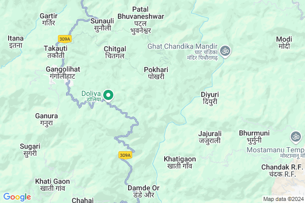
Golai
Golai Map
EDIT Map
Add Your House
 ..
..
Current Corona Virus Infected Patients Count in Pithoragarh District
| City Name | District Name | Total Covid cases |
|---|
Locality Name :
Golai
( गोलाई )
Block Name : Gangolihat
District : Pithoragarh
State : Uttarakhand
Language : Hindi and Urdu, Kumauni
Current Time 01:23 PM
Date: Tuesday , Apr 29,2025 (IST)
Time zone: IST (UTC+5:30)
Elevation / Altitude: 520 meters. Above Seal level
Telephone Code / Std Code: 05964
Assembly constituency : Gangolihat assembly constituency
Assembly MLA : Fakeer Ram
Lok Sabha constituency : Almora parliamentary constituency
Parliament MP : Ajay Tamta
Serpanch Name :
Pin Code : 262522
Post Office Name : Gangolihat
Main Village Name : Golai
Commodities Prices : Haldwani Market / Mandi
National Highways Reachable To Golai
Nationa High Way :NH109
Nationa High Way :NH309A
Nationa High Way :NH109
Nationa High Way :NH309A
Rivers Near Golai
Shalang Gad
Ramganga
Shalang Gad
Ramganga
About Golai
Correct below Info and add more info about GolaiGolai is a small Village/hamlet in Gangolihat Block in Pithoragarh District of Uttarakhand State, India. It comes under Golai Panchayath. It is located 15 KM towards west from District head quarters Pithoragarh. 10 KM from Gangolihat. 249 KM from State capital Dehradun
Golai Pin code is 262522 and postal head office is Gangolihat .
Agron ( 3 KM ) , Sanghar ( 3 KM ) , Jakhani Upreti ( 3 KM ) , Choli ( 4 KM ) , Simalkot ( 4 KM ) are the nearby Villages to Golai. Golai is surrounded by Pithoragarh Block towards East , Berinag Block towards North , Dhauladevi Block towards west , Munakot Block towards East .
Pithoragarh , Champawat , Almora , Nainital are the near by Cities to Golai.
Golai 2011 Census Details
Golai Local Language is Hindi. Golai Village Total population is 46 and number of houses are 11. Female Population is 50.0%. Village literacy rate is 89.1% and the Female Literacy rate is 45.7%.
Population
| Census Parameter | Census Data |
| Total Population | 46 |
| Total No of Houses | 11 |
| Female Population % | 50.0 % ( 23) |
| Total Literacy rate % | 89.1 % ( 41) |
| Female Literacy rate | 45.7 % ( 21) |
| Scheduled Tribes Population % | 0.0 % ( 0) |
| Scheduled Caste Population % | 0.0 % ( 0) |
| Working Population % | 52.2 % |
| Child(0 -6) Population by 2011 | 5 |
| Girl Child(0 -6) Population % by 2011 | 40.0 % ( 2) |
Golai Census More Deatils.
Politics in Golai
BJP , BJP , INC are the major political parties in this area.Polling Stations /Booths near Golai
1)Lohathal2)Surkhal Pathak
3)Amthal
4)Lachhima
5)Kimkot
HOW TO REACH Golai
By Rail
There is no railway station near to Golai in less than 10 km.Colleges near Golai
G I C Gandginager
Address :
Schools in Golai
Gp.s.golai
Address : golai , gangolihat , pithoragarh , Uttarakhand . PIN- 262522 , Post - Gangolihat
Govt Health Centers near Golai
1) Sainrathi , Sainranthi , Sainrathi ,2) Gangolihat Main Center , Gangolihat Main Center , Gangolihat Main Center , Gangolihat Main Center
3) CHC Gangolihat , CHC Gangolihat , CHC Gangolihat , CHC Gangolihat
Sub Villages in Golai
Hospitals in Golai,Gangolihat
Community Health centre
Ran Kote Upreti; Gangolihat; Uttarakhand 262522; India
7.0 KM distance Detail
more ..
Petrol Bunks in Golai,Gangolihat
Mahakali Fuels
Dasaithal - Sonkihat Rd; Gangolihat; Uttarakhand 262522; India
8.5 KM distance Detail
HARBANS MOTOR WORKS A/C PITHORAGARH
KUMOD;PITHORAGARH; Pithoragarh; Uttarakhand 262501; India
14.1 KM distance Detail
more ..
Colleges in Golai,Gangolihat
Government Girls Inter College
NH309A; Ran Kote Upreti; Gangolihat; Uttarakhand 262522; India
7.1 KM distance Detail
Shri Mahakali Government Inter College
Mahankali Rd; Ran Kote Upreti; Gangolihat; Uttarakhand 262522; India
7.3 KM distance Detail
L S M Government P G College
GIC Road; Pithoragarh; Uttarakhand 262501; India
13.4 KM distance Detail
Government Inter College
Link Rd; Jagdamba Colony; Kujoli; Pithoragarh; Uttarakhand 262502; India
13.7 KM distance Detail
more ..
Schools in Golai,Gangolihat
Rajiv Gandhi Navodaya Vidhalaya
Gangolihat Timta Pithoragarh Rd; Koon Upreti; Uttarakhand 262522; India
5.9 KM distance Detail
Smt. Heera Memorial Academy
Markhanuei; Gangolihat; Uttarakhand 262522; India
6.5 KM distance Detail
Vivekanand Vidya Mandir
Ran Kote Upreti; Gangolihat; Uttarakhand 262522; India
7.0 KM distance Detail
Electronic Shops in Golai,Gangolihat
Gitesh Mobile Repairing Center
Ran Kote Upreti; Gangolihat; Uttarakhand 262522; India
6.9 KM distance Detail
New Bimmy Electronics
Gangolihat Rd; Ran Kote Upreti; Gangolihat; Uttarakhand 262522; India
7.2 KM distance Detail
Local Parks in Golai,Gangolihat
Sampoornanand Park Ghantakaran
Ghantakaran; Pithoragarh; Uttarakhand 262501; India
14.2 KM distance Detail
Govind Ballabh Pant Park
Mahatma Gandhi Marg; Pithoragarh; Uttarakhand 262501; India
14.2 KM distance Detail
Police Stations near Golai,Gangolihat
Police Station Pithoragarh
Gandhi Nagar; Pithoragarh; Uttarakhand 262501; India
14.4 KM distance Detail
About Golai &
History
How to reach Golai
Tourist Places Near By Golai
Schools in Golai
Colleges in Golai
Temperature & weather of Golai
places in Golai
Golai photos
More Information
How to reach Golai
Tourist Places Near By Golai
Schools in Golai
Colleges in Golai
Temperature & weather of Golai
places in Golai
Golai photos
More Information
Village Talk
Post News or Events about this Village
Near Cities
Pithoragarh 14 KM near
Champawat 36 KM near
Almora 48 KM near
Nainital 75 KM near
Pithoragarh 14 KM near
Champawat 36 KM near
Almora 48 KM near
Nainital 75 KM near
Near By Taluks
Gangolihat 10 KM near
Pithoragarh 11 KM near
Berinag 19 KM near
Dhauladevi 21 KM near
Gangolihat 10 KM near
Pithoragarh 11 KM near
Berinag 19 KM near
Dhauladevi 21 KM near
Near By Air Ports
Pantnagar Airport 101 KM near
Dehra Dun Airport 238 KM near
Muzaffarnagar Airport 264 KM near
Indira Gandhi International Airport 353 KM near
Pantnagar Airport 101 KM near
Dehra Dun Airport 238 KM near
Muzaffarnagar Airport 264 KM near
Indira Gandhi International Airport 353 KM near
Near By Tourist Places
Pithoragarh 14 KM near
Chaukori 25 KM near
Abbott Mount 26 KM near
Champawat 37 KM near
Binsar 42 KM near
Pithoragarh 14 KM near
Chaukori 25 KM near
Abbott Mount 26 KM near
Champawat 37 KM near
Binsar 42 KM near
Near By Districts
Pithoragarh 14 KM near
Champawat 38 KM near
Bageshwar 42 KM near
Almora 48 KM near
Pithoragarh 14 KM near
Champawat 38 KM near
Bageshwar 42 KM near
Almora 48 KM near
Near By RailWay Station
Kathgodam Rail Way Station 76 KM near
Haldwani Rail Way Station 81 KM near
Kathgodam Rail Way Station 76 KM near
Haldwani Rail Way Station 81 KM near