| Home | City Bus | Maps | Villages | Cities | Rail | Tourist Places | School | College | Pin Codes | Corona Cases Count |
| Distance Calculator Bus Services IFSC Codes Trace Mobile Number Weather Search Place Trace IP Available Cash ATM/Banks Locate Polling Booth Report an Error contact People |
Gaurh
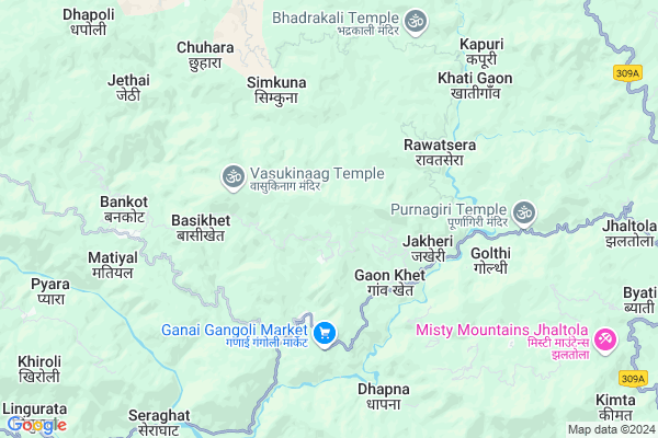
Gaurh Map
EDIT Map
Add Your House
 ..
..
Current Corona Virus Infected Patients Count in Pithoragarh District
| City Name | District Name | Total Covid cases |
|---|
Locality Name :
Gaurh
( गौढ़ )
Block Name : Gangolihat
District : Pithoragarh
State : Uttarakhand
Language : Hindi and Urdu, Kumauni
Current Time 05:30 PM
Date: Wednesday , Feb 05,2025 (IST)
Time zone: IST (UTC+5:30)
Elevation / Altitude: 520 meters. Above Seal level
Telephone Code / Std Code: 05964
Assembly constituency : Gangolihat assembly constituency
Assembly MLA : Fakeer Ram
Lok Sabha constituency : Almora parliamentary constituency
Parliament MP : Ajay Tamta
Serpanch Name :
Pin Code : 262532
Post Office Name : Ganai Gangoli
Main Village Name : Gaurh
Commodities Prices : Haldwani Market / Mandi
National Highways Reachable To Gaurh
Nationa High Way :NH109
Nationa High Way :NH309A
Nationa High Way :NH109
Nationa High Way :NH309A
Rivers Near Gaurh
Shalang Gad
Ramganga
Shalang Gad
Ramganga
About Gaurh
Correct below Info and add more info about GaurhGaurh is a small Village/hamlet in Gangolihat Block in Pithoragarh District of Uttarakhand State, India. It comes under Gaurh Panchayath. It is located 39 KM towards west from District head quarters Pithoragarh. 13 KM from Gangolihat. 226 KM from State capital Dehradun
Gaurh Pin code is 262532 and postal head office is Ganai Gangoli .
Simali ( 2 KM ) , Baisali ( 3 KM ) , Jakheri ( 3 KM ) , Basikhet ( 4 KM ) , Ganai Gangoli ( 4 KM ) are the nearby Villages to Gaurh. Gaurh is surrounded by Bageshwar Block towards west , Bhaisiya Chhana Block towards west , Berinag Block towards East , Dhauladevi Block towards South .
Almora , Pithoragarh , Champawat , Nainital are the near by Cities to Gaurh.
Gaurh 2011 Census Details
Gaurh Local Language is Hindi. Gaurh Village Total population is 19 and number of houses are 4. Female Population is 52.6%. Village literacy rate is 84.2% and the Female Literacy rate is 47.4%.
Population
| Census Parameter | Census Data |
| Total Population | 19 |
| Total No of Houses | 4 |
| Female Population % | 52.6 % ( 10) |
| Total Literacy rate % | 84.2 % ( 16) |
| Female Literacy rate | 47.4 % ( 9) |
| Scheduled Tribes Population % | 0.0 % ( 0) |
| Scheduled Caste Population % | 0.0 % ( 0) |
| Working Population % | 47.4 % |
| Child(0 -6) Population by 2011 | 2 |
| Girl Child(0 -6) Population % by 2011 | 0.0 % ( 0) |
Gaurh Census More Deatils.
Politics in Gaurh
BJP , BJP , INC are the major political parties in this area.Polling Stations /Booths near Gaurh
1)Nainoli2)Lohathal
3)Kimkot
4)Chaunala Baukta
5)Khitoli
HOW TO REACH Gaurh
By Rail
There is no railway station near to Gaurh in less than 10 km.Colleges near Gaurh
G I C Gandginager
Address :
Schools near Gaurh
R.n.school Gangolihat
Address : hat , gangolihat , pithoragarh , Uttarakhand . PIN- 262522 , Post - Gangolihat
J. B. S. G. V. M. Gan.
Address : hat , gangolihat , pithoragarh , Uttarakhand . PIN- 262522 , Post - Gangolihat
Gic Dobal Khet
Address : dobal khet , gangolihat , pithoragarh , Uttarakhand . PIN- 262522 , Post - Gangolihat
Gic Duboula
Address : duboula , gangolihat , pithoragarh , Uttarakhand . PIN- 262529 , Post - Gurna
Govt Health Centers near Gaurh
1) Rawatsera SC , Rawatsera ANM Center , Kanda Rawatsera Bans Patan Road , Near Primary School2) Bhandari gaon SC , Bhandari Gaon ANM center , Kanda Rawatsera Bans Patan Road , Near Aanganwadi Kendra
3) Saniudiyar SC , Saniudiyar , ,
Sub Villages in Gaurh
Hospitals in Gaurh,Gangolihat
State Allopathic Dispensary Saniudiyar
Kanda-Rawatsera-Bans Patan Road; Lwatoli; Uttarakhand 263631; India
6.4 KM distance Detail
Government Hospital
Vijaypur-Khantoli-Saniudiyar Road; Khantoli; Uttarakhand 263640; India
9.6 KM distance Detail
more ..
Petrol Bunks in Gaurh,Gangolihat
HP PETROL PUMP - BAJRANG FILLING STATION
Thal Road; Berinag Dist-pithoragrh Uttaranchal; Dehradun; UL 262531; India
11.7 KM distance Detail
Mahakali Fuels
Dasaithal - Sonkihat Rd; Gangolihat; Uttarakhand 262522; India
15.6 KM distance Detail
more ..
Colleges in Gaurh,Gangolihat
Government Inter College
Ganai Gangoli; Sheraghat Berinag Rd; Kuna; Uttarakhand 262532; India
3.9 KM distance Detail
Government Polytechnic College
Bageshwar-Didihat Road; Dhingal Laga Kirola; Uttarakhand 262532; India
4.2 KM distance Detail
Government Girls Inter College
Ganai Gangoli; Sheraghat Berinag Rd; Chauki; Uttarakhand 262532; India
5.2 KM distance Detail
Govt Inter College
Gwail; Gangolihat - Seraghat Rd; Kunve; Uttarakhand 262534; India
6.0 KM distance Detail
more ..
Schools in Gaurh,Gangolihat
Government Junior High School
Simalta Bhingari Rd; Pokhri; Uttarakhand 262532; India
1.0 KM distance Detail
Government Primary School
Gwari - Basikhet Rd; Pokhri; Uttarakhand 262532; India
1.4 KM distance Detail
Electronic Shops in Gaurh,Gangolihat
Deepak D. J Point Gangolihat
Govt Inter College; Gangolihat - Seraghat Rd; Kunve; Uttarakhand 262534; India
6.0 KM distance Detail
Local Parks in Gaurh,Gangolihat
देवकी लघु वाटिका ; मलड़ाखोला मंडलसेरा
देवकी लघु वाटिका ; मलड़ाखोला मंडलसेरा C/o श्री किशन सिंह मलड़ा वृक्षप्रेमी ;; ग्राम+पोस्ट ऑफिस - मलड़ाखोला ; मंडलसेरा; (देवकी सदन);; Matiyoli; बागेश्वर; Uttarakhand 263642; India
21.2 KM distance Detail
Police Stations near Gaurh,Gangolihat
S.P. Office;Bageshwar
S.P.; Chief Medical Officer Office; Bageshwar; Almora-Bageshwar Rd; Dunga Patli; Uttarakhand 263642; India
20.5 KM distance Detail
About Gaurh &
History
How to reach Gaurh
Tourist Places Near By Gaurh
Schools in Gaurh
Colleges in Gaurh
Temperature & weather of Gaurh
places in Gaurh
Gaurh photos
More Information
How to reach Gaurh
Tourist Places Near By Gaurh
Schools in Gaurh
Colleges in Gaurh
Temperature & weather of Gaurh
places in Gaurh
Gaurh photos
More Information
Village Talk
Post News or Events about this Village
Near Cities
Almora 36 KM near
Pithoragarh 37 KM near
Champawat 54 KM near
Nainital 69 KM near
Almora 36 KM near
Pithoragarh 37 KM near
Champawat 54 KM near
Nainital 69 KM near
Near By Taluks
Gangolihat 13 KM near
Bageshwar 14 KM near
Berinag 16 KM near
Bhaisiya Chhana 16 KM near
Gangolihat 13 KM near
Bageshwar 14 KM near
Berinag 16 KM near
Bhaisiya Chhana 16 KM near
Near By Air Ports
Pantnagar Airport 103 KM near
Dehra Dun Airport 216 KM near
Muzaffarnagar Airport 249 KM near
Indira Gandhi International Airport 343 KM near
Pantnagar Airport 103 KM near
Dehra Dun Airport 216 KM near
Muzaffarnagar Airport 249 KM near
Indira Gandhi International Airport 343 KM near
Near By Tourist Places
Chaukori 13 KM near
Bageshwar 20 KM near
Binsar 24 KM near
Almora 36 KM near
Pithoragarh 37 KM near
Chaukori 13 KM near
Bageshwar 20 KM near
Binsar 24 KM near
Almora 36 KM near
Pithoragarh 37 KM near
Near By Districts
Bageshwar 20 KM near
Almora 36 KM near
Pithoragarh 37 KM near
Champawat 56 KM near
Bageshwar 20 KM near
Almora 36 KM near
Pithoragarh 37 KM near
Champawat 56 KM near
Near By RailWay Station
Kathgodam Rail Way Station 74 KM near
Haldwani Rail Way Station 80 KM near
Kathgodam Rail Way Station 74 KM near
Haldwani Rail Way Station 80 KM near