| Home | City Bus | Maps | Villages | Cities | Rail | Tourist Places | School | College | Pin Codes | Corona Cases Count |
| Distance Calculator Bus Services IFSC Codes Trace Mobile Number Weather Search Place Trace IP Available Cash ATM/Banks Locate Polling Booth Report an Error contact People |
Dharmoli
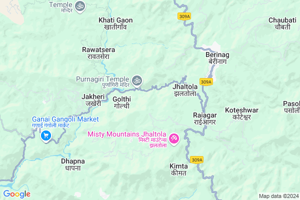
Dharmoli Map
EDIT Map
Add Your House
 ..
..
Current Corona Virus Infected Patients Count in Pithoragarh District
| City Name | District Name | Total Covid cases |
|---|
Locality Name :
Dharmoli
( धरमोली )
Block Name : Gangolihat
District : Pithoragarh
State : Uttarakhand
Language : Hindi and Urdu, Kumauni
Current Time 05:16 PM
Date: Wednesday , Feb 05,2025 (IST)
Time zone: IST (UTC+5:30)
Elevation / Altitude: 520 meters. Above Seal level
Telephone Code / Std Code: 05964
Assembly constituency : Gangolihat assembly constituency
Assembly MLA : Fakeer Ram
Lok Sabha constituency : Almora parliamentary constituency
Parliament MP : Ajay Tamta
Serpanch Name :
Pin Code : 262534
Post Office Name : Agar
Main Village Name : Dharmoli
Commodities Prices : Haldwani Market / Mandi
Dharmoli Live Weather
Temperature: 15.0 °C
scattered clouds
Humidity: 36%
Wind : 3.03 mt/sec towards S
StationName : "PithorÄ\u0081garh"
observed on 8 Mins Back
Temperature: 15.0 °C
scattered clouds
Humidity: 36%
Wind : 3.03 mt/sec towards S
StationName : "PithorÄ\u0081garh"
observed on 8 Mins Back
Dharmoli Weather Forecast for Next 5 days
06-02-2025
4.8°C to 14.5°C
scattered clouds, few clouds, clear sky
4.8°C to 14.5°C
scattered clouds, few clouds, clear sky
07-02-2025
3.7°C to 20.9°C
clear sky
3.7°C to 20.9°C
clear sky
08-02-2025
2.6°C to 22.3°C
clear sky, scattered clouds
2.6°C to 22.3°C
clear sky, scattered clouds
09-02-2025
3.7°C to 23.6°C
clear sky, few clouds, scattered clouds, broken clouds, overcast clouds
3.7°C to 23.6°C
clear sky, few clouds, scattered clouds, broken clouds, overcast clouds
10-02-2025
5.2°C to 23.4°C
broken clouds, clear sky
5.2°C to 23.4°C
broken clouds, clear sky
National Highways Reachable To Dharmoli
Nationa High Way :NH109
Nationa High Way :NH309A
Nationa High Way :NH109
Nationa High Way :NH309A
Rivers Near Dharmoli
Shalang Gad
Ramganga
Shalang Gad
Ramganga
About Dharmoli
Correct below Info and add more info about DharmoliDharmoli is a small Village/hamlet in Gangolihat Block in Pithoragarh District of Uttarakhand State, India. It comes under Dharmoli Panchayath. It is located 32 KM towards west from District head quarters Pithoragarh. 8 KM from Gangolihat. 234 KM from State capital Dehradun
Dharmoli Pin code is 262534 and postal head office is Agar .
Byati ( 3 KM ) , Mantoli ( 3 KM ) , Jakheri ( 4 KM ) , Gwal ( 4 KM ) , Gobar Gara ( 4 KM ) are the nearby Villages to Dharmoli. Dharmoli is surrounded by Berinag Block towards East , Didihat Block towards East , Bageshwar Block towards west , Bhaisiya Chhana Block towards west .
Pithoragarh , Almora , Champawat , Nainital are the near by Cities to Dharmoli.
Dharmoli 2011 Census Details
Dharmoli Local Language is Hindi. Dharmoli Village Total population is 121 and number of houses are 26. Female Population is 52.9%. Village literacy rate is 64.5% and the Female Literacy rate is 30.6%.
Population
| Census Parameter | Census Data |
| Total Population | 121 |
| Total No of Houses | 26 |
| Female Population % | 52.9 % ( 64) |
| Total Literacy rate % | 64.5 % ( 78) |
| Female Literacy rate | 30.6 % ( 37) |
| Scheduled Tribes Population % | 0.0 % ( 0) |
| Scheduled Caste Population % | 0.0 % ( 0) |
| Working Population % | 43.8 % |
| Child(0 -6) Population by 2011 | 11 |
| Girl Child(0 -6) Population % by 2011 | 18.2 % ( 2) |
Dharmoli Census More Deatils.
Politics in Dharmoli
BJP , BJP , INC are the major political parties in this area.Polling Stations /Booths near Dharmoli
1)Nainoli2)Lohathal
3)Kimkot
4)Chaunala Baukta
5)Amthal
HOW TO REACH Dharmoli
By Rail
There is no railway station near to Dharmoli in less than 10 km.Colleges near Dharmoli
G I C Gandginager
Address :
Schools near Dharmoli
R.n.school Gangolihat
Address : hat , gangolihat , pithoragarh , Uttarakhand . PIN- 262522 , Post - Gangolihat
J. B. S. G. V. M. Gan.
Address : hat , gangolihat , pithoragarh , Uttarakhand . PIN- 262522 , Post - Gangolihat
Gic Dobal Khet
Address : dobal khet , gangolihat , pithoragarh , Uttarakhand . PIN- 262522 , Post - Gangolihat
Gic Duboula
Address : duboula , gangolihat , pithoragarh , Uttarakhand . PIN- 262529 , Post - Gurna
Govt Health Centers near Dharmoli
1) Bhandari gaon SC , Bhandari Gaon ANM center , Kanda Rawatsera Bans Patan Road , Near Aanganwadi Kendra2) Rawatsera SC , Rawatsera ANM Center , Kanda Rawatsera Bans Patan Road , Near Primary School
3) Gangolihat Main Center , Gangolihat Main Center , Gangolihat Main Center , Gangolihat Main Center
Sub Villages in Dharmoli
Hospitals in Dharmoli,Gangolihat
Agari Health Clinic
NEAR PWD OFFICE NEW MAKET BERINAG; GIC ROAD BERINAG; Berinag; Uttarakhand 262531; India
6.1 KM distance Detail
नामदेव मेडिकल स्टोर
Animal Hospital Rd; Dhanoli; Berinag; Uttarakhand 262531; India
6.3 KM distance Detail
Government Health Hospital
Purana Bazar; Animal Hospital Rd; Dhanoli; Berinag; Uttarakhand 262531; India
6.3 KM distance Detail
more ..
Petrol Bunks in Dharmoli,Gangolihat
HP PETROL PUMP - BAJRANG FILLING STATION
Thal Road; Berinag Dist-pithoragrh Uttaranchal; Dehradun; UL 262531; India
5.4 KM distance Detail
Mahakali Fuels
Dasaithal - Sonkihat Rd; Gangolihat; Uttarakhand 262522; India
10.4 KM distance Detail
more ..
Colleges in Dharmoli,Gangolihat
Govt Inter College
Gwail; Gangolihat - Seraghat Rd; Kunve; Uttarakhand 262534; India
5.5 KM distance Detail
more ..
Electronic Shops in Dharmoli,Gangolihat
Deepak D. J Point Gangolihat
Govt Inter College; Gangolihat - Seraghat Rd; Kunve; Uttarakhand 262534; India
5.5 KM distance Detail
Governement Offices near Dharmoli,Gangolihat
SDM /Tahseeldar Office Berinag
Berinag Rd; Mantoli; Khitauli; Uttarakhand 262531; India
6.4 KM distance Detail
उपजिलाधिकारी/तहसील कार्यालय बेरीनाग
Mantoli; Berinag; Uttarakhand 262531; India
6.4 KM distance Detail
About Dharmoli &
History
How to reach Dharmoli
Tourist Places Near By Dharmoli
Schools in Dharmoli
Colleges in Dharmoli
Temperature & weather of Dharmoli
places in Dharmoli
Dharmoli photos
More Information
How to reach Dharmoli
Tourist Places Near By Dharmoli
Schools in Dharmoli
Colleges in Dharmoli
Temperature & weather of Dharmoli
places in Dharmoli
Dharmoli photos
More Information
Village Talk
Post News or Events about this Village
Near Cities
Pithoragarh 30 KM near
Almora 42 KM near
Champawat 51 KM near
Nainital 74 KM near
Pithoragarh 30 KM near
Almora 42 KM near
Champawat 51 KM near
Nainital 74 KM near
Near By Taluks
Gangolihat 8 KM near
Berinag 10 KM near
Didihat 20 KM near
Bageshwar 21 KM near
Gangolihat 8 KM near
Berinag 10 KM near
Didihat 20 KM near
Bageshwar 21 KM near
Near By Air Ports
Pantnagar Airport 106 KM near
Dehra Dun Airport 224 KM near
Muzaffarnagar Airport 256 KM near
Indira Gandhi International Airport 349 KM near
Pantnagar Airport 106 KM near
Dehra Dun Airport 224 KM near
Muzaffarnagar Airport 256 KM near
Indira Gandhi International Airport 349 KM near
Near By Tourist Places
Chaukori 11 KM near
Bageshwar 27 KM near
Pithoragarh 30 KM near
Binsar 31 KM near
Abbott Mount 41 KM near
Chaukori 11 KM near
Bageshwar 27 KM near
Pithoragarh 30 KM near
Binsar 31 KM near
Abbott Mount 41 KM near
Near By Districts
Bageshwar 27 KM near
Pithoragarh 30 KM near
Almora 42 KM near
Champawat 53 KM near
Bageshwar 27 KM near
Pithoragarh 30 KM near
Almora 42 KM near
Champawat 53 KM near
Near By RailWay Station
Kathgodam Rail Way Station 78 KM near
Haldwani Rail Way Station 84 KM near
Kathgodam Rail Way Station 78 KM near
Haldwani Rail Way Station 84 KM near