| Home | City Bus | Maps | Villages | Cities | Rail | Tourist Places | School | College | Pin Codes | Corona Cases Count |
| Distance Calculator Bus Services IFSC Codes Trace Mobile Number Weather Search Place Trace IP Available Cash ATM/Banks Locate Polling Booth Report an Error contact People |
Jalari
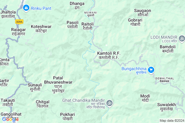
Jalari Map
EDIT Map
Add Your House
 ..
..
Current Corona Virus Infected Patients Count in Pithoragarh District
| City Name | District Name | Total Covid cases |
|---|
Locality Name :
Jalari
( जलरी )
Block Name : Berinag
District : Pithoragarh
State : Uttarakhand
Language : Hindi and Urdu, Kumauni
Current Time 01:50 PM
Date: Tuesday , Apr 29,2025 (IST)
Time zone: IST (UTC+5:30)
Elevation / Altitude: 520 meters. Above Seal level
Telephone Code / Std Code: 05964
Assembly constituency : Didihat assembly constituency
Assembly MLA : Vishan Singh
Lok Sabha constituency : Almora parliamentary constituency
Parliament MP : Ajay Tamta
Serpanch Name :
Pin Code : 262522
Post Office Name : Gangolihat
Main Village Name : Jalari
Commodities Prices : Haldwani Market / Mandi
Jalari Live Weather
Temperature: 32.9 °C
overcast clouds
Humidity: 19%
Wind : 1.64 mt/sec towards SW
StationName : "PithorÄ\u0081garh"
observed on 10 Mins Back
Temperature: 32.9 °C
overcast clouds
Humidity: 19%
Wind : 1.64 mt/sec towards SW
StationName : "PithorÄ\u0081garh"
observed on 10 Mins Back
Jalari Weather Forecast for Next 5 days
30-04-2025
18.3°C to 35.0°C
overcast clouds, broken clouds, light rain
18.3°C to 35.0°C
overcast clouds, broken clouds, light rain
01-05-2025
17.5°C to 36.3°C
broken clouds, clear sky, few clouds, light rain, moderate rain, overcast clouds
17.5°C to 36.3°C
broken clouds, clear sky, few clouds, light rain, moderate rain, overcast clouds
02-05-2025
18.0°C to 32.8°C
overcast clouds, broken clouds, light rain, scattered clouds
18.0°C to 32.8°C
overcast clouds, broken clouds, light rain, scattered clouds
03-05-2025
17.8°C to 33.1°C
scattered clouds, light rain, overcast clouds
17.8°C to 33.1°C
scattered clouds, light rain, overcast clouds
04-05-2025
19.0°C to 32.3°C
light rain, overcast clouds
19.0°C to 32.3°C
light rain, overcast clouds
National Highways Reachable To Jalari
Nationa High Way :NH109
Nationa High Way :NH27
Nationa High Way :NH109
Nationa High Way :NH27
Rivers Near Jalari
Shalang Gad
Siruanch
Shalang Gad
Siruanch
About Jalari
Correct below Info and add more info about JalariJalari is a small Village/hamlet in Berinag Block in Pithoragarh District of Uttarakhand State, India. It comes under Jalari Panchayath. It is located 19 KM towards North from District head quarters Pithoragarh. 12 KM from Berinag. 249 KM from State capital Dehradun
Jalari Pin code is 262522 and postal head office is Gangolihat .
Simayal ( 3 KM ) , Kachana ( 4 KM ) , Batgal ( 4 KM ) , Aamhat ( 4 KM ) , Nagaur ( 5 KM ) are the nearby Villages to Jalari. Jalari is surrounded by Gangolihat Block towards west , Didihat Block towards North , Pithoragarh Block towards South , Kanalichina Block towards East .
Pithoragarh , Champawat , Almora , Nainital are the near by Cities to Jalari.
Jalari 2011 Census Details
Jalari Local Language is Hindi. Jalari Village Total population is 124 and number of houses are 31. Female Population is 51.6%. Village literacy rate is 63.7% and the Female Literacy rate is 28.2%.
Population
| Census Parameter | Census Data |
| Total Population | 124 |
| Total No of Houses | 31 |
| Female Population % | 51.6 % ( 64) |
| Total Literacy rate % | 63.7 % ( 79) |
| Female Literacy rate | 28.2 % ( 35) |
| Scheduled Tribes Population % | 0.0 % ( 0) |
| Scheduled Caste Population % | 12.9 % ( 16) |
| Working Population % | 42.7 % |
| Child(0 -6) Population by 2011 | 13 |
| Girl Child(0 -6) Population % by 2011 | 30.8 % ( 4) |
Jalari Census More Deatils.
Politics in Jalari
BJP , UKKD , BJP , INC are the major political parties in this area.Polling Stations /Booths near Jalari
1)Borabunga (hararkatiya)2)Khawantari
3)Adichaura
4)Vishkholi
5)Pipli
HOW TO REACH Jalari
By Rail
There is no railway station near to Jalari in less than 10 km.Colleges near Jalari
G I C Gandginager
Address :
Rajendra Singh Pawar
Address : Smkot Teela
Schools in Jalari
Gjhs Jalari
Address : jalari , berinag , pithoragarh , Uttarakhand . PIN- 262531 , Post - Berinag
Govt Health Centers near Jalari
1) Gangolihat Main Center , Gangolihat Main Center , Gangolihat Main Center , Gangolihat Main Center2) CHC Gangolihat , CHC Gangolihat , CHC Gangolihat , CHC Gangolihat
3) Sainrathi , Sainranthi , Sainrathi ,
Sub Villages in Jalari
Hospitals in Jalari,Berinag
Secure Smile Dental Clinic Berinag
Berinag Rd; Mantoli; Berinag; Uttarakhand 262531; India
12.1 KM distance Detail
Agari Health Clinic
NEAR PWD OFFICE NEW MAKET BERINAG; GIC ROAD BERINAG; Berinag; Uttarakhand 262531; India
12.1 KM distance Detail
more ..
Petrol Bunks in Jalari,Berinag
Mahakali Fuels
Dasaithal - Sonkihat Rd; Gangolihat; Uttarakhand 262522; India
11.7 KM distance Detail
HP PETROL PUMP - BAJRANG FILLING STATION
Thal Road; Berinag Dist-pithoragrh Uttaranchal; Dehradun; UL 262531; India
13.8 KM distance Detail
more ..
Colleges in Jalari,Berinag
Government Inter College
Berinag - Muwani Rd; Mantoli; Berinag; Uttarakhand 262531; India
11.8 KM distance Detail
Shri Mahakali Government Inter College
Mahankali Rd; Ran Kote Upreti; Gangolihat; Uttarakhand 262522; India
12.1 KM distance Detail
Government Girls Inter College
NH309A; Ran Kote Upreti; Gangolihat; Uttarakhand 262522; India
12.6 KM distance Detail
more ..
Electronic Shops in Jalari,Berinag
New Bimmy Electronics
Gangolihat Rd; Ran Kote Upreti; Gangolihat; Uttarakhand 262522; India
12.3 KM distance Detail
Local Parks in Jalari,Berinag
Sampoornanand Park Ghantakaran
Ghantakaran; Pithoragarh; Uttarakhand 262501; India
18.3 KM distance Detail
Govind Ballabh Pant Park
Mahatma Gandhi Marg; Pithoragarh; Uttarakhand 262501; India
18.3 KM distance Detail
Police Stations near Jalari,Berinag
Didihat Thanna
262541; GIC Rd; G.I.C. Ward; Didihat; Uttarakhand 262544; India
18.2 KM distance Detail
Governement Offices near Jalari,Berinag
उपजिलाधिकारी/तहसील कार्यालय बेरीनाग
Mantoli; Berinag; Uttarakhand 262531; India
11.6 KM distance Detail
SDM /Tahseeldar Office Berinag
Berinag Rd; Mantoli; Khitauli; Uttarakhand 262531; India
11.6 KM distance Detail
About Jalari &
History
How to reach Jalari
Tourist Places Near By Jalari
Schools in Jalari
Colleges in Jalari
Temperature & weather of Jalari
places in Jalari
Jalari photos
More Information
How to reach Jalari
Tourist Places Near By Jalari
Schools in Jalari
Colleges in Jalari
Temperature & weather of Jalari
places in Jalari
Jalari photos
More Information
Village Talk
Post News or Events about this Village
Near Cities
Pithoragarh 18 KM near
Champawat 45 KM near
Almora 53 KM near
Nainital 82 KM near
Pithoragarh 18 KM near
Champawat 45 KM near
Almora 53 KM near
Nainital 82 KM near
Near By Taluks
Berinag 11 KM near
Gangolihat 12 KM near
Didihat 13 KM near
Pithoragarh 16 KM near
Berinag 11 KM near
Gangolihat 12 KM near
Didihat 13 KM near
Pithoragarh 16 KM near
Near By Air Ports
Pantnagar Airport 110 KM near
Dehra Dun Airport 238 KM near
Muzaffarnagar Airport 269 KM near
Indira Gandhi International Airport 359 KM near
Pantnagar Airport 110 KM near
Dehra Dun Airport 238 KM near
Muzaffarnagar Airport 269 KM near
Indira Gandhi International Airport 359 KM near
Near By Tourist Places
Pithoragarh 18 KM near
Chaukori 19 KM near
Abbott Mount 35 KM near
Bageshwar 41 KM near
Binsar 44 KM near
Pithoragarh 18 KM near
Chaukori 19 KM near
Abbott Mount 35 KM near
Bageshwar 41 KM near
Binsar 44 KM near
Near By Districts
Pithoragarh 18 KM near
Bageshwar 41 KM near
Champawat 47 KM near
Almora 52 KM near
Pithoragarh 18 KM near
Bageshwar 41 KM near
Champawat 47 KM near
Almora 52 KM near
Near By RailWay Station
Kathgodam Rail Way Station 84 KM near
Haldwani Rail Way Station 89 KM near
Kathgodam Rail Way Station 84 KM near
Haldwani Rail Way Station 89 KM near