| Home | City Bus | Maps | Villages | Cities | Rail | Tourist Places | School | College | Pin Codes | Corona Cases Count |
| Distance Calculator Bus Services IFSC Codes Trace Mobile Number Weather Search Place Trace IP Available Cash ATM/Banks Locate Polling Booth Report an Error contact People |
Guthal Gaon
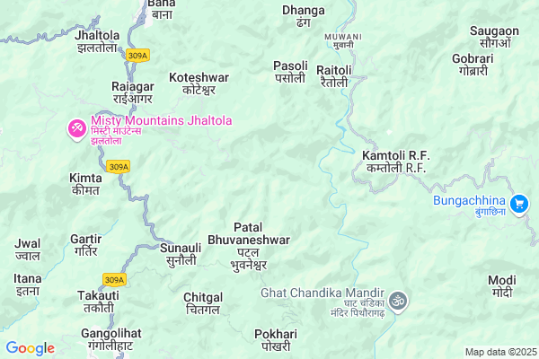
Guthal Gaon Map
EDIT Map
Add Your House
 ..
..
Current Corona Virus Infected Patients Count in Pithoragarh District
| City Name | District Name | Total Covid cases |
|---|
Locality Name :
Guthal Gaon
( गुथल गाओं )
Block Name : Berinag
District : Pithoragarh
State : Uttarakhand
Language : Hindi and Urdu, Kumauni
Current Time 01:34 PM
Date: Tuesday , Apr 29,2025 (IST)
Time zone: IST (UTC+5:30)
Elevation / Altitude: 520 meters. Above Seal level
Telephone Code / Std Code: 05964
Assembly constituency : Gangolihat assembly constituency
Assembly MLA : Fakeer Ram
Lok Sabha constituency : Almora parliamentary constituency
Parliament MP : Ajay Tamta
Serpanch Name :
Pin Code : 262522
Post Office Name : Gangolihat
Main Village Name : Guthal Gaon
Commodities Prices : Haldwani Market / Mandi
National Highways Reachable To Guthal Gaon
Nationa High Way :NH109
Nationa High Way :NH27
Nationa High Way :NH109
Nationa High Way :NH27
Rivers Near Guthal Gaon
Shalang Gad
Siruanch
Shalang Gad
Siruanch
About Guthal Gaon
Correct below Info and add more info about Guthal GaonGuthal Gaon is a small Village/hamlet in Berinag Block in Pithoragarh District of Uttarakhand State, India. It comes under Guthal Gaon Panchayath. It is located 21 KM towards North from District head quarters Pithoragarh. 11 KM from Berinag. 246 KM from State capital Dehradun
Guthal Gaon Pin code is 262522 and postal head office is Gangolihat .
Aamhat ( 3 KM ) , Batgal ( 3 KM ) , Chaukhuna ( 4 KM ) , Bora Agar ( 4 KM ) , Rawalkhet ( 4 KM ) are the nearby Villages to Guthal Gaon. Guthal Gaon is surrounded by Berinag Block towards North , Didihat Block towards North , Pithoragarh Block towards South , Kanalichina Block towards East .
Pithoragarh , Champawat , Almora , Nainital are the near by Cities to Guthal Gaon.
Demographics of Guthal Gaon
Hindi is the Local Language here.Politics in Guthal Gaon
BJP , BJP , INC are the major political parties in this area.Polling Stations /Booths near Guthal Gaon
1)Nainoli2)Lohathal
3)Surkhal Pathak
4)Amthal
5)Lachhima
HOW TO REACH Guthal Gaon
By Rail
There is no railway station near to Guthal Gaon in less than 10 km.Colleges near Guthal Gaon
G I C Gandginager
Address :
Rajendra Singh Pawar
Address : Smkot Teela
Schools near Guthal Gaon
Gic Kande Kiroli
Address : jagthali , berinag , pithoragarh , Uttarakhand . PIN- 262531 , Post - Berinag
Ggic Thal
Address : thal , berinag , pithoragarh , Uttarakhand . PIN- 262552 , Post - Thal (Pithoragarh)
Gic Rai Aagar
Address : bhandari gaon , berinag , pithoragarh , Uttarakhand . PIN- 262534 , Post - Agar
Gic Chormaneya
Address : nagore , berinag , pithoragarh , Uttarakhand . PIN- 262534 , Post - Agar
Govt Health Centers near Guthal Gaon
1) Gangolihat Main Center , Gangolihat Main Center , Gangolihat Main Center , Gangolihat Main Center2) CHC Gangolihat , CHC Gangolihat , CHC Gangolihat , CHC Gangolihat
3) Bhandari gaon SC , Bhandari Gaon ANM center , Kanda Rawatsera Bans Patan Road , Near Aanganwadi Kendra
Sub Villages in Guthal Gaon
Hospitals in Guthal Gaon,Berinag
सामुदायिक सवास्थ्य केंद्र गंगोलीहाट
Ran Kote Upreti; Gangolihat; Uttarakhand 262522; India
9.5 KM distance Detail
Community Health centre
Ran Kote Upreti; Gangolihat; Uttarakhand 262522; India
9.5 KM distance Detail
more ..
Petrol Bunks in Guthal Gaon,Berinag
Mahakali Fuels
Dasaithal - Sonkihat Rd; Gangolihat; Uttarakhand 262522; India
8.7 KM distance Detail
HP PETROL PUMP - BAJRANG FILLING STATION
Thal Road; Berinag Dist-pithoragrh Uttaranchal; Dehradun; UL 262531; India
11.5 KM distance Detail
more ..
Colleges in Guthal Gaon,Berinag
Shri Mahakali Government Inter College
Mahankali Rd; Ran Kote Upreti; Gangolihat; Uttarakhand 262522; India
9.4 KM distance Detail
Government Inter College
Berinag - Muwani Rd; Mantoli; Berinag; Uttarakhand 262531; India
9.8 KM distance Detail
Government Girls Inter College
NH309A; Ran Kote Upreti; Gangolihat; Uttarakhand 262522; India
10.0 KM distance Detail
more ..
Electronic Shops in Guthal Gaon,Berinag
New Bimmy Electronics
Gangolihat Rd; Ran Kote Upreti; Gangolihat; Uttarakhand 262522; India
9.7 KM distance Detail
Local Parks in Guthal Gaon,Berinag
Sampoornanand Park Ghantakaran
Ghantakaran; Pithoragarh; Uttarakhand 262501; India
20.2 KM distance Detail
Govind Ballabh Pant Park
Mahatma Gandhi Marg; Pithoragarh; Uttarakhand 262501; India
20.2 KM distance Detail
Police Stations near Guthal Gaon,Berinag
Police Station Pithoragarh
Gandhi Nagar; Pithoragarh; Uttarakhand 262501; India
20.6 KM distance Detail
Governement Offices near Guthal Gaon,Berinag
उपजिलाधिकारी/तहसील कार्यालय बेरीनाग
Mantoli; Berinag; Uttarakhand 262531; India
9.6 KM distance Detail
SDM /Tahseeldar Office Berinag
Berinag Rd; Mantoli; Khitauli; Uttarakhand 262531; India
9.6 KM distance Detail
About Guthal Gaon &
History
How to reach Guthal Gaon
Tourist Places Near By Guthal Gaon
Schools in Guthal Gaon
Colleges in Guthal Gaon
Temperature & weather of Guthal Gaon
places in Guthal Gaon
Guthal Gaon photos
More Information
How to reach Guthal Gaon
Tourist Places Near By Guthal Gaon
Schools in Guthal Gaon
Colleges in Guthal Gaon
Temperature & weather of Guthal Gaon
places in Guthal Gaon
Guthal Gaon photos
More Information
Village Talk
Post News or Events about this Village
Near Cities
Pithoragarh 20 KM near
Champawat 45 KM near
Almora 50 KM near
Nainital 79 KM near
Pithoragarh 20 KM near
Champawat 45 KM near
Almora 50 KM near
Nainital 79 KM near
Near By Taluks
Gangolihat 9 KM near
Berinag 10 KM near
Didihat 15 KM near
Pithoragarh 18 KM near
Gangolihat 9 KM near
Berinag 10 KM near
Didihat 15 KM near
Pithoragarh 18 KM near
Near By Air Ports
Pantnagar Airport 108 KM near
Dehra Dun Airport 235 KM near
Muzaffarnagar Airport 265 KM near
Indira Gandhi International Airport 356 KM near
Pantnagar Airport 108 KM near
Dehra Dun Airport 235 KM near
Muzaffarnagar Airport 265 KM near
Indira Gandhi International Airport 356 KM near
Near By Tourist Places
Chaukori 17 KM near
Pithoragarh 20 KM near
Abbott Mount 35 KM near
Bageshwar 38 KM near
Binsar 41 KM near
Chaukori 17 KM near
Pithoragarh 20 KM near
Abbott Mount 35 KM near
Bageshwar 38 KM near
Binsar 41 KM near
Near By Districts
Pithoragarh 20 KM near
Bageshwar 38 KM near
Champawat 47 KM near
Almora 49 KM near
Pithoragarh 20 KM near
Bageshwar 38 KM near
Champawat 47 KM near
Almora 49 KM near
Near By RailWay Station
Kathgodam Rail Way Station 81 KM near
Haldwani Rail Way Station 86 KM near
Kathgodam Rail Way Station 81 KM near
Haldwani Rail Way Station 86 KM near