| Home | City Bus | Maps | Villages | Cities | Rail | Tourist Places | School | College | Pin Codes | Corona Cases Count |
| Distance Calculator Bus Services IFSC Codes Trace Mobile Number Weather Search Place Trace IP Available Cash ATM/Banks Locate Polling Booth Report an Error contact People |
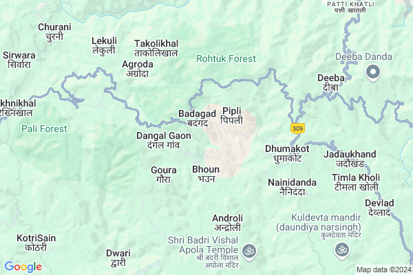
Dudera
Dudera Map
EDIT Map
Add Your House
 ..
..
Current Corona Virus Infected Patients Count in Pauri Garhwal District
| City Name | District Name | Total Covid cases |
|---|---|---|
| Dugadda | Pauri Garhwal | 1 |
Locality Name :
Dudera
( डुंडेरा )
Block Name : Nainidanda
District : Pauri Garhwal
State : Uttarakhand
Language : Hindi and Urdu
Current Time 10:47 AM
Date: Tuesday , Apr 29,2025 (IST)
Time zone: IST (UTC+5:30)
Telephone Code / Std Code: 01386
Assembly constituency : Lansdowne assembly constituency
Assembly MLA : Daleep Singh Rawat
Lok Sabha constituency : Garhwal parliamentary constituency
Parliament MP : Tirath Singh Rawat
Serpanch Name :
Pin Code : 246277
Post Office Name : Dhumakot
Main Village Name : Dudera
Commodities Prices : Ramnagar Market / Mandi
Dudera Live Weather
Temperature: 22.0 °C
scattered clouds
Humidity: 35%
Wind : 2.52 mt/sec towards SW
StationName : "Lansdowne"
observed on 1 Hours Back
Temperature: 22.0 °C
scattered clouds
Humidity: 35%
Wind : 2.52 mt/sec towards SW
StationName : "Lansdowne"
observed on 1 Hours Back
Dudera Weather Forecast for Next 5 days
30-04-2025
19.5°C to 29.5°C
broken clouds, light rain
19.5°C to 29.5°C
broken clouds, light rain
01-05-2025
18.8°C to 30.9°C
overcast clouds, broken clouds, clear sky, scattered clouds, light rain
18.8°C to 30.9°C
overcast clouds, broken clouds, clear sky, scattered clouds, light rain
02-05-2025
18.6°C to 28.5°C
broken clouds, overcast clouds, light rain
18.6°C to 28.5°C
broken clouds, overcast clouds, light rain
03-05-2025
17.2°C to 28.9°C
light rain, overcast clouds, moderate rain
17.2°C to 28.9°C
light rain, overcast clouds, moderate rain
04-05-2025
18.5°C to 29.4°C
overcast clouds, light rain
18.5°C to 29.4°C
overcast clouds, light rain
National Highways Reachable To Dudera
Nationa High Way :NH309A
Nationa High Way :NH534
Nationa High Way :NH309A
Nationa High Way :NH534
Rivers Near Dudera
Gagas
Khor Gadhera
Gagas
Khor Gadhera
About Dudera
Correct below Info and add more info about DuderaDudera is a small Village/hamlet in Nainidanda Block in Pauri Garhwal District of Uttarakhand State, India. It comes under Dudera Panchayath. It is located 55 KM towards South from District head quarters Pauri. 12 KM from Nainidanda. 128 KM from State capital Dehradun
Dudera Pin code is 246277 and postal head office is Dhumakot .
Khol ( 3 KM ) , Bangarh ( 3 KM ) , Tandoli ( 3 KM ) , Androli ( 4 KM ) , Dabrad ( 4 KM ) are the nearby Villages to Dudera. Dudera is surrounded by Nainidanda Block towards East , Bironkhal Block towards North , Kaljikhal Block towards South , Dwarikhal Block towards South .
Kotdwara , Ramnagar , Pauri , Jaspur are the near by Cities to Dudera.
Dudera 2011 Census Details
Dudera Local Language is Hindi. Dudera Village Total population is 127 and number of houses are 34. Female Population is 54.3%. Village literacy rate is 70.1% and the Female Literacy rate is 32.3%.
Population
| Census Parameter | Census Data |
| Total Population | 127 |
| Total No of Houses | 34 |
| Female Population % | 54.3 % ( 69) |
| Total Literacy rate % | 70.1 % ( 89) |
| Female Literacy rate | 32.3 % ( 41) |
| Scheduled Tribes Population % | 0.0 % ( 0) |
| Scheduled Caste Population % | 0.0 % ( 0) |
| Working Population % | 44.1 % |
| Child(0 -6) Population by 2011 | 11 |
| Girl Child(0 -6) Population % by 2011 | 54.5 % ( 6) |
Dudera Census More Deatils.
Politics in Dudera
UtRM , BJP , BJP , INC are the major political parties in this area.Polling Stations /Booths near Dudera
1)Bhamraikhal2)Meruda
3)Patal Malla
4)Kartiya
5)Kunjoli
HOW TO REACH Dudera
By Rail
There is no railway station near to Dudera in less than 10 km.Colleges near Dudera
Government Inter College Haldukhal
Address :
Schools in Dudera
Ps Dudera
Address : dudera , nainidanda , garhwal , Uttarakhand . PIN- 246277 , Post - Dhumakot
Govt Health Centers near Dudera
1) Bhaun SC , , Bhaun , Bhaun2) Andrauli SC , , Andrauli , Andrauli
3) Dhoomakot APHC , , Dhumakot , Dhumakot Markit
Sub Villages in Dudera
Schools in Dudera,Nainidanda
Government Primary School
Nayapanchayat Chetra Gween; Patti Khatli; Thapdiya Talla; Uttarakhand 246276; India
16.8 KM distance Detail
Govt. School Bhitakot Khal
Aassa Urf Sundoli Bakhal; Uttarakhand 263676; India
16.9 KM distance Detail
Electronic Shops in Dudera,Nainidanda
Super Markets in Dudera,Nainidanda
Local Parks in Dudera,Nainidanda
Markhlo Forest
Nayapanchayat Chetra Dhonr; Patti Khatli; Ringalcha; Uttarakhand 263661; India
18.7 KM distance Detail
Police Stations near Dudera,Nainidanda
Governement Offices near Dudera,Nainidanda
About Dudera &
History
How to reach Dudera
Tourist Places Near By Dudera
Schools in Dudera
Colleges in Dudera
Temperature & weather of Dudera
places in Dudera
Dudera photos
More Information
How to reach Dudera
Tourist Places Near By Dudera
Schools in Dudera
Colleges in Dudera
Temperature & weather of Dudera
places in Dudera
Dudera photos
More Information
Village Talk
Post News or Events about this Village
Near Cities
Kotdwara 46 KM near
Ramnagar 48 KM near
Pauri 52 KM near
Jaspur 61 KM near
Kotdwara 46 KM near
Ramnagar 48 KM near
Pauri 52 KM near
Jaspur 61 KM near
Near By Taluks
Rikhnikhal 9 KM near
Nainidanda 11 KM near
Bironkhal 16 KM near
Kaljikhal 17 KM near
Rikhnikhal 9 KM near
Nainidanda 11 KM near
Bironkhal 16 KM near
Kaljikhal 17 KM near
Near By Air Ports
Pantnagar Airport 105 KM near
Dehra Dun Airport 122 KM near
Muzaffarnagar Airport 146 KM near
Indira Gandhi International Airport 252 KM near
Pantnagar Airport 105 KM near
Dehra Dun Airport 122 KM near
Muzaffarnagar Airport 146 KM near
Indira Gandhi International Airport 252 KM near
Near By Tourist Places
Corbett National Park 28 KM near
Lansdowne 33 KM near
Ramnagar 47 KM near
Dwarahat 49 KM near
Gairsain 51 KM near
Corbett National Park 28 KM near
Lansdowne 33 KM near
Ramnagar 47 KM near
Dwarahat 49 KM near
Gairsain 51 KM near
Near By Districts
Pauri Garhwal 52 KM near
Rudra Prayag 65 KM near
Nainital 71 KM near
Almora 76 KM near
Pauri Garhwal 52 KM near
Rudra Prayag 65 KM near
Nainital 71 KM near
Almora 76 KM near
Near By RailWay Station
Ramnagar Rail Way Station 48 KM near
Kashipur Junction Rail Way Station 69 KM near
Ramnagar Rail Way Station 48 KM near
Kashipur Junction Rail Way Station 69 KM near