| Home | City Bus | Maps | Villages | Cities | Rail | Tourist Places | School | College | Pin Codes | Corona Cases Count |
| Distance Calculator Bus Services IFSC Codes Trace Mobile Number Weather Search Place Trace IP Available Cash ATM/Banks Locate Polling Booth Report an Error contact People |
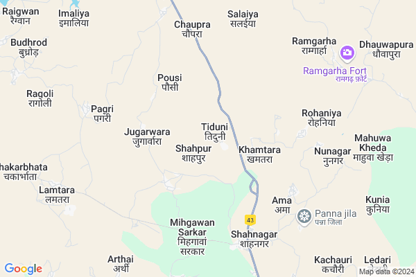
Ganj
Ganj Map
EDIT Map
Add Your House
 ..
..
Current Corona Virus Infected Patients Count in Panna District
| City Name | District Name | Total Covid cases |
|---|
Locality Name :
Ganj
( गंज )
Tehsil Name : Shahnagar
District : Panna
State : Madhya Pradesh
Division : Sagar
Language : Hindi and Dravidian,devanagari ,bharia, Bundeli
Current Time 04:19 PM
Date: Tuesday , Apr 29,2025 (IST)
Time zone: IST (UTC+5:30)
Elevation / Altitude: 397 meters. Above Seal level
Telephone Code / Std Code: 07734
Assembly constituency : Pawai assembly constituency
Assembly MLA : Prahlad Lodhi
Lok Sabha constituency : Khajuraho parliamentary constituency
Parliament MP : V.D. SHARMA (VISHNU DATT SHARMA)
Serpanch Name :
Pin Code : 488001
Post Office Name : Panna
Main Village Name : Ganj
Commodities Prices : Katni Market / Mandi
Ganj Live Weather
Temperature: 41.9 °C
broken clouds
Humidity: 7%
Wind : 4.61 mt/sec towards W
StationName : "MurwÄ\u0081ra"
observed on 1 Hours Back
Temperature: 41.9 °C
broken clouds
Humidity: 7%
Wind : 4.61 mt/sec towards W
StationName : "MurwÄ\u0081ra"
observed on 1 Hours Back
Ganj Weather Forecast for Next 5 days
30-04-2025
27.1°C to 41.8°C
broken clouds, scattered clouds, clear sky
27.1°C to 41.8°C
broken clouds, scattered clouds, clear sky
01-05-2025
25.6°C to 40.9°C
clear sky
25.6°C to 40.9°C
clear sky
02-05-2025
27.2°C to 42.5°C
clear sky, few clouds, scattered clouds
27.2°C to 42.5°C
clear sky, few clouds, scattered clouds
03-05-2025
27.3°C to 43.2°C
clear sky, scattered clouds, broken clouds
27.3°C to 43.2°C
clear sky, scattered clouds, broken clouds
04-05-2025
28.3°C to 42.2°C
few clouds, broken clouds, scattered clouds, light rain, overcast clouds
28.3°C to 42.2°C
few clouds, broken clouds, scattered clouds, light rain, overcast clouds
National Highways Reachable To Ganj
Nationa High Way :NH30;NH43
Nationa High Way :NH30
Nationa High Way :NH30;NH43
Nationa High Way :NH30
Rivers Near Ganj
Umar
Ken
Umar
Ken
About Ganj
Correct below Info and add more info about GanjGanj is a small Village/hamlet in Shahnagar Tehsil in Panna District of Madhya Pradesh State, India. It comes under Ganj Panchayath. It belongs to Sagar Division . It is located 88 KM towards South from District head quarters Panna. 358 KM from State capital Bhopal
Ganj Pin code is 488001 and postal head office is Panna .
Ganj is surrounded by Rithi Tehsil towards South , Murwara Tehsil towards South , Katni Tehsil towards South , Pawai Tehsil towards North .
Murwara , Katni , Maihar , Sihora are the near by Cities to Ganj.
This Place is in the border of the Panna District and Katni District. Katni District Murwara is South towards this place .
Ganj 2011 Census Details
Ganj Local Language is Hindi. Ganj Village Total population is 652 and number of houses are 161. Female Population is 48.9%. Village literacy rate is 60.7% and the Female Literacy rate is 24.5%.
Population
| Census Parameter | Census Data |
| Total Population | 652 |
| Total No of Houses | 161 |
| Female Population % | 48.9 % ( 319) |
| Total Literacy rate % | 60.7 % ( 396) |
| Female Literacy rate | 24.5 % ( 160) |
| Scheduled Tribes Population % | 0.0 % ( 0) |
| Scheduled Caste Population % | 30.4 % ( 198) |
| Working Population % | 48.0 % |
| Child(0 -6) Population by 2011 | 99 |
| Girl Child(0 -6) Population % by 2011 | 42.4 % ( 42) |
Ganj Census More Deatils.
Politics in Ganj
Bharatiya Janata Party , BJP , INC are the major political parties in this area.Polling Stations /Booths near Ganj
1)Bhitari Mutamuru2)Marha
3)Dhourra Khurd
4)Tikariya
5)Manakoura
HOW TO REACH Ganj
By Rail
There is no railway station near to Ganj in less than 10 km.Colleges near Ganj
Rajeev Gandhi Collage Raipura
Address :
Schools in Ganj
Ps Tola
Address : ganj , shahnagar , panna , Madhya Pradesh . PIN- 488001 , Post - Panna
Govt Health Centers near Ganj
1) SHC Khamtara , Khamtara , Bisani , near AWW center2) SHC Rampur Khajri , Rampur Khajri , Shahnagar , near AWW Center
3) SHC Ama , Ama , Shahnagar , inside of Aganwadi
Sub Villages in Ganj
Petrol Bunks in Ganj,Shahnagar
Indian Oil Petrol Pump
Panna; SH-10; Shahnagar; Shahnagar; Madhya Pradesh 488448; India
6.3 KM distance Detail
Bharat Petroleum
Panna; SH-10; Shahnagar; Shahnagar; Madhya Pradesh 488448; India
8.7 KM distance Detail
more ..
Colleges in Ganj,Shahnagar
शाशकीय कला एवं वाणिज्य महाविद्यालय शाहनगर
Shahnagar; Madhya Pradesh 488448; India
5.8 KM distance Detail
Government ITI College
Shanagarh; Panna; SH-10; Panna; Panna; Madhya Pradesh 488448; India
7.0 KM distance Detail
more ..
Schools in Ganj,Shahnagar
Government Primary School
Shirkarpuri; Panna; SH-10; Panna; Panna; Madhya Pradesh 488446; India
5.7 KM distance Detail
T T Memorial Higher Secondary School
Shanagarh; Panna; SH-10; Panna; Panna; Madhya Pradesh 488448; India
6.2 KM distance Detail
B P Memorial Higher Secondary School
Panna Katni Road; Near Petrol pump; Mamta Nagar Colony; Shahnagar; Madhya Pradesh 488448; India
6.3 KM distance Detail
Electronic Shops in Ganj,Shahnagar
Sahu Photocopy Shahnagar
main road shahnagar; Shahnagar; Madhya Pradesh 488448; India
6.5 KM distance Detail
Local Parks in Ganj,Shahnagar
Governement Offices near Ganj,Shahnagar
Anand Road Carriers
National Highway 7; Kailwara Kalan; Madhya Pradesh 483501; India
19.0 KM distance Detail
About Ganj &
History
How to reach Ganj
Tourist Places Near By Ganj
Schools in Ganj
Colleges in Ganj
Temperature & weather of Ganj
places in Ganj
Ganj photos
More Information
How to reach Ganj
Tourist Places Near By Ganj
Schools in Ganj
Colleges in Ganj
Temperature & weather of Ganj
places in Ganj
Ganj photos
More Information
Village Talk
Post News or Events about this Village
Near Cities
Murwara 27 KM near
Katni 27 KM near
Maihar 60 KM near
Sihora 73 KM near
Murwara 27 KM near
Katni 27 KM near
Maihar 60 KM near
Sihora 73 KM near
Near By Taluks
Shahnagar 0 KM near
Rithi 26 KM near
Murwara 27 KM near
Katni 30 KM near
Shahnagar 0 KM near
Rithi 26 KM near
Murwara 27 KM near
Katni 30 KM near
Near By Air Ports
Khajuraho Airport 105 KM near
Jabalpur Airport 176 KM near
Bamrauli Airport 239 KM near
Kanpur Airport 294 KM near
Khajuraho Airport 105 KM near
Jabalpur Airport 176 KM near
Bamrauli Airport 239 KM near
Kanpur Airport 294 KM near
Near By Tourist Places
Bandhavgarh National Park 54 KM near
Maihar 59 KM near
Panna 85 KM near
Satna 90 KM near
Khajuraho 107 KM near
Bandhavgarh National Park 54 KM near
Maihar 59 KM near
Panna 85 KM near
Satna 90 KM near
Khajuraho 107 KM near
Near By Districts
Katni 28 KM near
Panna 85 KM near
Umaria 89 KM near
Satna 91 KM near
Katni 28 KM near
Panna 85 KM near
Umaria 89 KM near
Satna 91 KM near
Near By RailWay Station
Jukehi Rail Way Station 17 KM near
Katni Murwara Rail Way Station 28 KM near
Jukehi Rail Way Station 17 KM near
Katni Murwara Rail Way Station 28 KM near