| Home | City Bus | Maps | Villages | Cities | Rail | Tourist Places | School | College | Pin Codes | Corona Cases Count |
| Distance Calculator Bus Services IFSC Codes Trace Mobile Number Weather Search Place Trace IP Available Cash ATM/Banks Locate Polling Booth Report an Error contact People |
Itbandh
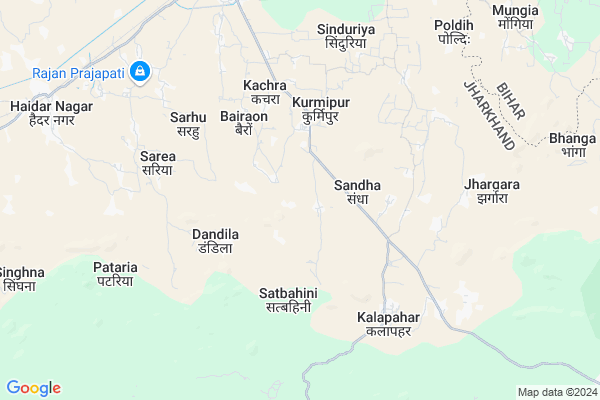
Itbandh Map
EDIT Map
Add Your House
 ..
..
Current Corona Virus Infected Patients Count in Palamu District
| City Name | District Name | Total Covid cases |
|---|---|---|
| Palamu District | Palamu | 3 |
Locality Name :
Itbandh
( ितबंध )
Block Name : Hussainabad
District : Palamu
State : Jharkhand
Language : Hindi and Santali, Asuri, Bhojpuri
Current Time 12:00 PM
Date: Wednesday , Apr 30,2025 (IST)
Time zone: IST (UTC+5:30)
Elevation / Altitude: 143 meters. Above Seal level
Telephone Code / Std Code: 06566
Assembly constituency : Hussainabad assembly constituency
Assembly MLA : Kamlesh Kumar Singh
Lok Sabha constituency : Palamu parliamentary constituency
Parliament MP : VISHNU DAYAL RAM
Serpanch Name :
Pin Code : 822115
Post Office Name : Haidar Nagar
Main Village Name : Itbandh
Commodities Prices : Gadhwah Market / Mandi
Itbandh Live Weather
Temperature: 35.5 °C
clear sky
Humidity: 26%
Wind : 3.33 mt/sec towards E
StationName : "HusainÄ\u0081bÄ\u0081d"
observed on 31 Mins Back
Temperature: 35.5 °C
clear sky
Humidity: 26%
Wind : 3.33 mt/sec towards E
StationName : "HusainÄ\u0081bÄ\u0081d"
observed on 31 Mins Back
Itbandh Weather Forecast for Next 5 days
01-05-2025
27.8°C to 38.3°C
clear sky
27.8°C to 38.3°C
clear sky
02-05-2025
26.2°C to 40.6°C
clear sky, few clouds, light rain, scattered clouds, overcast clouds
26.2°C to 40.6°C
clear sky, few clouds, light rain, scattered clouds, overcast clouds
03-05-2025
25.4°C to 40.6°C
broken clouds, clear sky, few clouds, light rain
25.4°C to 40.6°C
broken clouds, clear sky, few clouds, light rain
04-05-2025
27.6°C to 40.7°C
broken clouds, scattered clouds, light rain, overcast clouds, clear sky
27.6°C to 40.7°C
broken clouds, scattered clouds, light rain, overcast clouds, clear sky
05-05-2025
27.7°C to 43.4°C
clear sky, light rain, scattered clouds, broken clouds
27.7°C to 43.4°C
clear sky, light rain, scattered clouds, broken clouds
National Highways Reachable To Itbandh
Nationa High Way :NH119
Nationa High Way :NH119
Rivers Near Itbandh
Son
Batra Nadi
Son
Batra Nadi
About Itbandh
Correct below Info and add more info about ItbandhItbandh is a small Village/hamlet in Hussainabad Block in Palamu District of Jharkhand State, India. It comes under Itbandh Panchayath. It is located 54 KM towards North from District head quarters Daltonganj. 6 KM from Hussainabad. 210 KM from State capital Ranchi
Itbandh Pin code is 822115 and postal head office is Haidar Nagar .
Kurmipur ( 3 KM ) , Bairaon ( 4 KM ) , Patra Khurd ( 4 KM ) , Kosi ( 5 KM ) , Mahudand ( 9 KM ) are the nearby Villages to Itbandh. Itbandh is surrounded by Haidernagar Block towards west , Pandu Block towards South , Hariharganj Block towards East , Chhatarpur Block towards East .
Hussainabad , Garhwa , Daltonganj , Aurangabad are the near by Cities to Itbandh.
This Place is in the border of the Palamu District and Aurangabad District. Aurangabad District Nabinagar is North towards this place . Also it is in the Border of other district Rohtas . It is near to the Bihar State Border.
Itbandh 2011 Census Details
Itbandh Local Language is Hindi. Itbandh Village Total population is 604 and number of houses are 95. Female Population is 48.3%. Village literacy rate is 32.0% and the Female Literacy rate is 10.3%.
Population
| Census Parameter | Census Data |
| Total Population | 604 |
| Total No of Houses | 95 |
| Female Population % | 48.3 % ( 292) |
| Total Literacy rate % | 32.0 % ( 193) |
| Female Literacy rate | 10.3 % ( 62) |
| Scheduled Tribes Population % | 0.0 % ( 0) |
| Scheduled Caste Population % | 35.3 % ( 213) |
| Working Population % | 49.7 % |
| Child(0 -6) Population by 2011 | 101 |
| Girl Child(0 -6) Population % by 2011 | 45.5 % ( 46) |
Itbandh Census More Deatils.
Politics in Itbandh
Bharatiya Janata Party , BJP , NCP , JMM , RJD , BSP are the major political parties in this area.HOW TO REACH Itbandh
By Rail
Haidar Nagar Rail Way Station , Japla Rail Way Station are the very nearby railway stations to Itbandh.Colleges near Itbandh
Shahid Bhagat Singh College
Address :
Ak Singh Degree College
Address :
Schools near Itbandh
S&t Universal Academy
Address : At. - Datanagar, P.O. - Japla, P.S. Hussainabad, Distt. - Palamau
Udayan Public School
Address : shivpuri colony
Madrasa Ghousia Rizvia Beni Kalan
Address : Beni kalan
Middle School Jamua Bishwasiya
Address : Bishwasiya
Govt Health Centers near Itbandh
1) HSC DANDILA , NA , DANDILA , NA2) HSC KAMGARPUR , NA , KAMGARPUR , NA
3) HSC UDWAR , NA , UDWAR , NA
Sub Villages in Itbandh
Colleges in Itbandh,Hussainabad
Videsh Singh Inter Collage Haidarnagar
Haidar Nagar; Jharkhand 822115; India
12.1 KM distance Detail
more ..
Schools in Itbandh,Hussainabad
Government Utkramit Middle School
Japla - Chhatarpur Rd; Chhatarpur; Jharkhand 822115; India
1.8 KM distance Detail
Police Stations near Itbandh,Hussainabad
Mohammadganj Police Station
Mohsinnagar alias Muhammadganj; Jharkhand 822120; India
19.9 KM distance Detail
Governement Offices near Itbandh,Hussainabad
Forest and Environment Office
Bara; Palamu; NH-98; Aurangabad Road; Chhatarpur; Chhatarpur; Jharkhand 822113; India
22.2 KM distance Detail
About Itbandh &
History
How to reach Itbandh
Tourist Places Near By Itbandh
Schools in Itbandh
Colleges in Itbandh
Temperature & weather of Itbandh
places in Itbandh
Itbandh photos
More Information
How to reach Itbandh
Tourist Places Near By Itbandh
Schools in Itbandh
Colleges in Itbandh
Temperature & weather of Itbandh
places in Itbandh
Itbandh photos
More Information
Village Talk
Post News or Events about this Village
Near Cities
Hussainabad 20 KM near
Garhwa 43 KM near
Daltonganj 47 KM near
Aurangabad 52 KM near
Hussainabad 20 KM near
Garhwa 43 KM near
Daltonganj 47 KM near
Aurangabad 52 KM near
Near By Taluks
Hussainabad 5 KM near
Haidernagar 16 KM near
Pandu 20 KM near
Hariharganj 22 KM near
Hussainabad 5 KM near
Haidernagar 16 KM near
Pandu 20 KM near
Hariharganj 22 KM near
Near By Air Ports
Gaya Airport 109 KM near
Varanasi Airport 181 KM near
Patna Airport 185 KM near
Ranchi Airport 204 KM near
Gaya Airport 109 KM near
Varanasi Airport 181 KM near
Patna Airport 185 KM near
Ranchi Airport 204 KM near
Near By Tourist Places
Rohtasgarh Fort 23 KM near
Sasaram 61 KM near
Palamu 73 KM near
Betla National Park 75 KM near
Chatra 100 KM near
Rohtasgarh Fort 23 KM near
Sasaram 61 KM near
Palamu 73 KM near
Betla National Park 75 KM near
Chatra 100 KM near
Near By Districts
Garhwa 44 KM near
Palamu 52 KM near
Aurangabad 53 KM near
Rohtas 61 KM near
Garhwa 44 KM near
Palamu 52 KM near
Aurangabad 53 KM near
Rohtas 61 KM near
Near By RailWay Station
Haidar Nagar Rail Way Station 10 KM near
Japla Rail Way Station 10 KM near
Haidar Nagar Rail Way Station 10 KM near
Japla Rail Way Station 10 KM near