| Home | City Bus | Maps | Villages | Cities | Rail | Tourist Places | School | College | Pin Codes | Corona Cases Count |
| Distance Calculator Bus Services IFSC Codes Trace Mobile Number Weather Search Place Trace IP Available Cash ATM/Banks Locate Polling Booth Report an Error contact People |
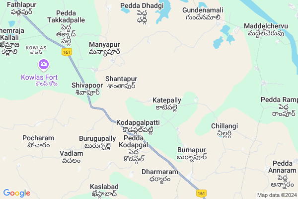
Sonpet Map
EDIT Map
Add Your House
 ..
..
Current Corona Virus Infected Patients Count in Nizamabad District
| City Name | District Name | Total Covid cases |
|---|---|---|
| Nizamabad District | Nizamabad | 62 |
| Kamareddy District | Kamareddy | 11 |
Locality Name :
Sonpet
( సొంపేట్ )
Mandal Name : Pitlam
District : Nizamabad
State : Telangana
Region : Telangana
Language : Telugu
Current Time 05:49 PM
Date: Tuesday , Apr 29,2025 (IST)
Time zone: IST (UTC+5:30)
Elevation / Altitude: 375 meters. Above Seal level
Telephone Code / Std Code: 08466
Assembly constituency : Jukkal assembly constituency
Assembly MLA : Laxmi Kantha Rao Thota
Lok Sabha constituency : Zahirabad parliamentary constituency
Parliament MP : B.B.PATIL
Serpanch Name :
Pin Code : 503310
Post Office Name : Pitlam
Main Village Name : Sonpet
Commodities Prices : Pitlam Market / Mandi
Sonpet Live Weather
Temperature: 40.5 °C
broken clouds
Humidity: 12%
Wind : 1.87 mt/sec towards E
StationName : "BÄ\u0081nswÄ\u0081da"
observed on 44 Mins Back
Temperature: 40.5 °C
broken clouds
Humidity: 12%
Wind : 1.87 mt/sec towards E
StationName : "BÄ\u0081nswÄ\u0081da"
observed on 44 Mins Back
Sonpet Weather Forecast for Next 5 days
30-04-2025
33.2°C to 40.3°C
broken clouds
33.2°C to 40.3°C
broken clouds
01-05-2025
31.2°C to 42.1°C
overcast clouds, broken clouds, scattered clouds, few clouds, clear sky
31.2°C to 42.1°C
overcast clouds, broken clouds, scattered clouds, few clouds, clear sky
02-05-2025
29.1°C to 42.1°C
scattered clouds, clear sky, few clouds, broken clouds
29.1°C to 42.1°C
scattered clouds, clear sky, few clouds, broken clouds
03-05-2025
28.9°C to 42.5°C
broken clouds, scattered clouds, few clouds, clear sky
28.9°C to 42.5°C
broken clouds, scattered clouds, few clouds, clear sky
04-05-2025
30.7°C to 42.8°C
scattered clouds, few clouds, clear sky, broken clouds
30.7°C to 42.8°C
scattered clouds, few clouds, clear sky, broken clouds
Rivers Near Sonpet
Manjira :Manjira :मांजरा :ಮಂಜೀರ :मांजरा :మంజీర
Kanapur Gudem Vagu
Manjira :Manjira :मांजरा :ಮಂಜೀರ :मांजरा :మంజీర
Kanapur Gudem Vagu
About Sonpet
Correct below Info and add more info about SonpetSonpet is a small Village/hamlet in Pitlam Mandal in Nizamabad District of Telangana State, India. It comes under Sonpet Panchayath. It belongs to Telangana region . As part Telangana Districts re-organisation , Sonpet Village Pitlam Mandal re organised from Nizamabad District to Kamareddy district. It is located 62 KM towards South from District head quarters Nizamabad. 7 KM from Pitlam.
Sonpet Pin code is 503310 and postal head office is Pitlam .
Wadlam ( 7 KM ) , Gundenamli ( 9 KM ) , Kowlas ( 9 KM ) , Karegaon ( 10 KM ) , Wajidnagar ( 11 KM ) are the nearby Villages to Sonpet. Sonpet is surrounded by Pitlam Mandal towards South , Banswada Mandal towards East , Birkoor Mandal towards North , Kangti Mandal towards South .
Bodhan , Nizamabad , Bidar , Medak are the near by Cities to Sonpet.
This Place is in the border of the Nizamabad District and Medak District. Medak District Kalher is South towards this place .
Sonpet 2011 Census Details
Sonpet Local Language is Telugu. Sonpet Village Total population is and number of houses are . Female Population is -1.0%. Village literacy rate is -1.0% and the Female Literacy rate is -1.0%.
Population
| Census Parameter | Census Data |
| Total Population | |
| Total No of Houses | |
| Female Population % | -1.0 % ( ) |
| Total Literacy rate % | -1.0 % ( ) |
| Female Literacy rate | -1.0 % ( ) |
| Scheduled Tribes Population % | -1.0 % ( ) |
| Scheduled Caste Population % | -1.0 % ( ) |
| Working Population % | -1.0 % |
| Child(0 -6) Population by 2011 | |
| Girl Child(0 -6) Population % by 2011 | -1.0 % ( ) |
Sonpet Census More Deatils.
Politics in Sonpet
TDP , TRS , INC are the major political parties in this area.Polling Stations /Booths near Sonpet
1)Zilla Parishat Unnatha Pathashala2)Zp High School Kodapgal Big South Side
3)Mandal Parishad Upper Pri.school
4)Mandal Parishad Upper Pri.school
5)Mandal Parishad Primary School Velahnoor
HOW TO REACH Sonpet
By Rail
There is no railway station near to Sonpet in less than 10 km. Bodhan Rail Way Station (near to Bodhan) , Shakar Nagar Rail Way Station (near to Bodhan) are the Rail way stations reachable from near by towns.By Road
Bodhan are the nearby by towns to Sonpet having road connectivity to SonpetColleges near Sonpet
Blue Bells Junior College For Girls
Address : 2-111/4 Blue Bells.pitlam
S R M Jr College Pitlam
Address : S R M Jr College Pitlam
Schools near Sonpet
Zphs U M Pitlam
Address : pitlam , pitlam , nizamabad , Andhra Pradesh . PIN- 503310 , Post - Pitlam
Vivekananda Vidya Nike
Address : pitlam , pitlam , nizamabad , Andhra Pradesh . PIN- 503310 , Post - Pitlam
Zphs Katepalle
Address : katepalle , pitlam , nizamabad , Andhra Pradesh . PIN- 503310 , Post - Pitlam
Zphs Godamgaon
Address : godmagaon , pitlam , nizamabad , Andhra Pradesh . PIN- 503310 , Post - Pitlam
Govt Health Centers near Sonpet
1) SubCentre, Shanthapur , , ,2) SubCentre, Peddakodapgal , , ,
3) Primary Health Centre, Peddakodapgal , , ,
Sub Villages in Sonpet
Petrol Bunks in Sonpet,Pitlam
HP PETROL PUMP - SAI RAM AUTO FUELS PITLAM
SY NO 854 A & 854;E Pitlam Bichkonda Road;Pitlam; Nizamabad; Telangana 503310; India
11.8 KM distance Detail
more ..
Electronic Shops in Sonpet,Pitlam
Sana Digital Studio & Mobile Point
Banswada Rd; Pitlam; Telangana 503310; India
12.9 KM distance Detail
Vayuputhra Moter Winding & Egg Workshop
Near SBI Bank; Pitlam; Telangana 503310; India
12.9 KM distance Detail
Governement Offices near Sonpet,Pitlam
Mee Seva Center
14-55;Bandrapalli;Ramakuppam;Chittoor-517401Bandrapalli(V); Rama Kuppam(M); Chittoor(D);; Banswada-Bichkunda Rd; Bandrapalli; Telangana 503187; India
9.6 KM distance Detail
Pedda Devada;Bichkunda;Nizamabad;Andhra Pradesh;India
1; Banswada-Bichkunda Rd; Pedda Devada; Telangana 503306; India
12.3 KM distance Detail
About Sonpet &
History
How to reach Sonpet
Tourist Places Near By Sonpet
Schools in Sonpet
Colleges in Sonpet
Temperature & weather of Sonpet
places in Sonpet
Sonpet photos
More Information
How to reach Sonpet
Tourist Places Near By Sonpet
Schools in Sonpet
Colleges in Sonpet
Temperature & weather of Sonpet
places in Sonpet
Sonpet photos
More Information
Village Talk
Post News or Events about this Village
Near Cities
Bodhan 46 KM near
Nizamabad 56 KM near
Bidar 57 KM near
Medak 66 KM near
Bodhan 46 KM near
Nizamabad 56 KM near
Bidar 57 KM near
Medak 66 KM near
Near By Taluks
Bichkunda 6 KM near
Pitlam 7 KM near
Banswada 18 KM near
Birkoor 19 KM near
Bichkunda 6 KM near
Pitlam 7 KM near
Banswada 18 KM near
Birkoor 19 KM near
Near By Air Ports
Nanded Airport 121 KM near
Rajiv Gandhi International Airport 154 KM near
Latur Airport 154 KM near
Sholapur Airport 233 KM near
Nanded Airport 121 KM near
Rajiv Gandhi International Airport 154 KM near
Latur Airport 154 KM near
Sholapur Airport 233 KM near
Near By Tourist Places
Bidar 57 KM near
Medak 66 KM near
Hyderabad 143 KM near
Gulbarga 164 KM near
Hingoli 190 KM near
Bidar 57 KM near
Medak 66 KM near
Hyderabad 143 KM near
Gulbarga 164 KM near
Hingoli 190 KM near
Near By Districts
Bidar 57 KM near
Nizamabad 59 KM near
Medak 93 KM near
Nanded 118 KM near
Bidar 57 KM near
Nizamabad 59 KM near
Medak 93 KM near
Nanded 118 KM near
Near By RailWay Station
Bidar Rail Way Station 58 KM near
Nizamabad Junction Rail Way Station 60 KM near
Bidar Rail Way Station 58 KM near
Nizamabad Junction Rail Way Station 60 KM near