| Home | City Bus | Maps | Villages | Cities | Rail | Tourist Places | School | College | Pin Codes | Corona Cases Count |
| Distance Calculator Bus Services IFSC Codes Trace Mobile Number Weather Search Place Trace IP Available Cash ATM/Banks Locate Polling Booth Report an Error contact People |
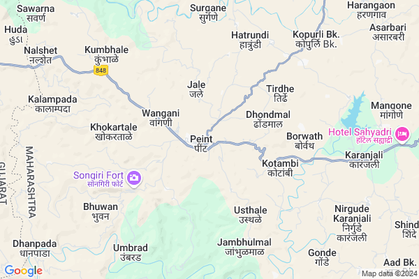
Peint
Peint Map
EDIT Map
Add Your House
 ..
..
Current Corona Virus Infected Patients Count in Nashik District
| City Name | District Name | Total Covid cases |
|---|---|---|
| Malegaon | Nashik | 46 |
| Nashik District | Nashik | 15 |
| Nashik | Nashik | 4 |
| Nashik Rural | Nashik | 3 |
Locality Name :
Peint
( पेइंग )
Taluka Name : Peth
District : Nashik
State : Maharashtra
Region : Khandesh and Northern Maharashtra
Division : Nashik
Language : Marathi and Hindi, Ahirani And Bhili
Current Time 09:50 AM
Date: Sunday , Apr 27,2025 (IST)
Time zone: IST (UTC+5:30)
Elevation / Altitude: 563 meters. Above Seal level
Telephone Code / Std Code: 02558
Assembly constituency : Dindori assembly constituency
Assembly MLA : Sunil Prabhu
Lok Sabha constituency : Dindori parliamentary constituency
Parliament MP : Dr. Bharati Pravin Pawar
Serpanch Name :
Pin Code : 422208
Post Office Name : Peint
Main Village Name : Peint
Commodities Prices : Dindori Market / Mandi
Peint Live Weather
Temperature: 29.1 °C
clear sky
Humidity: 34%
Wind : 1.15 mt/sec towards W
StationName : "SurgÄ\u0081na"
observed on 1 Hours Back
Temperature: 29.1 °C
clear sky
Humidity: 34%
Wind : 1.15 mt/sec towards W
StationName : "SurgÄ\u0081na"
observed on 1 Hours Back
Peint Weather Forecast for Next 5 days
28-04-2025
24.0°C to 38.0°C
clear sky
24.0°C to 38.0°C
clear sky
29-04-2025
23.4°C to 39.0°C
clear sky
23.4°C to 39.0°C
clear sky
30-04-2025
23.0°C to 38.2°C
clear sky
23.0°C to 38.2°C
clear sky
01-05-2025
22.0°C to 36.8°C
clear sky
22.0°C to 36.8°C
clear sky
02-05-2025
21.7°C to 37.9°C
clear sky
21.7°C to 37.9°C
clear sky
National Highways Reachable To Peint
Nationa High Way :NH848;SH30
Nationa High Way :NH60
Nationa High Way :NH848;SH30
Nationa High Way :NH60
Rivers Near Peint
Sakhal Todi
Alandi
Sakhal Todi
Alandi
About Peint
Correct below Info and add more info about PeintPeint is a small Village/hamlet in Peth Taluka in Nashik District of Maharashtra State, India. It comes under Peint Panchayath. It belongs to Khandesh and Northern Maharashtra region . It belongs to Nashik Division . It is located 50 KM towards North from District head quarters Nashik. 2 KM from Peth. 179 KM from State capital Mumbai
Peint Pin code is 422208 and postal head office is Peint .
Dhondmal ( 4 KM ) , Andhrute ( 4 KM ) , Kotambi ( 4 KM ) , Junothi ( 5 KM ) , Badgi ( 5 KM ) are the nearby Villages to Peint. Peint is surrounded by Trimbak Taluka towards South , Kaprada Taluka towards west , Dindori Taluka towards East , Surgana Taluka towards North .
Nashik , Dharampur, India , Ozar , Silvassa are the near by Cities to Peint.
Peint 2011 Census Details
Peint Local Language is Marathi. Peint Village Total population is 6858 and number of houses are 1368. Female Population is 48.3%. Village literacy rate is 74.2% and the Female Literacy rate is 33.5%.
Population
| Census Parameter | Census Data |
| Total Population | 6858 |
| Total No of Houses | 1368 |
| Female Population % | 48.3 % ( 3314) |
| Total Literacy rate % | 74.2 % ( 5089) |
| Female Literacy rate | 33.5 % ( 2300) |
| Scheduled Tribes Population % | 56.5 % ( 3875) |
| Scheduled Caste Population % | 4.6 % ( 317) |
| Working Population % | 37.1 % |
| Child(0 -6) Population by 2011 | 862 |
| Girl Child(0 -6) Population % by 2011 | 48.4 % ( 417) |
Peint Census More Deatils.
Politics in Peint
Bharatiya Janata Party , BJP , NCP , SHS are the major political parties in this area.Polling Stations /Booths near Peint
1)Pate "zila Parishad Primary School Room No.1 "2)Peth "zila Parishad Primary School Sulbhanagar East Side Room No.1"
3)Peth "zila Parishad Primary School Sulbhanagar East Side Room No.2"
4)Peth "zila Parishad Primary School Sulbhanagar East Side Room No.3"
5)Kayre Zila Parishad Primary School Room No.2 West Side
HOW TO REACH Peint
By Rail
There is no railway station near to Peint in less than 10 km. Nasik Road Rail Way Station (near to Nashik) are the Rail way stations reachable from near by towns.By Road
Nashik are the nearby by towns to Peint having road connectivity to PeintColleges near Peint
Art Sci College
Address :
Schools in Peint
Pri Ashram School Peint
Address : peint , peint , nashik , Maharashtra . PIN- 422208 , Post - Peint
Janata Vidyalay Peint
Address : peint , peint , nashik , Maharashtra . PIN- 422208 , Post - Peint
Z.p.school Peint No 2
Address : peint , peint , nashik , Maharashtra . PIN- 422208 , Post - Peint
Govt Health Centers near Peint
1) Devali Vani , SC DEVALI VANI , KHIRAD ROAD , NEAR MARUTI TEMPLE2) Mohandari , SC MOHANDARI , ABHONA ROAD , NEAR GRAM PANCHAYAT
3) Chausale , SC CHAUSALE , CHAUSALE ,
Sub Villages in Peint
Schools in Peint,Peth
Electronic Shops in Peint,Peth
Super Markets in Peint,Peth
Local Parks in Peint,Peth
Police Stations near Peint,Peth
Governement Offices near Peint,Peth
About Peint &
History
How to reach Peint
Tourist Places Near By Peint
Schools in Peint
Colleges in Peint
Temperature & weather of Peint
places in Peint
Peint photos
More Information
How to reach Peint
Tourist Places Near By Peint
Schools in Peint
Colleges in Peint
Temperature & weather of Peint
places in Peint
Peint photos
More Information
Village Talk
Post News or Events about this Village
Near Cities
Nashik 45 KM near
Dharampur, India 51 KM near
Ozar 52 KM near
Silvassa 57 KM near
Nashik 45 KM near
Dharampur, India 51 KM near
Ozar 52 KM near
Silvassa 57 KM near
Near By Taluks
Peth 2 KM near
Trimbak 28 KM near
Dindori 33 KM near
Surgana 33 KM near
Peth 2 KM near
Trimbak 28 KM near
Dindori 33 KM near
Surgana 33 KM near
Near By Air Ports
Gandhinagar Airport 50 KM near
Chhatrapati Shivaji International Airport 163 KM near
Lohegaon Airport 214 KM near
Chikkalthana Airport 226 KM near
Gandhinagar Airport 50 KM near
Chhatrapati Shivaji International Airport 163 KM near
Lohegaon Airport 214 KM near
Chikkalthana Airport 226 KM near
Near By Tourist Places
Trimbakeshwar 41 KM near
Nasik 46 KM near
Vikramgad 53 KM near
Dadra 57 KM near
Khodala 59 KM near
Trimbakeshwar 41 KM near
Nasik 46 KM near
Vikramgad 53 KM near
Dadra 57 KM near
Khodala 59 KM near
Near By Districts
Nashik 47 KM near
Dadra And Nagar Haveli 58 KM near
Dang 66 KM near
Valsad 80 KM near
Nashik 47 KM near
Dadra And Nagar Haveli 58 KM near
Dang 66 KM near
Valsad 80 KM near
Near By RailWay Station
Nasik Road Rail Way Station 54 KM near
Devlali Rail Way Station 59 KM near
Nasik Road Rail Way Station 54 KM near
Devlali Rail Way Station 59 KM near