| Home | City Bus | Maps | Villages | Cities | Rail | Tourist Places | School | College | Pin Codes | Corona Cases Count |
| Distance Calculator Bus Services IFSC Codes Trace Mobile Number Weather Search Place Trace IP Available Cash ATM/Banks Locate Polling Booth Report an Error contact People |
Orchhameta
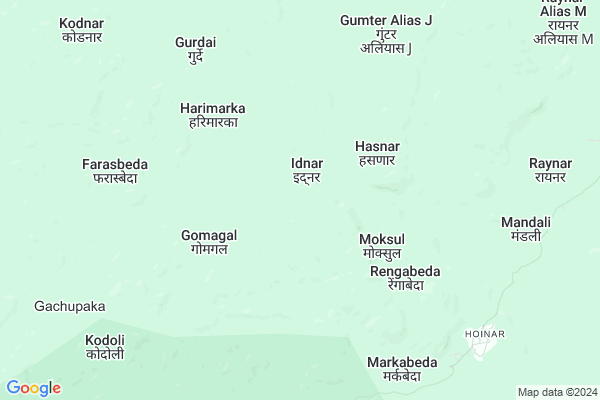
Orchhameta Map
EDIT Map
Add Your House
 ..
..
Current Corona Virus Infected Patients Count in Narayanpur District
| City Name | District Name | Total Covid cases |
|---|
Locality Name :
Orchhameta
( ओरछामेता )
Tehsil Name : Orchha(abhujmad)
District : Narayanpur
State : Chattisgarh
Language : Chhattisgarhi and Hindi
Current Time 12:37 PM
Date: Wednesday , Apr 30,2025 (IST)
Time zone: IST (UTC+5:30)
Elevation / Altitude: 408 meters. Above Seal level
Telephone Code / Std Code: 07783
Assembly constituency : Narayanpur assembly constituency
Assembly MLA : Kedar Kashyap
Lok Sabha constituency : Bastar parliamentary constituency
Parliament MP : DEEPAK BAIJ
Serpanch Name :
Main Village Name : Orchhameta
Commodities Prices : Narayanpur Market / Mandi
Orchhameta Live Weather
Temperature: 36.7 °C
clear sky
Humidity: 23%
Wind : 4.28 mt/sec towards SW
StationName : "GÄ«dam"
observed on 8 Mins Back
Temperature: 36.7 °C
clear sky
Humidity: 23%
Wind : 4.28 mt/sec towards SW
StationName : "GÄ«dam"
observed on 8 Mins Back
Orchhameta Weather Forecast for Next 5 days
01-05-2025
23.3°C to 36.0°C
few clouds, scattered clouds, clear sky
23.3°C to 36.0°C
few clouds, scattered clouds, clear sky
02-05-2025
21.9°C to 36.6°C
clear sky, scattered clouds
21.9°C to 36.6°C
clear sky, scattered clouds
03-05-2025
21.0°C to 37.0°C
clear sky, few clouds, broken clouds, light rain
21.0°C to 37.0°C
clear sky, few clouds, broken clouds, light rain
04-05-2025
20.2°C to 34.8°C
clear sky, scattered clouds, light rain
20.2°C to 34.8°C
clear sky, scattered clouds, light rain
05-05-2025
21.7°C to 36.6°C
light rain, broken clouds, scattered clouds, overcast clouds
21.7°C to 36.6°C
light rain, broken clouds, scattered clouds, overcast clouds
Rivers Near Orchhameta
Komra
Narangi
Komra
Narangi
About Orchhameta
Correct below Info and add more info about OrchhametaOrchhameta is a small Village/hamlet in Orchha(abhujmad) Tehsil in Narayanpur District of Chattisgarh State, India. It comes under Orchhameta Panchayath. It is located 44 KM towards South from District head quarters Narayanpur. 247 KM from State capital Raipur
Orchhameta is surrounded by Narayanpur Tehsil towards North , Bhairamgarh Tehsil towards South , Geedam Tehsil towards South , Bhamaragad Tehsil towards west .
Kondagaon , Bade Bacheli , Jagdalpur , Kanker are the near by Cities to Orchhameta.
Orchhameta 2011 Census Details
Orchhameta Local Language is Chhattisgarhi. Orchhameta Village Total population is 186 and number of houses are 39. Female Population is 56.5%. Village literacy rate is 29.6% and the Female Literacy rate is 13.4%.
Population
| Census Parameter | Census Data |
| Total Population | 186 |
| Total No of Houses | 39 |
| Female Population % | 56.5 % ( 105) |
| Total Literacy rate % | 29.6 % ( 55) |
| Female Literacy rate | 13.4 % ( 25) |
| Scheduled Tribes Population % | 97.3 % ( 181) |
| Scheduled Caste Population % | 0.5 % ( 1) |
| Working Population % | 52.7 % |
| Child(0 -6) Population by 2011 | 39 |
| Girl Child(0 -6) Population % by 2011 | 59.0 % ( 23) |
Orchhameta Census More Deatils.
Politics in Orchhameta
Indian National Congress , BJP , INC are the major political parties in this area.Polling Stations /Booths near Orchhameta
1)Golawand2)Gotabenoor
3)Kodiliyar
4)Netanar
5)Orchha 1
HOW TO REACH Orchhameta
By Rail
There is no railway station near to Orchhameta in less than 10 km.Pincodes near Orchhameta
494661 ( Narayanpur (Narayanpur) ) , 494441 ( Geedam ) , 494229 ( Pharasgaon Camp )Schools near Orchhameta
Govt Health Centers near Orchhameta
1) SHC Gomagal , shc Gomagal , ,2) SHC Mandali , shc Mandali , ,
3) CHC Orchha , chc orchha , tahsil para , ahead janpat
Sub Villages in Orchhameta
Schools in Orchhameta,Orchha(abhujmad)
Govt. Higher Secondary School Orchha
Nadipara Road; Orchha; Narayanpur; Chhattisgarh 404661; India
9.2 KM distance Detail
Dav Mukhyamantri Public School
Orchha; Village/Block/Ps Orchha; Distt Narayanpur; Chhattisgarh; Narayanpur; Chhattisgarh; India
9.5 KM distance Detail
Electronic Shops in Orchhameta,Orchha(abhujmad)
Local Parks in Orchhameta,Orchha(abhujmad)
Governement Offices near Orchhameta,Orchha(abhujmad)
About Orchhameta &
History
How to reach Orchhameta
Tourist Places Near By Orchhameta
Schools in Orchhameta
Colleges in Orchhameta
Temperature & weather of Orchhameta
places in Orchhameta
Orchhameta photos
More Information
How to reach Orchhameta
Tourist Places Near By Orchhameta
Schools in Orchhameta
Colleges in Orchhameta
Temperature & weather of Orchhameta
places in Orchhameta
Orchhameta photos
More Information
Village Talk
Post News or Events about this Village
Near Cities
Kondagaon 69 KM near
Bade Bacheli 89 KM near
Jagdalpur 115 KM near
Kanker 115 KM near
Kondagaon 69 KM near
Bade Bacheli 89 KM near
Jagdalpur 115 KM near
Kanker 115 KM near
Near By Taluks
Orchha(Abhujmad) 0 KM near
Narayanpur 40 KM near
Bhairamgarh 48 KM near
Geedam 52 KM near
Orchha(Abhujmad) 0 KM near
Narayanpur 40 KM near
Bhairamgarh 48 KM near
Geedam 52 KM near
Near By Air Ports
Raipur Airport 232 KM near
Rajahmundry Airport 298 KM near
Sonegaon Airport 319 KM near
Vishakhapatnam Airport 325 KM near
Raipur Airport 232 KM near
Rajahmundry Airport 298 KM near
Sonegaon Airport 319 KM near
Vishakhapatnam Airport 325 KM near
Near By Tourist Places
Bhamragarh Wildlife Sanctuary 62 KM near
Dantewada 70 KM near
Bastar 107 KM near
Jagdalpur 114 KM near
Kanker 115 KM near
Bhamragarh Wildlife Sanctuary 62 KM near
Dantewada 70 KM near
Bastar 107 KM near
Jagdalpur 114 KM near
Kanker 115 KM near
Near By Districts
Narayanpur 42 KM near
Dantewada 73 KM near
Bijapur 84 KM near
Bastar 98 KM near
Narayanpur 42 KM near
Dantewada 73 KM near
Bijapur 84 KM near
Bastar 98 KM near
Near By RailWay Station
Sirpur Kaghaznagar Rail Way Station 191 KM near
Bellampalli Rail Way Station 197 KM near
Sirpur Kaghaznagar Rail Way Station 191 KM near
Bellampalli Rail Way Station 197 KM near