| Home | City Bus | Maps | Villages | Cities | Rail | Tourist Places | School | College | Pin Codes | Corona Cases Count |
| Distance Calculator Bus Services IFSC Codes Trace Mobile Number Weather Search Place Trace IP Available Cash ATM/Banks Locate Polling Booth Report an Error contact People |
Palsun
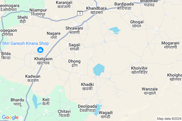
Palsun Map
EDIT Map
Add Your House
 ..
..
Current Corona Virus Infected Patients Count in Nandurbar District
| City Name | District Name | Total Covid cases |
|---|---|---|
| Nandurbar District | Nandurbar | 6 |
Locality Name :
Palsun
( प्लसून )
Taluka Name : Navapur
District : Nandurbar
State : Maharashtra
Region : Khandesh and Northern Maharashtra
Division : Nashik
Language : Marathi and Hindi, Bhili, Gujrathi And Kokani
Current Time 07:08 PM
Date: Monday , Apr 28,2025 (IST)
Time zone: IST (UTC+5:30)
Elevation / Altitude: 169 meters. Above Seal level
Telephone Code / Std Code: 02569
Assembly constituency : Nawapur assembly constituency
Assembly MLA : Naik Shirishkumar Surupsing
Lok Sabha constituency : Nandurbar parliamentary constituency
Parliament MP : Dr. Heena Vijaykumar Gavit
Serpanch Name :
Pin Code : 425416
Post Office Name : Khandbara
Main Village Name : Palsun
Commodities Prices : Nandurbar Market / Mandi
National Highways Reachable To Palsun
Nationa High Way :NH60
Nationa High Way :NH53
Nationa High Way :NH60
Nationa High Way :NH53
Rivers Near Palsun
Mangla
Bhad
Mangla
Bhad
About Palsun
Correct below Info and add more info about PalsunPalsun is a small Village/hamlet in Navapur Taluka in Nandurbar District of Maharashtra State, India. It comes under Palsun Panchayath. It belongs to Khandesh and Northern Maharashtra region . It belongs to Nashik Division . It is located 28 KM towards west from District head quarters Nandurbar. 16 KM from Navapur. 324 KM from State capital Mumbai
Palsun Pin code is 425416 and postal head office is Khandbara .
Shrawani ( 4 KM ) , Khatgaon ( 6 KM ) , Khandbar ( 6 KM ) , Navali ( 7 KM ) , Chitavi ( 8 KM ) are the nearby Villages to Palsun. Palsun is surrounded by Nandurbar Taluka towards East , Uchchhal Taluka towards west , Nizar Taluka towards North , Sakri Taluka towards South .
Nandurbar , Songadh , Shahade , Vyara are the near by Cities to Palsun.
This Place is in the border of the Nandurbar District and Surat District. Surat District Uchchhal is west towards this place . It is near to the Gujarat State Border.
Palsun 2011 Census Details
Palsun Local Language is Marathi. Palsun Village Total population is 1547 and number of houses are 268. Female Population is 48.9%. Village literacy rate is 54.2% and the Female Literacy rate is 22.6%.
Population
| Census Parameter | Census Data |
| Total Population | 1547 |
| Total No of Houses | 268 |
| Female Population % | 48.9 % ( 756) |
| Total Literacy rate % | 54.2 % ( 839) |
| Female Literacy rate | 22.6 % ( 349) |
| Scheduled Tribes Population % | 99.9 % ( 1546) |
| Scheduled Caste Population % | 0.0 % ( 0) |
| Working Population % | 57.1 % |
| Child(0 -6) Population by 2011 | 149 |
| Girl Child(0 -6) Population % by 2011 | 51.0 % ( 76) |
Palsun Census More Deatils.
Politics in Palsun
Bharatiya Janata Party , BJP , NCP , SP , INC are the major political parties in this area.Polling Stations /Booths near Palsun
1)Palipada2)Dhong
3)Rayangan
4)Navapada
5)Khadki
HOW TO REACH Palsun
By Rail
Khandbara Rail Way Station , Khatgaon Rail Way Station are the very nearby railway stations to Palsun. Choupale Rail Way Station (near to Nandurbar) , Nandurbar Rail Way Station (near to Nandurbar) are the Rail way stations reachable from near by towns.By Road
Nandurbar are the nearby by towns to Palsun having road connectivity to PalsunColleges near Palsun
National Backward Agriculture Education Of Information Technology
Address : At Kothada Post Raingan Tal Navapur Dist Nandurbar
Schools in Palsun
Navjeevan High School
Address : palsun , navapur , nandurbar , Maharashtra . PIN- 425416 , Post - Khandbara
Govt Health Centers near Palsun
1) RH Natawad , Rural Hospital Natawad , ,2) Mohane , 12 , 1 , mohane
3) Visarwadi 2 , SubCenter Visarvadi 2 , ,
Sub Villages in Palsun
Schools in Palsun,Navapur
Electronic Shops in Palsun,Navapur
Super Markets in Palsun,Navapur
Local Parks in Palsun,Navapur
Police Stations near Palsun,Navapur
Governement Offices near Palsun,Navapur
About Palsun &
History
How to reach Palsun
Tourist Places Near By Palsun
Schools in Palsun
Colleges in Palsun
Temperature & weather of Palsun
places in Palsun
Palsun photos
More Information
How to reach Palsun
Tourist Places Near By Palsun
Schools in Palsun
Colleges in Palsun
Temperature & weather of Palsun
places in Palsun
Palsun photos
More Information
Village Talk
Post News or Events about this Village
Near Cities
Nandurbar 29 KM near
Songadh 56 KM near
Shahade 62 KM near
Vyara 76 KM near
Nandurbar 29 KM near
Songadh 56 KM near
Shahade 62 KM near
Vyara 76 KM near
Near By Taluks
Navapur 15 KM near
Nandurbar 30 KM near
Uchchhal 30 KM near
Sakri 35 KM near
Navapur 15 KM near
Nandurbar 30 KM near
Uchchhal 30 KM near
Sakri 35 KM near
Near By Air Ports
Gandhinagar Airport 161 KM near
Vadodara Airport 164 KM near
Bhavnagar Airport 224 KM near
Chikkalthana Airport 233 KM near
Gandhinagar Airport 161 KM near
Vadodara Airport 164 KM near
Bhavnagar Airport 224 KM near
Chikkalthana Airport 233 KM near
Near By Tourist Places
Saputara 73 KM near
Kevadia Narmada 87 KM near
Toranmal 92 KM near
Dhule 95 KM near
Ankleshwar 128 KM near
Saputara 73 KM near
Kevadia Narmada 87 KM near
Toranmal 92 KM near
Dhule 95 KM near
Ankleshwar 128 KM near
Near By Districts
Nandurbar 27 KM near
Dang 72 KM near
Dhule 96 KM near
Narmada 99 KM near
Nandurbar 27 KM near
Dang 72 KM near
Dhule 96 KM near
Narmada 99 KM near
Near By RailWay Station
Khatgaon Rail Way Station 6.9 KM near
Khandbara Rail Way Station 7.2 KM near
Nandurbar Rail Way Station 28 KM near
Dondaicha Rail Way Station 61 KM near
Khatgaon Rail Way Station 6.9 KM near
Khandbara Rail Way Station 7.2 KM near
Nandurbar Rail Way Station 28 KM near
Dondaicha Rail Way Station 61 KM near