| Home | City Bus | Maps | Villages | Cities | Rail | Tourist Places | School | College | Pin Codes | Corona Cases Count |
| Distance Calculator Bus Services IFSC Codes Trace Mobile Number Weather Search Place Trace IP Available Cash ATM/Banks Locate Polling Booth Report an Error contact People |
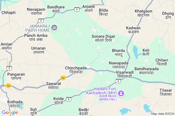
Masalipada
Masalipada Map
EDIT Map
Add Your House
 ..
..
Current Corona Virus Infected Patients Count in Nandurbar District
| City Name | District Name | Total Covid cases |
|---|---|---|
| Nandurbar District | Nandurbar | 6 |
Locality Name :
Masalipada
( मासळीपाडा )
Taluka Name : Navapur
District : Nandurbar
State : Maharashtra
Region : Khandesh and Northern Maharashtra
Division : Nashik
Language : Marathi and Hindi, Bhili, Gujrathi And Kokani
Current Time 07:17 PM
Date: Monday , Apr 28,2025 (IST)
Time zone: IST (UTC+5:30)
Elevation / Altitude: 169 meters. Above Seal level
Telephone Code / Std Code: 02569
Assembly constituency : Nawapur assembly constituency
Assembly MLA : Naik Shirishkumar Surupsing
Lok Sabha constituency : Nandurbar parliamentary constituency
Parliament MP : Dr. Heena Vijaykumar Gavit
Serpanch Name :
Main Village Name : Masalipada
Commodities Prices : Songadh(Umrada) Market / Mandi
Masalipada Live Weather
Temperature: 39.0 °C
clear sky
Humidity: 17%
Wind : 5.97 mt/sec towards W
StationName : "Songadh"
observed on 31 Mins Back
Temperature: 39.0 °C
clear sky
Humidity: 17%
Wind : 5.97 mt/sec towards W
StationName : "Songadh"
observed on 31 Mins Back
Masalipada Weather Forecast for Next 5 days
29-04-2025
27.4°C to 38.6°C
clear sky
27.4°C to 38.6°C
clear sky
30-04-2025
27.7°C to 42.3°C
clear sky, scattered clouds, broken clouds
27.7°C to 42.3°C
clear sky, scattered clouds, broken clouds
01-05-2025
27.9°C to 42.5°C
scattered clouds, clear sky
27.9°C to 42.5°C
scattered clouds, clear sky
02-05-2025
27.1°C to 42.2°C
clear sky
27.1°C to 42.2°C
clear sky
03-05-2025
27.2°C to 42.4°C
clear sky
27.2°C to 42.4°C
clear sky
National Highways Reachable To Masalipada
Nationa High Way :NH60
Nationa High Way :NH53
Nationa High Way :NH60
Nationa High Way :NH53
Rivers Near Masalipada
Mangla
Bhad
Mangla
Bhad
About Masalipada
Correct below Info and add more info about MasalipadaMasalipada is a small Village/hamlet in Navapur Taluka in Nandurbar District of Maharashtra State, India. It comes under Masalipada Panchayath. It belongs to Khandesh and Northern Maharashtra region . It belongs to Nashik Division . It is located 45 KM towards west from District head quarters Nandurbar. 311 KM from State capital Mumbai
Masalipada is surrounded by Uchchhal Taluka towards west , Sagbara Taluka towards North , Sakri Taluka towards East , Nandurbar Taluka towards East .
Songadh , Nandurbar , Vyara , Shahade are the near by Cities to Masalipada.
This Place is in the border of the Nandurbar District and Surat District. Surat District Uchchhal is west towards this place . It is near to the Gujarat State Border.
Demographics of Masalipada
Marathi is the Local Language here.Politics in Masalipada
Bharatiya Janata Party , BJP , NCP , SP , INC are the major political parties in this area.Polling Stations /Booths near Masalipada
1)Chinchpada2)Chimnipada
3)Chinchpada
4)Chinchpada
5)Chinchpada
HOW TO REACH Masalipada
By Rail
Kolde Rail Way Station , Chinchpada Rail Way Station are the very nearby railway stations to Masalipada. Choupale Rail Way Station (near to Nandurbar) , Nandurbar Rail Way Station (near to Nandurbar) are the Rail way stations reachable from near by towns.By Road
Nandurbar are the nearby by towns to Masalipada having road connectivity to MasalipadaPincodes near Masalipada
425417 ( Chinchpada ) , 425426 ( Visarwadi ) , 425418 ( Navapur )Colleges near Masalipada
National Backward Agriculture Education Of Information Technology
Address : At Kothada Post Raingan Tal Navapur Dist Nandurbar
Schools near Masalipada
Kudipak High School
Address : zamanzar , navapur , nandurbar , Maharashtra . PIN- 425418 , Post - Navapur
Adarsha High School
Address : vadkalambi (kk) , navapur , nandurbar , Maharashtra . PIN- 425418 , Post - Navapur
Tapi Parisar High School
Address : aanjane , navapur , nandurbar , Maharashtra . PIN- 425417 , Post - Chinchpada
High School
Address : karanji bk. , navapur , nandurbar , Maharashtra . PIN- 425417 , Post - Chinchpada
Govt Health Centers near Masalipada
1) Visarwadi 2 , SubCenter Visarvadi 2 , ,2) Savrat , SubCenter Savrat , ,
3) navagaon , SubCenter Navagaon , ,
Sub Villages in Masalipada
Schools in Masalipada,Navapur
Electronic Shops in Masalipada,Navapur
Super Markets in Masalipada,Navapur
Local Parks in Masalipada,Navapur
Police Stations near Masalipada,Navapur
Governement Offices near Masalipada,Navapur
About Masalipada &
History
How to reach Masalipada
Tourist Places Near By Masalipada
Schools in Masalipada
Colleges in Masalipada
Temperature & weather of Masalipada
places in Masalipada
Masalipada photos
More Information
How to reach Masalipada
Tourist Places Near By Masalipada
Schools in Masalipada
Colleges in Masalipada
Temperature & weather of Masalipada
places in Masalipada
Masalipada photos
More Information
Village Talk
Post News or Events about this Village
Near Cities
Songadh 42 KM near
Nandurbar 44 KM near
Vyara 61 KM near
Shahade 77 KM near
Songadh 42 KM near
Nandurbar 44 KM near
Vyara 61 KM near
Shahade 77 KM near
Near By Taluks
Navapur 0 KM near
Uchchhal 15 KM near
Sagbara 40 KM near
Sakri 41 KM near
Navapur 0 KM near
Uchchhal 15 KM near
Sagbara 40 KM near
Sakri 41 KM near
Near By Air Ports
Gandhinagar Airport 154 KM near
Vadodara Airport 162 KM near
Bhavnagar Airport 212 KM near
Chikkalthana Airport 239 KM near
Gandhinagar Airport 154 KM near
Vadodara Airport 162 KM near
Bhavnagar Airport 212 KM near
Chikkalthana Airport 239 KM near
Near By Tourist Places
Saputara 61 KM near
Kevadia Narmada 88 KM near
Dhule 105 KM near
Toranmal 105 KM near
Ankleshwar 117 KM near
Saputara 61 KM near
Kevadia Narmada 88 KM near
Dhule 105 KM near
Toranmal 105 KM near
Ankleshwar 117 KM near
Near By Districts
Nandurbar 42 KM near
Dang 60 KM near
Narmada 96 KM near
Dhule 106 KM near
Nandurbar 42 KM near
Dang 60 KM near
Narmada 96 KM near
Dhule 106 KM near
Near By RailWay Station
Kolde Rail Way Station 1.3 KM near
Chinchpada Rail Way Station 3.0 KM near
Nandurbar Rail Way Station 43 KM near
Vyara Rail Way Station 62 KM near
Kolde Rail Way Station 1.3 KM near
Chinchpada Rail Way Station 3.0 KM near
Nandurbar Rail Way Station 43 KM near
Vyara Rail Way Station 62 KM near