| Home | City Bus | Maps | Villages | Cities | Rail | Tourist Places | School | College | Pin Codes | Corona Cases Count |
| Distance Calculator Bus Services IFSC Codes Trace Mobile Number Weather Search Place Trace IP Available Cash ATM/Banks Locate Polling Booth Report an Error contact People |
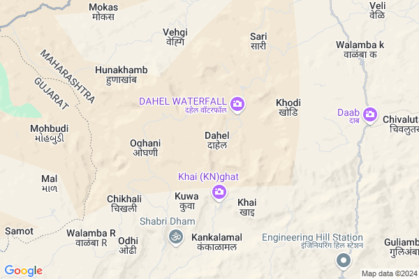
Dahel
Dahel Map
EDIT Map
Add Your House
 ..
..
Current Corona Virus Infected Patients Count in Nandurbar District
| City Name | District Name | Total Covid cases |
|---|---|---|
| Nandurbar District | Nandurbar | 6 |
Locality Name :
Dahel
( डाहेळ )
Taluka Name : Akkalkuwa
District : Nandurbar
State : Maharashtra
Region : Khandesh and Northern Maharashtra
Division : Nashik
Language : Marathi and Hindi, Bhili, Gujrathi And Kokani
Current Time 12:21 PM
Date: Thursday , Apr 24,2025 (IST)
Time zone: IST (UTC+5:30)
Elevation / Altitude: 209 meters. Above Seal level
Telephone Code / Std Code: 02567
Assembly constituency : Akkalkuwa assembly constituency
Assembly MLA : Adv KC Padavi
Lok Sabha constituency : Nandurbar parliamentary constituency
Parliament MP : Dr. Heena Vijaykumar Gavit
Serpanch Name :
Pin Code : 425452
Post Office Name : Molgi
Main Village Name : Dahel
Commodities Prices : Akkalkuwa Market / Mandi
Dahel Live Weather
Temperature: 31.7 °C
clear sky
Humidity: 20%
Wind : 2.88 mt/sec towards NW
StationName : "Taloda"
observed on 2 Hours Back
Temperature: 31.7 °C
clear sky
Humidity: 20%
Wind : 2.88 mt/sec towards NW
StationName : "Taloda"
observed on 2 Hours Back
Dahel Weather Forecast for Next 5 days
25-04-2025
23.8°C to 36.5°C
clear sky
23.8°C to 36.5°C
clear sky
26-04-2025
22.4°C to 36.3°C
clear sky
22.4°C to 36.3°C
clear sky
27-04-2025
21.0°C to 36.2°C
clear sky
21.0°C to 36.2°C
clear sky
28-04-2025
20.6°C to 37.6°C
clear sky
20.6°C to 37.6°C
clear sky
29-04-2025
21.7°C to 37.7°C
clear sky
21.7°C to 37.7°C
clear sky
National Highways Reachable To Dahel
Nationa High Way :NH53
Nationa High Way :NH160H
Nationa High Way :NH53
Nationa High Way :NH160H
Rivers Near Dahel
Mangla
Bhad
Mangla
Bhad
About Dahel
Correct below Info and add more info about DahelDahel is a small Village/hamlet in Akkalkuwa Taluka in Nandurbar District of Maharashtra State, India. It comes under Dahel Panchayath. It belongs to Khandesh and Northern Maharashtra region . It belongs to Nashik Division . It is located 54 KM towards North from District head quarters Nandurbar. 10 KM from Akkalkuwa. 372 KM from State capital Mumbai
Dahel Pin code is 425452 and postal head office is Molgi .
Veli ( 12 KM ) , Umaragavhan ( 12 KM ) , Ichhagavhan ( 13 KM ) , Kathi ( 14 KM ) , Horafali ( 15 KM ) are the nearby Villages to Dahel. Dahel is surrounded by Nizar Taluka towards South , Sagbara Taluka towards South , Taloda Taluka towards East , Akarani Taluka towards East .
Nandurbar , Rajpipla , Shahade , Songadh are the near by Cities to Dahel.
Dahel 2011 Census Details
Dahel Local Language is Marathi. Dahel Village Total population is 2313 and number of houses are 443. Female Population is 51.4%. Village literacy rate is 32.5% and the Female Literacy rate is 15.2%.
Population
| Census Parameter | Census Data |
| Total Population | 2313 |
| Total No of Houses | 443 |
| Female Population % | 51.4 % ( 1189) |
| Total Literacy rate % | 32.5 % ( 751) |
| Female Literacy rate | 15.2 % ( 352) |
| Scheduled Tribes Population % | 99.7 % ( 2306) |
| Scheduled Caste Population % | 0.0 % ( 0) |
| Working Population % | 52.0 % |
| Child(0 -6) Population by 2011 | 543 |
| Girl Child(0 -6) Population % by 2011 | 48.1 % ( 261) |
Dahel Census More Deatils.
Politics in Dahel
Bharatiya Janata Party , BJP , NCP , SP , INC are the major political parties in this area.Polling Stations /Booths near Dahel
1)Dahel2)Dab
3)Mktarzira
4)Oghani
5)Khadki
HOW TO REACH Dahel
By Rail
There is no railway station near to Dahel in less than 10 km. Rajpipla Rail Way Station (near to Rajpipla) are the Rail way stations reachable from near by towns.By Road
Rajpipla are the nearby by towns to Dahel having road connectivity to DahelColleges near Dahel
Savitribai Madhyamik And Uchamadhyamik Shala
Address :
Gram Vikas Mandal's Sanchalit Late Prof.b.s.saindane Arts Com & Science Jr.college Molgi Tal Akkalkuwa Dist.nandurbar
Address : Molgi Tal Akkalkuwa Dist.nandurbar
Schools in Dahel
Govt. Ashram School Dahel
Address : dahel , akkalkuwa , nandurbar , Maharashtra . PIN- 425419 , Post - Khapar
Govt Health Centers near Dahel
1) Kuwa , Sc Kuwa , Kuwa ,2) Chikhli , Sc Chikhali , Chikhali ,
3) Singpur , Sc Singpur , Singpur ,
Sub Villages in Dahel
Schools in Dahel,Akkalkuwa
Electronic Shops in Dahel,Akkalkuwa
Super Markets in Dahel,Akkalkuwa
Local Parks in Dahel,Akkalkuwa
Police Stations near Dahel,Akkalkuwa
Governement Offices near Dahel,Akkalkuwa
About Dahel &
History
How to reach Dahel
Tourist Places Near By Dahel
Schools in Dahel
Colleges in Dahel
Temperature & weather of Dahel
places in Dahel
Dahel photos
More Information
How to reach Dahel
Tourist Places Near By Dahel
Schools in Dahel
Colleges in Dahel
Temperature & weather of Dahel
places in Dahel
Dahel photos
More Information
Village Talk
Post News or Events about this Village
Near Cities
Nandurbar 52 KM near
Rajpipla 56 KM near
Shahade 63 KM near
Songadh 80 KM near
Nandurbar 52 KM near
Rajpipla 56 KM near
Shahade 63 KM near
Songadh 80 KM near
Near By Taluks
Akkalkuwa 10 KM near
Nizar 28 KM near
Sagbara 29 KM near
Taloda 31 KM near
Akkalkuwa 10 KM near
Nizar 28 KM near
Sagbara 29 KM near
Taloda 31 KM near
Near By Air Ports
Vadodara Airport 116 KM near
Bhavnagar Airport 204 KM near
Gandhinagar Airport 215 KM near
Ahmedabad Airport 229 KM near
Vadodara Airport 116 KM near
Bhavnagar Airport 204 KM near
Gandhinagar Airport 215 KM near
Ahmedabad Airport 229 KM near
Near By Tourist Places
Kevadia Narmada 37 KM near
Toranmal 63 KM near
Pavagadh 109 KM near
Champaner 109 KM near
Ankleshwar 110 KM near
Kevadia Narmada 37 KM near
Toranmal 63 KM near
Pavagadh 109 KM near
Champaner 109 KM near
Ankleshwar 110 KM near
Near By Districts
Nandurbar 52 KM near
Narmada 56 KM near
Alirajpur 89 KM near
Bharuch 112 KM near
Nandurbar 52 KM near
Narmada 56 KM near
Alirajpur 89 KM near
Bharuch 112 KM near
Near By RailWay Station
Nandurbar Rail Way Station 52 KM near
Dondaicha Rail Way Station 83 KM near
Nandurbar Rail Way Station 52 KM near
Dondaicha Rail Way Station 83 KM near