| Home | City Bus | Maps | Villages | Cities | Rail | Tourist Places | School | College | Pin Codes | Corona Cases Count |
| Distance Calculator Bus Services IFSC Codes Trace Mobile Number Weather Search Place Trace IP Available Cash ATM/Banks Locate Polling Booth Report an Error contact People |
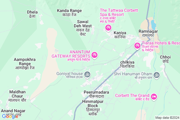
Bhagotpur Mariyal
Bhagotpur Mariyal Map
EDIT Map
Add Your House
 ..
..
Current Corona Virus Infected Patients Count in Nainital District
| City Name | District Name | Total Covid cases |
|---|---|---|
| Nainital District | Nainital | 10 |
Locality Name :
Bhagotpur Mariyal
( भगतपुर मरियल )
Block Name : Ramnagar
District : Nainital
State : Uttarakhand
Language : Hindi and Urdu, Garhwali, Kumauni
Current Time 04:41 PM
Date: Monday , Apr 28,2025 (IST)
Time zone: IST (UTC+5:30)
Elevation / Altitude: 345 meters. Above Seal level
Telephone Code / Std Code: 05947
Assembly constituency : Ramnagar assembly constituency
Assembly MLA : Diwan Singh Bisht
Lok Sabha constituency : Garhwal parliamentary constituency
Parliament MP : Tirath Singh Rawat
Serpanch Name :
Pin Code : 244715
Post Office Name : Ramnagar (Nainital)
Main Village Name : Bhagotpur Mariyal
Commodities Prices : Ramnagar Market / Mandi
Bhagotpur Mariyal Live Weather
Temperature: 37.4 °C
clear sky
Humidity: 12%
Wind : 2.64 mt/sec towards W
StationName : "Ramnagar"
observed on 4 Mins Back
Temperature: 37.4 °C
clear sky
Humidity: 12%
Wind : 2.64 mt/sec towards W
StationName : "Ramnagar"
observed on 4 Mins Back
Bhagotpur Mariyal Weather Forecast for Next 5 days
29-04-2025
26.4°C to 37.3°C
clear sky, broken clouds
26.4°C to 37.3°C
clear sky, broken clouds
30-04-2025
24.7°C to 38.0°C
broken clouds, overcast clouds, scattered clouds
24.7°C to 38.0°C
broken clouds, overcast clouds, scattered clouds
01-05-2025
25.0°C to 38.7°C
overcast clouds, scattered clouds, few clouds, broken clouds
25.0°C to 38.7°C
overcast clouds, scattered clouds, few clouds, broken clouds
02-05-2025
23.0°C to 39.3°C
overcast clouds, light rain, scattered clouds, broken clouds
23.0°C to 39.3°C
overcast clouds, light rain, scattered clouds, broken clouds
03-05-2025
23.1°C to 35.2°C
moderate rain, light rain, overcast clouds, broken clouds
23.1°C to 35.2°C
moderate rain, light rain, overcast clouds, broken clouds
National Highways Reachable To Bhagotpur Mariyal
Nationa High Way :NH109
Nationa High Way :NH109E
Nationa High Way :NH109
Nationa High Way :NH109E
Rivers Near Bhagotpur Mariyal
Ramganga
Phica
Ramganga
Phica
About Bhagotpur Mariyal
Correct below Info and add more info about Bhagotpur MariyalBhagotpur Mariyal is a small Village/hamlet in Ramnagar Block in Nainital District of Uttarakhand State, India. It comes under Bhagotpur Mariyal Panchayath. It is located 46 KM towards west from District head quarters Nainital. 7 KM from Ramnagar. 169 KM from State capital Dehradun
Bhagotpur Mariyal Pin code is 244715 and postal head office is Ramnagar (Nainital).
Basai ( 2 KM ) , Narayanpur Muliya ( 3 KM ) , Karanpur ( 3 KM ) , Himmatpur Dotiyal ( 5 KM ) , Chilkiya ( 5 KM ) are the nearby Villages to Bhagotpur Mariyal. Bhagotpur Mariyal is surrounded by Kashipur Block towards South , Jaspur Block towards west , Bajpur Block towards South , Kotabag Block towards East .
Ramnagar , Kashipur , Jaspur , Bazpur are the near by Cities to Bhagotpur Mariyal.
Bhagotpur Mariyal 2011 Census Details
Bhagotpur Mariyal Local Language is Hindi. Bhagotpur Mariyal Village Total population is 257 and number of houses are 39. Female Population is 49.0%. Village literacy rate is 59.1% and the Female Literacy rate is 24.1%.
Population
| Census Parameter | Census Data |
| Total Population | 257 |
| Total No of Houses | 39 |
| Female Population % | 49.0 % ( 126) |
| Total Literacy rate % | 59.1 % ( 152) |
| Female Literacy rate | 24.1 % ( 62) |
| Scheduled Tribes Population % | 0.0 % ( 0) |
| Scheduled Caste Population % | 11.3 % ( 29) |
| Working Population % | 26.8 % |
| Child(0 -6) Population by 2011 | 45 |
| Girl Child(0 -6) Population % by 2011 | 57.8 % ( 26) |
Bhagotpur Mariyal Census More Deatils.
Politics in Bhagotpur Mariyal
BJP , INC are the major political parties in this area.Polling Stations /Booths near Bhagotpur Mariyal
1)Kyari2)Lalapur Bansatila
3)Nagar Palika Parisad Ramnagar Poorvi Block R.n.3
4)B.v.p.k.ramnagar
5)G.p.v. Tadamallu (room N0 2)
HOW TO REACH Bhagotpur Mariyal
By Rail
Pirumadara Rail Way Station , Ramnagar Rail Way Station are the very nearby railway stations to Bhagotpur Mariyal.Colleges near Bhagotpur Mariyal
Iti Maldhan Chaur No.1
Address :
Schools near Bhagotpur Mariyal
U S R Indu J H S Basai
Address : basai , ramnagar , nainital , Uttarakhand . PIN- 244715 , Post - Ramnagar (Nainital)
D D S M Pub. S. Dhikuli
Address : dhikuli , ramnagar , nainital , Uttarakhand . PIN- 244715 , Post - Ramnagar (Nainital)
G I C Choi
Address : choi , ramnagar , nainital , Uttarakhand . PIN- 244715 , Post - Ramnagar (Nainital)
J H S Thela
Address : tehla , ramnagar , nainital , Uttarakhand . PIN- 244715 , Post - Ramnagar (Nainital)
Govt Health Centers near Bhagotpur Mariyal
1) Pirumdara , Sub Center , Peerumadara , PHC Peerumadara2) Peerumadara , Primary Health Center , Peerumadara , Kashipur Road
3) Karanpur , Sub Center , Karanpur , ANM Center
Sub Villages in Bhagotpur Mariyal
Hospitals in Bhagotpur Mariyal,Ramnagar
Brijesh Hospital
National Highway 121; Pant Colony; Shivlalpur Khazanchi; Uttarakhand 244715; India
7.3 KM distance Detail
more ..
Petrol Bunks in Bhagotpur Mariyal,Ramnagar
Dhyani Petrol Pump
Chandrapur Tiwari; Gangapur Pahari; Uttarakhand 244715; India
3.8 KM distance Detail
Mahalaxmi Filling Station
Kashipur Road; National Highway 121; Nainital; Ramnagar; Uttarakhand 263001; India
6.6 KM distance Detail
Singhal Indian Oil Petrol Pump
Pant Colony; Shivlalpur Khazanchi; Uttarakhand 244715; India
7.4 KM distance Detail
Lalta Prasad Indian oil petrol pump
NH309; Ramnagar; Uttarakhand 244715; India
8.1 KM distance Detail
more ..
Colleges in Bhagotpur Mariyal,Ramnagar
Renaissance College of Hotel Management & Catering Technology Uttarakhand
Vill : Basai; PO :- Peerumadara.; Ramnagar; Uttarakhand 244715; India
2.7 KM distance Detail
Uttarakhand Institute of Technical & Professional Education (Polytechnic)
Karanpur; Near Government Inter Colleg; Ramnagar; Uttarakhand 244715; India
3.4 KM distance Detail
kisaan inter college 67
Chandrapur Tiwari; Peerumadara; Uttarakhand 244715; India
4.3 KM distance Detail
Government Inter College Ramnagar
Karanpur; Ramnagar; Uttarakhand 244715; India
7.3 KM distance Detail
more ..
Super Markets in Bhagotpur Mariyal,Ramnagar
Yuvraj Traders Dist. - Luminous
Shivlalpur Chungi; National Highway 121; Jassaganja; Shivlalpur Khazanchi; Uttarakhand 244715; India
7.2 KM distance Detail
Local Parks in Bhagotpur Mariyal,Ramnagar
Corbett Solitaire
Near Jhirna Safari Zone; Punjabpur; Village Dhela; Ramnagar; Nainital; Uttarakhand 244715; India
8.0 KM distance Detail
Police Stations near Bhagotpur Mariyal,Ramnagar
About Bhagotpur Mariyal &
History
How to reach Bhagotpur Mariyal
Tourist Places Near By Bhagotpur Mariyal
Schools in Bhagotpur Mariyal
Colleges in Bhagotpur Mariyal
Temperature & weather of Bhagotpur Mariyal
places in Bhagotpur Mariyal
Bhagotpur Mariyal photos
More Information
How to reach Bhagotpur Mariyal
Tourist Places Near By Bhagotpur Mariyal
Schools in Bhagotpur Mariyal
Colleges in Bhagotpur Mariyal
Temperature & weather of Bhagotpur Mariyal
places in Bhagotpur Mariyal
Bhagotpur Mariyal photos
More Information
Village Talk
Post News or Events about this Village
Near Cities
Ramnagar 7 KM near
Kashipur 23 KM near
Jaspur 27 KM near
Bazpur 27 KM near
Ramnagar 7 KM near
Kashipur 23 KM near
Jaspur 27 KM near
Bazpur 27 KM near
Near By Taluks
Ramnagar 7 KM near
Kashipur 21 KM near
Jaspur 25 KM near
Bajpur 27 KM near
Ramnagar 7 KM near
Kashipur 21 KM near
Jaspur 25 KM near
Bajpur 27 KM near
Near By Air Ports
Pantnagar Airport 61 KM near
Muzaffarnagar Airport 151 KM near
Dehra Dun Airport 161 KM near
Indira Gandhi International Airport 236 KM near
Pantnagar Airport 61 KM near
Muzaffarnagar Airport 151 KM near
Dehra Dun Airport 161 KM near
Indira Gandhi International Airport 236 KM near
Near By Tourist Places
Ramnagar 7 KM near
Kashipur 22 KM near
Corbett National Park 24 KM near
Nainital 43 KM near
Jeolikot 44 KM near
Ramnagar 7 KM near
Kashipur 22 KM near
Corbett National Park 24 KM near
Nainital 43 KM near
Jeolikot 44 KM near
Near By Districts
Nainital 44 KM near
Udam Singh Nagar 61 KM near
Rampur 70 KM near
Almora 70 KM near
Nainital 44 KM near
Udam Singh Nagar 61 KM near
Rampur 70 KM near
Almora 70 KM near
Near By RailWay Station
Pirumadara Rail Way Station 3.3 KM near
Ramnagar Rail Way Station 7.4 KM near
Kashipur Junction Rail Way Station 23 KM near
Pirumadara Rail Way Station 3.3 KM near
Ramnagar Rail Way Station 7.4 KM near
Kashipur Junction Rail Way Station 23 KM near