| Home | City Bus | Maps | Villages | Cities | Rail | Tourist Places | School | College | Pin Codes | Corona Cases Count |
| Distance Calculator Bus Services IFSC Codes Trace Mobile Number Weather Search Place Trace IP Available Cash ATM/Banks Locate Polling Booth Report an Error contact People |
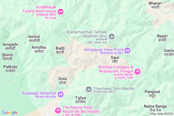
Salwa
Salwa Map
EDIT Map
Add Your House
 ..
..
Current Corona Virus Infected Patients Count in Nainital District
| City Name | District Name | Total Covid cases |
|---|---|---|
| Nainital District | Nainital | 10 |
Locality Name :
Salwa
( सलवा )
Block Name : Kotabag
District : Nainital
State : Uttarakhand
Language : Hindi and Urdu, Garhwali, Kumauni
Current Time 04:34 PM
Date: Monday , Apr 28,2025 (IST)
Time zone: IST (UTC+5:30)
Elevation / Altitude: 345 meters. Above Seal level
Telephone Code / Std Code: 05942
Assembly constituency : Nainital assembly constituency
Assembly MLA : Sarita Arya
Lok Sabha constituency : Nainital-Udhamsingh Nagar parliamentary constituency
Parliament MP : Ajay Bhatt
Serpanch Name :
Pin Code : 263159
Post Office Name : Kotabagh
Main Village Name : Salwa
Commodities Prices : Ramnagar Market / Mandi
Salwa Live Weather
Temperature: 25.2 °C
clear sky
Humidity: 19%
Wind : 3.77 mt/sec towards SW
StationName : "Nainital"
observed on 1 Hours Back
Temperature: 25.2 °C
clear sky
Humidity: 19%
Wind : 3.77 mt/sec towards SW
StationName : "Nainital"
observed on 1 Hours Back
Salwa Weather Forecast for Next 5 days
29-04-2025
21.2°C to 31.8°C
clear sky, scattered clouds, broken clouds
21.2°C to 31.8°C
clear sky, scattered clouds, broken clouds
30-04-2025
20.1°C to 32.9°C
overcast clouds, broken clouds, scattered clouds
20.1°C to 32.9°C
overcast clouds, broken clouds, scattered clouds
01-05-2025
18.7°C to 33.3°C
overcast clouds, clear sky, few clouds, light rain
18.7°C to 33.3°C
overcast clouds, clear sky, few clouds, light rain
02-05-2025
19.8°C to 31.5°C
overcast clouds, broken clouds, light rain
19.8°C to 31.5°C
overcast clouds, broken clouds, light rain
03-05-2025
19.2°C to 31.0°C
moderate rain, light rain, overcast clouds, broken clouds
19.2°C to 31.0°C
moderate rain, light rain, overcast clouds, broken clouds
National Highways Reachable To Salwa
Nationa High Way :NH109
Nationa High Way :NH109
Rivers Near Salwa
Ratela Gad
Dabka River
Ratela Gad
Dabka River
About Salwa
Correct below Info and add more info about SalwaSalwa is a small Village/hamlet in Kotabag Block in Nainital District of Uttarakhand State, India. It comes under Salwa Panchayath. It is located 16 KM towards west from District head quarters Nainital. 9 KM from Kotabag. 186 KM from State capital Dehradun
Salwa Pin code is 263159 and postal head office is Kotabagh .
Amotha ( 6 KM ) , Riyar ( 6 KM ) , Syat ( 8 KM ) , Awala Kot ( 8 KM ) , Kotabag ( 9 KM ) are the nearby Villages to Salwa. Salwa is surrounded by Betalghat Block towards North , Nainital Block towards East , Tarikhet Block towards North , Bhimtal Block towards East .
Nainital , Ramnagar , Haldwani , Almora are the near by Cities to Salwa.
Salwa 2011 Census Details
Salwa Local Language is Hindi. Salwa Village Total population is 119 and number of houses are 23. Female Population is 56.3%. Village literacy rate is 63.9% and the Female Literacy rate is 31.9%.
Population
| Census Parameter | Census Data |
| Total Population | 119 |
| Total No of Houses | 23 |
| Female Population % | 56.3 % ( 67) |
| Total Literacy rate % | 63.9 % ( 76) |
| Female Literacy rate | 31.9 % ( 38) |
| Scheduled Tribes Population % | 0.0 % ( 0) |
| Scheduled Caste Population % | 0.0 % ( 0) |
| Working Population % | 55.5 % |
| Child(0 -6) Population by 2011 | 22 |
| Girl Child(0 -6) Population % by 2011 | 63.6 % ( 14) |
Salwa Census More Deatils.
Politics in Salwa
BJP , UKKD , BJP , INC are the major political parties in this area.Polling Stations /Booths near Salwa
1)Basganv2)Ayarapata Mallital
3)Sanadaa Talla
4)Dholgaon
5)Maharagaon
HOW TO REACH Salwa
By Rail
There is no railway station near to Salwa in less than 10 km.Colleges near Salwa
Iti Maldhan Chaur No.1
Address :
G.i.c Betalghat
Address :
Shri Dhan Singh Negi G.i.c. Peora
Address : Peora
Govt. Inter College Dalkanya
Address :
Schools in Salwa
P S Salwa
Address : salwa , kotabagh , nainital , Uttarakhand . PIN- 263159 , Post - Kotabagh
Govt Health Centers near Salwa
1) Paatkot , Sub Center , Paatkot , ANM Center2) Simalkha , Sub Center , Simalkha , ANM Center
3) Kherali Bunga , Sub Center , Kherali Bunga , ANM Center
Sub Villages in Salwa
Hospitals in Salwa,Kotabag
सरकारी अस्पताल Betalghat
betalghat; Ghoria Halson; Uttarakhand 263134; India
12.3 KM distance Detail
more ..
Petrol Bunks in Salwa,Kotabag
Petrol Station Sukhatal
Nainital - Kaladungi Rd; Sherwani; Nainital; Uttarakhand 263002; India
13.9 KM distance Detail
Indian Oil Petrol Pump
Nainital - Kaladungi Rd; Ayarpatta; Nainital; Uttarakhand 263002; India
14.0 KM distance Detail
more ..
Colleges in Salwa,Kotabag
Government Degree College Betalghat Nainital
Ghoria Halson; Uttarakhand 263134; India
12.4 KM distance Detail
Government Degree College Betalghat
Ghoria Halson; Uttarakhand 263134; India
12.4 KM distance Detail
more ..
Schools in Salwa,Kotabag
Rajeev Gandhi Navodaya Vidyalaya Syat Kotabagh Nainital
Chauk Patelia; Uttarakhand 263159; India
9.7 KM distance Detail
Electronic Shops in Salwa,Kotabag
Jio Store
Nainital High Ct Rd; Ayarpatta; Nainital; Uttarakhand 263002; India
14.2 KM distance Detail
Solutions
126; 127; Bara Bazar; Mallital; Nainital; Uttarakhand 263001; India
14.2 KM distance Detail
Local Parks in Salwa,Kotabag
Sitabani Wildlife Reserve
Abhishek Ray; Village Maujli; PO Amgarhi; District Nainital; Ramnagar; Uttarakhand 263159; India
10.1 KM distance Detail
Police Stations near Salwa,Kotabag
Police Station
Bada-Bazzar Connecting Rd; Mallital; Nainital; Uttarakhand 263001; India
14.7 KM distance Detail
Police Chowki Mallitaal
Mall Rd; Mallital; Nainital; Uttarakhand 263001; India
14.9 KM distance Detail
Governement Offices near Salwa,Kotabag
Uttarakhand State Legal Services Authority
A.D.R Centre High Court; Nainital; Uttarakhand; India
13.9 KM distance Detail
Passport Seva Kendra; Head Post Office Mallital Nainital
Head post office; Mallital; Nainital; Uttarakhand 263001; India
14.4 KM distance Detail
About Salwa &
History
How to reach Salwa
Tourist Places Near By Salwa
Schools in Salwa
Colleges in Salwa
Temperature & weather of Salwa
places in Salwa
Salwa photos
More Information
How to reach Salwa
Tourist Places Near By Salwa
Schools in Salwa
Colleges in Salwa
Temperature & weather of Salwa
places in Salwa
Salwa photos
More Information
Village Talk
Post News or Events about this Village
Near Cities
Nainital 16 KM near
Ramnagar 25 KM near
Haldwani 34 KM near
Almora 37 KM near
Nainital 16 KM near
Ramnagar 25 KM near
Haldwani 34 KM near
Almora 37 KM near
Near By Taluks
Kotabag 8 KM near
Betalghat 10 KM near
Nainital 15 KM near
Tarikhet 21 KM near
Kotabag 8 KM near
Betalghat 10 KM near
Nainital 15 KM near
Tarikhet 21 KM near
Near By Air Ports
Pantnagar Airport 54 KM near
Dehra Dun Airport 177 KM near
Muzaffarnagar Airport 182 KM near
Indira Gandhi International Airport 269 KM near
Pantnagar Airport 54 KM near
Dehra Dun Airport 177 KM near
Muzaffarnagar Airport 182 KM near
Indira Gandhi International Airport 269 KM near
Near By Tourist Places
Jeolikot 15 KM near
Nainital 15 KM near
Bhowali 20 KM near
Ramgarh 21 KM near
Sattal 23 KM near
Jeolikot 15 KM near
Nainital 15 KM near
Bhowali 20 KM near
Ramgarh 21 KM near
Sattal 23 KM near
Near By Districts
Nainital 16 KM near
Almora 37 KM near
Udam Singh Nagar 60 KM near
Bageshwar 65 KM near
Nainital 16 KM near
Almora 37 KM near
Udam Singh Nagar 60 KM near
Bageshwar 65 KM near
Near By RailWay Station
Ramnagar Rail Way Station 26 KM near
Kathgodam Rail Way Station 32 KM near
Ramnagar Rail Way Station 26 KM near
Kathgodam Rail Way Station 32 KM near