| Home | City Bus | Maps | Villages | Cities | Rail | Tourist Places | School | College | Pin Codes | Corona Cases Count |
| Distance Calculator Bus Services IFSC Codes Trace Mobile Number Weather Search Place Trace IP Available Cash ATM/Banks Locate Polling Booth Report an Error contact People |
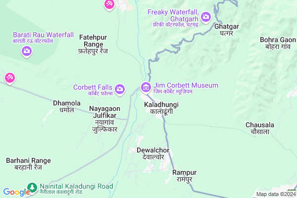
Chhoti Haldwani
Chhoti Haldwani Map
EDIT Map
Add Your House
 ..
..
Current Corona Virus Infected Patients Count in Nainital District
| City Name | District Name | Total Covid cases |
|---|---|---|
| Nainital District | Nainital | 10 |
Locality Name :
Chhoti Haldwani
( छोटी हल्द्वानी )
Block Name : Kotabag
District : Nainital
State : Uttarakhand
Language : Hindi and Urdu, Garhwali, Kumauni
Current Time 11:22 AM
Date: Monday , Apr 28,2025 (IST)
Time zone: IST (UTC+5:30)
Elevation / Altitude: 345 meters. Above Seal level
Telephone Code / Std Code: 05942
Assembly constituency : Kaladhungi assembly constituency
Assembly MLA : Banshidhar Bhagat
Lok Sabha constituency : Nainital-Udhamsingh Nagar parliamentary constituency
Parliament MP : Ajay Bhatt
Serpanch Name :
Pin Code : 263140
Post Office Name : Kaladhungi
Main Village Name : Chhoti Haldwani
Commodities Prices : Haldwani Market / Mandi
Chhoti Haldwani Live Weather
Temperature: 29.7 °C
clear sky
Humidity: 25%
Wind : 4.06 mt/sec towards SE
StationName : "Kaladhungi"
observed on 2 Hours Back
Temperature: 29.7 °C
clear sky
Humidity: 25%
Wind : 4.06 mt/sec towards SE
StationName : "Kaladhungi"
observed on 2 Hours Back
Chhoti Haldwani Weather Forecast for Next 5 days
29-04-2025
27.2°C to 38.3°C
clear sky, few clouds, overcast clouds
27.2°C to 38.3°C
clear sky, few clouds, overcast clouds
30-04-2025
24.7°C to 38.0°C
overcast clouds, broken clouds, scattered clouds, clear sky, few clouds
24.7°C to 38.0°C
overcast clouds, broken clouds, scattered clouds, clear sky, few clouds
01-05-2025
26.2°C to 37.9°C
overcast clouds, broken clouds, clear sky
26.2°C to 37.9°C
overcast clouds, broken clouds, clear sky
02-05-2025
22.7°C to 36.6°C
overcast clouds, broken clouds, scattered clouds, light rain
22.7°C to 36.6°C
overcast clouds, broken clouds, scattered clouds, light rain
03-05-2025
23.0°C to 36.9°C
light rain, overcast clouds, broken clouds, scattered clouds
23.0°C to 36.9°C
light rain, overcast clouds, broken clouds, scattered clouds
National Highways Reachable To Chhoti Haldwani
Nationa High Way :NH109
Nationa High Way :NH109
Rivers Near Chhoti Haldwani
Ratela Gad
Dabka River
Ratela Gad
Dabka River
About Chhoti Haldwani
Correct below Info and add more info about Chhoti HaldwaniChhoti Haldwani is a small Village/hamlet in Kotabag Block in Nainital District of Uttarakhand State, India. It comes under Chhoti Haldwani Panchayath. It is located 18 KM towards west from District head quarters Nainital. 13 KM from Kotabag. 199 KM from State capital Dehradun
Chhoti Haldwani Pin code is 263140 and postal head office is Kaladhungi .
Puranpur ( 5 KM ) , Kamola ( 6 KM ) , Dhamola ( 6 KM ) , Rampur ( 7 KM ) , Devi Rampur ( 7 KM ) are the nearby Villages to Chhoti Haldwani. Chhoti Haldwani is surrounded by Nainital Block towards East , Haldwani Block towards East , Bhimtal Block towards East , Bajpur Block towards west .
Nainital , Haldwani , Bazpur , Ramnagar are the near by Cities to Chhoti Haldwani.
Chhoti Haldwani 2011 Census Details
Chhoti Haldwani Local Language is Hindi. Chhoti Haldwani Village Total population is 779 and number of houses are 148. Female Population is 49.9%. Village literacy rate is 66.5% and the Female Literacy rate is 30.4%.
Population
| Census Parameter | Census Data |
| Total Population | 779 |
| Total No of Houses | 148 |
| Female Population % | 49.9 % ( 389) |
| Total Literacy rate % | 66.5 % ( 518) |
| Female Literacy rate | 30.4 % ( 237) |
| Scheduled Tribes Population % | 0.0 % ( 0) |
| Scheduled Caste Population % | 4.1 % ( 32) |
| Working Population % | 51.5 % |
| Child(0 -6) Population by 2011 | 116 |
| Girl Child(0 -6) Population % by 2011 | 45.7 % ( 53) |
Chhoti Haldwani Census More Deatils.
Politics in Chhoti Haldwani
BJP , BJP , INC are the major political parties in this area.Polling Stations /Booths near Chhoti Haldwani
1)Jitapur Negi2)Kaladhungi
3)Kaladhungi
4)Kaladhungi
5)Kaladhungi
HOW TO REACH Chhoti Haldwani
By Rail
There is no railway station near to Chhoti Haldwani in less than 10 km.Colleges near Chhoti Haldwani
Iti Maldhan Chaur No.1
Address :
G.i.c Betalghat
Address :
Shri Dhan Singh Negi G.i.c. Peora
Address : Peora
Govt. Inter College Dalkanya
Address :
Schools near Chhoti Haldwani
Rajiv Gandhi Navodaya Vidyalaya
Address : syat , kotabagh , nainital , Uttarakhand . PIN- 263159 , Post - Kotabagh
Univarsal Conv Sec School
Address : kaladhungi , kotabagh , nainital , Uttarakhand . PIN- 263140 , Post - Kaladhungi
Govt G I C Kaladhungi
Address : kaladhungi , kotabagh , nainital , Uttarakhand . PIN- 263140 , Post - Kaladhungi
Govt I C Bajoniyahaldu
Address : bajoniya haldu , kotabagh , nainital , Uttarakhand . PIN- 263159 , Post - Kotabagh
Govt Health Centers near Chhoti Haldwani
1) Pokhri , Sub Center , Pokhri , ANM Center2) Mangoli , Sub Center , Mangoli , ANM Center
3) Thapla , Sub Center , Thapla , ANM Center
Sub Villages in Chhoti Haldwani
Hospitals in Chhoti Haldwani,Kotabag
I Sight Super Specialty Eye Care Center
Above ICICI Bank; Thandi Sadak; Nainital Road; Haldwani; Haldwani; Uttarakhand 263139; India
1.1 KM distance Detail
Government Hospital Kaladhungi
Opposite Nagar Palika Complex Haldwani Road; KALADHUNGI; India
1.4 KM distance Detail
Titan Eye Plus
Teja Singh Bhasin & Bro; H.P Petrol Pump; Bhotia Paraw; Nainital Road; Haldwani; Haldwani; Uttarakhand 263139; India
2.3 KM distance Detail
more ..
Petrol Bunks in Chhoti Haldwani,Kotabag
Navdurga Service Station
Kaladhungi Ramnagar Highway Gupta Bagh Kaladhungi Bandobasti Kaladhungi; 263140; India
0.5 KM distance Detail
HP PETROL PUMP - PUNIAN FILLING STATION
Village Nayagaon Ramnagar Road Kaladhungi; Dehradun; 263140; India
2.6 KM distance Detail
more ..
Colleges in Chhoti Haldwani,Kotabag
Rajkiya Kanya Inter College
Ghat Garh; Nainital; SH-41; Haldwani Nainital Road; Nainital; Nainital; Uttarakhand 263140; India
1.2 KM distance Detail
Govt. Intermediate college Bajauniya haldu
Bajauniya Haldu; Uttarakhand 263159; India
8.9 KM distance Detail
more ..
Electronic Shops in Chhoti Haldwani,Kotabag
Dashmesh Electric Works And HS Electricals
Nainital Rd; Kaladungi; Uttarakhand 263140; India
0.9 KM distance Detail
Police Stations near Chhoti Haldwani,Kotabag
SSP NAINITAL
87; National Highway 87; Tallital; Nainital; Uttarakhand 263002; India
17.9 KM distance Detail
Governement Offices near Chhoti Haldwani,Kotabag
Collectorate Office Kaladhungi
Kaladungi; Nainital; SH-41; Haldwani Nainital Road; Nainital; Nainital; Uttarakhand 263139; India
0.1 KM distance Detail
Karyalaya Up Mandi Sthal
Kaladungi; Nainital; SH-41; Haldwani Nainital Road; Nainital; Nainital; Uttarakhand 263139; India
1.0 KM distance Detail
About Chhoti Haldwani &
History
How to reach Chhoti Haldwani
Tourist Places Near By Chhoti Haldwani
Schools in Chhoti Haldwani
Colleges in Chhoti Haldwani
Temperature & weather of Chhoti Haldwani
places in Chhoti Haldwani
Chhoti Haldwani photos
More Information
How to reach Chhoti Haldwani
Tourist Places Near By Chhoti Haldwani
Schools in Chhoti Haldwani
Colleges in Chhoti Haldwani
Temperature & weather of Chhoti Haldwani
places in Chhoti Haldwani
Chhoti Haldwani photos
More Information
Village Talk
Post News or Events about this Village
Near Cities
Nainital 17 KM near
Haldwani 22 KM near
Bazpur 24 KM near
Ramnagar 26 KM near
Nainital 17 KM near
Haldwani 22 KM near
Bazpur 24 KM near
Ramnagar 26 KM near
Near By Taluks
Kotabag 13 KM near
Nainital 17 KM near
Haldwani 23 KM near
Bajpur 23 KM near
Kotabag 13 KM near
Nainital 17 KM near
Haldwani 23 KM near
Bajpur 23 KM near
Near By Air Ports
Pantnagar Airport 35 KM near
Muzaffarnagar Airport 182 KM near
Dehra Dun Airport 190 KM near
Indira Gandhi International Airport 260 KM near
Pantnagar Airport 35 KM near
Muzaffarnagar Airport 182 KM near
Dehra Dun Airport 190 KM near
Indira Gandhi International Airport 260 KM near
Near By Tourist Places
Nainital 17 KM near
Jeolikot 18 KM near
Sattal 21 KM near
Kathgodam 22 KM near
Bhowali 22 KM near
Nainital 17 KM near
Jeolikot 18 KM near
Sattal 21 KM near
Kathgodam 22 KM near
Bhowali 22 KM near
Near By Districts
Nainital 17 KM near
Udam Singh Nagar 39 KM near
Almora 51 KM near
Rampur 69 KM near
Nainital 17 KM near
Udam Singh Nagar 39 KM near
Almora 51 KM near
Rampur 69 KM near
Near By RailWay Station
Kathgodam Rail Way Station 22 KM near
Haldwani Rail Way Station 22 KM near
Kathgodam Rail Way Station 22 KM near
Haldwani Rail Way Station 22 KM near