| Home | City Bus | Maps | Villages | Cities | Rail | Tourist Places | School | College | Pin Codes | Corona Cases Count |
| Distance Calculator Bus Services IFSC Codes Trace Mobile Number Weather Search Place Trace IP Available Cash ATM/Banks Locate Polling Booth Report an Error contact People |
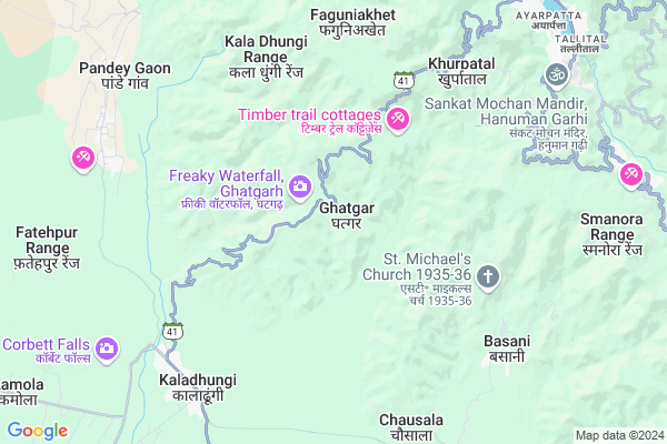
Ghatgar
Ghatgar Map
EDIT Map
Add Your House
 ..
..
Current Corona Virus Infected Patients Count in Nainital District
| City Name | District Name | Total Covid cases |
|---|---|---|
| Nainital District | Nainital | 10 |
Locality Name :
Ghatgar
( घटगर )
Block Name : Bhimtal
District : Nainital
State : Uttarakhand
Language : Hindi and Urdu, Garhwali, Kumauni
Current Time 01:55 AM
Date: Saturday , Apr 26,2025 (IST)
Time zone: IST (UTC+5:30)
Elevation / Altitude: 520 meters. Above Seal level
Telephone Code / Std Code: 05942
Assembly constituency : Nainital assembly constituency
Assembly MLA : Sarita Arya
Lok Sabha constituency : Nainital-Udhamsingh Nagar parliamentary constituency
Parliament MP : Ajay Bhatt
Serpanch Name :
Pin Code : 263001
Post Office Name : Pangoot
Main Village Name : Ghatgar
Commodities Prices : Haldwani Market / Mandi
Ghatgar Live Weather
Temperature: 23.8 °C
scattered clouds
Humidity: 10%
Wind : 3.3 mt/sec towards NE
StationName : "Kaladhungi"
observed on Now
Temperature: 23.8 °C
scattered clouds
Humidity: 10%
Wind : 3.3 mt/sec towards NE
StationName : "Kaladhungi"
observed on Now
Ghatgar Weather Forecast for Next 5 days
26-04-2025
21.6°C to 21.6°C
scattered clouds
21.6°C to 21.6°C
scattered clouds
27-04-2025
20.4°C to 35.1°C
scattered clouds, broken clouds, overcast clouds
20.4°C to 35.1°C
scattered clouds, broken clouds, overcast clouds
28-04-2025
21.8°C to 34.1°C
broken clouds, overcast clouds
21.8°C to 34.1°C
broken clouds, overcast clouds
29-04-2025
21.4°C to 34.8°C
broken clouds, scattered clouds, overcast clouds, clear sky
21.4°C to 34.8°C
broken clouds, scattered clouds, overcast clouds, clear sky
30-04-2025
20.8°C to 33.8°C
clear sky, broken clouds, scattered clouds, light rain, overcast clouds
20.8°C to 33.8°C
clear sky, broken clouds, scattered clouds, light rain, overcast clouds
Edit below overview about Ghatgar
Edit below overview about Ghatgar
OverView of Ghatgar
92 birds Spices Recored In ghatgarh Nainital.best time for Bird watching is early morning.Now you can stay here. in ghatgarh there is lots of Spaces to stay in ghatgarh. eg. The Gauri Retreat, Camp Site and few about to comeEdit below overview about Ghatgar
National Highways Reachable To Ghatgar
Nationa High Way :NH109
Nationa High Way :NH109
Rivers Near Ghatgar
Kundal Gad
Kosi
Kundal Gad
Kosi
About Ghatgar
Ghatgar is a small Village/hamlet in Bhimtal Block in Nainital District of Uttarakhand State, India. It comes under Ghatgar Panchayath. It is located 10 KM towards west from District head quarters Nainital. 18 KM from Bhimtal. 200 KM from State capital Dehradun
Ghatgar Pin code is 263001 and postal head office is Pangoot.
Bajoon ( 5 KM ) , Jalal Gaon ( 5 KM ) , Devidhura ( 6 KM ) , Basani ( 7 KM ) , Kaladungi Bandobasti ( 8 KM ) are the nearby Villages to Ghatgar. Ghatgar is surrounded by Kotabag Block towards west , Bhimtal Block towards East , Haldwani Block towards South , Betalghat Block towards North .
Nainital , Haldwani , Ramnagar , Bazpur are the near by Cities to Ghatgar.
Ghatgar 2011 Census Details
Ghatgar Local Language is Hindi. Ghatgar Village Total population is 93 and number of houses are 18. Female Population is 52.7%. Village literacy rate is 87.1% and the Female Literacy rate is 43.0%.
Population
| Census Parameter | Census Data |
| Total Population | 93 |
| Total No of Houses | 18 |
| Female Population % | 52.7 % ( 49) |
| Total Literacy rate % | 87.1 % ( 81) |
| Female Literacy rate | 43.0 % ( 40) |
| Scheduled Tribes Population % | 0.0 % ( 0) |
| Scheduled Caste Population % | 0.0 % ( 0) |
| Working Population % | 33.3 % |
| Child(0 -6) Population by 2011 | 7 |
| Girl Child(0 -6) Population % by 2011 | 57.1 % ( 4) |
Ghatgar Census More Deatils.
Politics in Ghatgar
BJP , UKKD , BJP , INC are the major political parties in this area.Polling Stations /Booths near Ghatgar
1)Mallisethi2)Naisela
3)Thapla
4)Bajedai
5)Reechi Naya Bhawan
HOW TO REACH Ghatgar
By Rail
There is no railway station near to Ghatgar in less than 10 km.Colleges near Ghatgar
Iti Maldhan Chaur No.1
Address :
G.i.c Betalghat
Address :
Shri Dhan Singh Negi G.i.c. Peora
Address : Peora
Govt. Inter College Dalkanya
Address :
Schools in Ghatgar
P S Ghatgar
Address : ghatgar , bheemtal , nainital , Uttarakhand . PIN- 263001
Govt Health Centers near Ghatgar
1) Mangoli , Sub Center , Mangoli , ANM Center2) Thapla , Sub Center , Thapla , ANM Center
3) Devidhura , Sub Center , Devidhura , ANM Center
Sub Villages in Ghatgar
Hospitals in Ghatgar,Bhimtal
Government Hospital Kaladhungi
Opposite Nagar Palika Complex Haldwani Road; KALADHUNGI; India
7.6 KM distance Detail
I Sight Super Specialty Eye Care Center
Above ICICI Bank; Thandi Sadak; Nainital Road; Haldwani; Haldwani; Uttarakhand 263139; India
7.9 KM distance Detail
more ..
Petrol Bunks in Ghatgar,Bhimtal
Navdurga Service Station
Kaladhungi Ramnagar Highway Gupta Bagh Kaladhungi Bandobasti Kaladhungi; 263140; India
7.5 KM distance Detail
Petrol Station Sukhatal
Nainital - Kaladungi Rd; Sherwani; Nainital; Uttarakhand 263002; India
10.3 KM distance Detail
more ..
Colleges in Ghatgar,Bhimtal
Rajkiya Kanya Inter College
Ghat Garh; Nainital; SH-41; Haldwani Nainital Road; Nainital; Nainital; Uttarakhand 263140; India
7.6 KM distance Detail
Govt. Intermediate college Bajauniya haldu
Bajauniya Haldu; Uttarakhand 263159; India
8.9 KM distance Detail
more ..
Schools in Ghatgar,Bhimtal
Govt. Polytechnic Kaladhungi
near post office; Kaladhungi; Uttarakhand 263140; India
7.2 KM distance Detail
Saraswati Shishu Mandir
Ghat Garh; Nainital; SH-41; Haldwani Nainital Road; Nainital; Nainital; Uttarakhand 263139; India
7.5 KM distance Detail
Universal Convent Senior Secondary School
Kaladhungi; Uttarakhand 263140; India
7.6 KM distance Detail
Electronic Shops in Ghatgar,Bhimtal
krishna all moile servic senter and software and anluck
Kaladhungi; Uttarakhand 263140; India
7.5 KM distance Detail
Police Stations near Ghatgar,Bhimtal
SSP NAINITAL
87; National Highway 87; Tallital; Nainital; Uttarakhand 263002; India
10.2 KM distance Detail
Karyalay Varisht Police Adhishak
87; National Highway 87; Tallital; Nainital; Uttarakhand 263002; India
10.3 KM distance Detail
Governement Offices near Ghatgar,Bhimtal
Collectorate Office Kaladhungi
Kaladungi; Nainital; SH-41; Haldwani Nainital Road; Nainital; Nainital; Uttarakhand 263139; India
7.6 KM distance Detail
Karyalaya Up Mandi Sthal
Kaladungi; Nainital; SH-41; Haldwani Nainital Road; Nainital; Nainital; Uttarakhand 263139; India
7.6 KM distance Detail
About Ghatgar &
History
How to reach Ghatgar
Tourist Places Near By Ghatgar
Schools in Ghatgar
Colleges in Ghatgar
Temperature & weather of Ghatgar
places in Ghatgar
Ghatgar photos
More Information
How to reach Ghatgar
Tourist Places Near By Ghatgar
Schools in Ghatgar
Colleges in Ghatgar
Temperature & weather of Ghatgar
places in Ghatgar
Ghatgar photos
More Information
Village Talk
Post News or Events about this Village
Near Cities
Nainital 10 KM near
Haldwani 19 KM near
Ramnagar 29 KM near
Bazpur 31 KM near
Nainital 10 KM near
Haldwani 19 KM near
Ramnagar 29 KM near
Bazpur 31 KM near
Near By Taluks
Nainital 10 KM near
Kotabag 11 KM near
Bhimtal 17 KM near
Haldwani 22 KM near
Nainital 10 KM near
Kotabag 11 KM near
Bhimtal 17 KM near
Haldwani 22 KM near
Near By Air Ports
Pantnagar Airport 38 KM near
Muzaffarnagar Airport 187 KM near
Dehra Dun Airport 191 KM near
Indira Gandhi International Airport 267 KM near
Pantnagar Airport 38 KM near
Muzaffarnagar Airport 187 KM near
Dehra Dun Airport 191 KM near
Indira Gandhi International Airport 267 KM near
Near By Tourist Places
Nainital 10 KM near
Jeolikot 11 KM near
Sattal 15 KM near
Bhowali 15 KM near
Kathgodam 18 KM near
Nainital 10 KM near
Jeolikot 11 KM near
Sattal 15 KM near
Bhowali 15 KM near
Kathgodam 18 KM near
Near By Districts
Nainital 10 KM near
Udam Singh Nagar 43 KM near
Almora 44 KM near
Bageshwar 75 KM near
Nainital 10 KM near
Udam Singh Nagar 43 KM near
Almora 44 KM near
Bageshwar 75 KM near
Near By RailWay Station
Kathgodam Rail Way Station 18 KM near
Haldwani Rail Way Station 21 KM near
Kathgodam Rail Way Station 18 KM near
Haldwani Rail Way Station 21 KM near