| Home | City Bus | Maps | Villages | Cities | Rail | Tourist Places | School | College | Pin Codes | Corona Cases Count |
| Distance Calculator Bus Services IFSC Codes Trace Mobile Number Weather Search Place Trace IP Available Cash ATM/Banks Locate Polling Booth Report an Error contact People |
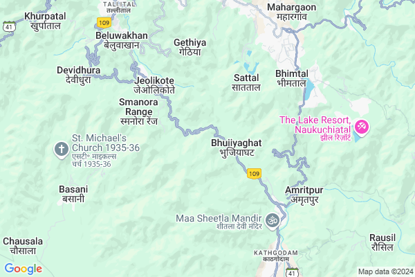
Dolmar
Dolmar Map
EDIT Map
Add Your House
 ..
..
Current Corona Virus Infected Patients Count in Nainital District
| City Name | District Name | Total Covid cases |
|---|---|---|
| Nainital District | Nainital | 10 |
Locality Name :
Dolmar
( डोलमार )
Block Name : Bhimtal
District : Nainital
State : Uttarakhand
Language : Hindi and Urdu, Garhwali, Kumauni
Current Time 01:47 AM
Date: Saturday , Apr 26,2025 (IST)
Time zone: IST (UTC+5:30)
Elevation / Altitude: 520 meters. Above Seal level
Telephone Code / Std Code: 05942
Assembly constituency : Nainital assembly constituency
Assembly MLA : Sarita Arya
Lok Sabha constituency : Nainital-Udhamsingh Nagar parliamentary constituency
Parliament MP : Ajay Bhatt
Serpanch Name :
Main Village Name : Dolmar
Commodities Prices : Haldwani Market / Mandi
Dolmar Live Weather
Temperature: 20.7 °C
scattered clouds
Humidity: 10%
Wind : 3.55 mt/sec towards NE
StationName : "BhÄ«m TÄ\u0081l"
observed on Now
Temperature: 20.7 °C
scattered clouds
Humidity: 10%
Wind : 3.55 mt/sec towards NE
StationName : "BhÄ«m TÄ\u0081l"
observed on Now
Dolmar Weather Forecast for Next 5 days
26-04-2025
22.0°C to 22.0°C
scattered clouds
22.0°C to 22.0°C
scattered clouds
27-04-2025
21.2°C to 35.3°C
scattered clouds, broken clouds, overcast clouds
21.2°C to 35.3°C
scattered clouds, broken clouds, overcast clouds
28-04-2025
22.7°C to 34.4°C
broken clouds, overcast clouds
22.7°C to 34.4°C
broken clouds, overcast clouds
29-04-2025
22.3°C to 34.8°C
broken clouds, scattered clouds, overcast clouds, clear sky
22.3°C to 34.8°C
broken clouds, scattered clouds, overcast clouds, clear sky
30-04-2025
21.2°C to 33.8°C
clear sky, overcast clouds, broken clouds, light rain
21.2°C to 33.8°C
clear sky, overcast clouds, broken clouds, light rain
National Highways Reachable To Dolmar
Nationa High Way :NH109
Nationa High Way :NH109
Rivers Near Dolmar
Kundal Gad
Kosi
Kundal Gad
Kosi
About Dolmar
Correct below Info and add more info about DolmarDolmar is a small Village/hamlet in Bhimtal Block in Nainital District of Uttarakhand State, India. It comes under Dolmar Panchayath. It is located 9 KM towards South from District head quarters Nainital. 5 KM from Bhimtal. 211 KM from State capital Dehradun
Jantwal Gaon ( 4 KM ) , Surya Gaon ( 4 KM ) , Kuriyagaon ( 5 KM ) , Bhimtal ( 5 KM ) , Ranibag ( 5 KM ) are the nearby Villages to Dolmar. Dolmar is surrounded by Nainital Block towards North , Dhari Block towards East , Haldwani Block towards South , Kotabag Block towards west .
Nainital , Haldwani , Almora , Nagla are the near by Cities to Dolmar.
Dolmar 2011 Census Details
Dolmar Local Language is Hindi. Dolmar Village Total population is 221 and number of houses are 48. Female Population is 49.3%. Village literacy rate is 76.9% and the Female Literacy rate is 34.8%.
Population
| Census Parameter | Census Data |
| Total Population | 221 |
| Total No of Houses | 48 |
| Female Population % | 49.3 % ( 109) |
| Total Literacy rate % | 76.9 % ( 170) |
| Female Literacy rate | 34.8 % ( 77) |
| Scheduled Tribes Population % | 0.0 % ( 0) |
| Scheduled Caste Population % | 0.0 % ( 0) |
| Working Population % | 38.0 % |
| Child(0 -6) Population by 2011 | 28 |
| Girl Child(0 -6) Population % by 2011 | 46.4 % ( 13) |
Dolmar Census More Deatils.
Politics in Dolmar
BJP , UKKD , BJP , INC are the major political parties in this area.Polling Stations /Booths near Dolmar
1)Jituvapipal2)Jyolikot
3)Chhada
4)Gauna
5)Tikuri
HOW TO REACH Dolmar
By Rail
Kathgodam Rail Way Station is the very nearby railway stations to Dolmar.Pincodes near Dolmar
263127 ( Jeolikote ) , 263126 ( Kathgodam ) , 263156 ( Ghorakhal )Colleges near Dolmar
Iti Maldhan Chaur No.1
Address :
G.i.c Betalghat
Address :
Shri Dhan Singh Negi G.i.c. Peora
Address : Peora
Govt. Inter College Dalkanya
Address :
Schools near Dolmar
Central School
Address : bheemtaal , bheemtal , nainital , Uttarakhand . PIN- 263136 , Post - Bhimtal
Lee Pant I College Bheemtal
Address : bheemtaal , bheemtal , nainital , Uttarakhand . PIN- 263136 , Post - Bhimtal
J H S Bhorsa
Address : bhorsa , bheemtal , nainital , Uttarakhand . PIN- 263126 , Post - Kathgodam
Govt Jhs Ranibagh
Address : ranibagh , bheemtal , nainital , Uttarakhand . PIN- 263126 , Post - Kathgodam
Govt Health Centers near Dolmar
1) Jyolikot , Sub Center , Jeolikot , ANM Center2) Jyolikot PHC , PHC , Jeolikot , Jeolikot
3) Gethiya , Sub Center , Gethiya , ANM Center
Sub Villages in Dolmar
Hospitals in Dolmar,Bhimtal
Life Care Pathology Lab
Bareilly - Nainital Rd; Jeolikote; Uttarakhand 263127; India
4.4 KM distance Detail
more ..
Petrol Bunks in Dolmar,Bhimtal
NAINI FILLING STATION
NAINITAL ROAD JEOLIKOT NAINITAL; UTTRAKHAND; Uttarakhand 263126; India
3.8 KM distance Detail
Indian Oil Petrol Pump
Thandi Rd; Tallital; Nainital; Uttarakhand 263002; India
9.5 KM distance Detail
more ..
Colleges in Dolmar,Bhimtal
Don Bosco Girls College
Aam Parao; Chopra; Nainital; Uttarakhand 263127; India
2.2 KM distance Detail
NAINCY COLLEGE OF HOTEL MANAGEMENT
Naincy Campus; Jeolikote; Nainital; Uttarakhand 263127; India
4.0 KM distance Detail
Dept. of Biotechnology (K.U)
Kuyatal; Block Road Area; Gair Banelia; Uttarakhand 263136; India
6.1 KM distance Detail
more ..
Schools in Dolmar,Bhimtal
Siddharth Public School
Nainital-Jeliokot-Haldwani Rd; Chopra; Uttarakhand 263127; India
1.0 KM distance Detail
Don Bosco Public School
Dogaon; Post Office Dogra; NH 87; Uttarakhand 263139; India
1.1 KM distance Detail
Green Mount Global School
Bhowali-Bhimtal-Haldwani Rd; Smanora Range; Uttarakhand 263136; India
3.8 KM distance Detail
Electronic Shops in Dolmar,Bhimtal
Saqleini Auto Sarvice Sentar
Mahragaon Chauhan Ghat; Uttarakhand 263136; India
6.4 KM distance Detail
Super Markets in Dolmar,Bhimtal
Sah General Store
Bhowali-Bhimtal-Haldwani Rd; Bhimtal; Uttarakhand 263136; India
6.5 KM distance Detail
zishan and kayyum trading company
Daa; Sanguri Gaon; Uttarakhand 263136; India
6.7 KM distance Detail
Local Parks in Dolmar,Bhimtal
YMCA Campsite Sattal
YMCA Campsite Sattal Mehragaon; Uttarakhand 263132; India
4.2 KM distance Detail
Police Stations near Dolmar,Bhimtal
Police Chowki Mullah Kathgodam
NH-87; Kathgodam; Haldwani; Uttarakhand 263126; India
7.4 KM distance Detail
Governement Offices near Dolmar,Bhimtal
Police Control Room
Nainital Rd; Tallital; Nainital; Uttarakhand 263002; India
8.8 KM distance Detail
About Dolmar &
History
How to reach Dolmar
Tourist Places Near By Dolmar
Schools in Dolmar
Colleges in Dolmar
Temperature & weather of Dolmar
places in Dolmar
Dolmar photos
More Information
How to reach Dolmar
Tourist Places Near By Dolmar
Schools in Dolmar
Colleges in Dolmar
Temperature & weather of Dolmar
places in Dolmar
Dolmar photos
More Information
Village Talk
Post News or Events about this Village
Near Cities
Nainital 8 KM near
Haldwani 10 KM near
Almora 38 KM near
Nagla 38 KM near
Nainital 8 KM near
Haldwani 10 KM near
Almora 38 KM near
Nagla 38 KM near
Near By Taluks
Bhimtal 5 KM near
Nainital 9 KM near
Dhari 17 KM near
Haldwani 17 KM near
Bhimtal 5 KM near
Nainital 9 KM near
Dhari 17 KM near
Haldwani 17 KM near
Near By Air Ports
Pantnagar Airport 36 KM near
Muzaffarnagar Airport 200 KM near
Dehra Dun Airport 202 KM near
Indira Gandhi International Airport 279 KM near
Pantnagar Airport 36 KM near
Muzaffarnagar Airport 200 KM near
Dehra Dun Airport 202 KM near
Indira Gandhi International Airport 279 KM near
Near By Tourist Places
Sattal 4 KM near
Bhimtal 5 KM near
Kathgodam 7 KM near
Bhowali 7 KM near
Nainital 9 KM near
Sattal 4 KM near
Bhimtal 5 KM near
Kathgodam 7 KM near
Bhowali 7 KM near
Nainital 9 KM near
Near By Districts
Nainital 8 KM near
Almora 38 KM near
Udam Singh Nagar 44 KM near
Champawat 64 KM near
Nainital 8 KM near
Almora 38 KM near
Udam Singh Nagar 44 KM near
Champawat 64 KM near
Near By RailWay Station
Kathgodam Rail Way Station 8.1 KM near
Haldwani Rail Way Station 13 KM near
Kathgodam Rail Way Station 8.1 KM near
Haldwani Rail Way Station 13 KM near