| Home | City Bus | Maps | Villages | Cities | Rail | Tourist Places | School | College | Pin Codes | Corona Cases Count |
| Distance Calculator Bus Services IFSC Codes Trace Mobile Number Weather Search Place Trace IP Available Cash ATM/Banks Locate Polling Booth Report an Error contact People |
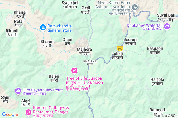
Chhara
Chhara Map
EDIT Map
Add Your House
 ..
..
Current Corona Virus Infected Patients Count in Nainital District
| City Name | District Name | Total Covid cases |
|---|---|---|
| Nainital District | Nainital | 10 |
Locality Name :
Chhara
( छारा )
Block Name : Betalghat
District : Nainital
State : Uttarakhand
Language : Hindi and Urdu, Garhwali, Kumauni
Current Time 01:16 PM
Date: Sunday , Apr 27,2025 (IST)
Time zone: IST (UTC+5:30)
Elevation / Altitude: 345 meters. Above Seal level
Telephone Code / Std Code: 05966
Assembly constituency : Ranikhet assembly constituency
Assembly MLA : Pramod Nainwal
Lok Sabha constituency : Almora parliamentary constituency
Parliament MP : Ajay Tamta
Serpanch Name :
Main Village Name : Chhara
Commodities Prices : Haldwani Market / Mandi
Chhara Live Weather
Temperature: 28.6 °C
overcast clouds
Humidity: 15%
Wind : 2.13 mt/sec towards S
StationName : "Nainital"
observed on Now
Temperature: 28.6 °C
overcast clouds
Humidity: 15%
Wind : 2.13 mt/sec towards S
StationName : "Nainital"
observed on Now
Chhara Weather Forecast for Next 5 days
28-04-2025
20.2°C to 30.2°C
overcast clouds, scattered clouds
20.2°C to 30.2°C
overcast clouds, scattered clouds
29-04-2025
19.0°C to 33.3°C
broken clouds, clear sky, overcast clouds
19.0°C to 33.3°C
broken clouds, clear sky, overcast clouds
30-04-2025
19.1°C to 33.3°C
broken clouds, few clouds, scattered clouds, overcast clouds
19.1°C to 33.3°C
broken clouds, few clouds, scattered clouds, overcast clouds
01-05-2025
16.9°C to 33.0°C
scattered clouds, clear sky, overcast clouds, broken clouds
16.9°C to 33.0°C
scattered clouds, clear sky, overcast clouds, broken clouds
02-05-2025
17.2°C to 31.5°C
broken clouds, few clouds, clear sky, light rain, moderate rain
17.2°C to 31.5°C
broken clouds, few clouds, clear sky, light rain, moderate rain
National Highways Reachable To Chhara
Nationa High Way :NH309A
Nationa High Way :NH309A
Rivers Near Chhara
Kosi
That Gad
Kosi
That Gad
About Chhara
Correct below Info and add more info about ChharaChhara is a small Village/hamlet in Betalghat Block in Nainital District of Uttarakhand State, India. It comes under Chhara Panchayath. It is located 15 KM towards North from District head quarters Nainital. 9 KM from Betalghat. 195 KM from State capital Dehradun
Siltona ( 2 KM ) , Seem ( 2 KM ) , Lohali ( 3 KM ) , Bargal ( 4 KM ) , Hali ( 4 KM ) are the nearby Villages to Chhara. Chhara is surrounded by Ramgarh Block towards East , Nainital Block towards South , Tarikhet Block towards North , Dhari Block towards East .
Nainital , Almora , Haldwani , Ramnagar are the near by Cities to Chhara.
This Place is in the border of the Nainital District and Almora District. Almora District Tarikhet is North towards this place .
Chhara 2011 Census Details
Chhara Local Language is Hindi. Chhara Village Total population is 1564 and number of houses are 382. Female Population is 46.7%. Village literacy rate is 77.4% and the Female Literacy rate is 34.0%.
Population
| Census Parameter | Census Data |
| Total Population | 1564 |
| Total No of Houses | 382 |
| Female Population % | 46.7 % ( 731) |
| Total Literacy rate % | 77.4 % ( 1210) |
| Female Literacy rate | 34.0 % ( 531) |
| Scheduled Tribes Population % | 0.6 % ( 10) |
| Scheduled Caste Population % | 16.9 % ( 265) |
| Working Population % | 37.0 % |
| Child(0 -6) Population by 2011 | 203 |
| Girl Child(0 -6) Population % by 2011 | 44.3 % ( 90) |
Chhara Census More Deatils.
Politics in Chhara
INC , BJP , INC are the major political parties in this area.Polling Stations /Booths near Chhara
1)Visona2)Chamdoli Bagauti
3)Pastaudawar
4)Raghulipipal
5)Khuredi
HOW TO REACH Chhara
By Rail
There is no railway station near to Chhara in less than 10 km.Pincodes near Chhara
263135 ( Garampani ) , 263158 ( Narain Swamy Ashram ) , 263137 ( Ramgarh (Nainital) )Colleges near Chhara
G.i.c Betalghat
Address :
Schools near Chhara
Govt J H S Dhniyakot
Address : dhaniyakot , betaalghat , nainital , Uttarakhand . PIN- 263135 , Post - Garampani
J H S Unchakot
Address : unchakot , betaalghat , nainital , Uttarakhand . PIN- 263134 , Post - Betalghat
Govt Girls I C Betalghat
Address : betaalghat , betaalghat , nainital , Uttarakhand . PIN- 263134 , Post - Betalghat
Govt I C Lohali
Address : lohali2 , betaalghat , nainital , Uttarakhand . PIN- 263135 , Post - Garampani
Govt Health Centers near Chhara
1) Garampani CHC , CHC , Garampani , Kharna2) Garampani , Sub Center , Garampani Kharna , Kharna
3) Lohali , Sub Center , Lohali , ANM Center
Sub Villages in Chhara
Hospitals in Chhara,Betalghat
Government Hospital Garampani; Nainital Uttarakhand
garampani;; Uttarakhand; India
0.6 KM distance Detail
more ..
Petrol Bunks in Chhara,Betalghat
Indian Oil Petrol Pump
Nainital - Kaladungi Rd; Ayarpatta; Nainital; Uttarakhand 263002; India
14.5 KM distance Detail
Petrol Station Sukhatal
Nainital - Kaladungi Rd; Sherwani; Nainital; Uttarakhand 263002; India
14.5 KM distance Detail
Indian Oil Petrol Pump
Thandi Rd; Tallital; Nainital; Uttarakhand 263002; India
15.7 KM distance Detail
more ..
Colleges in Chhara,Betalghat
GB Pant Government Inter College
Khairna; Bhowali-Ranikhet Rd; Chhara; Uttarakhand 263135; India
0.7 KM distance Detail
Government Inter College
Kaichi - Ramgarh Road; Ramgarh; Uttarakhand 263137; India
11.6 KM distance Detail
more ..
Schools in Chhara,Betalghat
Saraswati Shishu Mandir; Garampani
Saraswati Shishu mandir; garampani; Nainital; Uttarakhand; India
0.8 KM distance Detail
Local Parks in Chhara,Betalghat
LION'S BRAND PEACH GARDEN (SHER SINGH MER )
Bhowali Range; Uttarakhand 263137; India
12.4 KM distance Detail
Police Stations near Chhara,Betalghat
Police Chowki Mallitaal
Mall Rd; Mallital; Nainital; Uttarakhand 263001; India
14.4 KM distance Detail
Police Station
Bada-Bazzar Connecting Rd; Mallital; Nainital; Uttarakhand 263001; India
14.5 KM distance Detail
Governement Offices near Chhara,Betalghat
Uttarakhand State Legal Services Authority
A.D.R Centre High Court; Nainital; Uttarakhand; India
14.0 KM distance Detail
About Chhara &
History
How to reach Chhara
Tourist Places Near By Chhara
Schools in Chhara
Colleges in Chhara
Temperature & weather of Chhara
places in Chhara
Chhara photos
More Information
How to reach Chhara
Tourist Places Near By Chhara
Schools in Chhara
Colleges in Chhara
Temperature & weather of Chhara
places in Chhara
Chhara photos
More Information
Village Talk
Post News or Events about this Village
Near Cities
Nainital 15 KM near
Almora 22 KM near
Haldwani 33 KM near
Ramnagar 40 KM near
Nainital 15 KM near
Almora 22 KM near
Haldwani 33 KM near
Ramnagar 40 KM near
Near By Taluks
Betalghat 8 KM near
Ramgarh 12 KM near
Nainital 14 KM near
Tarikhet 17 KM near
Betalghat 8 KM near
Ramgarh 12 KM near
Nainital 14 KM near
Tarikhet 17 KM near
Near By Air Ports
Pantnagar Airport 58 KM near
Dehra Dun Airport 186 KM near
Muzaffarnagar Airport 196 KM near
Indira Gandhi International Airport 284 KM near
Pantnagar Airport 58 KM near
Dehra Dun Airport 186 KM near
Muzaffarnagar Airport 196 KM near
Indira Gandhi International Airport 284 KM near
Near By Tourist Places
Ramgarh 9 KM near
Jeolikot 13 KM near
Nainital 15 KM near
Bhowali 15 KM near
Mukteshwar 18 KM near
Ramgarh 9 KM near
Jeolikot 13 KM near
Nainital 15 KM near
Bhowali 15 KM near
Mukteshwar 18 KM near
Near By Districts
Nainital 15 KM near
Almora 22 KM near
Bageshwar 52 KM near
Udam Singh Nagar 65 KM near
Nainital 15 KM near
Almora 22 KM near
Bageshwar 52 KM near
Udam Singh Nagar 65 KM near
Near By RailWay Station
Kathgodam Rail Way Station 30 KM near
Haldwani Rail Way Station 35 KM near
Kathgodam Rail Way Station 30 KM near
Haldwani Rail Way Station 35 KM near