| Home | City Bus | Maps | Villages | Cities | Rail | Tourist Places | School | College | Pin Codes | Corona Cases Count |
| Distance Calculator Bus Services IFSC Codes Trace Mobile Number Weather Search Place Trace IP Available Cash ATM/Banks Locate Polling Booth Report an Error contact People |
Indarwada
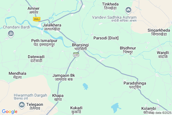
Indarwada Map
EDIT Map
Add Your House
 ..
..
Current Corona Virus Infected Patients Count in Nagpur District
| City Name | District Name | Total Covid cases |
|---|---|---|
| Nagpur | Nagpur | 51 |
| Nagpur District | Nagpur | 36 |
| Nagpur Rural | Nagpur | 6 |
Locality Name :
Indarwada
( इंदरवाडा )
Taluka Name : Narkhed
District : Nagpur
State : Maharashtra
Region : Vidarbh
Division : Nagpur
Language : Marathi and Hindi, English
Current Time 01:37 AM
Date: Wednesday , Apr 30,2025 (IST)
Time zone: IST (UTC+5:30)
Elevation / Altitude: 411 meters. Above Seal level
Telephone Code / Std Code: 07105
Assembly constituency : Katol assembly constituency
Assembly MLA : Anil Deshmukh
Lok Sabha constituency : Ramtek parliamentary constituency
Parliament MP : Krupal Balaji Tumane
Serpanch Name :
Pin Code : 441305
Post Office Name : Paradsinga
Main Village Name : Indarwada
Commodities Prices : Narkhed Market / Mandi
Indarwada Live Weather
Temperature: 31.2 °C
broken clouds
Humidity: 32%
Wind : 3.24 mt/sec towards E
StationName : "MowÄ\u0081d"
observed on 1 Hours Back
Temperature: 31.2 °C
broken clouds
Humidity: 32%
Wind : 3.24 mt/sec towards E
StationName : "MowÄ\u0081d"
observed on 1 Hours Back
Indarwada Weather Forecast for Next 5 days
30-04-2025
30.3°C to 31.9°C
broken clouds
30.3°C to 31.9°C
broken clouds
01-05-2025
29.0°C to 42.9°C
scattered clouds, clear sky, few clouds, overcast clouds
29.0°C to 42.9°C
scattered clouds, clear sky, few clouds, overcast clouds
02-05-2025
29.6°C to 42.4°C
broken clouds, few clouds, clear sky, scattered clouds
29.6°C to 42.4°C
broken clouds, few clouds, clear sky, scattered clouds
03-05-2025
29.4°C to 42.2°C
scattered clouds, clear sky, broken clouds
29.4°C to 42.2°C
scattered clouds, clear sky, broken clouds
04-05-2025
28.7°C to 43.1°C
broken clouds, clear sky, few clouds, overcast clouds, light rain
28.7°C to 43.1°C
broken clouds, clear sky, few clouds, overcast clouds, light rain
Rivers Near Indarwada
Kar
Jam
Kar
Jam
About Indarwada
Correct below Info and add more info about IndarwadaIndarwada is a small Village/hamlet in Narkhed Taluka in Nagpur District of Maharashtra State, India. It comes under Indarwada Panchayath. It belongs to Vidarbh region . It belongs to Nagpur Division . It is located 80 KM towards west from District head quarters Nagpur. 4 KM from Narkhed. 748 KM from State capital Mumbai
Indarwada Pin code is 441305 and postal head office is Paradsinga .
Rohna ( 2 KM ) , Jalalkheda ( 6 KM ) , Thaturwada ( 6 KM ) , Umtha ( 6 KM ) , Khapa(gu) ( 6 KM ) are the nearby Villages to Indarwada. Indarwada is surrounded by Katol Taluka towards East , Warud Taluka towards west , Karanja Taluka towards South , Pandhurna Taluka towards North .
Narkhed , Warud , Shendurjana , Pandhurna are the near by Cities to Indarwada.
This Place is in the border of the Nagpur District and Chhindwara District. Chhindwara District Pandhurna is North towards this place . It is near to the Madhya Pradesh State Border.
Indarwada 2011 Census Details
Indarwada Local Language is Marathi. Indarwada Village Total population is 553 and number of houses are 142. Female Population is 52.6%. Village literacy rate is 74.7% and the Female Literacy rate is 36.5%.
Population
| Census Parameter | Census Data |
| Total Population | 553 |
| Total No of Houses | 142 |
| Female Population % | 52.6 % ( 291) |
| Total Literacy rate % | 74.7 % ( 413) |
| Female Literacy rate | 36.5 % ( 202) |
| Scheduled Tribes Population % | 9.0 % ( 50) |
| Scheduled Caste Population % | 27.1 % ( 150) |
| Working Population % | 51.4 % |
| Child(0 -6) Population by 2011 | 63 |
| Girl Child(0 -6) Population % by 2011 | 49.2 % ( 31) |
Indarwada Census More Deatils.
Politics in Indarwada
RPI(A) , BJP , NCP , Shivsena , SHS , INC are the major political parties in this area.Polling Stations /Booths near Indarwada
1)Belona2)Vasantnagar
3)Ringnabodi
4)Rohana
5)Mahendri
HOW TO REACH Indarwada
By Rail
Tinkheda Rail Way Station is the very nearby railway stations to Indarwada. Metpanjra Rail Way Station (near to Katol) , Katol Rail Way Station (near to Katol) , Narkher Junction Rail Way Station (near to Narkhed) , Tinkheda Rail Way Station (near to Narkhed) are the Rail way stations reachable from near by towns.By Road
Mowad , Narkhed , Katol are the nearby by towns to Indarwada having road connectivity to IndarwadaColleges near Indarwada
Shree Pandharinath Arts & Commerce College
Address :
Mundafale Arts & Commerce College, Narkhed
Address :
Rani Laxmibai
Address :
Schools in Indarwada
Upper Primary School
Address : indarwada , narkhed , nagpur , Maharashtra . PIN- 441305 , Post - Paradsinga
Govt Health Centers near Indarwada
1) Belkheda , Sub Center , Ward 1 , Near Anganwadi kendra2) PHC Ambada , Primary Health Centre Ambada , Ambada , PHC AMBADA
3) Rural Hospital Warud , 1825 , Sawata square , Near BSNL Office
Sub Villages in Indarwada
Hospitals in Indarwada,Narkhed
Zila Parishad Pashu Vaidyakiya Hospital
Jalalkheda; Amravati; SH-248; Nagpur Warud Road; Narkhed; Narkhed; Maharashtra 441301; India
6.3 KM distance Detail
Veterinary Dispensaty Grade 1 Jalalkhrda
Muktapur Rd; Jalalkhera; Maharashtra 441301; India
6.5 KM distance Detail
more ..
Petrol Bunks in Indarwada,Narkhed
Hindustan Petroleum
Jalakheda; Nagpur; SH-248; Nagpur Warud raod; Narkhed; Narkhed; Maharashtra 441301; India
5.3 KM distance Detail
HP PETROL PUMP - SAWARKAR & SONS
HPC Retail Outlet Jalalkheda Road Karimabad; TAH Narkhed; Maharashtra 441304; India
5.3 KM distance Detail
Indian Oil Petrol Pump
Jalalkheda; Amravati; SH-246; Mowad Jalalkheda Road; Narkhed; Narkhed; Maharashtra 441301; India
7.0 KM distance Detail
more ..
Colleges in Indarwada,Narkhed
Janta MCVC College Jalalkheda
MH SH 248; Gaulkheda; Maharashtra 441301; India
6.2 KM distance Detail
K B N Chaudhary Mahavidyalaya
Jalalkheda; Amravati; SH-248; Nagpur Warud Road; Narkhed; Narkhed; Maharashtra 441301; India
6.3 KM distance Detail
Lt.K.B.N.Choudhari Arts;Science;Commerce Junior College Jalalkhera
MH SH 248; Jalalkhera; Maharashtra 441301; India
6.5 KM distance Detail
more ..
Schools in Indarwada,Narkhed
Zilla Parishad Primary School
Narkhed;Nagpur; Indarwada; Maharashtra 441305; India
0.3 KM distance Detail
Sant Kabir Vidyalaya
Rohana; Nagpur; SH-248; Nagpur Warud Road; Narkhed; Narkhed; Maharashtra 441305; India
1.5 KM distance Detail
About Indarwada &
History
How to reach Indarwada
Tourist Places Near By Indarwada
Schools in Indarwada
Colleges in Indarwada
Temperature & weather of Indarwada
places in Indarwada
Indarwada photos
More Information
How to reach Indarwada
Tourist Places Near By Indarwada
Schools in Indarwada
Colleges in Indarwada
Temperature & weather of Indarwada
places in Indarwada
Indarwada photos
More Information
Village Talk
Post News or Events about this Village
Near Cities
Narkhed 17 KM near
Warud 27 KM near
Shendurjana 30 KM near
Pandhurna 31 KM near
Narkhed 17 KM near
Warud 27 KM near
Shendurjana 30 KM near
Pandhurna 31 KM near
Near By Taluks
Narkhed 5 KM near
Katol 25 KM near
Warud 25 KM near
Karanja 28 KM near
Narkhed 5 KM near
Katol 25 KM near
Warud 25 KM near
Karanja 28 KM near
Near By Air Ports
Sonegaon Airport 76 KM near
Jabalpur Airport 235 KM near
Bhopal Airport 273 KM near
Nanded Airport 301 KM near
Sonegaon Airport 76 KM near
Jabalpur Airport 235 KM near
Bhopal Airport 273 KM near
Nanded Airport 301 KM near
Near By Tourist Places
Nagpur 76 KM near
Sevagram 78 KM near
Amravati 96 KM near
Chikhaldara Wildlife Sanctuary 131 KM near
Pachmarhi 139 KM near
Nagpur 76 KM near
Sevagram 78 KM near
Amravati 96 KM near
Chikhaldara Wildlife Sanctuary 131 KM near
Pachmarhi 139 KM near
Near By Districts
Nagpur 77 KM near
Wardha 77 KM near
Betul 95 KM near
Amravati 97 KM near
Nagpur 77 KM near
Wardha 77 KM near
Betul 95 KM near
Amravati 97 KM near
Near By RailWay Station
Narkher Junction Rail Way Station 16 KM near
Katol Rail Way Station 18 KM near
Narkher Junction Rail Way Station 16 KM near
Katol Rail Way Station 18 KM near