| Home | City Bus | Maps | Villages | Cities | Rail | Tourist Places | School | College | Pin Codes | Corona Cases Count |
| Distance Calculator Bus Services IFSC Codes Trace Mobile Number Weather Search Place Trace IP Available Cash ATM/Banks Locate Polling Booth Report an Error contact People |
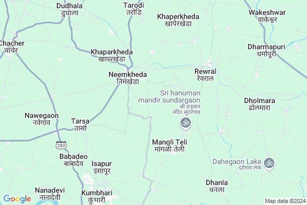
Kotgaon
Kotgaon Map
EDIT Map
Add Your House
 ..
..
Current Corona Virus Infected Patients Count in Nagpur District
| City Name | District Name | Total Covid cases |
|---|---|---|
| Nagpur | Nagpur | 51 |
| Nagpur District | Nagpur | 36 |
| Nagpur Rural | Nagpur | 6 |
Locality Name :
Kotgaon
( कोटगाव )
Taluka Name : Mouda
District : Nagpur
State : Maharashtra
Region : Vidarbh
Division : Nagpur
Language : Marathi and Hindi, English
Current Time 10:46 AM
Date: Friday , Apr 25,2025 (IST)
Time zone: IST (UTC+5:30)
Elevation / Altitude: 284 meters. Above Seal level
Telephone Code / Std Code: 07115
Assembly constituency : Ramtek assembly constituency
Assembly MLA : Ashish Nandkishor Jaiswal
Lok Sabha constituency : Ramtek parliamentary constituency
Parliament MP : Krupal Balaji Tumane
Serpanch Name :
Pin Code : 441104
Post Office Name : Mauda
Main Village Name : Kotgaon
Commodities Prices : Ramtek Market / Mandi
Kotgaon Live Weather
Temperature: 40.4 °C
clear sky
Humidity: 12%
Wind : 1.7 mt/sec towards W
StationName : "KÄ\u0081mthi"
observed on 16 Mins Back
Temperature: 40.4 °C
clear sky
Humidity: 12%
Wind : 1.7 mt/sec towards W
StationName : "KÄ\u0081mthi"
observed on 16 Mins Back
Kotgaon Weather Forecast for Next 5 days
26-04-2025
32.5°C to 42.9°C
clear sky, broken clouds, scattered clouds
32.5°C to 42.9°C
clear sky, broken clouds, scattered clouds
27-04-2025
31.5°C to 43.0°C
few clouds, clear sky, light rain
31.5°C to 43.0°C
few clouds, clear sky, light rain
28-04-2025
26.7°C to 38.9°C
light rain, broken clouds, few clouds, clear sky
26.7°C to 38.9°C
light rain, broken clouds, few clouds, clear sky
29-04-2025
26.0°C to 42.0°C
few clouds, clear sky, scattered clouds
26.0°C to 42.0°C
few clouds, clear sky, scattered clouds
30-04-2025
27.2°C to 43.9°C
few clouds, clear sky, broken clouds, scattered clouds
27.2°C to 43.9°C
few clouds, clear sky, broken clouds, scattered clouds
National Highways Reachable To Kotgaon
Nationa High Way :NH353I
Nationa High Way :NH44
Nationa High Way :NH353I
Nationa High Way :NH44
Rivers Near Kotgaon
Pivli Nadi
Nag River :नाग नदी
Pivli Nadi
Nag River :नाग नदी
About Kotgaon
Correct below Info and add more info about KotgaonKotgaon is a small Village/hamlet in Mouda Taluka in Nagpur District of Maharashtra State, India. It comes under Kotgaon Panchayath. It belongs to Vidarbh region . It belongs to Nagpur Division . It is located 43 KM towards East from District head quarters Nagpur. 853 KM from State capital Mumbai
Kotgaon Pin code is 441104 and postal head office is Mauda .
Kotgaon is surrounded by Mohadi Taluka towards East , Ramtek Taluka towards North , Kamptee Taluka towards west , Kuhi Taluka towards South .
Ramtek , Kamthi , Bhandara , Tumsar are the near by Cities to Kotgaon.
Kotgaon 2011 Census Details
Kotgaon Local Language is Marathi. Kotgaon Village Total population is 942 and number of houses are 215. Female Population is 49.5%. Village literacy rate is 70.8% and the Female Literacy rate is 32.8%.
Population
| Census Parameter | Census Data |
| Total Population | 942 |
| Total No of Houses | 215 |
| Female Population % | 49.5 % ( 466) |
| Total Literacy rate % | 70.8 % ( 667) |
| Female Literacy rate | 32.8 % ( 309) |
| Scheduled Tribes Population % | 5.4 % ( 51) |
| Scheduled Caste Population % | 23.6 % ( 222) |
| Working Population % | 57.5 % |
| Child(0 -6) Population by 2011 | 78 |
| Girl Child(0 -6) Population % by 2011 | 38.5 % ( 30) |
Kotgaon Census More Deatils.
Politics in Kotgaon
BJP , Shivsena , SHS , INC are the major political parties in this area.Polling Stations /Booths near Kotgaon
1)Bhandarbodi2)Bhendala
3)Umri (pali)
4)Deolapar
5)Nimba
HOW TO REACH Kotgaon
By Rail
Tharsa Rail Way Station , Rewral Rail Way Station are the very nearby railway stations to Kotgaon. Kamptee Rail Way Station (near to Kamthi) , Bhandara Road Rail Way Station (near to Bhandara) , Nagpur Junction Rail Way Station (near to Nagpur) , Ramtek Rail Way Station (near to Ramtek) , Kanhan Junction Rail Way Station (near to Kamthi) , Ajni Rail Way Station (near to Nagpur) , Amdi Halt Rail Way Station (near to Ramtek) are the Rail way stations reachable from near by towns.By Road
Ramtek , Kamthi , Bhandara , Nagpur are the nearby by towns to Kotgaon having road connectivity to KotgaonColleges near Kotgaon
Shri Lemdeo Patil Art And Science Collage, Mandhal
Address : At Post Mandhal Tah Kuhi Dist Nagpur
Nibe College Of Hotel Management
Address : Nibe College Of Hotel Management, Near St. Gianelli Convent, Gumthala Road, Ajani (radke), Kamptee - 441401(dist. Nagpur) M.s.
Shree Pandharinath Arts & Commerce College
Address :
New English Highschool Mohpa
Address :
Shri G.umap College Yenwa
Address :
Schools in Kotgaon
Primary School
Address : kotgaon , mouda , nagpur , Maharashtra . PIN- 441104 , Post - Mauda
Govt Health Centers near Kotgaon
1) Dhanala , Subcenter Dhanla , Dhanla , Near ZP School2) Salwa , , ,
3) Thana Mandhal SC , Subcenter Thana , Thana , Near Grampanchayat
Sub Villages in Kotgaon
Hospitals in Kotgaon,Mouda
Shrinivas Multispeshialiti Hospital Nimkheda
Tarsa - Neemkheda Rd; Tarsa; Maharashtra 441106; India
3.1 KM distance Detail
more ..
Petrol Bunks in Kotgaon,Mouda
HP PETROL PUMP - VSR PETROLEUM
Village Babdeo Tarsa Taluka Mouda; Nagpur; Maharashtra 441104; India
8.4 KM distance Detail
more ..
Colleges in Kotgaon,Mouda
Bar. Sheshrao Wankhede Arts & Commerce College
Khaperkheda; Bhanegaon; Saoner; Maharashtra 441102; India
8.3 KM distance Detail
GURUKUL of Business Management & Professional Studies
Plot No-38; Kh.No.-14/4; Welahari; Nagpur; Maharashtra 441102; India
8.3 KM distance Detail
SAMARTH RAMDAS HIGH SCHOOL AND JUNIOR COLLAGE OF ARTS; SCIENCE AND COMMERCE
Khat Rd; Aroli; Maharashtra 441106; India
11.4 KM distance Detail
more ..
Schools in Kotgaon,Mouda
INDIRA GANDHI PRIMARY SCHOOL AND JUNIOR COLLEGE
Neemkheda; Maharashtra 441106; India
2.9 KM distance Detail
Electronic Shops in Kotgaon,Mouda
Laxmi Ganpati Mobile Shopy
Nimkheda road; Nimkheda Rd; Nimkheda; Maharashtra 431206; India
3.3 KM distance Detail
Super Markets in Kotgaon,Mouda
Arya Kirana
Nagpur; Mother Teresa Nagar; Kashmiri Colony; Yerawada; Pune; Maharashtra; India
8.1 KM distance Detail
Police Stations near Kotgaon,Mouda
Jawaharnagar Police Station
Kharbi Gowri Rd; Sawari Jawharnagar; Maharashtra 441906; India
21.0 KM distance Detail
About Kotgaon &
History
How to reach Kotgaon
Tourist Places Near By Kotgaon
Schools in Kotgaon
Colleges in Kotgaon
Temperature & weather of Kotgaon
places in Kotgaon
Kotgaon photos
More Information
How to reach Kotgaon
Tourist Places Near By Kotgaon
Schools in Kotgaon
Colleges in Kotgaon
Temperature & weather of Kotgaon
places in Kotgaon
Kotgaon photos
More Information
Village Talk
Post News or Events about this Village
Near Cities
Ramtek 21 KM near
Kamthi 26 KM near
Bhandara 28 KM near
Tumsar 41 KM near
Ramtek 21 KM near
Kamthi 26 KM near
Bhandara 28 KM near
Tumsar 41 KM near
Near By Taluks
Mouda 0 KM near
Mohadi 25 KM near
Ramtek 27 KM near
Kamptee 28 KM near
Mouda 0 KM near
Mohadi 25 KM near
Ramtek 27 KM near
Kamptee 28 KM near
Near By Air Ports
Sonegaon Airport 47 KM near
Jabalpur Airport 186 KM near
Raipur Airport 268 KM near
Bhopal Airport 350 KM near
Sonegaon Airport 47 KM near
Jabalpur Airport 186 KM near
Raipur Airport 268 KM near
Bhopal Airport 350 KM near
Near By Tourist Places
Bhandara 26 KM near
Nagpur 41 KM near
Pench National Park 85 KM near
Seoni 106 KM near
Sevagram 115 KM near
Bhandara 26 KM near
Nagpur 41 KM near
Pench National Park 85 KM near
Seoni 106 KM near
Sevagram 115 KM near
Near By Districts
Bhandara 27 KM near
Nagpur 41 KM near
Gondia 93 KM near
Seoni 105 KM near
Bhandara 27 KM near
Nagpur 41 KM near
Gondia 93 KM near
Seoni 105 KM near
Near By RailWay Station
Tharsa Rail Way Station 2.8 KM near
Rewral Rail Way Station 5.3 KM near
Chacher Rail Way Station 9.0 KM near
Bhandara Road Rail Way Station 25 KM near
Kamptee Rail Way Station 27 KM near
Tharsa Rail Way Station 2.8 KM near
Rewral Rail Way Station 5.3 KM near
Chacher Rail Way Station 9.0 KM near
Bhandara Road Rail Way Station 25 KM near
Kamptee Rail Way Station 27 KM near