| Home | City Bus | Maps | Villages | Cities | Rail | Tourist Places | School | College | Pin Codes | Corona Cases Count |
| Distance Calculator Bus Services IFSC Codes Trace Mobile Number Weather Search Place Trace IP Available Cash ATM/Banks Locate Polling Booth Report an Error contact People |
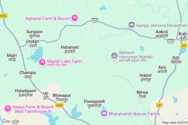
Khetapur
Khetapur Map
EDIT Map
Add Your House
 ..
..
Current Corona Virus Infected Patients Count in Nagpur District
| City Name | District Name | Total Covid cases |
|---|---|---|
| Nagpur | Nagpur | 51 |
| Nagpur District | Nagpur | 36 |
| Nagpur Rural | Nagpur | 6 |
Locality Name :
Khetapur
( खेतापूर )
Taluka Name : Kuhi
District : Nagpur
State : Maharashtra
Region : Vidarbh
Division : Nagpur
Language : Marathi and Hindi, English
Current Time 04:54 PM
Date: Monday , Apr 28,2025 (IST)
Time zone: IST (UTC+5:30)
Elevation / Altitude: 271 meters. Above Seal level
Telephone Code / Std Code: 07100
Assembly constituency : Umred assembly constituency
Assembly MLA : Raju Devnath Parwe
Lok Sabha constituency : Ramtek parliamentary constituency
Parliament MP : Krupal Balaji Tumane
Serpanch Name :
Pin Code : 441204
Post Office Name : Umred Project
Main Village Name : Khetapur
Commodities Prices : Umared Market / Mandi
Khetapur Live Weather
Temperature: 40.2 °C
scattered clouds
Humidity: 8%
Wind : 2.96 mt/sec towards NW
StationName : "Umred"
observed on Now
Temperature: 40.2 °C
scattered clouds
Humidity: 8%
Wind : 2.96 mt/sec towards NW
StationName : "Umred"
observed on Now
Khetapur Weather Forecast for Next 5 days
29-04-2025
31.3°C to 41.1°C
scattered clouds, few clouds, broken clouds
31.3°C to 41.1°C
scattered clouds, few clouds, broken clouds
30-04-2025
28.6°C to 42.6°C
scattered clouds, clear sky, few clouds, broken clouds, overcast clouds
28.6°C to 42.6°C
scattered clouds, clear sky, few clouds, broken clouds, overcast clouds
01-05-2025
32.3°C to 44.8°C
broken clouds, scattered clouds, few clouds, clear sky
32.3°C to 44.8°C
broken clouds, scattered clouds, few clouds, clear sky
02-05-2025
29.6°C to 43.1°C
few clouds, clear sky, scattered clouds, broken clouds
29.6°C to 43.1°C
few clouds, clear sky, scattered clouds, broken clouds
03-05-2025
28.8°C to 43.0°C
broken clouds, clear sky, few clouds
28.8°C to 43.0°C
broken clouds, clear sky, few clouds
National Highways Reachable To Khetapur
Nationa High Way :NH44
Nationa High Way :NH353I
Nationa High Way :NH44
Nationa High Way :NH353I
Rivers Near Khetapur
Kanhan
Nag River :नाग
Kanhan
Nag River :नाग
About Khetapur
Correct below Info and add more info about KhetapurKhetapur is a small Village/hamlet in Kuhi Taluka in Nagpur District of Maharashtra State, India. It comes under Khetapur Panchayath. It belongs to Vidarbh region . It belongs to Nagpur Division . It is located 29 KM towards East from District head quarters Nagpur. 20 KM from Kuhi. 824 KM from State capital Mumbai
Khetapur Pin code is 441204 and postal head office is Umred Project .
Dongargaon ( 6 KM ) , Malni ( 6 KM ) , Uti ( 7 KM ) , Surgaon ( 8 KM ) , Chitapur ( 9 KM ) are the nearby Villages to Khetapur. Khetapur is surrounded by Kuhi Taluka towards East , Kamptee Taluka towards North , Nagpur Taluka towards west , Bhivapur Taluka towards South .
Umred , Kamthi , Nagpur , Pauni are the near by Cities to Khetapur.
Khetapur 2011 Census Details
Khetapur Local Language is Marathi. Khetapur Village Total population is 368 and number of houses are 82. Female Population is 45.7%. Village literacy rate is 64.4% and the Female Literacy rate is 25.5%.
Population
| Census Parameter | Census Data |
| Total Population | 368 |
| Total No of Houses | 82 |
| Female Population % | 45.7 % ( 168) |
| Total Literacy rate % | 64.4 % ( 237) |
| Female Literacy rate | 25.5 % ( 94) |
| Scheduled Tribes Population % | 5.7 % ( 21) |
| Scheduled Caste Population % | 12.5 % ( 46) |
| Working Population % | 65.8 % |
| Child(0 -6) Population by 2011 | 51 |
| Girl Child(0 -6) Population % by 2011 | 45.1 % ( 23) |
Khetapur Census More Deatils.
Politics in Khetapur
BJP , Shivsena , BSP , SHS , INC are the major political parties in this area.Polling Stations /Booths near Khetapur
1)Somnala2)Sarandi
3)Sasegaon
4)Dhurkheda
5)Nand
HOW TO REACH Khetapur
By Rail
Mahuli Rail Way Station , Titur Rail Way Station are the very nearby railway stations to Khetapur. Umred Rail Way Station (near to Umred) , Bhandara Road Rail Way Station (near to Bhandara) , Nagpur Junction Rail Way Station (near to Nagpur) , Ajni Rail Way Station (near to Nagpur) , Bamhni Rail Way Station (near to Umred) are the Rail way stations reachable from near by towns.By Road
Umred , Bhandara , Nagpur are the nearby by towns to Khetapur having road connectivity to KhetapurColleges near Khetapur
Shri Lemdeo Patil Art And Science Collage, Mandhal
Address : At Post Mandhal Tah Kuhi Dist Nagpur
Mukundrajswami Mahavidyalaya
Address : At-post Pachkhedi(g) Ta-kuhi Dist-nagpur
Schools in Khetapur
Z.p.upper Primary School
Address : khetapur , kuhi , nagpur , Maharashtra . PIN- 441202 , Post - Kuhi
Govt Health Centers near Khetapur
1) Titur , Primary Health Center Titur , Titur , On Khalasna Kuhi Road2) Titur , Subcenter Titur , Titur , Near Grampanchayat
3) Kuhi , Subcenter Kuhi , Kuhi , Near Grampanchayat
Sub Villages in Khetapur
Colleges in Khetapur,Kuhi
Shri Sadguru Datta Institute Of Pharmacy
Kuhi; Bhojapur; Maharashtra 441202; India
10.4 KM distance Detail
Avdhoot Diploma College Of Engineering
Akoli Road; Mouza Bhojapur; Kuhi; Nagpur; Maharashtra 441202; India
12.4 KM distance Detail
more ..
Schools in Khetapur,Kuhi
Zilla Parishad Primary School
Taluka Katol; Nagpur; Dongargaon; Maharashtra 441302; India
5.5 KM distance Detail
Zilla Parishad Upper Primary School
Umred;Nagpur; Welsakra.; Maharashtra 441203; India
10.8 KM distance Detail
Electronic Shops in Khetapur,Kuhi
Pankaj Timbar Mart
Kurkheda - Wadsa - Bramhapuri - Nagpur Hwy; Maharashtra 441204; India
11.5 KM distance Detail
Zilpe Furnitures &Msmart Securities And IT Solutions
Kuhi; Maharashtra 441202; India
12.0 KM distance Detail
Governement Offices near Khetapur,Kuhi
Tehsil Office
Nagpur; SH-254; Kuhi Fata Ambhora Road; Kuhi; Kuhi; Maharashtra 441202; India
10.4 KM distance Detail
About Khetapur &
History
How to reach Khetapur
Tourist Places Near By Khetapur
Schools in Khetapur
Colleges in Khetapur
Temperature & weather of Khetapur
places in Khetapur
Khetapur photos
More Information
How to reach Khetapur
Tourist Places Near By Khetapur
Schools in Khetapur
Colleges in Khetapur
Temperature & weather of Khetapur
places in Khetapur
Khetapur photos
More Information
Village Talk
Post News or Events about this Village
Near Cities
Umred 17 KM near
Kamthi 31 KM near
Nagpur 32 KM near
Pauni 48 KM near
Umred 17 KM near
Kamthi 31 KM near
Nagpur 32 KM near
Pauni 48 KM near
Near By Taluks
Umred 16 KM near
Kuhi 19 KM near
Kamptee 23 KM near
Nagpur 27 KM near
Umred 16 KM near
Kuhi 19 KM near
Kamptee 23 KM near
Nagpur 27 KM near
Near By Air Ports
Sonegaon Airport 27 KM near
Jabalpur Airport 222 KM near
Raipur Airport 287 KM near
Nanded Airport 320 KM near
Sonegaon Airport 27 KM near
Jabalpur Airport 222 KM near
Raipur Airport 287 KM near
Nanded Airport 320 KM near
Near By Tourist Places
Nagpur 30 KM near
Bhandara 49 KM near
Sevagram 84 KM near
Tadoba 94 KM near
Pench National Park 121 KM near
Nagpur 30 KM near
Bhandara 49 KM near
Sevagram 84 KM near
Tadoba 94 KM near
Pench National Park 121 KM near
Near By Districts
Nagpur 28 KM near
Bhandara 50 KM near
Wardha 82 KM near
Gondia 122 KM near
Nagpur 28 KM near
Bhandara 50 KM near
Wardha 82 KM near
Gondia 122 KM near
Near By RailWay Station
Mahuli Rail Way Station 7.9 KM near
Titur Rail Way Station 9.3 KM near
Itwari Junction Rail Way Station 27 KM near
Ajni Rail Way Station 27 KM near
Mahuli Rail Way Station 7.9 KM near
Titur Rail Way Station 9.3 KM near
Itwari Junction Rail Way Station 27 KM near
Ajni Rail Way Station 27 KM near