| Home | City Bus | Maps | Villages | Cities | Rail | Tourist Places | School | College | Pin Codes | Corona Cases Count |
| Distance Calculator Bus Services IFSC Codes Trace Mobile Number Weather Search Place Trace IP Available Cash ATM/Banks Locate Polling Booth Report an Error contact People |
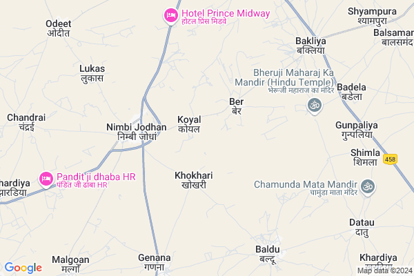
Koyal Map
EDIT Map
Add Your House
 ..
..
Current Corona Virus Infected Patients Count in Nagaur District
| City Name | District Name | Total Covid cases |
|---|---|---|
| Nagaur District | Nagaur | 113 |
Locality Name :
Koyal
( कोयल )
Tehsil Name : Ladnu
District : Nagaur
State : Rajasthan
Division : Ajmer
Language : Marwari and Hindi, English, Urdu Rajasthani
Current Time 12:57 PM
Date: Friday , Apr 25,2025 (IST)
Time zone: IST (UTC+5:30)
Elevation / Altitude: 330 meters. Above Seal level
Telephone Code / Std Code: 01581
Assembly constituency : Ladnun assembly constituency
Assembly MLA : Mukesh Bhakar
Lok Sabha constituency : Nagaur parliamentary constituency
Parliament MP : HANUMAN BENIWAL
Serpanch Name :
Pin Code : 341316
Post Office Name : Nimbijodhan
Main Village Name : Koyal
Commodities Prices : Deedwana(Choti Khatu) Market / Mandi
Koyal Live Weather
Temperature: 40.2 °C
clear sky
Humidity: 5%
Wind : 3.95 mt/sec towards W
StationName : "LÄ\u0081dnÅ«n"
observed on 16 Mins Back
Temperature: 40.2 °C
clear sky
Humidity: 5%
Wind : 3.95 mt/sec towards W
StationName : "LÄ\u0081dnÅ«n"
observed on 16 Mins Back
Koyal Weather Forecast for Next 5 days
26-04-2025
27.8°C to 41.2°C
clear sky, scattered clouds, broken clouds
27.8°C to 41.2°C
clear sky, scattered clouds, broken clouds
27-04-2025
25.9°C to 40.4°C
scattered clouds, broken clouds, light rain, few clouds
25.9°C to 40.4°C
scattered clouds, broken clouds, light rain, few clouds
28-04-2025
25.9°C to 41.3°C
few clouds, clear sky
25.9°C to 41.3°C
few clouds, clear sky
29-04-2025
27.5°C to 43.5°C
clear sky
27.5°C to 43.5°C
clear sky
30-04-2025
26.8°C to 43.7°C
clear sky, overcast clouds, broken clouds
26.8°C to 43.7°C
clear sky, overcast clouds, broken clouds
Edit below overview about Koyal
Edit below overview about Koyal
OverView of Koyal
Koyal is near to Ladnun. It is 15 kilometer from Ladnun via Nimbi Jodhan. Nimbi Jodhan is 3 Kilometer from Koyal. Mainly residents of Koyal are Rathore (Jodha) rajputs. One house is of shekhawats. It has one Brahminfamily, one Nai(barber)family, one Bawari (earlier used to do chowkidari i.e. guarding village at night time)family. Rest all are rajputs only.Edit below overview about Koyal
About Koyal
Koyal is a small Village/hamlet in Ladnu Tehsil in Nagaur District of Rajasthan State, India. It comes under Koyal Panchayath. It belongs to Ajmer Division . It is located 85 KM towards East from District head quarters Nagaur. 7 KM from Ladnu. 184 KM from State capital Jaipur
Koyal Pin code is 341316 and postal head office is Nimbijodhan .
Chandrai ( 7 KM ) , Genana ( 8 KM ) , Dudoli ( 10 KM ) , Dujjar ( 10 KM ) , Odeet ( 10 KM ) are the nearby Villages to Koyal. Koyal is surrounded by Sujangarh Tehsil towards North , Didwana Tehsil towards South , Jayal Tehsil towards South , Makrana Tehsil towards South .
Ladnu , Sujangarh , Losal , Rajaldesar are the near by Cities to Koyal.
This Place is in the border of the Nagaur District and Churu District. Churu District Sujangarh is North towards this place .
Koyal 2011 Census Details
Koyal Local Language is Marwari. Koyal Village Total population is 895 and number of houses are 180. Female Population is 50.1%. Village literacy rate is 55.9% and the Female Literacy rate is 21.8%.
Population
| Census Parameter | Census Data |
| Total Population | 895 |
| Total No of Houses | 180 |
| Female Population % | 50.1 % ( 448) |
| Total Literacy rate % | 55.9 % ( 500) |
| Female Literacy rate | 21.8 % ( 195) |
| Scheduled Tribes Population % | 0.6 % ( 5) |
| Scheduled Caste Population % | 2.0 % ( 18) |
| Working Population % | 39.1 % |
| Child(0 -6) Population by 2011 | 139 |
| Girl Child(0 -6) Population % by 2011 | 50.4 % ( 70) |
Koyal Census More Deatils.
Politics in Koyal
Rashtriya Loktantrik Party , BJP , INC are the major political parties in this area.Polling Stations /Booths near Koyal
1)Govt.upper Primary School Khokari2)Govt.upper Primary School Khanadi
3)Govt. Upper Primary School Saandas
4)Dr. Jakir Husain Upper Primary School (middle Part) Ladnun
5)Govt.higher Secondary School ( Left Part ) Hudas
HOW TO REACH Koyal
By Rail
There is no railway station near to Koyal in less than 10 km.Colleges near Koyal
Marudhar Industrial Training Centre Jayal [itc]
Address :
Govt Collage Jayal
Address :
Marwar College Parbatsar
Address :
Tagor Collage
Address :
Shree Pooja College Nagaur
Address :
Schools in Koyal
Gups Koyal
Address : koyal , ladnun , nagaur , Rajasthan . PIN- 341316 , Post - Nimbijodhan
Govt Health Centers near Koyal
1) CHANDRAI , , Chandrai , CHANDRAI2) Nimbijodha , , Nimbijodha , Nimbijodha
3) NOTIONAL Nimbijodha , , Nimbijodha , Nimbijodha
Sub Villages in Koyal
Hospitals in Koyal,Ladnu
Govt Hospital
Silanwad - Nimbi Jodhan Road; Nimbi Jodhan; Rajasthan 341316; India
4.2 KM distance Detail
more ..
Petrol Bunks in Koyal,Ladnu
MANGALAM HIGHWAY FILLING STATION
NIMBIJODHA;CHAINAGE NO 94/; NAGAUR; Rajasthan 341316; India
4.5 KM distance Detail
Bharat Petroleum
Ladnu; Nagaur; NH-65; Nagaur Road; Ladnun; Ladnun; Rajasthan 341303; India
4.5 KM distance Detail
HP PETROL PUMP - VEER TEJA HIGHWAY CENTRE
Nimbi Ladnu Rd;nimbi Nh-65;teh-ladnu; Rajasthan 341316; India
4.6 KM distance Detail
more ..
Colleges in Koyal,Ladnu
Mega Industrial Training Institute; Badela
Didwana-Ladnun Rd; Rajasthan 341304; India
8.7 KM distance Detail
Sh.Bapuji College of Nursing
Dayanand Colony; Ladnun; Rajasthan 341306; India
13.2 KM distance Detail
more ..
Schools in Koyal,Ladnu
Dewasi water suppliers (Madanlal Raika)
Nimbi Jodhan; Rajasthan 341316; India
3.2 KM distance Detail
NAVEEN VIDHYA PEETH SCHOOL
NEAR BY KOYAL CHORHA; NIMBI JODHAN; Nimbi Jodhan; Rajasthan 341316; India
3.9 KM distance Detail
Nehru Bal Vidhya Mandir
8; Rajasthan State Highway 59; Nimbi Jodhan; Rajasthan 341316; India
3.9 KM distance Detail
Electronic Shops in Koyal,Ladnu
Aman Auto Electric & Battery
Nimbi Jodhan - Banthri Rd; Nimbi Jodhan; Rajasthan 341316; India
3.8 KM distance Detail
आर;डी;कबाणी पत्ता रिपेयरिंग
बांठङी रोङ; आर;डी मोटर्स गैरेज; निंबी जोधन; राजस्थान 341316; India
4.2 KM distance Detail
Shree Krishna Electronics Nimbi Jodhan
8; Rajasthan State Highway 59; Nimbi Jodhan; Rajasthan 341306; India
4.2 KM distance Detail
Super Markets in Koyal,Ladnu
Ramniwas Tholiya (Balaji Stones Supplier)
Nimbi Jodhan; Rajasthan 341316; India
5.0 KM distance Detail
Local Parks in Koyal,Ladnu
Amar Shaheed Shri Dalip Singh Memorial Park; Dabri
Dabri; Rajasthan 341304; India
15.4 KM distance Detail
Amar Sahid Shree Shishupal Singh Memorial; Dabri
Dabri; Rajasthan 341304; India
15.5 KM distance Detail
Mangal Garden - Mangalchand Gaggar Foundation
Nagaur; Rajasthan 341304; India
18.8 KM distance Detail
About Koyal &
History
How to reach Koyal
Tourist Places Near By Koyal
Schools in Koyal
Colleges in Koyal
Temperature & weather of Koyal
places in Koyal
Koyal photos
More Information
How to reach Koyal
Tourist Places Near By Koyal
Schools in Koyal
Colleges in Koyal
Temperature & weather of Koyal
places in Koyal
Koyal photos
More Information
Village Talk
Post News or Events about this Village
Near Cities
Ladnu 14 KM near
Sujangarh 24 KM near
Losal 61 KM near
Rajaldesar 63 KM near
Ladnu 14 KM near
Sujangarh 24 KM near
Losal 61 KM near
Rajaldesar 63 KM near
Near By Taluks
Ladnu 7 KM near
Sujangarh 30 KM near
Didwana 34 KM near
Jayal 50 KM near
Ladnu 7 KM near
Sujangarh 30 KM near
Didwana 34 KM near
Jayal 50 KM near
Near By Air Ports
Sanganeer Airport 180 KM near
Jodhpur Airport 216 KM near
Surat Gujarat Airport 226 KM near
Indira Gandhi International Airport 325 KM near
Sanganeer Airport 180 KM near
Jodhpur Airport 216 KM near
Surat Gujarat Airport 226 KM near
Indira Gandhi International Airport 325 KM near
Near By Tourist Places
Tal Chhapar Sanctuary 33 KM near
Kuchaman 71 KM near
Sikar 85 KM near
Nawalgarh 105 KM near
Mandawa 106 KM near
Tal Chhapar Sanctuary 33 KM near
Kuchaman 71 KM near
Sikar 85 KM near
Nawalgarh 105 KM near
Mandawa 106 KM near
Near By Districts
Nagaur 82 KM near
Sikar 86 KM near
Churu 115 KM near
Bikaner 130 KM near
Nagaur 82 KM near
Sikar 86 KM near
Churu 115 KM near
Bikaner 130 KM near
Near By RailWay Station
Ladnun Rail Way Station 14 KM near
Sujangarh Rail Way Station 24 KM near
Ladnun Rail Way Station 14 KM near
Sujangarh Rail Way Station 24 KM near